Lenna, Oklahoma | |
|---|---|
 Lenna  Lenna | |
| Coordinates: 35°22′35″N95°46′10″W / 35.37639°N 95.76944°W | |
| Country | United States |
| State | Oklahoma |
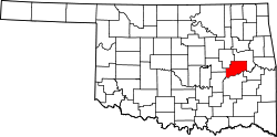
| County | McIntosh |
| Elevation | 630 ft (190 m) |
| Time zone | UTC-6 (Central (CST)) |
| • Summer (DST) | UTC-5 (CDT) |
| GNIS feature ID | 1100573 [1] |
Lenna is a community in McIntosh County, Oklahoma, United States. The post office was established on January 4, 1902. It was named for Lenna Moore, a local Creek Indian. [2]