U.S. Route 69 in Oklahoma

Last updated

US 69.svg

U.S. Highway 69

U.S. Route 69 in Oklahoma
US 69 highlighted in red
Route information
Maintained by ODOT
Length260.82 mi [1]  (419.75 km)
Major junctions
South endUS 69.svgUS 75.svg US 69  / US 75 south of Colbert
Major intersectionsUS 70.svg US 70 in Durant
US 75.svg US 75 in Atoka
US 270.svg US 270 in McAlester
I-40.svg I-40 in Checotah
US 266.svg US 266 in Checotah
US 62.svgUS 64.svg US 62  / US 64 in Muskogee
US 412.svg US 412 near Chouteau
Toll plate yellow.svg
I-44.svg
Will Rogers Turnpike.svg I-44 Toll  / Will Rogers Turnpike in Big Cabin
US 60.svg US 60 in Vinita
US 59.svg US 59 in Miami
North endUS 69.svgK-7.svg US-69  / K-7 north of Picher
Location
Country United States
State Oklahoma
Counties Bryan, Atoka, Pittsburg, McIntosh, Muskogee, Wagoner, Mayes, Craig, Delaware, Ottawa
Highway system
  • Oklahoma State Highway System
Oklahoma State Highway 67.svg SH-67 US 70.svg US 70

U.S. Route 69 (US 69) is a major north-south U.S. Highway in the U.S. state of Oklahoma. It extends the corridor formed by U.S. Route 75 in Texas, from Dallas northeast via McAlester and Muskogee to the Will Rogers Turnpike (Interstate 44) near Vinita. From Vinita to the Kansas state line, US-69 generally parallels the turnpike along old U.S. Highway 66.

Contents

Route description

U.S. Highway 69 crosses the Red River to enter Bryan County, Oklahoma concurrent with US-75 3 miles (4.8 km) [2] south of Colbert. The first few miles of highway north of the state line are freeway-grade, featuring three interchanges, including one at State Highway 91. Near Calera, the route downgrades to an expressway. On the west side of Durant, however, US-69/75 becomes a freeway again, beginning with an interchange with U.S. Highway 70, and followed by an interchange with SH-78. The freeway continues northeast, providing access to Armstrong, Caddo, and SH-22 before becoming an expressway once again at the Atoka County line.

In Atoka County, US-69/75 bypass Caney and Tushka to the west before coming to the SH-3/7 junction in the county seat of Atoka, Oklahoma; at this junction, SH-3 joins with the U.S. routes while SH-7 has its eastern terminus. North of this interchange, US-75 and SH-3 split off, leaving US-69 without any concurrent routes for the first time since crossing the Red River. Seven miles (11.3 km) [2] northwest of Atoka, US-69 begins another concurrency, this time with SH-43, near Stringtown. The two routes run along the east shore of Atoka Lake before SH-43 splits off to the west. US-69 then heads through unincorporated Chockie, and then serves as the eastern terminus of SH-131 just south of the Pittsburg County line.

US-69 then crosses into Pittsburg County. US-69 runs just east of Kiowa, where it intersects State Highway 63 at its western terminus. US-69 runs along the east edge of the McAlester Army Ammunition Plant, which it provides access to via an interchange near Savanna. It then has an interchange with the Indian Nation Turnpike, after which it enters McAlester. US-69 mostly runs along the east side of McAlester, the county seat of Pittsburg County, with the downtown area being served by U.S. Highway 69 Business. The main route of US-69 has an interchange with US-270/SH-1/SH-31. North of McAlester, US-69 reunites with its business loop at an interchange which also serves as the southern terminus of SH-113. US-69 regains freeway status at this interchange, and begins crossing over several arms of Lake Eufaula. US-69 provides several interchanges for lake access. Other interchanges serve the northern terminus of SH-113 (which has both termini at US-69) and the western terminus of SH-9A. US-69 then crosses the main channel of the Canadian River into McIntosh County.

Soon after crossing into McIntosh Co., US-69 serves the county seat of Eufaula, with exits for US-69's Eufaula business loop and State Highway 9. The freeway then has an exit to the southern terminus of State Highway 150. US-69 then meets Interstate 40 at a cloverleaf interchange and has a pair of interchanges serving Checotah. The route then enters Muskogee County, where it has exits for Oktaha and Wainwright. The freeway then ends near Summit, and US-69 continues north at-grade.[ further explanation needed ]

US-69 meets the western terminus of State Highway 165 as it enters Muskogee. The route runs along the west side of the city, intersecting U.S. Highway 64 and briefly concurring with US-62. US-69 then crosses the Arkansas River into Wagoner County. Shortly after entering the county, the highway has an interchange with the Muskogee Turnpike, northeast of Tullahassee. In Wagoner, US-69 meets SH-51. It then enters Mayes County.

In Mayes County, the highway has an interchange with US-412 south of Chouteau. US-69 creates a spur to Sportsman Acres, SH-69A. The route then intersects SH-20 in Pryor and SH-28 in Adair. US-69 leaves Mayes County and enters Craig County south of Big Cabin. As the route approaches Big Cabin, signage affixed to the side of parked truck trailers warns of a speed zone, due to Big Cabin's former speed trap status. [3] The trap was shut down by the Oklahoma Department of Public Safety on August 1, 2005. [3] Just north of the town, US-69 has the first of three interchanges with Interstate 44, the Will Rogers Turnpike. After crossing the turnpike, the route begins a concurrency with US-60 into Vinita. The two U.S. routes serve as the southern terminus of SH-2 there. East of town, another access point to the turnpike is offered. SH-82's northern terminus lies 4 miles (6.4 km) east of this. [2]

U.S. Rte 69 at East 1st St, Picher, Oklahoma, looking south. U.S. Rte 69 at East 1st St, Picher, Oklahoma, looking south, August 2023.jpg
U.S. Rte 69 at East 1st St, Picher, Oklahoma, looking south.

US-60/69 cut the northwest corner of Delaware County, entering just west of the northern terminus of State Highway 85. The routes then cross into Ottawa County, passing through Afton, before US-59 joins the concurrency. Just north of this, US-60 splits off at an interchange which also serves as the third entry to the Will Rogers Turnpike. Near Narcissa, US-59/69 passes the east end of SH-25. US-59 then splits off to follow SH-10 westbound, while SH-10 eastbound follows US-69 into Miami. The two routes concur briefly before splitting near downtown Miami, where US-69 forms a one-way couplet. After reuniting north of downtown, US-69 serves as a major arterial through the city, before leaving town and arcing northeast through North Miami and Commerce. US-69 then spawns U.S. Highway 69 Alternate to Quapaw and Baxter Springs, Kansas. The main route turns north, running through the Tar Creek Superfund site and abandoned community of Picher, before leaving Oklahoma and entering the state of Kansas.

History

U.S. Highway 69 in Oklahoma generally follows the old Texas Road.

All of US-69 between the US-60 junction west of Vinita and the western terminus of US-69 ALT is part of the former route of Route 66.

The Intermodal Surface Transportation Efficiency Act of 1991 requires the United States Secretary of Transportation to designate US-69 between the Texas state line and Checotah as an Interstate highway upon request from ODOT. [4]

Major intersections

CountyLocationmi [5] kmExit [6] DestinationsNotes
Bryan Red River 0.000.00South plate.svg
US 75.svg
US 75 south (US 69 south) Denison
Texas state line
0.71.11Old River Road, South Franklin Street
Colbert 2.23.52Oklahoma State Highway 91.svg SH-91  Colbert, Denison Dam
4.06.44North Franklin Street, Leavenworth TrailNorth end of freeway; Formerly signed Platter
Calera 8.914.38 Calera Northbound exit and southbound entrance; south end of freeway
9.715.610Main Street - Calera
10.817.411ARose Hill Road, South 9th AvenueNorthbound exit and southbound entrance; former US-69B/US-75B north
11.318.211CCalera Service RoadSouthbound exit and northbound entrance
Durant 11.718.811BChoctaw Road – Choctaw Nation Resort Southbound exit signed as exits 11A-B and also includes Rose Hill Road and South 9th Avenue
12.5–
12.8
20.1–
20.6
12US 70.svg US 70  Madill, Hugo Signed as exits 12A (east) and 12B (west)
14.924.014West Main StreetFormer US-70
15.625.115University Boulevard, Westside DriveSouthbound exit only
15Hospital sign.svg University Boulevard, Bryan DriveNorthbound exit only; access to AllianceHealth Durant
16.626.716Washington Avenue
18.029.018North plate.svg
Oklahoma State Highway 48.svg
Oklahoma State Highway 78.svg SH-48 north / SH-78  Durant
SH-78 south is former US-69B/US-75B south
19.230.919Ury DriveFormerly signed Armstrong, Durant State Fish Hatchery
22.836.723County Road N3760Formally signed Stockyard
Caddo 27.243.827Oklahoma State Highway 22.svg SH-22  Caddo, Kenefic North end of freeway
Atoka Atoka 46.374.5East plate.svg
Oklahoma State Highway 3.svg
West plate.svg
Oklahoma State Highway 7.svg
West plate.svg
By-pass plate.svg
Oklahoma State Highway 3.svg
SH-3 east / SH-7 west / SH-3 Byp. west (13th Street)
Southern end of SH-3 concurrency; eastern terminus of SH-7
47.276.0North plate.svg
US 75.svg
West plate.svg
Oklahoma State Highway 3.svg
US 75 north / SH-3 west Coalgate, Ada
Northern end of US-75/SH-3 concurrency
Stringtown 54.587.7East plate.svg
Oklahoma State Highway 43.svg
SH-43 east Daisy
Southern end of SH-43 concurrency
59.695.9West plate.svg
Oklahoma State Highway 43.svg
SH-43 west Coalgate
Northern end of SH-43 concurrency
70.0112.7West plate.svg
Oklahoma State Highway 131.svg
SH-131 west Wardville
Pittsburg Kiowa 74.5119.9East plate.svg
Oklahoma State Highway 63.svg
SH-63 east (8th Street) Pittsburg, Haileyville
Savanna 82.7133.182 U.S. Army Ammunition Plant Interchange
85.7–
85.9
137.9–
138.2
Indian Nation Turnpike.svgOklahoma State Highway 375.svg Indian Nation Turnpike  Henryetta, Tulsa, Antlers, Hugo Indian Nation Turnpike exit 63
McAlester 87.8141.387North plate.svg
Business plate.svg
US 69.svg
US 69 Bus. north McAlester
No northbound entrance
89.7144.489Village BoulevardSouth end of expressway
90.3145.390Peaceable Road, Comanche Avenue
91.5–
91.7
147.3–
147.6
91US 270.svgOklahoma State Highway 1.svgOklahoma State Highway 31.svg US 270  / SH-1  / SH-31  McAlester, Krebs, Wilburton Signed as exits 91A (east) and 91B (west)
92.2148.492Electric Avenue
93.4150.393Hereford LaneNorth end of expressway
96.4155.196South plate.svg
Business plate.svg
US 69.svg
North plate.svg
Oklahoma State Highway 113.svg
US 69 Bus. south / SH-113 north Indianola, McAlester
South end of freeway
99.8160.6100Shady Grove RoadFormerly Coal Creek Road
102.8165.4103Rock Creek Road
105.3169.5106Nale Road, Crowder
Canadian 110.7178.2109Oklahoma State Highway 113.svg SH-113  Canadian, Indianola, Arrowhead State Park
114.7184.6113East plate.svg
Oklahoma State Highway 9A.svg
To plate.svg
Oklahoma State Highway 9.svg
SH-9A east to SH-9  Carlton Landing, Stigler
McIntosh 118.2190.2North plate.svg
Business plate.svg
US 69.svg
US 69 Bus. north Eufaula
northbound exit and southbound entrance
Eufaula 120.9194.6Oklahoma State Highway 9.svg SH-9  Eufaula, Wetumka
121.4195.4South plate.svg
Business plate.svg
US 69.svg
US 69 Bus. south Eufaula
125.8202.5Oklahoma State Highway 150.svg SH-150  / Texanna Road Lake Eufaula State Park
128.6207.0Onapa Road
132.6–
133.1
213.4–
214.2
I-40.svg I-40 (US 69 Bus. north) Oklahoma City, Fort Smith I-40 exits 264 A–B
Checotah 133.9215.5US 266.svg US 266  Checotah
135.9218.7South plate.svg
Business plate.svg
US 69.svg
US 69 Bus. south Checotah, Rentiesville
Muskogee 141.6227.9 Oktaha, Rentiesville
144.2232.1 Wainwright
150.6242.4 Summit At-grade intersection; north end of freeway; former US-69 south
Muskogee 152.9246.1East plate.svg
US 64.svg
To plate.svg
Oklahoma State Highway 165.svg
US 64 east to SH-165 (Peak Boulevard) Tahlequah
Interchange; southern end of US-64 concurrency
155.9250.9West plate.svg
US 62.svg
West plate.svg
US 64.svg
West plate.svg
Oklahoma State Highway 16.svg
East plate.svg
Business plate.svg
US 62.svg
East plate.svg
Business plate.svg
US 64.svg
US 62 west / US 64 west / SH-16 west / US 62 Bus. east / US 64 Bus. east (Okmulgee Avenue)
Northern end of US-64 concurrency, southern end of US-62/SH-16 concurrency
156.9252.5East plate.svg
US 62.svg
East plate.svg
Oklahoma State Highway 16.svg
US 62 east / SH-16 east (Shawnee Bypass) Tahlequah
Northern end of US-62/SH-16 concurrency
Wagoner 161.7260.2West plate.svg
Oklahoma State Highway 51B.svg
SH-51B west Porter
161.9260.6Oklahoma State Highway 351.svg SH-351 (Muskogee Turnpike) Tulsa, Fort Smith SH-351 exit 26
Wagoner 170.3274.1Oklahoma State Highway 51.svg SH-51  Coweta, Wagoner
Mayes Chouteau 185.0–
185.2
297.7–
298.1
US 412.svg US 412  Tulsa, Locust Grove Interchange
190.9307.2East plate.svg
Oklahoma State Highway 69A.svg
SH-69A east MidAmerica Industrial Park
Pryor 195.2314.1Oklahoma State Highway 20.svg SH-20 (Graham Avenue)
Adair 204.7329.4Oklahoma State Highway 28.svg SH-28 (Main Street) Chelsea, Langley
Craig Big Cabin 214.4345.0I-44.svg I-44 (Will Rogers Turnpike)I-44 exit 283
218.7352.0West plate.svg
US 60.svg
US 60 west Chelsea
Southern end of US-60 concurrency
Vinita 222.5358.1North plate.svg
Oklahoma State Highway 2.svg
SH-2 north (Wilson Street)
Southern terminus of SH-2
223.5359.7I-44.svg I-44 (Will Rogers Turnpike)I-44 exit 289
227.9366.8South plate.svg
Oklahoma State Highway 82.svg
SH-82 south Langley
Delaware 232.4374.0South plate.svg
Oklahoma State Highway 85.svg
SH-85 south Bernice
Northern terminus of SH-85
Ottawa 239.7385.8South plate.svg
US 59.svg
US 59 south Grove
Southern end of US-59 concurrency
240.4386.9East plate.svg
US 60.svg
US 60 east
Interchange; northern end of US-60 concurrency
240.6387.2I-44.svg I-44 (Will Rogers Turnpike) Tulsa, Joplin I-44 exit 302
Narcissa 246.3396.4West plate.svg
Oklahoma State Highway 25.svg
SH-25 west (150 Road) Bluejacket
Eastern terminus of SH-25
250.6403.3North plate.svg
US 59.svg
West plate.svg
Oklahoma State Highway 10.svg
US 59 north / SH-10 west Welch, Lenapah
Northern end of US-59 concurrency, southern end of SH-10 concurrency
Miami 252.4406.2South plate.svg
Oklahoma State Highway 125.svg
SH-125 south (Main Street) Fairland, Grove
Northern terminus of SH-125; does not intersect US-69 south ('A' Street SW)
252.5406.4East plate.svg
Oklahoma State Highway 10.svg
SH-10 east (Steve Owens Boulevard)
Northern end of SH-10 concurrency
259.0416.8South plate.svg
Oklahoma State Highway 69A.svg
To plate blue.svg
I-44.svg
SH-69A south to I-44
Northern terminus of SH-69A
259.6417.8North plate.svg
Alt plate.svg
US 69.svg
US 69 Alt. north Quapaw
260.82419.75North plate.svg
US 69.svg
North plate.svg
K-7.svg
US-69 north / K-7 north Columbus
Kansas state line
1.000 mi = 1.609 km; 1.000 km = 0.621 mi

Related Research Articles

<span class="mw-page-title-main">U.S. Route 75</span> Highway in the United States

U.S. Route 75 is a north–south U.S. Highway that runs 1,239 miles (1,994 km) in the central United States. The highway's northern terminus is located at the Canadian border near Noyes, Minnesota, at a now-closed border crossing. From this point, the highway once continued farther north as Manitoba Highway 75. Its southern terminus is located at Interstate 30 (I-30) and I-45 in Dallas, Texas, where US 75 is known as North Central Expressway.

<span class="mw-page-title-main">U.S. Route 69</span> Highway in the United States

U.S. Route 69 (US 69) is a major north–south United States highway in the central United States. When it was first created, it was only 150 miles (241 km) long, but it has since been expanded into a Minnesota to Texas cross-country route. The highway's southern terminus is in Port Arthur, Texas at an intersection with State Highway 87. Its northern terminus is in Albert Lea, Minnesota at Minnesota State Highway 13.

<span class="mw-page-title-main">U.S. Route 266</span> Highway in the United States

U.S. Route 266 is a 43.09-mile (69.35 km), east–west U.S. Numbered Highway in Okmulgee, McIntosh, and Muskogee counties in Oklahoma, United States, that connects U.S. Route 62 U.S. Route 75 in Henryetta with U.S. Route 64 in Warner. The highway no longer meets the former route of its parent, U.S. Route 66, and is closely paralleled by Interstate 40 (I-40), which replaced US 266 as the major east–west highway east of Oklahoma City during the 1960s.

<span class="mw-page-title-main">Oklahoma State Highway 66</span> Highway in Oklahoma

State Highway 66 is a 192.7-mile (310.1 km) state highway in the U.S. state of Oklahoma, beginning at U.S. Highway 81 in El Reno and ending at U.S. Highway 60 near White Oak. The highway was designated in 1985 as a replacement for the decommissioned U.S. Highway 66. Although most of the highway follows Historic Route 66, the highway follows US 66's final alignment, joining Interstate 44 through Tulsa and Oklahoma City, while older versions of the route follow various city streets through both cities.

<span class="mw-page-title-main">Oklahoma State Highway 9</span> Highway in Oklahoma

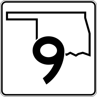
State Highway 9, abbreviated as SH-9, OK-9, or simply Highway 9, is a major east–west highway in the U.S. state of Oklahoma. Spanning across the central part of the state, SH-9 begins at the Texas state line west of Vinson, Oklahoma, and ends at the Arkansas state line near Fort Smith, Arkansas. State Highway 9 is a major highway around the Norman area. At 348.1 miles (560.2 km), SH-9 is Oklahoma's second-longest state highway.

<span class="mw-page-title-main">Oklahoma State Highway 7</span> State highway in Oklahoma, United States

State Highway 7 is a 150.5-mile (242.2 km) highway in southern Oklahoma. This lengthy highway connects many towns in Oklahoma's "Little Dixie" area. It runs from Interstate 44 in Lawton to U.S. 69/US-75 in Atoka.

<span class="mw-page-title-main">Oklahoma State Highway 51</span> State highway in Oklahoma, United States

State Highway 51, abbreviated to SH-51 or OK-51, is a major state highway in Oklahoma, United States. It runs for 332.8 miles (535.6 km) east–west across the state, running from the Texas state line to Arkansas. It is the third-longest state highway in the system.

<span class="mw-page-title-main">Indian Nation Turnpike</span> Tollway

The Indian Nation Turnpike, also designated State Highway 375 (SH-375), is a controlled-access toll road in southeastern Oklahoma, United States, running between Hugo and Henryetta, a distance of 105.2 miles (169.3 km). It is the longest tollway in the state.

<span class="mw-page-title-main">Oklahoma State Highway 165</span> State highway in Oklahoma, United States

State Highway 165 (SH-165) is a state highway in Muskogee County, Oklahoma. It runs east along Peak Boulevard in the southern part of Muskogee from US-64 to the northern terminus of the southern section of the Muskogee Turnpike, then runs north as a freeway connecting the two sections of the turnpike. The total length of the highway is 8.21 miles (13.21 km).

<span class="mw-page-title-main">Oklahoma State Highway 31</span> State highway in Oklahoma, United States

State Highway 31 is a state highway in Oklahoma. It runs 132.6 miles in an irregular west-to-east pattern in the southeastern part of the state.

<span class="mw-page-title-main">Oklahoma State Highway 43</span> State highway in Oklahoma, United States

State Highway 43 is a state highway in Oklahoma, United States. It runs 65.3 miles west-to-east through Coal, Atoka, Pushmataha and Pittsburg counties.

<span class="mw-page-title-main">U.S. Route 77 in Oklahoma</span> Section of U.S. Highway in Oklahoma, United States

U.S. Highway 77 (US-77) in Oklahoma is a 267.21-mile-long (430.03 km) U.S. Highway in the U.S. state of Oklahoma. It travels from south to north, paralleling Interstate 35 (I-35), connecting Texas to Kansas through the central part of the state. It travels through many major cities, including Ardmore, Oklahoma City and its suburbs, Guthrie, and Ponca City. It has four lettered spur routes.

<span class="mw-page-title-main">Interstate 40 in Oklahoma</span> Highway in Oklahoma

Interstate 40 (I-40) is an Interstate Highway in Oklahoma that runs 331 miles (533 km) across the state from Texas to Arkansas. West of Oklahoma City, it parallels and replaces old U.S. Highway 66 (US-66), and, east of Oklahoma City, it parallels US-62, US-266, and US-64. I-40 is the longest Interstate highway in Oklahoma.

<span class="mw-page-title-main">U.S. Route 62 in Oklahoma</span> Highway in Oklahoma

In Oklahoma, U.S. Highway 62 (US 62) runs diagonally across the state, from the Texas state line in far southwestern Oklahoma to the Arkansas state line near Fayetteville. US-62 spends a total of 402.48 miles (647.73 km) in the Sooner State. The highway passes through fifteen of Oklahoma's counties. Along the way the route serves two of Oklahoma's largest cities, Lawton and Oklahoma City, as well as many regionally important cities, like Altus, Chickasha, Muskogee, and Tahlequah. Despite this, US-62 has no lettered spur routes like many other U.S. routes in Oklahoma do.

<span class="mw-page-title-main">U.S. Route 59 in Oklahoma</span> Highway in Oklahoma

U.S. Highway 59 (US-59) heads along the eastern portion of the state of Oklahoma. US-59's 216.47-mile (348.37 km) route through Oklahoma takes it through the mountainous terrain of the eastern Oklahoma Ouachitas and Ozarks. US-59 serves several lakes and towns through Oklahoma's Green Country, including Grand Lake, a major recreation center. The route enters the state from Arkansas near Fogel, Arkansas, and ends at the Kansas state line south of Chetopa, Kansas.

<span class="mw-page-title-main">U.S. Route 70 in Oklahoma</span> Highway in Oklahoma

U.S. Route 70 is a transcontinental U.S. highway extending from Globe, Arizona to Atlantic, North Carolina. Along the way, 289.81 miles (466.40 km) of its route passes through the state of Oklahoma. Entering the state south of Davidson, the highway serves Oklahoma's southern tier before exiting the state east of Broken Bow. It serves the cities of Ardmore, Durant, Hugo, and Idabel, as well as Tillman, Cotton, Jefferson, Carter, Marshall, Bryan, Choctaw, and McCurtain counties.

<span class="mw-page-title-main">U.S. Route 60 in Oklahoma</span> Section of U.S. Highway in Oklahoma, United States

U.S. Route 60 (US-60) is a transcontinental U.S. highway extending from near Brenda, Arizona to Virginia Beach, Virginia on the Atlantic Ocean. Along the way, 352.39 miles (567.12 km) of the route lies within the state of Oklahoma. The highway crosses into the state from Texas west of Arnett and serves many towns and cities in the northern part of the state, including Arnett, Seiling, Fairview, Enid, Ponca City, Pawhuska, Bartlesville, and Vinita. US-60 exits Oklahoma near Seneca, Missouri. In Oklahoma, US-60 has three business routes, serving Tonkawa, Ponca City, and Seneca. The first 60.2 miles (96.9 km) of the route, from the Texas line to Seiling, is also designated as State Highway 51 (SH-51).

<span class="mw-page-title-main">U.S. Route 412 in Oklahoma</span> Highway in Oklahoma

U.S. Route 412 is a U.S. highway in the south-central portion of the United States, connecting Springer, New Mexico to Columbia, Tennessee. A 504.11-mile (811.29 km) section of the highway crosses the state of Oklahoma, traversing the state from west to east. Entering the state southwest of Boise City, US-412 runs the length of the Oklahoma Panhandle and serves the northern portion of the state's main body, before leaving the state at West Siloam Springs. Along the way, the route serves many notable cities and towns, including Boise City, Guymon, Woodward, Enid, and the state's second-largest city, Tulsa.

<span class="mw-page-title-main">U.S. Route 75 in Oklahoma</span> Section of Numbered Highway in Oklahoma, United States

U.S. Route 75 is a major north–south highway that enters the U.S. state of Oklahoma from Texas concurrent with US 69 crossing the Red River. US 75 serves the city of Tulsa, the 2nd largest city in Oklahoma.

<span class="mw-page-title-main">U.S. Route 64 in Oklahoma</span> Highway in Oklahoma

U.S. Route 64 (US-64) is a U.S. highway running from the Four Corners area to the Outer Banks of North Carolina. Between these two points, the highway passes through the entire width of Oklahoma; a total of 591.17 miles (951.40 km) of US-64 lies in the state of Oklahoma. US-64 enters the state from New Mexico, crossing the line between the two states between Clayton, New Mexico, and Boise City in Cimarron County. The route runs the full length of the Oklahoma Panhandle, then serves the northernmost tier of counties in the main body of the state before dipping southeastward to Tulsa, the state's second-largest city. From Tulsa, the highway continues southeast, leaving Oklahoma just west of Fort Smith, Arkansas. In addition to Tulsa, US-64 serves fifteen Oklahoma counties and the cities of Guymon, Woodward, Enid, and Muskogee.

References

Template:Attached KML/U.S. Route 69 in Oklahoma
KML is not from Wikidata
  1. Oklahoma Department of Transportation. "State Highway System: Log of U.S. Highway 62" (PDF). Retrieved 2007-12-19.
  2. 1 2 3 2007 Centennial State Map (Map). Oklahoma Department of Transportation.
  3. 1 2 Morgan, Rhett (2005-07-22). "Speed trap snaps on town". Tulsa World. Retrieved 2008-01-07.
  4. Intermodal Surface Transportation Efficiency Act bill text.
  5. Stuve, Eric. "U.S. 69". OKHighways. Retrieved 2007-12-19.
  6. Oklahoma Department of Transportation. "Plan of Proposed State Highway Traffic Signing" (PDF). Retrieved 2019-01-30.
US 69.svg U.S. Route 69
Previous state:
Texas
Oklahoma Next state:
Kansas