Columbus, Kansas

Last updated

Columbus, Kansas
Columbus, KS public library funded by Andrew Carnegie..jpg
Motto: 
"Help America Discover Columbus..." [1]
Cherokee County Kansas Incorporated and Unincorporated areas Columbus Highlighted.svg
Location within Cherokee County and Kansas
Map of Cherokee Co, Ks, USA.png
Coordinates: 37°10′18″N94°50′39″W / 37.17167°N 94.84417°W / 37.17167; -94.84417 [2]
Country United States
State Kansas
County Cherokee
Founded1868
Incorporated 1871
Named for Columbus, Ohio
Area
[3]
  Total2.39 sq mi (6.20 km2)
  Land2.39 sq mi (6.20 km2)
  Water0.00 sq mi (0.00 km2)
Elevation
[2]
912 ft (278 m)
Population
 (2020) [4]
  Total2,929
  Density1,200/sq mi (470/km2)
Time zone UTC-6 (CST)
  Summer (DST) UTC-5 (CDT)
ZIP code
66725
Area code 620
FIPS code 20-15075
GNIS ID 485558 [2]
Website columbusks.gov

Columbus is the second largest city and county seat of Cherokee County, Kansas, United States. [2] As of the 2020 census, the population of the city was 2,929. [4] It is located approximately 15 miles south-southwest of Pittsburg.

Contents

History

The first settlement was made at Columbus in 1868. [5] The first post office in Columbus was established in 1869. [6]

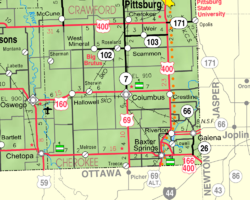
Columbus was a railroad junction for the Saint Louis and San Francisco, and the Missouri, Kansas, and Texas railroads. It was named Columbus by A.L. Peters, one of the European-American founders, for his hometown of Columbus, Ohio; the name thus indirectly honors Christopher Columbus, the explorer. [7] [8] Coal, lead and zinc were mined in the region. Columbus had a considerable trade in agricultural products, and its businesses included machine shops, grain elevators, flour mills, a cigar factory, bottle works (soft drinks), a canning factory, and an extensive brick-making plant. [9]

In 1875, Robert A. Long and Victor Bell formed the Long-Bell Lumber Company in Columbus. From one lumberyard, Long-Bell expanded operations and holdings to become one of the largest vertically integrated lumber companies in the United States. In 1956 it was purchased by International Paper. [10]

Geography

According to the United States Census Bureau, the city has a total area of 2.42 square miles (6.27 km2), all land. [11]

Climate

The climate in this area is characterized by hot, humid summers and generally mild to cool winters. According to the Köppen Climate Classification system, Columbus has a humid subtropical climate, abbreviated "Cfa" on climate maps. [12]

Climate data for Columbus, Kansas (1991–2020 normals, extremes 1892–present)
MonthJanFebMarAprMayJunJulAugSepOctNovDecYear
Record high °F (°C)77
(25)
85
(29)
93
(34)
97
(36)
98
(37)
108
(42)
117
(47)
115
(46)
108
(42)
98
(37)
85
(29)
76
(24)
117
(47)
Mean maximum °F (°C)66.6
(19.2)
70.6
(21.4)
78.7
(25.9)
83.2
(28.4)
87.6
(30.9)
93.1
(33.9)
97.8
(36.6)
98.7
(37.1)
93.5
(34.2)
85.5
(29.7)
75.7
(24.3)
67.5
(19.7)
100.0
(37.8)
Average high °F (°C)43.6
(6.4)
48.8
(9.3)
58.1
(14.5)
67.6
(19.8)
75.8
(24.3)
85.0
(29.4)
89.6
(32.0)
89.3
(31.8)
81.4
(27.4)
70.3
(21.3)
57.5
(14.2)
46.8
(8.2)
67.8
(19.9)
Daily mean °F (°C)33.4
(0.8)
38.1
(3.4)
47.1
(8.4)
56.6
(13.7)
65.7
(18.7)
74.9
(23.8)
79.5
(26.4)
78.5
(25.8)
70.3
(21.3)
58.9
(14.9)
46.9
(8.3)
37.1
(2.8)
57.2
(14.0)
Average low °F (°C)23.3
(−4.8)
27.4
(−2.6)
36.1
(2.3)
45.5
(7.5)
55.5
(13.1)
64.9
(18.3)
69.3
(20.7)
67.7
(19.8)
59.3
(15.2)
47.5
(8.6)
36.3
(2.4)
27.5
(−2.5)
46.7
(8.2)
Mean minimum °F (°C)6.0
(−14.4)
11.4
(−11.4)
18.7
(−7.4)
30.6
(−0.8)
41.1
(5.1)
54.5
(12.5)
60.8
(16.0)
57.5
(14.2)
44.9
(7.2)
31.4
(−0.3)
21.0
(−6.1)
11.0
(−11.7)
1.6
(−16.9)
Record low °F (°C)−19
(−28)
−28
(−33)
−17
(−27)
16
(−9)
28
(−2)
42
(6)
45
(7)
44
(7)
30
(−1)
15
(−9)
4
(−16)
−15
(−26)
−28
(−33)
Average precipitation inches (mm)1.67
(42)
1.99
(51)
3.41
(87)
5.07
(129)
7.10
(180)
5.17
(131)
4.15
(105)
3.81
(97)
4.45
(113)
3.77
(96)
2.98
(76)
2.43
(62)
46.00
(1,168)
Average snowfall inches (cm)2.3
(5.8)
1.1
(2.8)
1.3
(3.3)
0.0
(0.0)
0.0
(0.0)
0.0
(0.0)
0.0
(0.0)
0.0
(0.0)
0.0
(0.0)
0.0
(0.0)
0.2
(0.51)
2.3
(5.8)
7.2
(18)
Average precipitation days (≥ 0.01 in)7.16.29.59.911.910.48.47.27.88.87.86.7101.7
Average snowy days (≥ 0.1 in)1.80.80.70.00.00.00.00.00.00.00.31.04.6
Source: NOAA [13] [14]

Demographics

Historical population
CensusPop.Note
1870 402
1880 1,164189.6%
1890 2,16085.6%
1900 2,3106.9%
1910 3,06432.6%
1920 3,1553.0%
1930 3,2352.5%
1940 3,4025.2%
1950 3,4902.6%
1960 3,395−2.7%
1970 3,356−1.1%
1980 3,4262.1%
1990 3,268−4.6%
2000 3,3963.9%
2010 3,312−2.5%
2020 2,929−11.6%
U.S. Decennial Census

2010 census

As of the census [15] of 2010, there were 3,312 people, 1,424 households, and 850 families living in the city. The population density was 1,368.6 inhabitants per square mile (528.4/km2). There were 1,633 housing units at an average density of 674.8 per square mile (260.5/km2). The racial makeup of the city was 92.9% White, 0.5% African American, 2.7% Native American, 0.3% Asian, 0.4% from other races, and 3.3% from two or more races. Hispanic or Latino of any race were 2.1% of the population.

There were 1,424 households, of which 30.3% had children under the age of 18 living with them, 42.1% were married couples living together, 13.6% had a female householder with no husband present, 4.1% had a male householder with no wife present, and 40.3% were non-families. 34.9% of all households were made up of individuals, and 19.3% had someone living alone who was 65 years of age or older. The average household size was 2.29 and the average family size was 2.94.

The median age in the city was 39.1 years. 25% of residents were under the age of 18; 8.9% were between the ages of 18 and 24; 22.6% were from 25 to 44; 23.8% were from 45 to 64; and 19.7% were 65 years of age or older. The gender makeup of the city was 46.4% male and 53.6% female.

2000 census

As of the census of 2000, there were 3,396 people, 1,412 households, and 885 families living in the city. The population density was 1,408.6 inhabitants per square mile (543.9/km2). There were 1,610 housing units at an average density of 667.8 per square mile (257.8/km2). The racial makeup of the city was 94.70% White, 0.32% African American, 1.56% Native American, 0.41% Asian, 0.77% from other races, and 2.24% from two or more races. Hispanic or Latino of any race were 2.03% of the population.

There were 1,412 households, out of which 29.7% had children under the age of 18 living with them, 47.5% were married couples living together, 11.3% had a female householder with no husband present, and 37.3% were non-families. 34.5% of all households were made up of individuals, and 18.7% had someone living alone who was 65 years of age or older. The average household size was 2.30 and the average family size was 2.94.

In the city, the population was spread out, with 26.3% under the age of 18, 8.4% from 18 to 24, 24.3% from 25 to 44, 20.7% from 45 to 64, and 20.3% who were 65 years of age or older. The median age was 38 years. For every 100 females, there were 82.1 males. For every 100 females age 18 and over, there were 78.1 males.

The median income for a household in the city was $27,530, and the median income for a family was $38,136. Males had a median income of $30,541 versus $17,069 for females. The per capita income for the city was $14,937. About 12.2% of families and 16.2% of the population were below the poverty line, including 23.1% of those under age 18 and 8.3% of those age 65 or over.

Education

The community is served by Columbus USD 493 public school district. [16]

Notable people

Related Research Articles

<span class="mw-page-title-main">Colony, Kansas</span> City in Anderson County, Kansas

Colony is a city in Anderson County, Kansas, United States. As of the 2020 census, the population of the city was 381.

<span class="mw-page-title-main">St. Francis, Kansas</span> City in Cheyenne County, Kansas

St. Francis is a city in and the county seat of Cheyenne County, Kansas, United States. As of the 2020 census, the population of the city was 1,263.

<span class="mw-page-title-main">Waverly, Kansas</span> City in Coffey County, Kansas

Waverly is a city in Coffey County, Kansas, United States. As of the 2020 census, the population of the city was 574.

<span class="mw-page-title-main">Hepler, Kansas</span> City in Crawford County, Kansas

Hepler is a city in Crawford County, Kansas, United States. As of the 2020 census, the population of the city was 90.

<span class="mw-page-title-main">Walnut, Kansas</span> City in Crawford County, Kansas

Walnut is a city in Crawford County, Kansas, United States. As of the 2020 census, the population of the city was 187.

<span class="mw-page-title-main">Park, Kansas</span> City in Gove County, Kansas

Park is a city in Gove County, Kansas, United States. As of the 2020 census, the population of the city was 112.

<span class="mw-page-title-main">Hamilton, Kansas</span> City in Greenwood County, Kansas

Hamilton is a city in Greenwood County, Kansas, United States. As of the 2020 census, the population of the city was 182.

<span class="mw-page-title-main">Hoyt, Kansas</span> City in Jackson County, Kansas

Hoyt is a city in Jackson County, Kansas, United States. As of the 2020 census, the population of the city was 593.

<span class="mw-page-title-main">Mission, Kansas</span> City in Kansas, United States

Mission is a city in Johnson County, Kansas, United States, and part of the Kansas City Metropolitan Area. As of the 2020 census, the population of the city was 9,954.

<span class="mw-page-title-main">Westwood Hills, Kansas</span> City in Kansas, United States

Westwood Hills is a city in Johnson County, Kansas, United States. As of the 2020 census, the population of the city was 400. It is the most densely populated city in the Kansas City Metropolitan Area at 6,240 people per square mile. It borders Kansas City, Missouri.

<span class="mw-page-title-main">Barnard, Kansas</span> City in Lincoln County, Kansas

Barnard is a city in Lincoln County, Kansas, United States. As of the 2020 census, the population of the city was 64.

<span class="mw-page-title-main">Windom, Kansas</span> City in McPherson County, Kansas

Windom is a city in McPherson County, Kansas, United States. As of the 2020 census, the population of the city was 85.

<span class="mw-page-title-main">Meade, Kansas</span> City in Meade County, Kansas

Meade is a city in and the county seat of Meade County, Kansas, United States. As of the 2020 census, the population of the city was 1,505.

<span class="mw-page-title-main">Osage City, Kansas</span> City in Osage County, Kansas

Osage City is a city in Osage County, Kansas, United States. As of the 2020 census, the population of the city was 2,861.

<span class="mw-page-title-main">Chase, Kansas</span> City in Rice County, Kansas

Chase is a city in Rice County, Kansas, United States. As of the 2020 census, the population of the city was 396.

<span class="mw-page-title-main">Randolph, Kansas</span> City in Riley County, Kansas

Randolph is a city in Riley County, Kansas, United States. As of the 2020 census, the population of the city was 159.

<span class="mw-page-title-main">Damar, Kansas</span> City in Rooks County, Kansas

Damar is a city in Rooks County, Kansas, United States. As of the 2020 census, the population of the city was 112.

<span class="mw-page-title-main">Liebenthal, Kansas</span> City in Rush County, Kansas

Liebenthal is a city in Rush County, Kansas, United States. As of the 2020 census, the population of the city was 92. It is located 8 miles north of La Crosse.

<span class="mw-page-title-main">Selden, Kansas</span> City in Sheridan County, Kansas

Selden is a city in Sheridan County, Kansas, United States. As of the 2020 census, the population of the city was 184.

<span class="mw-page-title-main">Park River, North Dakota</span> City in North Dakota, United States

Park River is a city in Walsh County, North Dakota, United States. The population was 1,424 at the 2020 census. Park River was founded in 1884.

References

  1. "Columbus Chamber of Commerce". Columbus Chamber of Commerce. Archived from the original on July 22, 2012. Retrieved August 17, 2012.
  2. 1 2 3 4 U.S. Geological Survey Geographic Names Information System: Columbus, Kansas
  3. "2019 U.S. Gazetteer Files". United States Census Bureau. Retrieved July 24, 2020.
  4. 1 2 "Profile of Columbus, Kansas in 2020". United States Census Bureau. Archived from the original on November 9, 2022. Retrieved November 9, 2022.
  5. Blackmar, Frank Wilson (1912). Kansas: A Cyclopedia of State History, Embracing Events, Institutions, Industries, Counties, Cities, Towns, Prominent Persons, Etc. Standard Publishing Company. pp.  391.
  6. "Kansas Post Offices, 1828-1961 (archived)". Kansas Historical Society. Archived from the original on October 9, 2013. Retrieved June 6, 2014.
  7. John Rydjord, Kansas Place-Names, University of Oklahoma Press, 1972, ISBN   0-8061-0994-7
  8. The Modern Light, Columbus, August 16, 1951
  9. "1904 History of Cherokee County Kansas, Chapter 12". Archived from the original on July 2, 2009. Retrieved March 28, 2009.
  10. William E. Connelley, A Standard History of Kansas and Kansans,, Chicago: Lewis Publishing Company, 1918
  11. "US Gazetteer files 2010". United States Census Bureau. Archived from the original on July 2, 2012. Retrieved July 6, 2012.
  12. Climate Summary for Columbus, Kansas
  13. "NowData – NOAA Online Weather Data". National Oceanic and Atmospheric Administration. Retrieved August 3, 2021.
  14. "Station: Columbus, KS". U.S. Climate Normals 2020: U.S. Monthly Climate Normals (1991–2020). National Oceanic and Atmospheric Administration. Retrieved August 3, 2021.
  15. "U.S. Census website". United States Census Bureau . Retrieved July 6, 2012.
  16. USD 493

Further reading