Carona, Kansas | |
|---|---|
 | |
 Carona  Carona | |
| Coordinates: 37°16′49″N94°52′07″W / 37.28028°N 94.86861°W [1] | |
| Country | United States |
| State | Kansas |
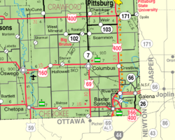
| County | Cherokee |
| Elevation | 912 ft (278 m) |
| Time zone | UTC-6 (CST) |
| • Summer (DST) | UTC-5 (CDT) |
| Area code | 620 |
| FIPS code | 20-10825 |
| GNIS ID | 482751 [1] |
Carona is an unincorporated community in Cherokee County, Kansas, United States. [1]
