Summit, Oklahoma | |
|---|---|
 A church in Summit, May 2025 | |
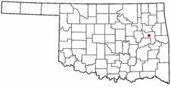 Location in Oklahoma | |
| Coordinates: 35°40′10″N95°25′14″W / 35.66944°N 95.42056°W | |
| Country | United States |
| State | Oklahoma |
| County | Muskogee |
| Area | |
• Total | 0.98 sq mi (2.53 km2) |
| • Land | 0.98 sq mi (2.53 km2) |
| • Water | 0 sq mi (0.00 km2) |
| Elevation | 617 ft (188 m) |
| Population | |
• Total | 108 |
| • Density | 110.7/sq mi (42.73/km2) |
| Time zone | UTC-6 (Central (CST)) |
| • Summer (DST) | UTC-5 (CDT) |
| ZIP Code | 74401 |
| FIPS code | 40-71450 [4] |
| GNIS feature ID | 2413349 [2] |
Summit is a town in Muskogee County, Oklahoma, United States. It was originally called "South Muskogee" when it was platted in 1910, and is one of 13 all-black towns still surviving at the beginning of the 21st century. [5] The population was 108 at the time of the 2020 Census, [3] down from 139 in 2010. The community had a post office as early as 1896. Like many of the other Black towns previously mentioned, Summit was a stopover destination on the Missouri, Kansas and Texas Railway and had a depot in the community. It is said that the town may have been named Summit because it was the highest point on the railroad between the Arkansas and the North Canadian rivers.
