Stringtown, Oklahoma

Last updated

Stringtown, Oklahoma
Stringtown 1978.jpg
A view of the town in 1978 looking towards the old post office
OKMap-doton-Stringtown.PNG
Location of Stringtown, Oklahoma
Coordinates: 34°28′12″N96°03′18″W / 34.47000°N 96.05500°W / 34.47000; -96.05500
Country United States
State Oklahoma
County Atoka
Government
  Mayor and Chairman of Water DepartmentRobert Smith
Area
[1]
  Total5.44 sq mi (14.09 km2)
  Land5.39 sq mi (13.95 km2)
  Water0.05 sq mi (0.14 km2)
Elevation
[2]
653 ft (199 m)
Population
 (2020)
  Total419
  Density77.79/sq mi (30.03/km2)
Time zone UTC-6 (CST)
  Summer (DST) UTC-5 (CDT)
ZIP code
74569
Area code 580
FIPS code 40-70850 [3]
GNIS feature ID2413343 [2]

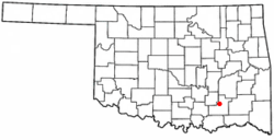
Stringtown is a town in Atoka County, Oklahoma, United States. The population was 419 as of the 2020 Census, [4] which was a 2.2% increase over the population of 410 reported at the 2010 census, [5] which itself was an increase of 3.5% from the figure of 396 recorded in 2000. It is the second largest town in Atoka County.

Contents

The town is notable for the Mack H. Alford Correctional Center, a medium-security prison operated by the Oklahoma Department of Corrections, just outside Stringtown.

Geography

According to the United States Census Bureau, the town has a total area of 4.7 square miles (12.2 km2), of which 4.7 square miles (12.1 km2) is land and 0.077 square miles (0.2 km2), or 1.24%, is water. [5]

Stringtown is located at the southern intersection of U.S. Highway 69 and State Highway 43. [6]

History

The abandoned dance hall where Deputy Eugene C. Moore was shot and killed by the Barrow Gang in 1932 Stringtown Dance Hall.jpg
The abandoned dance hall where Deputy Eugene C. Moore was shot and killed by the Barrow Gang in 1932

Sources differ as to the origins of the name: one suggests the original name was Springtown for a local sulphur spring but a spelling mistake labeled it Stringtown, while another suggests it got the name because businesses were strung out along the railroad tracks. [7] Once home to a bank, theater, and pub, the town has grown recently, both economically and in population. Companies noticing business opportunities in game hunting. population growth since the 1990 census and the addition of a new café have brought new life to the town. Annually in September, the Good Ole Days Festival celebrates the town's past with a parade, cookout, and concert.

Oklahoma and Indian Territory, 1890s Okterritory.png
Oklahoma and Indian Territory, 1890s

A post office was established at Stringtown, Indian Territory on August 17, 1874. For a few weeks in July 1877 the official name of the post office was Sulphur Springs, Indian Territory. the present name is a modification of Springtown, the original name of the settlement. At the time of its founding, Stringtown was located in Atoka County, Choctaw Nation, a territorial-era government unit that included parts of today's Atoka, Coal, Hughes, and Pittsburg counties. [8]

On August 5, 1932, while Bonnie Parker was visiting her mother, Clyde Barrow and two associates were drinking alcohol at a dance in Stringtown (illegal under Prohibition). They were approached by Sheriff C. G. Maxwell and his deputy, at which time Clyde opened fire, killing deputy Eugene C. Moore. That was the first killing of a lawman by what was later known as the Barrow Gang, a total which would eventually amount to nine slain officers.

In the 1940s during World War II, Fritz Johann Hansgirg, the Austrian inventor of magnesium and heavy water processes was interned at the U.S. alien internment camp located in Stringtown.

In the late 1960s, a tornado touched down in the town directly on top of the (then) recently built Community Center, now the Senior Citizens Center. The tornado was only on the ground for a few seconds, but during that time the building was almost destroyed. It was an unusual occurrence for a tornado to touch down in the town itself, given its location between two chains of steep hills.

The nearby Mack Alford State Penitentiary is a large source of employment in the county. It was an internment camp for Japanese Americans arrested as "enemy aliens" and later for German POWs during World War II. [9] [10]

Despite its small size, Stringtown (2010 pop. 410) is the second-largest town in Atoka County, behind Atoka (pop. 3,107) and ahead of Tushka (pop. 312). On January 14, 2014, the Oklahoma Highway Patrol disbanded the Stringtown Police Department for generating too much of the city’s revenue off of writing traffic tickets, a violation of the state "speed trap" law. [11]

The Garside house is one of the biggest historical sites of the town, next to the Bonnie and Clyde monument. The land the Garside house sits on was allotted to Joseph and Sarah Garside and their two children in 1902. In the middle of building the house, a tornado came through the town and tore down the part of the house that had been built. The Garsides had to start over again, but in 1915 they finished a two-story house. The house and land was later purchased by E. H. Colbertson, the first white man to buy land in that area. Approximately four years ago, the house was remodeled and decorated to be a museum.

The Southwest Stone Company, also known as the Rock Crusher, is one of the biggest sources of employment in the county. The crusher moved from Chockee to Stringtown in the early 1900s. Up until that point, Stringtown had not had electricity yet.

The railroad that runs through Stringtown stretches from south Texas, takes several routes in Oklahoma and Kansas, and reaches to the northern parts of Missouri. The part that runs through Stringtown was built in 1872 and is known now as the Union Pacific Railroad.

Stringtown was once home to a sawmill and a cotton gin that had the biggest production rate in the late 1800s. When a fire burnt the town on July 15, 1954, the sawmill and cotton gin burned down, along with half the town, including a café, a jailhouse, a barbershop, a bank, and a hotel. All that was left was Robert’s Store and a few homes. The town never really was rebuilt after this. Today, there is a school, a church, a fire department, City Hall, Dianna’s Store, and a senior citizens center.

Government and infrastructure

The old Stringtown Post Office, which was demolished early in the 1990s as it had become structurally unsound. Stringtown Post Office.jpg
The old Stringtown Post Office, which was demolished early in the 1990s as it had become structurally unsound.

The United States Postal Service operates the Stringtown Post Office. [12]

The Oklahoma Department of Corrections operates the Mack Alford Correctional Center in an unincorporated area in Atoka County, near Stringtown. [13]

Demographics

Historical population
CensusPop.Note
1920 360
1930 55855.0%
1940 71828.7%
1950 499−30.5%
1960 414−17.0%
1970 397−4.1%
1980 1,047163.7%
1990 366−65.0%
2000 3968.2%
2010 4103.5%
2020 4192.2%
U.S. Decennial Census [14]

As of the census [3] of 2000, there were 396 people, 166 households, and 113 families residing in the town. The population density was 83.7 inhabitants per square mile (32.3/km2). There were 217 housing units at an average density of 45.9 per square mile (17.7/km2). The racial makeup of the town was 69.95% White, 11.36% African American, 10.35% Native American, 0.25% Asian, 0.25% Pacific Islander, and 7.83% from two or more races.

There were 166 households, out of which 26.5% had children under the age of 18 living with them, 54.2% were married couples living together, 10.8% had a female householder with no husband present, and 31.9% were non-families. 28.9% of all households were made up of individuals, and 14.5% had someone living alone who was 65 years of age or older. The average household size was 2.39 and the average family size was 2.89.

In the town, the population was spread out, with 24.0% under the age of 18, 9.6% from 18 to 24, 21.2% from 25 to 44, 27.5% from 45 to 64, and 17.7% who were 65 years of age or older. The median age was 42 years. For every 100 females, there were 103.1 males. For every 100 females age 18 and over, there were 89.3 males.

The median income for a household in the town was $20,536, and the median income for a family was $22,614. Males had a median income of $19,643 versus $14,861 for females. The per capita income for the town was $9,612. About 15.1% of families and 25.1% of the population were below the poverty line, including 45.0% of those under age 18 and 30.9% of those age 65 or over.

Notable people

Related Research Articles

<span class="mw-page-title-main">Pottawatomie County, Oklahoma</span> County in Oklahoma, United States

Pottawatomie County is a county located in the U.S. state of Oklahoma. As of the 2020 census, the population was 72,454. Its county seat is Shawnee.

<span class="mw-page-title-main">Atoka County, Oklahoma</span> County in Oklahoma, United States

Atoka County is a county located in the U.S. state of Oklahoma. As of the 2020 census, the population was 14,143. Its county seat is Atoka. The county was formed before statehood from Choctaw Lands, and its name honors a Choctaw Chief named Atoka. The county is part of Choctaw Nation reservation lands.

<span class="mw-page-title-main">Baca County, Colorado</span> County in Colorado, United States

Baca County is a county located in the U.S. state of Colorado. As of the 2020 census, the population was 3,506. The county seat is Springfield. Located at the southeast corner of Colorado, the county shares state borders with Kansas, New Mexico, and Oklahoma.

<span class="mw-page-title-main">Springtown, Arkansas</span> Town in Arkansas, United States

Springtown is a town in Benton County, Arkansas, United States. The population was 83 at the 2020 census. It is part of the Northwest Arkansas region.

<span class="mw-page-title-main">Atoka, Oklahoma</span> City in Oklahoma, United States

Atoka is a city in and the county seat of Atoka County, Oklahoma, United States. The population was 3,195 as of the 2020 Census, a 2.4% increase over the 3,107 reported at the 2010 census, which was itself an increase of 4.0 percent from the figure of 2,988 in 2000.

<span class="mw-page-title-main">Caney, Oklahoma</span> Town in Oklahoma, United States

Caney is a town in Atoka County, Oklahoma, United States. The population was 185 as of the 2020 Census.

<span class="mw-page-title-main">Tushka, Oklahoma</span> Town in Oklahoma, United States

Tushka is a town in Atoka County, Oklahoma, United States. The population was 413 as of the 2020 Census, a 32.4% increase over the 312 reported at the 2010 census.

<span class="mw-page-title-main">Canton, Oklahoma</span> Town in Oklahoma, United States

Canton is a town in Blaine County, Oklahoma, United States. The population was 625 at the 2010 census.

<span class="mw-page-title-main">Union City, Oklahoma</span> Town in Oklahoma, United States

Union City is a town in Canadian County, Oklahoma, United States. The population was 1,645 at the 2010 census, a 19.6 percent increase from 1,375 in 2000. It is part of the Oklahoma City metropolitan statistical area.

<span class="mw-page-title-main">Lone Grove, Oklahoma</span> City in Oklahoma, United States

Lone Grove is a city in Carter County, Oklahoma, United States. The population was 5,054 at the 2010 census. It is part of the Micropolitan Statistical Area of Ardmore.

<span class="mw-page-title-main">Coalgate, Oklahoma</span> City in Oklahoma, United States

Coalgate is a city in and the county seat of Coal County, Oklahoma, United States. The population was 1,967 at the 2010 census, a 1.9 percent decrease from the figure of 2,005 recorded in 2000. The town was founded in 1889 in the Choctaw Nation, Indian Territory as a coal mining camp named Liddle. The name changed to Coalgate on January 23, 1890.

<span class="mw-page-title-main">Twin Oaks, Oklahoma</span> Census-designated place in Oklahoma, United States

Twin Oaks is an unincorporated community and census-designated place (CDP) in Delaware County, Oklahoma, United States. The population was 198 at the 2010 census. A tornado hit the town on March 12, 2006, destroying 36 homes and damaging 31 others. 8 people were injured.

<span class="mw-page-title-main">Leedey, Oklahoma</span> Town in Oklahoma, United States

Leedey is a town in Dewey County, Oklahoma, United States. The population was 415 at the 2020 census.

<span class="mw-page-title-main">Holdenville, Oklahoma</span> City in Oklahoma, United States

Holdenville is a city in and county seat of Hughes County, Oklahoma, United States. The population was 5,934 at the time of the 2020 United States census.

<span class="mw-page-title-main">Spiro, Oklahoma</span> Town in Oklahoma, United States

Spiro is a town in Le Flore County, Oklahoma, United States. It is part of the Fort Smith, Arkansas-Oklahoma Metropolitan Statistical Area. The population was 2,164 at the 2010 census, a 2.8 percent decline from the figure of 2,227 recorded in 2000.

<span class="mw-page-title-main">Cole, Oklahoma</span> Town in Oklahoma, United States

Cole is a town in McClain County, Oklahoma, United States. The population was 624 at the 2020 census, up from 555 at the 2010 census.

<span class="mw-page-title-main">Wayne, Oklahoma</span> Town in Oklahoma, United States

Wayne is a town in McClain County, Oklahoma, United States. Wayne and McClain County are part of the Oklahoma City Metropolitan Area. The population was 625 at the 2020 census, a 9.2% decrease from 2010. Wayne is part of the "Heart of Oklahoma" exurban area south of Norman and Oklahoma City.

<span class="mw-page-title-main">Westport, Oklahoma</span> Town in Oklahoma, United States

Westport is a town in Pawnee County, Oklahoma, United States. The population was 298 at the 2010 census, a gain of 12.9 percent over the figure of 264 in 2000.

<span class="mw-page-title-main">Tecumseh, Oklahoma</span> City in Oklahoma, United States

Tecumseh is a city in Pottawatomie County, Oklahoma. The population was 6,302 by the 2020 United States census. It was named for the noted Shawnee chief, Tecumseh. The locale was designated as the county seat at Oklahoma's statehood, but a county-wide election moved the seat to Shawnee in 1930.

<span class="mw-page-title-main">Konawa, Oklahoma</span> City in Oklahoma, United States

Konawa is a city in Seminole County, Oklahoma, United States. The population was 1,288 at the time of the 2020 census. Konawa is a Seminole word meaning, "string of beads."

References

  1. "ArcGIS REST Services Directory". United States Census Bureau. Retrieved September 20, 2022.
  2. 1 2 U.S. Geological Survey Geographic Names Information System: Stringtown, Oklahoma
  3. 1 2 "U.S. Census website". United States Census Bureau . Retrieved January 31, 2008.
  4. "Stringtown (town), Oklahoma". United States Census Bureau. Retrieved July 2, 2024.
  5. 1 2 "Geographic Identifiers: 2010 Demographic Profile Data (G001): Stringtown town, Oklahoma". U.S. Census Bureau, American Factfinder. Archived from the original on February 12, 2020. Retrieved July 16, 2013.
  6. Official State Map (Map) (2008 ed.). Oklahoma Department of Transportation.
  7. "Stringtown". Oklahoma Historical Society. Retrieved December 28, 2020.
  8. Morris, John W. Historical Atlas of Oklahoma (Norman: University of Oklahoma Press, 1986), plate 38; Shirk, George H. Oklahoma Place Names (Norman: University of Oklahoma Press, 1965), p. 199.
  9. "Stringtown (detention facility)" Densho Encyclopedia. Retrieved June 20, 2014.
  10. J. Burton, M. Farrell, F. Lord & R. Lord. Confinement and Ethnicity: An Overview of World War II Japanese American Relocation Sites, "U.S. Army Facilities: Stringtown, Oklahoma", (National Park Service, 2001); retrieved June 20, 2014.
  11. "New laws aim to put brakes on nation's speed traps", CBS News; retrieved May 3, 2017.
  12. "Post Office Location - STRINGTOWN", United States Postal Service; retrieved November 22, 2010.
  13. "Mack Alford Correctional Center Archived 2013-04-04 at the Wayback Machine ", Oklahoma Department of Corrections; retrieved November 22, 2010.
  14. "Census of Population and Housing". Census.gov. Retrieved June 4, 2015.