List of U.S. Highways in Oklahoma

Last updated

US 64.svg US 412.svg
Highway markers for US-64 and US-412
System information
FormedNational system formed November 11, 1926, by BPR [1]
Designations applied in Oklahoma December 7, 1926 [2]
Highway names
US Highways U.S. Highway X (US-X)
System links
  • Oklahoma State Highway System

United States Numbered Highways in Oklahoma are part of a nationwide network of roadways passing through the 48 contiguous states. These U.S. Highways are the second-highest category of road classifications in the Oklahoma road system, just below the Interstate Highways. U.S. Highways are marked with a number contained inside a white shield in a black box. The number is generally even if the highway runs east–west, and generally odd if it runs north–south, though there are many substantial deviations from this plan.

Contents

Mainline highways

NumberLength (mi)Length (km)Southern or western terminusNorthern or eastern terminusFormedRemovedNotes
US 54.svg US 54 56.07 [3] 90.24Texas state line in Texhoma Kansas state line northeast of Tyrone 01926-12-071926current
US 56.svg US 56 71.17 [4] 114.54New Mexico state line southwest of Felt Kansas state line south of Elkhart, Kan. 01956-01-011956current
US 59.svg US 59 216.47 [5] 348.37Arkansas state line southeast of Page Kansas state line north of Welch 01935-01-011935current
US 60.svg US 60 352.39 [6] 567.12Texas state line east of Higgins, Tex. Missouri state line south of Seneca, Mo. 01930-01-011930current
US 62.svg US 62 402.49 [7] 647.74Texas state line west of Hollis Arkansas state line east of Westville 01931-01-011931current
US 64.svg US 64 591.17 [8] 951.40New Mexico state line southwest of Felt Arkansas state line east of Moffett 01926-12-071926current
US 66.svg US 66 374.6 [9] 602.9Texas state line west of Erick Kansas state line south of Baxter Springs, Kan. 01926-12-07192601985-04-011985Replaced by I-40 and SH-66
US 69.svg US 69 260.82 [10] 419.75Texas state line south of Colbert Kansas state line north of Picher 01935-01-011935current
US 70.svg US 70 289.81 [11] 466.40Texas state line south of Davidson Arkansas state line west of DeQueen, Ark. 01926-12-071926current
US 73.svg US 73 US-75 in Atoka Kansas state line north of Picher 01926-12-07192601935-01-011935Replaced by US-69
US 75.svg US 75 249.42401.40Texas state line south of Colbert Kansas state line north of Copan 01926-12-071926current
US 77.svg US 77 267.21430.03Texas state line south of Thackerville Kansas state line north of Newkirk 01926-12-071926current
US 81.svg US 81 229.28368.99Texas state line south of Terral Kansas state line north of Renfrow 01927-12-071927current
US 83.svg US 83 36.3258.45Texas state line south of Gray Kansas state line north of Turpin 01930-01-011930current
US 164.svg US 164 Texas state line east of Higgins, Tex. Enid 01926-12-07192601930-05-291930Replaced by US-60
US 169.svg US 169 73.67118.56 US-64  / Creek Turnpike  / Memorial Drive in Tulsa Kansas state line north of Lenapah 01935-01-011935current
US 177.svg US 177 229.25368.94 US-70  / SH-199 in Madill Kansas state line north of Braman 01928-01-011928current
US 183.svg US 183 219.94353.96Texas state line south of Davidson Kansas state line north of Buffalo 01938-01-011938current
US 259.svg US 259 98.33158.25Texas state line south of Harris US-59 west of Page 01963-01-011963current
US 266.svg US 266 43.09 [12] 69.35 US-62  / US-75 north of Henryetta US-64  / SH-2 in Warner 01926-01-011926current
US 270.svg US 270 476.86767.43Kansas state line north of Turpin Arkansas state line east of Page 01931-01-011931current
US 271.svg US 271 158.32254.79Texas state line south of Hugo Arkansas state line northeast of Pocola 01926-01-011926current
US 277.svg US 277 124.47200.32Texas state line southwest of Randlett I-44  / US-62 in Newcastle 01930-01-011930current
US 281.svg US 281 255.57411.30Texas state line southwest of Randlett Kansas state line north of Alva 01938-01-011938current
US 283.svg US 283 203.31327.20Texas state line south of Altus Kansas state line northeast of Rosston 01931-01-011931current
US 287.svg US 287 41.4166.64Texas state line northwest of Stratford, Tex. Colorado state line north of Boise City 01940-01-011940current
US 377.svg US 377 139.91225.16Texas state line south of Madill Stroud 01964-06-181964currentConcurrent with SH-99 for its entire length in Oklahoma
US 385.svg US 385 35.9857.90Texas state line south of Boise City Colorado state line north of Boise City01958-01-011958current
US 412.svg US 412 504.11811.29New Mexico state line west of Boise City Arkansas state line in West Siloam Springs 01988-02-011988 [13] currentThe highway designations made redundant by US-412 were removed, effective December 12, 1988. [14]
  •       Former

Special routes

NumberLength (mi)Length (km)Southern or western terminusNorthern or eastern terminusFormedRemovedNotes
Temporary plate.svg
US 56.svg Temp. US 56
01957-01-01195701961-01-011961Served Boise CityElkhart, Kan.; now US 412/US 56/US 64/SH-3 and SH-95
Temporary plate.svg
US 59.svg Temp. US 59
01935-01-01193501935-01-011935Served Maud, Tex.Page; now US 59
By-pass plate.svg
US 59.svg US 59 Byp.
02003-01-012003currentServes Poteau
Alt plate.svg
US 59.svg US 59 Alt.
01935-01-01193501935-01-011935Served Ft. Smith, Ark.West Siloam Springs; became US 59
Temporary plate.svg
US 59.svg Temp. US 59
01935-01-01193501936-01-011936Served Ft. Smith, Ark.West Siloam Springs; now US 412
Business plate.svg
US 60.svg US 60 Bus.
Serves Tonkawa
Business plate.svg
US 60.svg US 60 Bus.
Serves Ponca City
City plate.svg
US 60.svg City US 60
01938-01-011938Served Ponca City
Business plate.svg
US 60.svg US 60 Bus.
US-60 northeast of Wyandotte Missouri state line west of Seneca, Mo. 01965-01-011965currentServes Seneca, Mo.
Business plate.svg
US 62.svg US 62 Bus.
7.612.201973-01-011973currentServes Snyder
Temporary plate.svg
US 62.svg Temp. US 62
01997-01-011997Served Lawton
Temporary plate.svg
US 62.svg Temp. US 62
01961-01-01196101961-01-011961Served Oklahoma City
Business plate.svg
US 62.svg US 62 Bus.
2.944.73Serves Henryetta; concurrent with US 75 Bus. and I-40 Bus.
Business plate.svg
US 62.svg US 62 Bus.
01960-01-011960currentServes Muskogee
Business plate.svg
US 62.svg US 62 Bus.
Serves Tahlequah
Business plate.svg
US 64.svg US 64 Bus.
01967-01-01196702009-01-012009Served Enid
Business plate.svg
US 64.svg US 64 Bus.
4.87.701960-01-011960currentServes Muskogee
Business plate.svg
US 66.svg US 66 Bus.
Served Clinton
City plate.svg
US 66.svg City US 66
01941-01-01194101959-01-011959Served Clinton
Business plate.svg
US 66.svg US 66 Bus.
01958-01-01195801979-01-011979Served Oklahoma City
City plate.svg
US 66.svg City US 66
01954-01-01195401958-01-011958Served Oklahoma City
Business plate.svg
US 69.svg US 69 Bus.
01966-01-011966currentServes Durant
Business plate.svg
US 69.svg US 69 Bus.
01964-01-011964currentServes McAlester
Business plate.svg
US 69.svg US 69 Bus.
01964-01-011964currentServes Eufaula
Business plate.svg
US 69.svg US 69 Bus.
01974-01-011974currentServes Checotah; decommissioned from 1979-1990
City plate.svg
US 69.svg City US 69
01952-01-011952Served Commerce; former US 66, became US 69 Bus.
Alt plate.svg
US 69.svg US 69 Alt.
20.332.7US 69 south of PicherKansas state line south of Baxter Springs01985-01-011985currentServes Ottawa County and Cherokee County, Kan.; former routing of US-66
City plate.svg
US 70.svg City US 70
01941-01-01194101941-01-011941Served Wilson
By-pass plate.svg
US 70.svg US 70 Byp.
Served Durant
Truck plate.svg
US 70.svg US 70 Truck
01967-01-011967Served Durant
Business plate.svg
US 70.svg US 70 Bus.
58.001981-01-011981currentServes Hugo
By-pass plate.svg
US 70.svg US 70 Byp.
01995-01-011995currentServes Idabel
Business plate.svg
US 75.svg US 75 Bus.
Serves Durant
Business plate.svg
US 75.svg US 75 Bus.
2.944.7301967-01-011967currentServes Henryetta; concurrent with US 62 Bus. and I-40 Bus.
Alt plate.svg
US 75.svg US 75 Alt.
30.1548.52 US-75/SH-16 east of Beggs I-44 in Sapulpa01959-01-011959currentFormer routing of US 75
Temporary plate.svg
US 75.svg Temp. US 75
01965-01-01196501966-01-011966Served OakhurstOwasso
Temporary plate.svg
US 75.svg Temp. US 75
01966-01-01196601970-01-011970Served OakhurstOwasso
Business plate.svg
US 75.svg US 75 Bus.
01966-01-01196601973-01-011973Served Tulsa; became US 75
Business plate.svg
US 77.svg US 77 Bus.
01964-01-011964Served Ardmore; became US 70
Alt plate.svg
US 77.svg US 77 Alt.
01954-01-011954Served Oklahoma City; former US 77
Business plate.svg
US 77.svg US 77 Bus.
01951-01-01195101965-01-011965Served Perry
Alt plate.svg
US 77.svg US 77 Alt.
01952-01-01195201966-01-011966Served Ponca City; became US 77
Business plate.svg
US 77.svg US 77 Bus.
01953-01-01195301965-01-011965Served Ponca City
City plate.svg
US 77.svg City US 77
01938-01-01193801953-01-011953Served Ponca City; became US 77 Bus.
Alt plate.svg
US 81.svg US 81 Alt.
01950-01-01195001960-01-011960Served Waurika; became US 70 and SH-5
City plate.svg
US 81.svg City US 81
01951-01-011951Served Duncan
Business plate.svg
US 81.svg US 81 Bus.
01971-01-011971currentServes Rush Springs
No image.svgTemporary plate.svgNo image.svg
US 169.svg Temp. US 169
01965-01-01196501966-01-011966Served Tulsa; became US 66 (now I-40) and I-44
No image.svgAlt plate.svgNo image.svg
US 169.svg US 169 Alt.
2.74.3Serves Nowata
No image.svgAlt plate.svgNo image.svg
US 183.svg US 183 Alt.
01959-01-011959Served Clinton
No image.svgBy-pass plate.svgNo image.svg
US 259.svg US 259 Byp.
01995-01-01199502000-01-012000Served Idabel; became US 259
No image.svgBusiness plate.svgNo image.svg
US 270.svg US 270 Bus.
Serves Shawnee
No image.svgBusiness plate.svgNo image.svg
US 270.svg US 270 Bus.
Serves Wewoka
No image.svgBusiness plate.svgNo image.svg
US 270.svg US 270 Bus.
Serves Holdenville
No image.svgBusiness plate.svgNo image.svg
US 271.svg US 271 Bus.
4.26.801962-01-011962currentServes Hugo
No image.svgBusiness plate.svgNo image.svg
US 281.svg US 281 Bus.
01967-01-011967currentServes Lawton
US 281.svg US 281 Spur Serves Geary
No image.svgAlt plate.svgNo image.svg
US 412.svg US 412 Alt.
33.8154.4102012-01-012012currentFormerly designated US-412 Scenic
  •       Former

Related Research Articles

<span class="mw-page-title-main">Interstate 40</span> Interstate Highway across south-central US

Interstate 40 (I-40) is a major east–west transcontinental Interstate Highway in the southeastern and southwestern portions of the United States. At a length of 2,556.61 miles (4,114.46 km), it is the third-longest Interstate Highway in the country, after I-90 and I-80. From west to east, it passes through California, Arizona, New Mexico, Texas, Oklahoma, Arkansas, Tennessee, and North Carolina. Its western terminus is at I-15 in Barstow, California, while its eastern terminus is at a concurrency with U.S. Route 117 (US 117) and North Carolina Highway 132 (NC 132) in Wilmington, North Carolina. Major cities served by the interstate include Flagstaff, Arizona; Albuquerque, New Mexico; Amarillo, Texas; Oklahoma City, Oklahoma; Little Rock, Arkansas; Memphis, Nashville, and Knoxville in Tennessee; and Asheville, Winston-Salem, Greensboro, Durham, Raleigh, and Wilmington in North Carolina.

<span class="mw-page-title-main">U.S. Route 270</span> Highway in the United States

U.S. Route 270 (US 270) is a spur of US 70. It travels for 643 miles (1,035 km) from Liberal, Kansas at US 54 and US 83 to White Hall, Arkansas at Interstate 530 (I-530) and US 65. It travels through the states of Arkansas, Oklahoma, and Kansas. It travels through the cities of Oklahoma City, Oklahoma, Hot Springs, Arkansas, and McAlester, Oklahoma.

<span class="mw-page-title-main">Oklahoma State Highway 66</span> Highway in Oklahoma

State Highway 66 is a 192.7-mile (310.1 km) state highway in the U.S. state of Oklahoma, beginning at U.S. Highway 81 in El Reno and ending at U.S. Highway 60 near White Oak. The highway was designated in 1985 as a replacement for the decommissioned U.S. Highway 66. Although most of the highway follows Historic Route 66, the highway follows US 66's final alignment, joining Interstate 44 through Tulsa and Oklahoma City, while older versions of the route follow various city streets through both cities.

<span class="mw-page-title-main">Oklahoma State Highway 99</span> Highway in Oklahoma

State Highway 99 (SH-99) is a north–south state highway through central Oklahoma. It runs from the Texas state line at Lake Texoma to the Kansas state line near Lake Hulah. It is 241.5 miles (388.7 km) long. The highway overlaps U.S. Highway 377 (US-377) for over half its length.
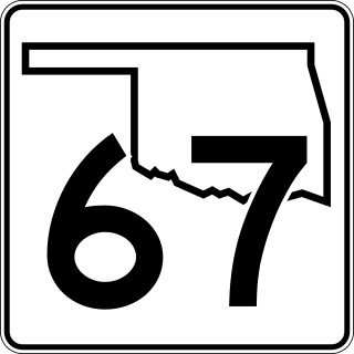
<span class="mw-page-title-main">Oklahoma State Highway 77H</span> State highway in Oklahoma, United States

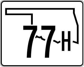
State Highway 77H is a spur that runs from US-77 in Norman, north through a small piece of unincorporated Cleveland County and Moore, to Oklahoma City. The state highway designation ends at I-240, although Sooner Road continues north to its terminus at I-35, I-44, Turner Turnpike, Kilpatrick Turnpike, and SH-66.

<span class="mw-page-title-main">Oklahoma State Highway 51</span> State highway in Oklahoma, United States

State Highway 51, abbreviated to SH-51 or OK-51, is a major state highway in Oklahoma, United States. It runs for 332.8 miles (535.6 km) east–west across the state, running from the Texas state line to Arkansas. It is the third-longest state highway in the system.

<span class="mw-page-title-main">Oklahoma State Highway 270</span> State highway in Oklahoma, United States

State Highway 270, abbreviated as SH-270, is a 14.45-mile-long (23.26 km) state highway in Oklahoma and Pottawatomie counties in Oklahoma, United States. It runs on a former alignment of U.S. Route 270 (US-270) between US-62 in Harrah and US-177 north of Shawnee. SH-270 has no lettered spur routes.

<span class="mw-page-title-main">Oklahoma State Highway 325</span> State highway in Cimarron County, Oklahoma, United States

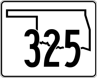
State Highway 325, officially, SH-325, is a 38.08-mile (61.28 km)state highway Cimarron County, Oklahoma, United States, that connects New Mexico State Road 456 to the traffic circle in Boise City that includes U.S. Route 56, U.S. Route 64, U.S. Route 287, U.S. Route 287, U.S. Route 412 and Oklahoma State Highway 3. Along the way it provides access to Black Mesa State Park, near Black Mesa, the highest point in the state of Oklahoma.

<span class="mw-page-title-main">Oklahoma State Highway 8</span> Highway in Oklahoma

State Highway 8, also abbreviated as SH-8 or OK-8, is a highway maintained by the U.S. state of Oklahoma. Because it runs mainly north–south, it has an even number. Highway 8 runs from U.S. Highway 277 in Cyril, Oklahoma to the state line south of Kiowa, Kansas, for a total length of 179.1 miles (288.2 km) The highway has two lettered spur routes.

<span class="mw-page-title-main">Oklahoma State Highway 6</span> Highway in Oklahoma

State Highway 6, abbreviated SH-6 or OK-6, is a state highway in Oklahoma. It runs in a 121.8 miles (196.0 km) crescent through the southwestern part of the state, running from the Texas state line north of Quanah, Texas, to SH-152 in the unincorporated town of Sweetwater. There are no letter-suffixed spur branching from SH-6.

<span class="mw-page-title-main">Oklahoma State Highway 50</span> State highway in Oklahoma, United States

State Highway 50 is a state highway in northwestern Oklahoma. The majority of the 37.7-mile (60.7 km) highway is in Woodward County, though the northernmost three miles (4.8 km) are in Woods County. SH-50 runs near two state parks and has a lettered spur that goes to each of them.

<span class="mw-page-title-main">Oklahoma State Highway 108</span> Highway in Oklahoma

State Highway 108 is a minor state highway in Payne, Noble, and Pawnee counties in north-central Oklahoma. It runs for 24.1 miles (38.8 km), from SH-33 south of Ripley to U.S. Route 64 (US-64) in Lela. It has no lettered spurs.
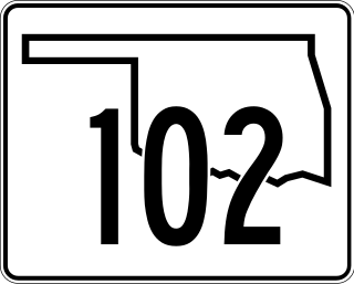
<span class="mw-page-title-main">Oklahoma State Highway 56</span> Highway in Oklahoma, United States

State Highway 56 is a state highway in the U.S. state of Oklahoma. The road serves Seminole County, Okfuskee County, and Okmulgee Counties in central and east-central Oklahoma. In Seminole County, it is also designated as the Seminole Nation Highway in honor of the contributions the Seminole Nation has made to the state of Oklahoma.

<span class="mw-page-title-main">Oklahoma State Highway 34</span> Highway in Oklahoma

State Highway 34 is a state highway in the U.S. state of Oklahoma. It runs for 188.3 miles (303.0 km) south-to-north in the western part of the state. The highway begins northeast of Eldorado, in the southwest corner of the state, and extends north to the Kansas state line between Woodward and Coldwater, Kansas.

<span class="mw-page-title-main">Oklahoma State Highway 58</span> Highway in Oklahoma

State Highway 58 is the name of two state highways in Oklahoma. One of them runs for 72.7 miles (117.0 km) from Medicine Park to the Blaine–Custer County line near Hydro, and the other connects US-270/281/SH-3/33 to the Kansas state line, a length of 105.9 mi (170.4 km). The northern section has one lettered spur route, SH-58A.

<span class="mw-page-title-main">U.S. Route 81 in Oklahoma</span> Segment of American highway

U.S. Route 81 (US-81) is a north–south U.S. highway running through the central United States' Great Plains region, from Fort Worth, Texas to the U.S.–Canadian border at Pembina, North Dakota. A 229.28-mile (368.99 km) segment of the highway lies within the state of Oklahoma. US-81 crosses the Red River from Texas south of Terral, passing through several Oklahoma cities, such as Chickasha, El Reno, Kingfisher, and Enid, before entering Kansas north of Renfrow.

<span class="mw-page-title-main">U.S. Route 169 in Oklahoma</span> Highway in Oklahoma

U.S. Route 169 is a U.S. highway that begins in Tulsa southeast of Downtown. The highway runs north into Kansas.

<span class="mw-page-title-main">Special routes of U.S. Route 62</span>

Sixteen special routes of U.S. Route 62 currently exist. Seven of them lie within the state of Arkansas. Three existed in the past but have since been decommissioned.

References

  1. Bureau of Public Roads & American Association of State Highway Officials (November 11, 1926). United States System of Highways Adopted for Uniform Marking by the American Association of State Highway Officials (Map). 1:7,000,000. Washington, DC: United States Geological Survey. OCLC   32889555 . Retrieved November 7, 2013 via Wikimedia Commons.
  2. Oklahoma Department of Transportation. "Memorial Dedication and Revision History, US 81". Oklahoma Department of Transportation. Retrieved September 7, 2013.
  3. Oklahoma Department of Transportation. "State Highway System: Log of U.S. Highway 54" (PDF). Retrieved 2008-01-01.
  4. Oklahoma Department of Transportation. "State Highway System: Log of U.S. Highway 56" (PDF). Retrieved 2008-01-01.
  5. Oklahoma Department of Transportation. "State Highway System: Log of U.S. Highway 59" (PDF). Retrieved 2008-01-01.
  6. Oklahoma Department of Transportation. "State Highway System: Log of U.S. Highway 60" (PDF). Retrieved 2008-01-01.
  7. Oklahoma Department of Transportation. "State Highway System: Log of U.S. Highway 62" (PDF). Retrieved 2008-01-01.
  8. Oklahoma Department of Transportation. "State Highway System: Log of U.S. Highway 64" (PDF). Retrieved 2008-01-01.
  9. Google Maps driving directions:
  10. Oklahoma Department of Transportation. "State Highway System: Log of U.S. Highway 69" (PDF). Retrieved 2008-01-01.
  11. Oklahoma Department of Transportation. "State Highway System: Log of U.S. Highway 70" (PDF). Retrieved 2008-01-01.
  12. Oklahoma Department of Transportation. "State Highway System: Log of U.S. Highway 266" (PDF). Retrieved 2008-01-01.
  13. Oklahoma Transportation Commission (February 1, 1988). "Minutes of the Regular Meeting of the Transportation Commission" (PDF). Retrieved December 6, 2012.
  14. Oklahoma Department of Transportation. "Memorial Dedication & Revision History – US 412" . Retrieved December 6, 2012.