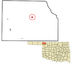
Buffalo, Oklahoma

Last updated

Buffalo, Oklahoma
HARPER COUNTY COURTHOUSE.jpg
Harper County Courthouse (2007)
Harper County Oklahoma incorporated and unincorporated areas Buffalo highlighted.svg
Location in Harper County and the state of Oklahoma.
Coordinates: 36°50′07″N99°37′40″W / 36.83528°N 99.62778°W / 36.83528; -99.62778 [1]
Country United States
State Oklahoma
County Harper
Government
   Mayor Jarie Coggins [ citation needed ]
Area
[2]
  Total1.11 sq mi (2.88 km2)
  Land1.11 sq mi (2.88 km2)
  Water0.00 sq mi (0.00 km2)
Elevation
[1]
1,801 ft (549 m)
Population
 (2020)
  Total1,039
  Density933.51/sq mi (360.37/km2)
Time zone UTC-6 (CST)
  Summer (DST) UTC-5 (CDT)
ZIP code
73834 [3]
Area code 580
FIPS code 40-09850
GNIS ID 2411740 [1]
Website buffalooklahoma.org

Buffalo is a town and county seat of Harper County, Oklahoma, United States. [1] As of the 2020 census, the town's population was 1,039. [4] It was named after the Buffalo Creek valley, in which it is located. [5]

Contents

History

In 1907, the town was "staked out" and a post office was established with the name Buffalo, which was derived from nearby Buffalo Creek. In 1908, a county seat election gave the seat to Buffalo and the town was incorporated in the same year. [6] Buffalo's founders issued instructions for all buildings to be built of stone, thereby many of those structures survived the test of time.

When citizens of Harper County decided to link their county seat with the railroads, [7] they created the Buffalo and Northwestern Railroad, which arrived in Buffalo in May 1920. [8] However, that trackage was abandoned in 1982, [9] and Buffalo currently has no rail service. [10]

Geography

According to the United States Census Bureau, Buffalo has a total area of 0.8 square miles (2.1 km2), all land. [1] The city lies in the northwestern corner of Oklahoma at the Panhandle's eastern entrance, along U.S. routes 64/183, 12 miles (19 km) south of the Kansas state line. It is 30 miles (48 km) northeast of the Texas state line and 174 miles (280 km) northwest of Oklahoma City. [6]

Doby Springs Park and Campgrounds, located about 11 miles west, [11] includes a fishing lake, camping sites, a playground, and nature trails along rolling canyons. [12] [13] The complex also has a PGA-rated 9-hole golf course. [13]

Climate

While not the snowiest location in Oklahoma ranked by highest annual average snowfall, Buffalo has the distinction of holding the State snowfall record over 24 hours, being 23” which fell February 21, 1971. [14]

Climate data for Buffalo, Oklahoma (1981–2010 normals, extremes 1907–2011)
MonthJanFebMarAprMayJunJulAugSepOctNovDecYear
Record high °F (°C)87
(31)
92
(33)
99
(37)
105
(41)
108
(42)
115
(46)
115
(46)
115
(46)
112
(44)
102
(39)
93
(34)
89
(32)
115
(46)
Mean maximum °F (°C)73.5
(23.1)
78.6
(25.9)
86.2
(30.1)
92.2
(33.4)
98.0
(36.7)
103.1
(39.5)
107.4
(41.9)
107.1
(41.7)
101.6
(38.7)
93.2
(34.0)
82.1
(27.8)
71.4
(21.9)
109.7
(43.2)
Mean daily maximum °F (°C)47.3
(8.5)
52.3
(11.3)
60.8
(16.0)
70.1
(21.2)
79.0
(26.1)
88.4
(31.3)
94.3
(34.6)
93.6
(34.2)
84.8
(29.3)
72.0
(22.2)
58.9
(14.9)
47.0
(8.3)
70.7
(21.5)
Daily mean °F (°C)34.1
(1.2)
38.4
(3.6)
46.5
(8.1)
56.0
(13.3)
66.0
(18.9)
76.0
(24.4)
81.3
(27.4)
80.4
(26.9)
71.4
(21.9)
58.5
(14.7)
45.4
(7.4)
34.5
(1.4)
57.4
(14.1)
Mean daily minimum °F (°C)20.8
(−6.2)
24.5
(−4.2)
32.2
(0.1)
41.9
(5.5)
53.0
(11.7)
63.6
(17.6)
68.2
(20.1)
67.2
(19.6)
58.1
(14.5)
45.0
(7.2)
31.9
(−0.1)
22.0
(−5.6)
44.0
(6.7)
Mean minimum °F (°C)5.3
(−14.8)
8.1
(−13.3)
16.4
(−8.7)
26.5
(−3.1)
38.6
(3.7)
51.2
(10.7)
57.9
(14.4)
56.5
(13.6)
40.6
(4.8)
27.8
(−2.3)
16.1
(−8.8)
6.9
(−13.9)
−0.8
(−18.2)
Record low °F (°C)−17
(−27)
−13
(−25)
−8
(−22)
15
(−9)
25
(−4)
35
(2)
45
(7)
43
(6)
26
(−3)
12
(−11)
0
(−18)
−10
(−23)
−17
(−27)
Average precipitation inches (mm)0.66
(17)
1.00
(25)
1.81
(46)
2.21
(56)
3.63
(92)
4.08
(104)
2.06
(52)
2.84
(72)
2.09
(53)
2.14
(54)
1.22
(31)
0.95
(24)
24.69
(627)
Average snowfall inches (cm)2.1
(5.3)
3.7
(9.4)
2.0
(5.1)
0.2
(0.51)
0.0
(0.0)
0.0
(0.0)
0.0
(0.0)
0.0
(0.0)
0.0
(0.0)
0.0
(0.0)
1.8
(4.6)
3.5
(8.9)
13.3
(34)
Average precipitation days (≥ 0.01 in)2.23.55.45.67.27.65.36.55.45.33.23.160.3
Average snowy days (≥ 0.1 in)1.01.40.60.10.00.00.00.00.00.00.41.34.8
Source: NOAA [15] [16]

Demographics

Historical population
CensusPop.Note
1910 282
1920 47969.9%
1930 990106.7%
1940 1,20922.1%
1950 1,54427.7%
1960 1,6184.8%
1970 1,579−2.4%
1980 1,381−12.5%
1990 1,5129.5%
2000 1,200−20.6%
2010 1,2998.3%
2020 1,039−20.0%
U.S. Decennial Census

As of the census [17] of 2000, there were 1,200 people, 495 households, and 336 families residing in the town. The population density was 1,502.4 inhabitants per square mile (580.1/km2). There were 599 housing units at an average density of 750.0 per square mile (289.6/km2). The racial makeup of the town was 92.92% White, 0.08% African American, 1.17% Native American, 4.67% from other races, and 1.17% from two or more races. Hispanic or Latino of any race were 10.33% of the population.

There were 495 households, out of which 28.9% had children under the age of 18 living with them, 56.0% were married couples living together, 8.7% had a female householder with no husband present, and 32.1% were non-families. 28.7% of all households were made up of individuals, and 15.8% had someone living alone who was 65 years of age or older. The average household size was 2.34 and the average family size was 2.87.

In the town, the population was spread out, with 22.8% under the age of 18, 7.5% from 18 to 24, 22.8% from 25 to 44, 24.2% from 45 to 64, and 22.8% who were 65 years of age or older. The median age was 43 years. For every 100 females, there were 91.4 males. For every 100 females age 18 and over, there were 92.5 males.

The median income for a household in the town was $30,433, and the median income for a family was $38,333. Males had a median income of $25,625 versus $20,515 for females. The per capita income for the town was $15,328. About 8.2% of families and 11.7% of the population were below the poverty line, including 18.1% of those under age 18 and 5.4% of those age 65 or over.

Education

Buffalo School District oversees primary and secondary education.

Media

The Buffalo Weekly News was established in 2014 and is published every Wednesday. [18]

The Harper County Journal, consolidated from the Buffalo Republican and the Harper County Democrat, was published in Buffalo from 1903 to 2014, when it merged with the Laverne Leader Tribune to become the Harper County Leader, [19] still published weekly in Laverne, Oklahoma. [20]

Other early newspapers included the Buffalo News, the Buffalo Bugle, and the Post.

Transportation

U.S. Route 64 and U.S. Route 183 run concurrently through town. [21]

Buffalo Municipal Airport is located about 2 miles north. [21]

Historic sites

The following in the Buffalo area are NRHP-listed:

Related Research Articles

<span class="mw-page-title-main">Woodward County, Oklahoma</span> County in Oklahoma, United States

Woodward County is a county located in the U.S. state of Oklahoma. As of the 2020 census, the population was 20,470. Its county seat is Woodward.

<span class="mw-page-title-main">Woods County, Oklahoma</span> County in Oklahoma, United States

Woods County is a county located in the northwestern part of the U.S. state of Oklahoma. As of the 2020 census, the population was 8,624. Its county seat is Alva. The county is named after Samuel Newitt Wood, a renowned Kansas populist.

<span class="mw-page-title-main">Nowata County, Oklahoma</span> County in Oklahoma, United States

Nowata County is a county located in northeastern Oklahoma, United States, on the Kansas border. As of the 2020 census, its population is 9,320. Its county seat is Nowata. Their name is derived from a Delaware word, no-we-ata, meaning "come here" or "welcome".

<span class="mw-page-title-main">Harper County, Oklahoma</span> County in Oklahoma, United States

Harper County is a county located in the U.S. state of Oklahoma. As of the 2020 census, the population was 3,272, making it the third-least populous county in Oklahoma. The county seat is Buffalo. It was created in 1907 from the northwestern part of Woodward County, and named for Oscar Green Harper, who was clerk of the Oklahoma Constitutional Convention.

<span class="mw-page-title-main">Beaver County, Oklahoma</span> County in Oklahoma, United States

Beaver County is a county located in the U.S. state of Oklahoma. As of the 2020 census, the population was 5,049. The county seat is Beaver. The name was given because of the presence of many beaver dams on the Beaver River, which runs through the area. It is located in the Oklahoma Panhandle.

<span class="mw-page-title-main">Harper County, Kansas</span> County in Kansas, United States

Harper County is a county located in the U.S. state of Kansas. Its county seat and most populous city is Anthony. As of the 2020 census, the county population was 5,485. The county was named for Sergeant Marion Harper of the 2nd Kansas Cavalry, who died in battle during the American Civil War.

<span class="mw-page-title-main">Anthony, Kansas</span> City in Harper County, Kansas

Anthony is a city in and the county seat of Harper County, Kansas, United States. As of the 2020 census, the population of the city was 2,108.

<span class="mw-page-title-main">Dickson, Oklahoma</span> Town in Oklahoma, United States

Dickson is a town in Carter County, Oklahoma, United States. The population was 1,207 at the 2010 census. It is part of the Ardmore, Oklahoma Micropolitan Statistical Area.

<span class="mw-page-title-main">Shady Grove, Cherokee County, Oklahoma</span> Census-designated place in Oklahoma, United States

Shady Grove is an unincorporated community and census-designated place (CDP) in Cherokee County, Oklahoma, United States. The population was 556 at the 2010 census. This is not to be confused with the similarly-named Shady Grove in McIntosh County, or the Shady Grove in Pawnee County.

<span class="mw-page-title-main">Phillips, Oklahoma</span> Town in Oklahoma, United States

Phillips is a town in Coal County, Oklahoma, United States. The population was 135 at the 2010 census.

<span class="mw-page-title-main">Taloga, Oklahoma</span> Town in Oklahoma, United States

Taloga is a town in Dewey County, Oklahoma, United States. The population was 288 at the time of the 2020 census.

<span class="mw-page-title-main">Shattuck, Oklahoma</span> Town in Oklahoma, United States

Shattuck is a town in Ellis County, Oklahoma, United States. The population was 1,249 at the time of the 2020 census, a change from the 1,356 reported in the 2010 census.

<span class="mw-page-title-main">Waukomis, Oklahoma</span> Town in Oklahoma, United States

Waukomis is a town in Garfield County, Oklahoma, United States. The population was 1,286 at the 2010 census, an increase of 2.0 percent from 1,261 in 2000.

<span class="mw-page-title-main">Laverne, Oklahoma</span> Town in Oklahoma, United States

Laverne is a town in Harper County, Oklahoma, United States. The population was 1,223 at the 2020 census.

<span class="mw-page-title-main">May, Oklahoma</span> Town in Oklahoma, United States

May is a town in Harper County, Oklahoma, United States. As of the 2020 census, the town’s population was 29.

<span class="mw-page-title-main">Tishomingo, Oklahoma</span> City in Oklahoma

Tishomingo is the largest city in, and the county seat of, Johnston County, Oklahoma, United States. The population was 3,101 as of the 2020 Census,, an increase of 2.2% over the population of 3,034 reported at the 2010 census. It was the first capital of the Chickasaw Nation, from 1856 until Oklahoma statehood in 1907. The city is home to Murray State College, a community college with an annual enrollment of 3,015 students. Tishomingo is part of the Texoma region.

<span class="mw-page-title-main">Kendrick, Oklahoma</span> Town in Oklahoma, United States

Kendrick is a town in Lincoln County, Oklahoma, United States. The population was 139 at the 2010 census.

<span class="mw-page-title-main">Oakland, Oklahoma</span> Town in Oklahoma, United States

Oakland is a town in Marshall County, Oklahoma, United States. It is located just northwest of Madill, Oklahoma off US Route 70. The population was 831 as of the 2020 Census,

<span class="mw-page-title-main">Johnson, Oklahoma</span> Town in Oklahoma, United States

Johnson is a town in north-central Pottawatomie County, Oklahoma, United States. The population was 247 at the 2010 census, a 10.8 percent increase from the figure of 223 in 2000.

<span class="mw-page-title-main">Waynoka, Oklahoma</span> City in Oklahoma, United States

Waynoka is a city in Woods County, Oklahoma, United States. It is located on U.S. Highway 281 and State Highway 14, seventy miles west of Enid. The population, which peaked at 2,018 in 1950, was 708 at the time of the 2020 Census.

References

  1. 1 2 3 4 5 U.S. Geological Survey Geographic Names Information System: Buffalo, Oklahoma
  2. "ArcGIS REST Services Directory". United States Census Bureau. Retrieved September 20, 2022.
  3. United States Postal Service (2012). "USPS - Look Up a ZIP Code" . Retrieved February 15, 2012.
  4. "Buffalo (Town), Oklahoma". United States Census Bureau. Retrieved August 6, 2023.
  5. "Town History - Buffalo, Oklahoma". Town of Buffalo, Oklahoma. Retrieved August 22, 2021.
  6. 1 2 Bamburg, Maxine. "Buffalo," Encyclopedia of Oklahoma History and Culture. Archived June 8, 2009, at the Wayback Machine
  7. "Harper County, Oklahoma, County History". GenealogyTrails. Retrieved November 15, 2021.
  8. "Buffalo". Maxine Bamburg, Oklahoma Historical Society. Retrieved November 15, 2021.
  9. "The Buffalo District". AbandonedRails.com. Retrieved November 15, 2021.
  10. "Oklahoma 2018-2020 State Railroad Map" (PDF). Oklahoma Department of Transportation. Retrieved October 22, 2021.
  11. "Doby Springs Park to Buffalo, Oklahoma". Google Maps. Retrieved August 20, 2021.
  12. "Outdoor Recreation". Town of Buffalo, Oklahoma. Retrieved August 20, 2021.
  13. 1 2 "Doby Springs Municipal Golf Course & Recreation Park". TravelOK.com. Retrieved August 20, 2021.
  14. "Oklahoma Annual Rainfall and Climate Data". CoolWeather.net. Retrieved April 8, 2021.
  15. "NOWData - NOAA Online Weather Data". National Oceanic and Atmospheric Administration. Retrieved December 15, 2023.
  16. "Summary of Monthly Normals 1991-2020". National Oceanic and Atmospheric Administration. Retrieved December 15, 2023.
  17. "U.S. Census website". United States Census Bureau . Retrieved January 31, 2008.
  18. "Homepage". Buffalo Weekly News. Retrieved April 8, 2021.
  19. "Harper County Journal". mondotimes.com. Retrieved December 30, 2020.
  20. "Harper County Leader". mondotimes.com. Retrieved December 30, 2020.
  21. 1 2 "Buffalo Municipal Airport to Buffalo, Oklahoma". Google Maps. Retrieved December 29, 2020.