Waurika, Oklahoma

Last updated
Waurika, Oklahoma
Jefferson county courthouse.jpg
Jefferson County Courthouse in Waurika c. 2014
Motto(s): 
"On The Trail, By The Lake"
USA Oklahoma location map.svg
Red pog.svg
Waurika
Usa edcp location map.svg
Red pog.svg
Waurika
Coordinates: 34°10′12″N98°0′5″W / 34.17000°N 98.00139°W / 34.17000; -98.00139
Country United States
State Oklahoma
County Jefferson
Area
[1]
  Total11.93 sq mi (30.90 km2)
  Land11.92 sq mi (30.87 km2)
  Water0.01 sq mi (0.03 km2)
Elevation
896 ft (273 m)
Population
 (2020)
  Total1,837
  Density154.11/sq mi (59.50/km2)
Time zone UTC-6 (Central (CST))
  Summer (DST) UTC-5 (CDT)
ZIP code
73573
Area code 580
FIPS code 40-79250 [2]
GNIS feature ID1099439 [3]

Waurika is the county seat of Jefferson County, Oklahoma, United States. [4] The population was 2,064 at the 2010 census, a 4.36 percent decrease from 2,158 at the 2000 census. [5]

Contents

An article from 1985 in The Oklahoman claimed that Waurika promoted itself as "The Parakeet Capital of the World". It gave no explanation for using this slogan. [6] The Waurika Chamber of Commerce website in 2020 echoes that the town was "once a parakeet paradise," but currently seems to be promoting the motto On The Trail, By The Lake, complete with a logo of a cowboy bronc-riding a fish. [7]

City name

The name is the anglicized version of the Comanche compound woarɨhka ("worm eater") from woa ("worm") + tɨhka ("eat") and presumably refers to early European settlers whose plowing humorously resembled digging for worms. [8] Without indicating the source of their opinions, the City of Waurika and the Oklahoma Historical Society say the name means "clear (or pure) water" in some unidentified "American Indian language". [9] [10]

History

Former First Presbyterian Church transformed into a city office building. Listed on the US National Register of Historic Places. First Presbyterian Church Waurika.jpg
Former First Presbyterian Church transformed into a city office building. Listed on the US National Register of Historic Places.

Waurika was settled after the Comanche, Kiowa, and Apache Reservation was opened to non-Indians on August 6, 1901. The first white settler was James McGraw, who homesteaded on the present town site after moving from Burlington, Iowa. [10] The first sale of town lots was held on June 18, 1902. Nearly three thousand people attended the sale. [10]

Waurika was incorporated in May 1903. On May 8 of that year, C.A. McBrian was sworn in as the town's first mayor. [10] At the time of its founding, Waurika was located in Pickens County, Chickasaw Nation. [11]

The Chicago, Rock Island and Pacific Railway came to Waurika on January 1902 after the railroad superintendent "designated the town as a flag station." [10] Waurika was formerly the northern terminus for the Wichita Falls and Southern Railroad, one of the 20th century properties of Frank Kell and Joseph A. Kemp of Wichita Falls, Texas, [12] where the Kell House Museum is located today.

Historical population
CensusPop.Note
1910 2,928
1920 3,2049.4%
1930 2,368−26.1%
1940 2,4583.8%
1950 2,327−5.3%
1960 1,933−16.9%
1970 1,833−5.2%
1980 2,36929.2%
1990 2,088−11.9%
2000 2,1583.4%
2010 2,064−4.4%
2020 1,837−11.0%
[5] [10]

Geography

Waurika is located in northwestern Jefferson County at 34°10′12″N98°0′5″W / 34.17000°N 98.00139°W / 34.17000; -98.00139 (34.170130, -98.001268). [13] U.S. Route 70 passes through the southern side of the city, leading east 49 miles (79 km) to Ardmore and west 27 miles (43 km) to Randlett. U.S. Route 81 crosses US 70 in the southeastern corner of Waurika, leading north 26 miles (42 km) to Duncan and south 24 miles (39 km) to Ringgold. Oklahoma State Highway 5 (Waurika's Main Street) leads northwest 19 miles (31 km) to Temple. Waurika is approximately 109 miles (175 km) southwest of Oklahoma City. [10]

According to the United States Census Bureau, Waurika has a total area of 12.5 square miles (32.4 km2), of which 0.01 square miles (0.03 km2), or 0.08%, are water. [14] The city center lies on the east side of the valley of Beaver Creek, a south-flowing tributary of the Red River.

Waurika Lake is 6 miles (10 km) northwest of the city center. [15]

Economy

Waurika's economy has largely been based on cattle raising, agriculture and petroleum production since the founding of the city. [10]

Demographics

As of the census [2] of 2000, there were 1,988 people, 741 households, and 500 families residing in the city. The population density was 168.0 inhabitants per square mile (64.9/km2). There were 929 housing units at an average density of 78.5 per square mile (30.3/km2). The racial makeup of the city was 85.41% White, 1.81% African American, 4.28% Native American, 3.37% Asian, 0.10% Pacific Islander, 2.36% from other races, and 2.67% from two or more races. Hispanic or Latino of any race were 8.00% of the population.

There were 741 households, out of which 28.5% had children under the age of 18 living with them, 54.1% were married couples living together, 9.9% had a female householder with no husband present, and 32.4% were non-families. 30.5% of all households were made up of individuals, and 17.3% had someone living alone who was 65 years of age or older. The average household size was 2.35 and the average family size was 2.89.

In the city, the population was spread out, with 22.3% under the age of 18, 7.5% from 18 to 24, 29.1% from 25 to 44, 20.6% from 45 to 64, and 20.5% who were 65 years of age or older. The median age was 39 years. For every 100 females, there were 107.3 males. For every 100 females age 18 and over, there were 107.9 males.

The median income for a household in the city was $23,800, and the median income for a family was $31,594. Males had a median income of $24,844 versus $16,286 for females. The per capita income for the city was $13,496. About 6.4% of families and 12.2% of the population were below the poverty line, including 14.4% of those under age 18 and 17.4% of those age 65 or over.
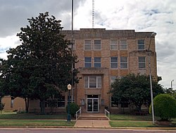
Government

Waurika has a home rule charter form of government. [10]

Notable people

Places

The town's Rock Island Passenger Depot was rehabilitated starting in 1987, and in 2002 was added to the National Register of Historic Places listings in Jefferson County, Oklahoma. [9] Also NHRP-listed are the First Presbyterian Church, [9] the Jefferson County Courthouse, [18] and the State Highway 79 Bridge at the Red River leading to Byers, Texas, which has since been demolished. [18] There was a Chisholm Trail Historical Museum in Waurika, now closed. [19]

Waurika Lake, completed in 1980, is 11 miles long, contains 192,000 acre feet of water at its normal elevation of 951 feet, has a surface area of 10,000 acres, and features 80 miles of shoreline. [9]

Notable events

The 1996 murder of Heather Rich brought brief notoriety to Waurika. Rich, a 16-year-old sophomore at the local high school, was murdered by two classmates and an acquaintance in a case that attracted national media coverage.

Related Research Articles

<span class="mw-page-title-main">Stephens County, Oklahoma</span> County in Oklahoma, United States

Stephens County is a county located in the U.S. state of Oklahoma. As of the 2020 census, its population was 42,848. Its county seat is Duncan. The county was created at statehood, partly from the Chickasaw Nation in Indian Territory and partly from Comanche County in Oklahoma Territory. It was named for Texas politician John Hall Stephens.

<span class="mw-page-title-main">Jefferson County, Oklahoma</span> County in Oklahoma, United States

Jefferson County is a county located in the U.S. state of Oklahoma. As of the 2020 census, the population was 5,337. Its county seat is Waurika. The county was created at statehood and named in honor of President Thomas Jefferson.

<span class="mw-page-title-main">Grady County, Oklahoma</span> County in Oklahoma, United States

Grady County is a county located in the U.S. state of Oklahoma. As of the 2020 census, the population was 54,795. Its county seat is Chickasha. It was named for Henry W. Grady, an editor of the Atlanta Constitution and southern orator.

<span class="mw-page-title-main">Caddo, Oklahoma</span> Town in Oklahoma, United States

Caddo is a town in Bryan County, Oklahoma, United States. The population was 997 at the 2010 census, a 5.6 percent gain over the figure of 944 recorded in 2000. The name is derived from a Caddo word, ka do hada’ cho, meaning "real chief" in English. According to Encyclopedia of Oklahoma History and Culture, the town was named for the nearby Caddo Hills.

<span class="mw-page-title-main">Lone Grove, Oklahoma</span> City in Oklahoma, United States

Lone Grove is a city in Carter County, Oklahoma, United States. The population was 5,054 at the 2010 census. It is part of the Micropolitan Statistical Area of Ardmore.

<span class="mw-page-title-main">Wilson, Oklahoma</span> Town in Oklahoma, United States

Wilson is a town in Carter County, Oklahoma, United States. The population was 1,724 at the 2010 census. It is part of the Ardmore, Oklahoma Micropolitan Statistical Area. It is home to one of the oldest Assemblies of God churches in Oklahoma, the Wilson Assembly of God Church.

<span class="mw-page-title-main">Medicine Park, Oklahoma</span> Town in Oklahoma, United States

Medicine Park is a town in Comanche County, Oklahoma, United States, situated in the Wichita Mountains near the entrance to the 60,000-acre (240 km2) Wichita Mountain Wildlife Refuge. Medicine Park has a long history as a vintage cobblestone resort town. Medicine Park is located near the city of Lawton and Fort Sill. It is an exurb, part of the Lawton Metropolitan Statistical Area. Many of the original structures are constructed of naturally formed cobblestones—these red granite cobblestones are unique to the Wichita Mountains. The population was 382 at the 2010 census.

<span class="mw-page-title-main">Walters, Oklahoma</span> City in Oklahoma, United States

Walters is a town in Cotton County, Oklahoma, United States. The population was 2,551 at the 2010 census. The city, nestled between twin creeks, is the county seat of Cotton County. The city's motto is "Small town; Big heart."

<span class="mw-page-title-main">Addington, Oklahoma</span> Town in Oklahoma, United States

Addington is a town in Jefferson County, Oklahoma, United States. The population was 114 at the 2010 census, a decrease of 2.6 percent from the figure of 117 in 2000. The town was founded in 1890.

<span class="mw-page-title-main">Cornish, Oklahoma</span> Town in Oklahoma, United States

Cornish is an incorporated town in eastern Jefferson County, Oklahoma, United States. The population was 163 at the 2010 census, a decline of 5.2 percent from the figure of 172 in 2000.

Hastings is a town in Jefferson County, Oklahoma, United States. The population was 143 at the 2010 census, a decline of 7.8 percent from the figure of 155 in 2000.

<span class="mw-page-title-main">Ringling, Oklahoma</span> Town in Oklahoma, United States

Ringling is a town in Jefferson County, Oklahoma, United States. The population was 1,037 at the 2010 census, a decline of 8.6 percent from the figure of 1,135 in 2000. It was named for John Ringling, the founder of the Ringling Brothers Circus.

<span class="mw-page-title-main">Ryan, Oklahoma</span> Town in Oklahoma, United States

Ryan is a town in Jefferson County, Oklahoma, United States, located north of the Texas state line. The population was 816 at the 2010 census, a decline of over 8.7 percent from the figure of 894 in 2000.

<span class="mw-page-title-main">Sugden, Oklahoma</span> Town in Oklahoma, United States

Sugden is a town in Jefferson County, Oklahoma, United States. The population was 43 at the 2010 census.

<span class="mw-page-title-main">Terral, Oklahoma</span> Town in Oklahoma, United States

Terral is an agricultural town in Jefferson County, Oklahoma, United States. The population was 382 at the 2010 census, a decline of 1.01 percent from the figure of 386 in 2000.

<span class="mw-page-title-main">Porter Township, Jefferson County, Pennsylvania</span> Township in Pennsylvania, United States

Porter Township is a township in Jefferson County, Pennsylvania, United States. The population was 292 at the 2020 census.

<span class="mw-page-title-main">Ringgold Township, Jefferson County, Pennsylvania</span> Township in Pennsylvania, United States

Ringgold Township is a township in Jefferson County, Pennsylvania, United States. The population was 771 at the 2020 census.

<span class="mw-page-title-main">Byers, Texas</span> City in Texas, United States

Byers is a city in Clay County, Texas, United States. It is part of the Wichita Falls, Texas Metropolitan Statistical Area. The population was 496 at the 2010 census.

<span class="mw-page-title-main">Petrolia, Texas</span> City in Texas, United States

Petrolia is a city in Clay County, Texas, United States. It is part of the Wichita Falls, Texas Metropolitan Statistical Area. The population was 686 at the 2010 census, down from 782 at the 2000 census.

<span class="mw-page-title-main">Wellington, Texas</span> City in Texas, United States

Wellington is a city and county seat of Collingsworth County, Texas, United States. The population was 2,189 at the 2010 census.

References

  1. "ArcGIS REST Services Directory". United States Census Bureau. Retrieved September 20, 2022.
  2. 1 2 "U.S. Census website". United States Census Bureau . Retrieved 2008-01-31.
  3. "US Board on Geographic Names". United States Geological Survey. 2007-10-25. Retrieved 2008-01-31.
  4. "Find a County". National Association of Counties. Retrieved 2011-06-07.
  5. 1 2 "Census Viewer: Waurika, Oklahoma Population". Moonshadow Mobile, Inc. Retrieved February 18, 2016.
  6. Etter, Jim. "Catchy Slogans Strive to Put Towns on Map." The Oklahoman. October 20, 1985. Accessed November 3, 2016.
  7. "Waurika, Oklahoma". Waurika Chamber of Commerce. Retrieved November 16, 2020.
  8. William Bright. 2013. Native American Placenames of the Southwest (Univ. of Oklahoma Press)
  9. 1 2 3 4 "History". City of Waurika. Retrieved November 16, 2020.
  10. 1 2 3 4 5 6 7 8 9 Sheridan B. Drowatzky, "Waurika," Encyclopedia of Oklahoma History and Culture, 2009. Accessed March 27, 2015.
  11. Charles Goins, Historical Atlas of Oklahoma (Norman: University of Oklahoma Press, 2006), plate 105.
  12. "H. Allen Anderson, "Wichita Falls and Southern Railroad"". tshaonline.org. Retrieved April 19, 2013.
  13. "US Gazetteer files: 2010, 2000, and 1990". United States Census Bureau. February 12, 2011. Retrieved April 23, 2011.
  14. "Geographic Identifiers: 2010 Census Summary File 1 (G001): Waurika city, Oklahoma". American Factfinder. U.S. Census Bureau. Archived from the original on February 13, 2020. Retrieved October 17, 2018.
  15. Google Maps
  16. "Chris Kidd wins Republican nomination for State Senate District 31 seat". Duncanbanner.com. 2016-08-23. Retrieved 2019-05-05.
  17. "Senator Chris Kidd - District 31". Oksenate.gov. Retrieved 2019-05-05.
  18. 1 2 "Jefferson County". Oklahoma Historical Society. Retrieved November 16, 2020.
  19. "Chisholm Trail Historical Museum". Yelp. Retrieved November 16, 2020.

Commons-logo.svg Media related to Waurika, Oklahoma at Wikimedia Commons