Sayre, Oklahoma

Last updated

Sayre, Oklahoma
Sayre, Oklahoma.jpg
Buildings in Sayre, 2016
Motto: 
"Main Street On Historic Route (66)"
Beckham County Oklahoma incorporated and unincorporated areas Sayre highlighted.svg
Location in Beckham County and the state of Oklahoma
Coordinates: 35°17′48″N99°37′43″W / 35.29667°N 99.62861°W / 35.29667; -99.62861
Country United States
State Oklahoma
County Beckham
Government
  TypeAldermanic
Area
[1]
  Total5.41 sq mi (14.00 km2)
  Land5.39 sq mi (13.95 km2)
  Water0.02 sq mi (0.05 km2)
Elevation
[2]
1,893 ft (577 m)
Population
 (2020)
  Total4,809
  Density892.87/sq mi (344.72/km2)
Time zone UTC-6 (Central (CST))
  Summer (DST) UTC-5 (CDT)
ZIP code
73662
Area code 580
FIPS code 40-65700 [3]
GNIS feature ID2411836 [2]
Website Sayre, Oklahoma

Sayre is a city in, and the county seat of, Beckham County, in western Oklahoma, United States. [4] It is halfway between Oklahoma City and Amarillo, Texas on Interstate 40 and the former U.S. Route 66. The population was 4,809 at the time of the 2020 census, [5] an increase over the 4,375 figure from the 2010 census, and the largest population ever recorded by a census since Sayre's founding. [6]

Contents

History

After the Civil War, Congress wanted to stimulate the economy and aid the growth of the nation. One way that they achieved this was to promote the building of the western railroads. Upon completion of the Union Pacific-Central Pacific joining in 1869 with the Golden Spike, other railroads trying to capitalize on commerce and trade also began crossing the western country. This included the Great Northern and Burlington in the far north, and the Southern Pacific on the extreme southern border.

Eventually this would lead to rails crossing Indian Territory, present-day Oklahoma, around the start of the 20th century. A new rail line was extended from Weatherford to Texola by McCabe & Steen Contractors in July 1901. Entrepreneurs would buy land near where the new tracks were being laid, and also near a source of water. The Choctaw Town Site and Improvement Company did this, and when the Choctaw, Oklahoma and Gulf Railroad crossed the North Fork of the Red River in Western Indian Territory an instant town sprang up, which incorporated on 14 September 1901.

The Choctaw Townsite & Improvement Company began selling lots to new "Sooners" arriving to start a new life. The seeds of a new town were sown, businessmen came to sell their wares to the new town folk, and within one year the town's population was up to around 1,000. Pennsylvanian Robert Heysham Sayre, a stockholder of the railroad, gave his name to the newly formed town in 1901. [7]

The Chicago, Rock Island and Pacific Railway Company (called the "Rock Island") leased the new line. The Rock Island would complete its march to the Pacific by filling in the line to Tucumcari, New Mexico.

During the period of 1901–1907, Sayre was part of Roger Mills County in Oklahoma Territory. At the time Oklahoma became a state, Beckham County was created and Sayre, which was within the boundary of Beckham County, was named as the temporary county seat. An election in 1908 confirmed Sayre as the permanent seat, with voters preferring it to the town of Erick. The Beckham County Courthouse was completed in 1911, and is still in service over a century later. It is listed on the National Register of Historic Places. [7]

The discovery of oil and gas nearby caused the population to boom between 1920 and 1930. In the 1930s U.S. Route 66, a dream forwarded by fellow Oklahoman Cyrus Avery, would come through Sayre, cementing the town's fate to fuel the cars and feed the people exploring the country.

In 1940 film director John Ford used Sayre's Beckham County Courthouse in the film The Grapes of Wrath , based on the famous book by John Steinbeck.

During the 1970s Sayre and the surrounding area benefited from the natural gas and oil development in the Panhandle-Hugoton field, the largest-volume gas field in the United States, and the world's largest known source of helium. Between 1973 and 1993 the field produced over 8 trillion cubic feet (230,000,000 m³) of gas.

Geography

Sayre is located on the North Fork of the Red River, at an elevation of 1,800 feet (550 m) and 128 miles (206 km) west of Oklahoma City. [7] The area is dominated by low rolling red clay hills.

According to the United States Census Bureau, the city has a total area of 5.6 square miles (14.5 km2), of which 0.019 square miles (0.05 km2), or 0.36%, is water. [6]

Demographics

Historical population
CensusPop.Note
1910 1,881
1920 1,703−9.5%
1930 3,15785.4%
1940 3,037−3.8%
1950 3,36210.7%
1960 2,913−13.4%
1970 2,712−6.9%
1980 3,17717.1%
1990 2,881−9.3%
2000 4,11442.8%
2010 4,3756.3%
2020 4,8099.9%
U.S. Decennial Census [8]

As of the census [3] of 2000, there were 4,114 people, 1,132 households, and 678 families residing in the city. The population density was 1,215.9 inhabitants per square mile (469.5/km2). There were 1,399 housing units at an average density of 413.5 units per square mile (159.7 units/km2). The racial makeup of the city was 74.99% White, 18.25% African American, 2.53% Native American, 0.41% Asian, 1.92% from other races, and 1.90% from two or more races. Hispanic or Latino of any race were 5.35% of the population.

There were 1,132 households, out of which 26.7% had children under the age of 18 living with them, 45.8% were married couples living together, 10.6% had a female householder with no husband present, and 40.1% were non-families. 36.5% of all households were made up of individuals, and 18.9% had someone living alone who was 65 years of age or older. The average household size was 2.20 and the average family size was 2.87.

In the city, the population was spread out, with 14.6% under the age of 18, 14.0% from 18 to 24, 40.9% from 25 to 44, 16.0% from 45 to 64, and 14.5% who were 65 years of age or older. The median age was 35 years. For every 100 females, there were 197.0 males. For every 100 females age 18 and over, there were 216.8 males.

The median income for a household in the city was $21,713, and the median income for a family was $30,000. Males had a median income of $22,167 versus $18,147 for females. The per capita income for the city was $10,378. About 15.9% of families and 20.7% of the population were below the poverty line, including 26.1% of those under age 18 and 14.0% of those age 65 or over.

Economy

Sayre's economy has been based on agriculture and the production of oil and gas. By the 1930s, the town had five oil companies and one gasoline plant in operation. United Carbon Company built a carbon black plant there. [7] Circa 2000 the Flying J truck stop opened on a 28-acre (11 ha) plot of land along Interstate 40 in Sayre; As of 2001 it paid $150,000 in annual sales taxes and had 117 employees. The city government had purchased the land and sold it to the developer at cost in order to attract the development. [9]

The North Fork Correctional Facility, a privately owned, medium-security prison opened in 1998. [7] This prison had 270 employees as of 2001, and that year Peter T. Kilborn of The New York Times wrote that the prison "is responsible for lifting Sayre's spirits and reigniting its economy." [9] Circa 2003 the community experienced economic issues when prisoners from Wisconsin were recalled from the prison. [10]

Education

Southwestern Oklahoma State University at Sayre or SWOSU@Sayre, is an accredited junior college serving western Oklahoma. [11] It was founded in 1938 as Sayre Junior College and merged with SWOSU by an act of the Oklahoma Legislature in 1987. [12]

Western Technology Center, Sayre campus provides the opportunity for adults and high school students to get occupationally-specific training. Sayre Public Schools is a member of the WTC district.

Sayre Public Schools is a school district serving the cities of Sayre and Elk City in Oklahoma. [13] It includes the following schools:

In 1994–5, the district was the defendant in a liability suit eventually decided by the Supreme Court of Oklahoma. [14]

Government

Sayre has an aldermanic form of city government. [7]

NRHP listings

The following sites in and around Sayre are listed on the National Register of Historic Places:

Notable people

Related Research Articles

<span class="mw-page-title-main">Marshall County, Oklahoma</span> County in Oklahoma, United States

Marshall County is a county located on the south central border of Oklahoma. As of the 2020 census, the population was 15,312. Its county seat is Madill. The county was created at statehood in 1907 from the former Pickens County of the Chickasaw Nation. It was named to honor the maiden name of the mother of George Henshaw, a member of the 1906 Oklahoma Constitutional Convention. The county and its cities are part of the Texoma region.

<span class="mw-page-title-main">LeFlore County, Oklahoma</span> County in Oklahoma, United States

LeFlore County is a county along the eastern border of the U.S state of Oklahoma. As of the 2020 census, the population was 48,129. Its county seat is Poteau. The county is part of the Fort Smith metropolitan area and the name honors a Choctaw family named LeFlore. The United States District Court for the Eastern District of Oklahoma is the federal district court with jurisdiction in LeFlore County.

<span class="mw-page-title-main">Johnston County, Oklahoma</span> County in Oklahoma, United States

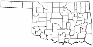
Johnston County is a county located in the U.S. state of Oklahoma. As of the 2020 census, the population was 10,272. Its county seat is Tishomingo. It was established at statehood on November 16, 1907, and named for Douglas H. Johnston, a governor of the Chickasaw Nation.

<span class="mw-page-title-main">Grady County, Oklahoma</span> County in Oklahoma, United States

Grady County is a county located in the U.S. state of Oklahoma. As of the 2020 census, the population was 54,795. Its county seat is Chickasha. It was named for Henry W. Grady, an editor of the Atlanta Constitution and southern orator.

<span class="mw-page-title-main">Bryan County, Oklahoma</span> County in Oklahoma, United States

Bryan County is a county in the U.S. state of Oklahoma. As of the 2020 census, the population was 46,067. Its county seat is Durant. It is the only county in the United States named for Democratic politician William Jennings Bryan.

<span class="mw-page-title-main">Beckham County, Oklahoma</span> County in Oklahoma, United States

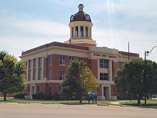
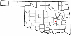
Beckham County is a county located on the western border of the U.S. state of Oklahoma. As of the 2020 census, the population was 22,410. Its county seat is Sayre. Founded upon statehood in 1907, Beckham County was named for J. C. W. Beckham, who was Governor of Kentucky and the first popularly elected member of the United States Senate from Kentucky. Beckham County comprises the Elk City, OK Micropolitan Statistical Area.

<span class="mw-page-title-main">Elk City, Oklahoma</span> City in Oklahoma, United States

Elk City is a city in Beckham County, Oklahoma, United States. The population was 11,561 at the time of the 2020 census, a slight decrease from the 11,693 figure of the 2010 census. Elk City is located on Interstate 40 and Historic U.S. Route 66 in western Oklahoma, approximately 110 miles (180 km) west of Oklahoma City and 150 miles (240 km) east of Amarillo, Texas.

<span class="mw-page-title-main">Erick, Oklahoma</span> City in Oklahoma, United States

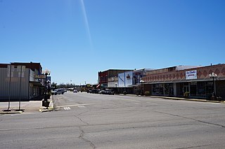
Erick is a city in Beckham County, Oklahoma, United States. It is located 15 miles (24 km) west of Sayre, the county seat, and 6 miles (9.7 km) east of the Oklahoma-Texas border. The population was an even 1,000 at the time of the 2020 census.

<span class="mw-page-title-main">Texola, Oklahoma</span> Town in Oklahoma, United States

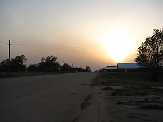
Texola is a town in Beckham County, Oklahoma, United States. The population was 43 at the time of the 2020 census, an increase over the 36 figure from the 2010 census.

<span class="mw-page-title-main">Hugo, Oklahoma</span> City in Oklahoma, United States

Hugo is a city in and the county seat of Choctaw County, Oklahoma, United States. It is located in southeastern Oklahoma, approximately 9 miles (14 km) north of the Texas state line. As of the 2010 census, the city population was 5,310.

Weatherford is a city in Custer County, Oklahoma, United States. The population was 12,076 at the time of the 2020 census, a gain of about 11.5% over the 10,833 figure from the 2010 census.

Kinta is a town in Haskell County, Oklahoma, United States. The population was 297 at the 2010 census, an increase of 22.2 percent over the figure of 243 recorded in 2000.

<span class="mw-page-title-main">Calvin, Oklahoma</span> Town in Oklahoma, United States

Calvin is a town in Hughes County, Oklahoma, United States. The population was 294 at the 2010 census.

<span class="mw-page-title-main">Stuart, Oklahoma</span> Town in Oklahoma, United States

Stuart is a town in southeastern Hughes County, Oklahoma, United States. The population was 180 at the 2010 census, down from 220 in 2000.

<span class="mw-page-title-main">Wilburton, Oklahoma</span> City in Oklahoma, United States

Wilburton is a city in Latimer County, Oklahoma, United States. It is the county seat of Latimer County. The city had a population of 2,285 as of the 2020 Census. Robbers Cave State Park is 5 miles (8.0 km) north of Wilburton.

<span class="mw-page-title-main">Talihina, Oklahoma</span> Town in Oklahoma, United States

Talihina is a town in LeFlore County, Oklahoma, United States, its name originating from two Choctaw words, tully and hena, meaning "iron road," a reference to the railroad around which the town was built. It is part of the Fort Smith, Arkansas–Oklahoma Metropolitan Statistical Area. The population was 925 at the time of the 2020 Census.

<span class="mw-page-title-main">Idabel, Oklahoma</span> City in Oklahoma, United States

Idabel is a city in and county seat of McCurtain County, Oklahoma, United States. The population was 7,010 at the 2010 census. It is in Oklahoma's southeast corner, a tourist area known as Choctaw Country.

<span class="mw-page-title-main">Choctaw, Oklahoma</span> City in Oklahoma, United States

Choctaw is a city in Oklahoma County, Oklahoma, United States, with a population of 12,182 at the 2020 census, a 9.3% increase from 2010. It is the oldest chartered town in Oklahoma Territory. The city is located approximately 10 miles (16.1 km) east of Oklahoma City and is part of the Oklahoma City metropolitan area.

<span class="mw-page-title-main">Haileyville, Oklahoma</span> City in Oklahoma, United States

Haileyville is a city in Pittsburg County, Oklahoma, United States. The population was 813 at the 2010 census.

<span class="mw-page-title-main">Sallisaw, Oklahoma</span> City in Oklahoma, United States

Sallisaw is a city and county seat in Sequoyah County, Oklahoma, United States. As of the 2010 Census, it had a population of 8,880, an 11.2 percent increase over the figure of 7,891 recorded in 2000. Sallisaw is part of the Fort Smith, Arkansas–Oklahoma Metropolitan Statistical Area.

References

  1. "ArcGIS REST Services Directory". United States Census Bureau. Retrieved September 20, 2022.
  2. 1 2 U.S. Geological Survey Geographic Names Information System: Sayre, Oklahoma
  3. 1 2 "U.S. Census website". United States Census Bureau . Retrieved January 31, 2008.
  4. "Find a County". National Association of Counties. Retrieved June 7, 2011.
  5. "Sayre (city), Oklahoma". United States Census Bureau. Retrieved August 29, 2023.
  6. 1 2 "Geographic Identifiers: 2010 Demographic Profile Data (G001): Sayre city, Oklahoma". U.S. Census Bureau, American Factfinder. Archived from the original on February 12, 2020. Retrieved February 24, 2014.
  7. 1 2 3 4 5 6 Linda D. Wilson, "Sayre," Encyclopedia of Oklahoma History and Culture, Accessed April 15, 2015.
  8. "Census of Population and Housing". Census.gov. Retrieved June 4, 2015.
  9. 1 2 Kilborn, Peter T. "Rural Towns Turn to Prisons To Reignite Their Economies." The New York Times . August 1, 2001. Retrieved on April 11, 2016.
  10. Kilborn, Peter T. "A Small Town Loses Its Prisoners and Livelihood." The New York Times . October 13, 2003. Retrieved on April 11, 2016.
  11. "SWOSU | Southwestern Oklahoma State University | Sayre Campus". Archived from the original on August 4, 2010. Retrieved August 29, 2010.
  12. "SWOSU Sayre".
  13. "Overview of Sayre Public Schools, Oklahoma (Unified School District)". Statistical Atlas. Retrieved April 11, 2016.
  14. "Curtis v. Board of Educ. of Sayre Public Schools". Justia. Retrieved April 11, 2016.