This area was part of the territory of the Osage, but they were forced out under a treaty with the United States. During the Indian Removal period and until statehood, this area was a reserve of the Cherokee Nation, which had been removed from its territory in the Southeast United States. This was within what was known as the Cherokees' Cooweescoowee District.
Around 1802, bands of Osage Indians settled in this area of what is now northeastern Oklahoma. Black Dog was the chief of a band that settled at Pasona, where Claremore later developed. He shared power with chiefs Clermont (or Claremore), and Pawhuska. Clermont, named by French traders, settled with his band in a village known as Pasuga, meaning "Big Cedar", which was located on an ancient platform earthwork mound in this area.
The Osage village of Pasuga was destroyed by Cherokee in June 1817, during the Battle of Claremore Mound, also known as the Battle of the Strawberry Moon.[7][8] These Western Cherokee had moved into the region from the Southeastern United States and were perpetually competing with the Osage, who looked down on them. At the time of the attack, most of the men were out of the villages to hunt bison on the plains. The Cherokee killed the men in the village, and took more than 100 women and children captive, selling them to Eastern Cherokee. Accounts differ as to whether Chief Clermont was killed in the raid.
After the Indian Removal Act of 1830 was passed by Congress, this area was designated as part of Indian Territory and the Cherokee Nation was assigned much of this territory. Claremore and the mound were within a part of the Cooweescoowee District in the northwestern part of the Cherokee Nation.
The Rogers family, for whom the county is named, were among the first European-American settlers. Clem Rogers, father of the famous entertainer Will Rogers, was born of mixed-blood parents in the Cherokee Nation, as was his wife. He moved to the county in 1856 and acquired lands for his Dog Iron Ranch that eventually consisted of more than 60,000 acres (240km2). The Clem Rogers home (Will Rogers' birthplace) still stands outside Oologah, and is considered an important historical site.[a] Clem Rogers was a major advocate of Oklahoma statehood; he was the oldest delegate to the state's Constitutional Convention in 1907 at age 69. Other members of his family and he were buried at the Will Rogers Memorial.
A post office was established on June 25, 1874. The coming of railways to Indian Territory was the driving factor in early growth. Two early lines intersected in the center of town. The town changed the spelling of its name from Clermont to Claremore on September 19, 1882. A clerk recording the town as having a post office had spelled the name incorrectly, and it stuck. The town was incorporated in the Cherokee Nation on May 2, 1903.[8] newspaper, the Claremore Daily Progress, was founded in 1893 by cowboy Joe Klein and is still published daily. It is the oldest business in Rogers County.
Growth was aided by the popularity of sulfur springs among Americans in the late 19th and early 20th centuries. They believed bathing in such springs to have medical benefits. George Eaton had settled with his family in the Claremore area in 1874 and conducted farming and cattle raising. He later branched into the mercantile business, real estate, and oil exploration. While drilling just east of Claremore in 1903, Easton struck an underground pool of water that smelled of sulfur. Local physician Dr. W. G. Williams tested the water and marketed it as a cure. Known as "Radium Water", it contained no radium, but hydrogen sulfide and sulfur compounds that were believed to make it medically useful. Eaton built a bath house and promoted the pool area as Radium Town.[10] Radium Town was centered on 9th Street between Seminole and Dorothy. Bath houses were built by promoters all over this area of Claremore, and for a time attracted travelers and tourists for the waters. Only one was still standing as of 2008.[11] The first hospital was established in the early 1900s along what is now known as Will Rogers Boulevard or Oklahoma State Highway 20. The building is standing and is currently being renovated.
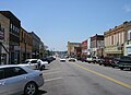
The town has many historic homes and other buildings, with several located in the old business district. In 2002, Claremore received a grant from the state's Oklahoma Main Street program to redevelop its business district with improved urban design and enhancement of historic properties. Renovation work on the downtown was completed in 2007. On July 9, 2020, the Supreme Court of the United States determined in McGirt v. Oklahoma that the reservations of the Five Tribes, comprising much of Eastern Oklahoma, were never disestablished by Congress, thus are still "Indian Country" for the purposes of criminal law.
On the night of May 25, 2024, a EF3 tornado impacted Claremore and caused considerable damage to the city and the areas surrounding it.[12]
Will Rogers Memorial Museum in Claremore, Oklahoma 2021091100008Will Rogers Memorial Museum in Claremore, Oklahoma 2021091100011
In popular culture
The Rodgers and Hammerstein musical Oklahoma! is set in Claremore and the surrounding area, in 1906 (the year before Oklahoma became a state); it was based on the play Green Grow the Lilacs by playwright Lynn Riggs, who grew up on a farm in the Claremore area.[13] The Quantum Leap season-three episode "8½ Months" is also set near Claremore. The movie Where the Heart Is fictionally portrays Rogers County and the area surrounding Claremore.
Claremore was featured in the Supernatural season-14 episode "Nightmare Logic", where Maggie tracks a ghoul to the town.[14]
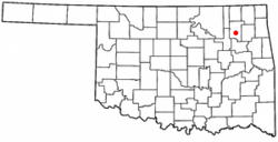
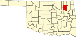
Geography
According to the United States Census Bureau, the town has a total area of 12.3 square miles (32km2), of which 0.2sqmi (0.52km2) (1.96%) is covered by water.
The city is located in Green Country, a popular nickname and marketing label for northeast Oklahoma that stems from the region's green vegetation and relatively high number of hills and lakes, compared to central and western areas of Oklahoma.[15] Claremore lies near the Verdigris River with undulating terrain producing hills and valleys. The city's primary water sources are the Claremore and Oologah Lakes, both within the drainage basin of the Verdigris River.
Claremore is a major intersection of heavily traveled highways. Interstate 44 crosses the town to its southeast. State Highway 66 (historic US-66) was designated along with one of the main east–west roads of the town. State Highway 88 and State Highway 20 intersect within the town.
Two railroad lines, the Kansas and Arkansas Valley Railway line (now owned by Union Pacific) and the St. Louis-San Francisco Railway or "Frisco" line (now owned by BNSF) intersect in Claremore. The traffic problems resulting from the intersection of two major national rail lines have led to discussions among town officials about how best to improve traffic flow.
Claremore Regional Airport (KGCM; FAA ID GCM), is located about 7 miles east of Claremore, and features a paved 5200 x 75ft. runway.[17]
As of the 2020 census, Claremore had a population of 19,580. The median age was 36.6 years. 21.5% of residents were under the age of 18 and 19.5% of residents were 65 years of age or older. For every 100 females there were 92.3 males, and for every 100 females age 18 and over there were 89.6 males age 18 and over.[23]
99.3% of residents lived in urban areas, while 0.7% lived in rural areas.[24]
There were 7,661 households in Claremore, of which 30.2% had children under the age of 18 living in them. Of all households, 39.6% were married-couple households, 19.4% were households with a male householder and no spouse or partner present, and 33.1% were households with a female householder and no spouse or partner present. About 31.4% of all households were made up of individuals and 13.9% had someone living alone who was 65 years of age or older.[23]
There were 8,358 housing units, of which 8.3% were vacant. Among occupied housing units, 53.0% were owner-occupied and 47.0% were renter-occupied. The homeowner vacancy rate was 3.2% and the rental vacancy rate was 6.5%.[23]
As of the 2000 census,[4] 15,873 people, 6,283 households, and 4,165 families resided in the town. The population density was 1,319.4 inhabitants per square mile (509.4/km2). The 6,784 housing units had an average density of 563.9/sqmi (217.7/km2). The racial makeup of the town was 75.69% White, 1.99% African American, 14.31% Native American, 0.44% Asian, 0.03% Pacific Islander, 1.12% from other races, and 6.42% from two or more races. Hispanics or Latinos of any race were 3.02% of the population.
Of the 6,283 households, 33.6% had children under 18 living with them, 49.6% were married couples living together, 12.4% had a female householder with no husband present, and 33.7% were not families. About 29.7% of all households were made up of individuals, and 13.8% had someone living alone who was 65 or older. The average household size was 2.43 and the average family size was 3.02.
In the town, the age distribution was 26.7% under 18, 9.0% from 18 to 24, 27.6% from 25 to 44, 19.8% from 45 to 64, and 16.9% who were 65 or older. The median age was 36 years. For every 100 females, there were 89.5 males. For every 100 females 18 and over, there were 86.1 males.
The median income for a household in the town was $34,547, and for a family was $45,810. Males had a median income of $36,227 versus $21,742 for females. The per capita income for the town was $17,853. About 8.9% of families and 11.9% of the population were below the poverty line, including 15.4% of those under 18 and 15.0% of those 65 and older.
Claremore is also home to one of four campuses of Northeast Tech, a vocational training school.[26] The Claremore campus serves over 200 students and offers both full-time and short-term classes.[27]
The public school district serving Claremore is the Claremore Independent School District, consisting of Claremore High School, Will Rogers Junior High, Catalayah Elementary, Westside Elementary, Claremont Elementary, and Stuart Roosa Elementary Schools, and the Alternative Learning Center.[28] The first school in the Claremore area was opened to students in 1870. The first major high school was built in 1919; it was the most expensive public-school building in Oklahoma at the time. The building was used as a school for almost 80 years, until 1999. The increasing costs of maintenance of the old building forced its closure.
Economy
Claremore's economy is diversified. Baker Hughes, an oil field services company, has a large presence in the town. Together with several other large companies, it is located in Claremore Industrial Park. which is only a few miles from the Tulsa Port of Catoosa, located on the Verdigris and Arkansas Rivers. Coal mining is also an important industry; strip-style mines are operating on both the north and south sides of town.
Media
Claremore has a website called moreClaremore.com, which focuses on positive community journalism. It was launched in April 2013 and centers on community events, local businesses, people, and schools. This was implemented in an effort to reverse the city's overall negative reputation with local residents, specifically in relation to its police department. The site also features the central community calendar for the area. It has an average of 40,000 visitors per month and has an active, though heavily restricted social media presence, with more than 29,000 followers on Facebook.
The daily newspaper (and one of the oldest ongoing businesses in the county) is the Claremore Daily Progress, first published as a weekly in 1892 and as a daily in 1893.[29] As of September 2020, the Daily Progress publishes only two print editions a week.
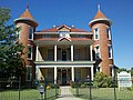
As of February 2022, the National Register of Historic Places list the following Claremore sites, buildings, structures, or districts as worthy of preservation for their historical significance:
(note that mauve color for #3 denotes "district" rather than a specific item)
↑Numbers represent an alphabetical ordering by significant words. Various colorings, defined here, differentiate National Historic Landmarks and historic districts from other NRHP buildings, structures, sites or objects.
↑The eight-digit number below each date is the number assigned to each location in the National Register Information System database, which can be viewed by clicking the number.
This page is based on this Wikipedia article Text is available under the CC BY-SA 4.0 license; additional terms may apply. Images, videos and audio are available under their respective licenses.