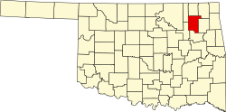
Fair Oaks, Oklahoma

Last updated

Fair Oaks, Oklahoma
Motto: 
Live on David Hewitt
OKMap-doton-FairOaks.PNG
Location of Fair Oaks, Oklahoma
Coordinates: 36°8′53″N95°42′30″W / 36.14806°N 95.70833°W / 36.14806; -95.70833
Country United States
State Oklahoma
Counties Wagoner, Rogers
Area
[1]
  Total5.66 sq mi (14.66 km2)
  Land5.66 sq mi (14.65 km2)
  Water0.00 sq mi (0.01 km2)
Elevation
[2]
607 ft (185 m)
Population
 (2020)
  Total73
  Density12.90/sq mi (4.98/km2)
Time zone UTC-6 (Central (CST))
  Summer (DST) UTC-5 (CDT)
FIPS code 40-25000 [3]
GNIS feature ID2412608 [2]

Fair Oaks is a town in Rogers and Wagoner counties in the U.S. state of Oklahoma. The population was 103 at the 2010 census, a 15.6 percent decline from the figure of 122 recorded in 2000. [4] It is a suburb of Tulsa.

Contents

History

Fair Oaks was incorporated in 1966, by L. S. Robson, owner of a large ranch in Wagoner County. At the time, it contained two hundred acres of land and twenty residents. In 1969, the town added 15,000 acres. By 1980, the town was recognized as a "bedroom community" of Tulsa, and the population had grown to 324. The population peaked at 1,133 in 1990, and the Robson descendants agreed for the town and the remainder of the Robson ranch to be annexed by Tulsa. [5]

Geography

According to the United States Census Bureau, the town has a total area of 17.4 square miles (45.0 km2), of which 17.3 square miles (44.9 km2) is land and 0.04 square mile (0.1 km2) (0.17%) is water.

Demographics

Historical population
CensusPop.Note
1970 23
1980 228891.3%
1990 1,133396.9%
2000 122−89.2%
2010 103−15.6%
2020 73−29.1%
U.S. Decennial Census [6]

As of the census [3] of 2000, there were 122 people, 53 households, and 31 families residing in the town. The population density was 7.0 people per square mile (2.7/km2). There were 60 housing units at an average density of 3.5 per square mile (1.3/km2). The racial makeup of the town was 81.97% White, 13.93% Native American, and 4.10% from two or more races.

There were 53 households, out of which 30.2% had children under the age of 18 living with them, 49.1% were married couples living together, 7.5% had a female householder with no husband present, and 41.5% were non-families. 37.7% of all households were made up of individuals, and 5.7% had someone living alone who was 65 years of age or older. The average household size was 2.30 and the average family size was 3.10.

In the town, the population was spread out, with 26.2% under the age of 18, 9.0% from 18 to 24, 28.7% from 25 to 44, 24.6% from 45 to 64, and 11.5% who were 65 years of age or older. The median age was 37 years. For every 100 females, there were 125.9 males. For every 100 females age 18 and over, there were 114.3 males.

The median income for a household in the town was $32,500, and the median income for a family was $41,875. Males had a median income of $33,750 versus $21,875 for females. The per capita income for the town was $16,307. There were 10.7% of families and 10.9% of the population living below the poverty line, including 21.4% of under eighteens and none of those over 64.

Related Research Articles

<span class="mw-page-title-main">Wagoner County, Oklahoma</span> County in Oklahoma, United States

Wagoner County is a county located in the U.S. state of Oklahoma. As of the 2020 census, the population was 80,981. Its county seat is Wagoner.

<span class="mw-page-title-main">Rogers County, Oklahoma</span> County in Oklahoma, United States

Rogers County is located in the northeastern part of the U.S. state of Oklahoma. As of the 2020 census, the population was 95,240, making it the sixth-most populous county in Oklahoma. The county seat is Claremore. Rogers County is included in the Tulsa, OK metropolitan statistical area.

<span class="mw-page-title-main">Gene Autry, Oklahoma</span> Town in Oklahoma, United States

Gene Autry is a town in Carter County, Oklahoma, United States. The population was 154 at the time of the 2020 census, down just slightly from the 158 reported in the 2010 census. It is part of the Ardmore, Oklahoma Micropolitan Statistical Area.

<span class="mw-page-title-main">Hulbert, Oklahoma</span> Town in Oklahoma, United States

Hulbert is a town in Cherokee County, Oklahoma, United States, named after Ben H. Hulbert, a prominent Cherokee man. The population was 483 at the 2020 census, previously it was 590 in 2010. Our Lady of the Annunciation of Clear Creek Monastery is a Benedictine monastery located in Hulbert. The Clear Creek Monastery, recently elevated to the status of an abbey, is a foundation abbey of France's Notre Dame de Fontgombault, which is itself a foundation abbey of Saint Pierre de Solesmes, also in France.

<span class="mw-page-title-main">Kiefer, Oklahoma</span> Town in Oklahoma, United States

Kiefer is a town in Creek County, Oklahoma, United States. The population was 2,187 at the 2020 census, a 30% increase over the 1,685 population recorded at the 2010 census, which itself was a 64 percent increase over the 1,026 figure recorded in 2000.

<span class="mw-page-title-main">Lawrence Creek, Oklahoma</span> Town in Oklahoma, United States

Lawrence Creek is a town in Creek County, Oklahoma, United States. Incorporated March 15, 1983, it is primarily a bedroom community whose employed residents work in Sapulpa and Tulsa. The population was 149 at the 2010 census, a gain of 25.2 percent over the figure of 119 recorded in 2000.

<span class="mw-page-title-main">Colcord, Oklahoma</span> Town in Oklahoma, United States

Colcord is a town in southern Delaware County, Oklahoma, United States. The community lies in the northeastern part of the state in a region known as Green Country. The population was 815 at the 2010 census, a decline of 0.5 percent from the figure of 819 recorded in 2000.

<span class="mw-page-title-main">Kendrick, Oklahoma</span> Town in Oklahoma, United States

Kendrick is a town in Lincoln County, Oklahoma, United States. The population was 139 at the 2010 census.

<span class="mw-page-title-main">Warwick, Oklahoma</span> Town in Oklahoma, United States

Warwick is a town in Lincoln County, Oklahoma, United States. The population was 184 at the 2020 census, up from 148 in 2010.

<span class="mw-page-title-main">Strang, Oklahoma</span> Town in Oklahoma, United States

Strang is a town in Mayes County, Oklahoma, United States. The population was 64 at the 2020 census.

<span class="mw-page-title-main">Wann, Oklahoma</span> Town in Oklahoma, United States

Wann is a town in Nowata County, Oklahoma, United States. The population was 125 at the 2010 census, a decrease of 5.3 percent from the figure of 132 recorded in 2000. Wann is known for the "Six Flag Poles Over Wann America.

<span class="mw-page-title-main">Avant, Oklahoma</span> Town in Oklahoma, United States

Avant is an incorporated community in eastern Osage County, Oklahoma, United States. The population was 320 at the 2010 census, a decline of 14.0 percent from the figure of 372 recorded in 2000.

Lotsee is a town in Tulsa County, Oklahoma, United States. The population was 6 at the 2020 census, compared to a total of 2 in 2010. It is the smallest incorporated municipality in Oklahoma, and in an article on “The Tiniest Town in Every State” by House Beautiful in November 2023, it was cited as the tiniest town in Oklahoma as it had only two people.

<span class="mw-page-title-main">Sperry, Oklahoma</span> Town in Oklahoma, United States

Sperry is a town in Tulsa County, Oklahoma, United States. The population was 1,115 at the time of the 2020 census. It is primarily a bedroom community, since approximately 85 percent of the employed residents commute to work in Tulsa and other nearby towns. Sperry also has an active retirement community.

<span class="mw-page-title-main">New Tulsa, Oklahoma</span> Defunct Town in Oklahoma, United States

New Tulsa was a town in Wagoner County, Oklahoma, United States. The population was 568 at the 2000 census. The town was dissolved in 2001 by a vote of the residents and is now part of the city of Broken Arrow.

<span class="mw-page-title-main">Porter, Oklahoma</span> Town in Oklahoma, United States

Porter is a town in Wagoner County, Oklahoma, United States. It promotes itself as "The Peach Capital of Oklahoma." The population was 566 at the 2010 census, a loss of 1.4 percent, compared to 574 at the 2000 census.

<span class="mw-page-title-main">Redbird, Oklahoma</span> Town in Oklahoma, United States

Redbird is a town in Wagoner County, Oklahoma, United States. The population was 137 at the 2010 census, a 10.5 percent decline from the figure of 153 in 2000. Founded at the turn of the 20th century, it was one of more than fifty all-black towns in Oklahoma Territory and Indian Territory and is one of thirteen surviving black communities in Oklahoma.

<span class="mw-page-title-main">Wagoner, Oklahoma</span> City in Oklahoma, United States

Wagoner is a city in Wagoner County, Oklahoma, United States. The population was 8,323 at the 2010 census, compared to the figure of 7,669 recorded in 2000. It is the county seat of Wagoner County. Wagoner became the first city incorporated in Indian Territory on January 4, 1896.

<span class="mw-page-title-main">Catoosa, Oklahoma</span> City in Oklahoma, United States

Catoosa is a city in Rogers and Wagoner counties in the U.S. state of Oklahoma. The population was 7,440 at the 2020 census compared to 7,159 at the 2010 census.

<span class="mw-page-title-main">Fair Oaks Ranch, Texas</span> City in Texas, United States

Fair Oaks Ranch is a city in Bexar, Comal, and Kendall counties in the U.S. state of Texas. The population was 5,986 at the 2010 census and an estimated 9,700 in 2018. It is part of the San Antonio-New Braunfels Metropolitan Statistical Area. The city was named after Ralph Fair Sr, an oilman who had a large cattle ranch on the now residential town. The Fair family decided to sell a portion of the ranch to build what is now Fair Oaks Ranch in 1975.

References

  1. "ArcGIS REST Services Directory". United States Census Bureau. Retrieved September 20, 2022.
  2. 1 2 U.S. Geological Survey Geographic Names Information System: Fair Oaks, Oklahoma
  3. 1 2 "U.S. Census website". United States Census Bureau . Retrieved January 31, 2008.
  4. CensusViewer: Population of the City of Fair Oaks, Oklahoma
  5. Encyclopedia of Oklahoma History and Culture. "Fair Oaks". Retrieved June 14, 2011.Encyclopedia of Oklahoma History and Culture - Fair Oaks
  6. "Census of Population and Housing". Census.gov. Retrieved June 4, 2015.