Foyil, Oklahoma

Last updated

Foyil, Oklahoma
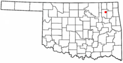
OKMap-doton-Foyil.PNG
Location of Foyil, Oklahoma
Coordinates: 36°25′49″N95°31′14″W / 36.43028°N 95.52056°W / 36.43028; -95.52056
Country United States
State Oklahoma
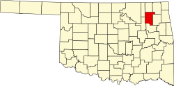
County Rogers
Government
  TypeTown
Area
[1]
  Total0.83 sq mi (2.14 km2)
  Land0.83 sq mi (2.14 km2)
  Water0.00 sq mi (0.00 km2)
Elevation
[2]
728 ft (222 m)
Population
 (2020)
  Total368
  Density444.44/sq mi (171.63/km2)
Time zone UTC-6 (Central (CST))
  Summer (DST) UTC-5 (CDT)
ZIP code
74031
Area code(s) 539/918
FIPS code 40-27600 [3]
GNIS feature ID2412650 [2]

Foyil is a town in Rogers County, Oklahoma, United States. It was named for Alfred Foyil, a local landowner and the first postmaster of the town. [4] The population was 344 at the 2010 census, a 47.0 percent increase over the figure of 234 recorded in 2000. [5]

Contents

Geography

Foyil is 10 miles (16 km) northeast of Claremore and 9 miles (14 km) southwest of Chelsea. It lies on Oklahoma State Highway 66, formerly U.S. Route 66, just south of its junction with Oklahoma State Highway 28.

According to the United States Census Bureau, the town has a total area of 0.4 square miles (1.0 km2), all land.

Demographics

Historical population
CensusPop.Note
1920 109
1930 18468.8%
1940 170−7.6%
1950 146−14.1%
1960 127−13.0%
1970 16429.1%
1980 19116.5%
1990 86−55.0%
2000 234172.1%
2010 34447.0%
2020 3687.0%
U.S. Decennial Census [6]

As of the census [3] of 2000, there were 234 people, 97 households, and 68 families residing in the town. The population density was 657.2 inhabitants per square mile (253.7/km2). There were 112 housing units at an average density of 314.6 per square mile (121.5/km2). The racial makeup of the town was 79.06% White, 9.40% Native American, 1.71% from other races, and 9.83% from two or more races. Hispanic or Latino of any race were 2.56% of the population.

There were 97 households, out of which 23.7% had children under the age of 18 living with them, 57.7% were married couples living together, 11.3% had a female householder with no husband present, and 28.9% were non-families. 23.7% of all households were made up of individuals, and 12.4% had someone living alone who was 65 years of age or older. The average household size was 2.41 and the average family size was 2.83.

In the town, the population was spread out, with 21.8% under the age of 18, 6.8% from 18 to 24, 22.6% from 25 to 44, 33.3% from 45 to 64, and 15.4% who were 65 years of age or older. The median age was 44 years. For every 100 females, there were 95.0 males. For every 100 females age 18 and over, there were 88.7 males.

The median income for a household in the town was $23,125, and the median income for a family was $28,500. Males had a median income of $27,083 versus $24,107 for females. The per capita income for the town was $11,260. About 31.9% of families and 33.7% of the population were below the poverty line, including 37.7% of those under the age of eighteen and 15.6% of those 65 or over.

Related Research Articles

<span class="mw-page-title-main">Blaine, Maine</span> Town in the state of Maine, United States

Blaine is a town in Aroostook County, Maine, United States. The population was 667 at the 2020 census. It was known as Alva prior to incorporation in 1874, when it was renamed in honor of James G. Blaine, then Speaker of the U.S. House of Representatives. According to local history, Blaine offered to donate a large bell for the tower of the town's new meeting hall, if the citizens would rename the town after him. The town's name was changed, but Blaine never donated a bell. The building still stands on the north end of town, on Route 1.

<span class="mw-page-title-main">St. Francis, Maine</span> Town in the state of Maine, United States

St. Francis is a town in Aroostook County, Maine, United States on the Canada–United States border at the junction of the St. Francis River and the Saint John River. The population was 438 at the 2020 census. First settled by English speakers from southern Maine, the original population has been supplanted by French-speaking Acadians.

<span class="mw-page-title-main">Hitchcock, Oklahoma</span> Town in Oklahoma, United States

Hitchcock is a town in Blaine County, Oklahoma, United States. The population was 121 at the 2010 census.

<span class="mw-page-title-main">Indiahoma, Oklahoma</span> Town in Oklahoma, United States

Indiahoma is a town in Comanche County, Oklahoma, United States. It is located just south of US Route 62, about 24.4 driving miles west of Lawton.

<span class="mw-page-title-main">Ninnekah, Oklahoma</span> Town in Oklahoma, United States

Ninnekah is a town in Grady County, Oklahoma, United States. The population was 775 at the 2020 census, a 22.7% decrease from 2010.

<span class="mw-page-title-main">Nash, Oklahoma</span> Town in Oklahoma, United States

Nash is a town in Grant County, Oklahoma, United States. The population was 204 at the 2010 census, an 8.9 percent decline from the figure of 224 in 2000.

<span class="mw-page-title-main">Eldorado, Oklahoma</span> Town in Oklahoma, United States

Eldorado is a town in Jackson County, Oklahoma, United States. The population was 446 at the 2010 census.

<span class="mw-page-title-main">Wellston, Oklahoma</span> Town in Oklahoma, United States

Wellston is a town in Lincoln County, Oklahoma, United States. The population was 788 at the 2010 census.

<span class="mw-page-title-main">Rosedale, Oklahoma</span> Town in Oklahoma, United States

Rosedale is a town in McClain County, Oklahoma, United States. The population was 62 at the 2020 census, a 8.8% decrease from 2010.

<span class="mw-page-title-main">Clearview, Oklahoma</span> Town in Oklahoma, United States

Clearview is a town in Okfuskee County, Oklahoma, United States. The population was 41 at the 2020 Census. It was historically an all-black freedmen's town and was platted by the Lincoln Townsite Company and designated as Lincoln.

<span class="mw-page-title-main">Paden, Oklahoma</span> Town in Oklahoma, United States

Paden is a town in Okfuskee County, Oklahoma, United States. The population was 419 at the 2020 Census. It is named for Paden Tolbert, a U.S. Deputy Marshal who served the area in the early 1900s.

<span class="mw-page-title-main">Schulter, Oklahoma</span> Town in Oklahoma, United States

Schulter is a town in Okmulgee County, Oklahoma, United States. The population was 422 at the time of the 2020 census.

<span class="mw-page-title-main">Sharon, Oklahoma</span> Town in Oklahoma, United States

Sharon is a town in Woodward County, Oklahoma, United States. The population was 133 at the 2020 census.

<span class="mw-page-title-main">Onaka, South Dakota</span> Town in South Dakota, United States

Onaka is a town in Faulk County, South Dakota, United States. The population was 13 at the 2020 census.

<span class="mw-page-title-main">Rockford, Washington</span> Town in Washington, United States

Rockford is a town in Spokane County, Washington, United States. The population was 522 at the 2020 census.

<span class="mw-page-title-main">South Lancaster, Wisconsin</span> Town in Wisconsin, United States

South Lancaster is a town in Grant County, Wisconsin, United States. The population was 808 at the 2000 census.

<span class="mw-page-title-main">Waterloo, Grant County, Wisconsin</span> Town in Wisconsin, United States

Waterloo is a town in Grant County in the U.S. state of Wisconsin. The population was 557 at the 2000 census. The unincorporated communities of Burton and McCartney are located in the town.

<span class="mw-page-title-main">Bear Creek, Waupaca County, Wisconsin</span> Town in Wisconsin, United States

Bear Creek is a town in Waupaca County, Wisconsin, United States. The population was 838 at the 2000 census. The unincorporated communities of Bear Creek Corners and Nicholson are located in the town. The village of Bear Creek is located immediately east of the town, across the county line in Outagamie County.

<span class="mw-page-title-main">Millington, Maryland</span> Town in Maryland, United States

Millington is a town in Kent and Queen Anne's counties in the U.S. state of Maryland. The population was 642 at the 2010 census. Millington is the head of navigation for the Chester River.

<span class="mw-page-title-main">Fair Oaks, Oklahoma</span> Town in Oklahoma, United States

Fair Oaks is a town in Rogers and Wagoner counties in the U.S. state of Oklahoma. The population was 103 at the 2010 census, a 15.6 percent decline from the figure of 122 recorded in 2000. It is a suburb of Tulsa.

References

  1. "ArcGIS REST Services Directory". United States Census Bureau. Retrieved September 20, 2022.
  2. 1 2 U.S. Geological Survey Geographic Names Information System: Foyil, Oklahoma
  3. 1 2 "U.S. Census website". United States Census Bureau . Retrieved January 31, 2008.
  4. Larry O'Dell, "Foyil," Encyclopedia of Oklahoma History and Culture. Accessed April 26, 2015.
  5. MuniNetGuide:Foyil, Oklahoma Archived October 7, 2012, at the Wayback Machine
  6. "Census of Population and Housing". Census.gov. Retrieved June 4, 2015.