Rogers County, Oklahoma

Last updated

Rogers County
2006-08-23 - Road Trip - Day 31 - United States - Oklahoma - Foyil - Route 66 - Ed Galloway's Totem 4889676280.jpg
Rogers County Flag.webp
Rogers County Seal.gif
Map of Oklahoma highlighting Rogers County.svg
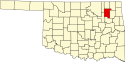
Location within the U.S. state of Oklahoma
Oklahoma in United States.svg
Oklahoma's location within the U.S.
Coordinates: 36°18′38.35″N95°37′1.48″W / 36.3106528°N 95.6170778°W / 36.3106528; -95.6170778
CountryFlag of the United States.svg United States
StateFlag of Oklahoma.svg  Oklahoma
FoundedJanuary 26, 1907
Named for Clement Vann Rogers
Seat Claremore
Largest cityClaremore
Other cities Catoosa, Collinsville, Owasso, Tulsa
Government
  ChairmanSteve Hendrix
Area
  Total711 sq mi (1,840 km2)
  Land676 sq mi (1,750 km2)
  Water36 sq mi (90 km2)  5.0%
Population
 (2020)
  Total95,240 [1]
  Density140.9/sq mi (54.4/km2)
Time zone UTC−6 (Central)
  Summer (DST) UTC−5 (CDT)
ZIP Codes
74015, 74016, 74017, 74018, 74019, 74031, 74036, 74053, 74080
Area code 539, 918
Congressional districts 1st, 2nd
Website www.rogerscounty.org

Rogers County is located in the northeastern part of the U.S. state of Oklahoma. As of the 2020 census, the population was 95,240, [1] making it the sixth-most populous county in Oklahoma. The county seat is Claremore. [2] Rogers County is included in the Tulsa, OK metropolitan statistical area.

Contents

Created in 1907 from the western Saline District of the Cherokee Nation, this area was named the Cooweescoowee District, and Cooweescoowee County at the time of statehood. However, the residents protested, and the name was changed to Rogers County, after Clem Vann Rogers, a prominent Cherokee rancher, and father of Will Rogers. [3] [4]

History

View of Claremore's skyline View of Claremore with Rogers Tomb.jpg
View of Claremore's skyline

According to the Encyclopedia of Oklahoma History and Culture , the Arkansas Band of the Osage Nation settled in the Three Forks area (the junction of the Arkansas River, Grand River, and Verdigris River during the 1760s and established two villages called Pasuga and Pasona in what is now Rogers County. Pasona was near an ancient earthwork platform mound near the Verdigris River. It was later called Claremore Mound, to honor Osage chief Claremore (aka Gra-mon in Osage, meaning Arrow Going Home; his name was first recorded by French colonists as Clermont.) [3]

In 1828, Cherokee bands who had left the Southeast early exchanged their Arkansas land for an area that included present-day Rogers County. This had been ceded by the Osage in 1825 under a treaty to the United States. [3] The area became organized by the Cherokee Nation as the Saline District of their portion of Indian Territory. In 1907 the western portion of that district was organized as the Cooweescoowee District. [3]

Upon statehood in 1908, the district was designated as a county named Cooweescoowee. Residents supported renaming the county in honor of Clement Vann Rogers, an early Cherokee settler and prominent rancher here. [3]

Shortly after statehood, Eastern University Preparatory School was established on College Hill, just west of Claremore, Oklahoma. [5] The Oklahoma Military Academy, established in 1919, took over the facility. [5] In 1971 the academy was closed and the facility was converted for use by Claremore Junior College. [5] As a four-year curriculum and graduate departments were added, the state legislature renamed the institution as Rogers State College and Rogers University, before settling in 1998 on the current Rogers State University. [5]

Geography

Claremore Lake Claremore Lake.jpg
Claremore Lake

According to the U.S. Census Bureau, the county has a total area of 711 square miles (1,840 km2), of which 676 square miles (1,750 km2) is land and 36 square miles (93 km2) (5.0%) is water. [6] The largest body of water is Lake Oologah. The main streams are the Caney River and the Verdigris River. There are also several smaller creeks and lakes in the county. [3]

Adjacent counties

Demographics

Historical population
CensusPop.Note
1910 17,736
1920 17,605−0.7%
1930 18,9567.7%
1940 21,07811.2%
1950 19,532−7.3%
1960 20,6145.5%
1970 28,42537.9%
1980 46,43663.4%
1990 55,17018.8%
2000 70,64128.0%
2010 86,90523.0%
2020 95,2409.6%
2022 (est.)98,836 [7] 3.8%
U.S. Decennial Census [8]
1790–1960 [9] 1900–1990 [10]
1990–2000 [11] 2010–2019 [1]

As of the census of 2010, there were 86,905 people, 31,884 households, and 24,088 families residing in the county. [12] The population density was 105 inhabitants per square mile (41 inhabitants/km2). There were 27,476 housing units at an average density of 41 units per square mile (16/km2). The racial makeup of the county was 75.3% White, 1.0% Black or African American, 13.1% Native American, 1.1% Asian (0.5% Hmong, 0.1% Filipino, 0.1% Indian), [13] 0.1% Pacific Islander, 1.4% from other races, and 8.1% from two or more races. Of the population 3.7% were Hispanic or Latino of any race (2.7% Mexican, 0.3% Puerto Rican, 0.2% Spanish, 0.1% Peruvian). [14] [15] [16] 18.1% were of German, 13.8% Irish, 8.7% English, 3.0% French, 2.5% Scottish, and 2.2% Italian ancestries. [17] By 2020, its population was 92,240, with a 2022 census-estimated population of 98,836. As of 2021's census estimates, its racial makeup was 70.1% non-Hispanic white, 1.3% African American, 13.9% Native American, 1.7% Asian, 0.1% Pacific Islander, 8.7% multiracial, and 5.5% Hispanic or Latino of any race. [1]

Of its population as of 2006, 96.7% spoke English, 1.7% Spanish, and 0.4% German as their first language. [18]

As of 2010, there were 31,884 households, out of which 38.40% had children under the age of 18 living with them, 65.60% were married couples living together, 8.90% had a female householder with no husband present, and 21.90% were non-families. Of all households, 19.00% were made up of individuals, and 7.50% had someone living alone who was 65 years of age or older. The average household size was 2.71 and the average family size was 3.10. In the county, the population was spread out, with 28.70% under the age of 18, 7.40% from 18 to 24, 28.60% from 25 to 44, 24.00% from 45 to 64, and 11.30% who were 65 years of age or older. The median age was 36 years. For every 100 females, there were 96.80 males. For every 100 females age 18 and over, there were 94.40 males. From 2017 to 2021, it had 34,465 households with an average of 2.71 people per household. [1]

As of 2010, its median income for a household in the county was $58,434 and the median income for a family was $67,691. The per capita income for the county was $26,400. About 7.2% of families and 9.9% of the population were below the poverty line, including 13.3% of those under age 18 and 7.3% of those aged 65 or over. [14] [19] [20] In 2021, its median household income was $69,322 and 9.7% lived at or below the poverty line. [1]

Politics

Voter Registration and Party Enrollment as of June 30, 2023 [21]
PartyNumber of VotersPercentage
Republican 39,22063.76%
Democratic 12,29319.98%
Libertarian 5270.86%
Unaffiliated9,47315.40%
Total61,513100%
United States presidential election results for Rogers County, Oklahoma [22]
Year Republican Democratic Third party
No.%No.%No.%
2020 34,03176.38%9,58921.52%9332.09%
2016 30,91375.65%7,90219.34%2,0475.01%
2012 27,55375.07%9,14824.93%00.00%
2008 27,74372.03%10,77227.97%00.00%
2004 24,97667.70%11,91832.30%00.00%
2000 17,71361.18%10,81337.35%4251.47%
1996 12,88350.41%9,54437.35%3,12712.24%
1992 12,45544.65%8,25729.60%7,18025.74%
1988 12,94059.22%8,77140.14%1400.64%
1984 16,13772.40%6,01326.98%1380.62%
1980 11,58162.12%6,39934.33%6623.55%
1976 7,31849.40%7,36849.73%1290.87%
1972 9,69776.19%2,60720.48%4243.33%
1968 4,63144.37%2,66525.53%3,14130.09%
1964 4,20243.54%5,44956.46%00.00%
1960 5,41263.08%3,16736.92%00.00%
1956 4,48758.49%3,18541.51%00.00%
1952 4,87355.99%3,83044.01%00.00%
1948 2,84940.43%4,19759.57%00.00%
1944 3,73953.75%3,20946.13%80.12%
1940 4,08650.20%4,02849.49%250.31%
1936 3,11941.86%4,29057.58%420.56%
1932 1,87926.00%5,34774.00%00.00%
1928 3,47761.38%2,14737.90%410.72%
1924 2,20741.29%2,90154.28%2374.43%
1920 2,84451.53%2,45944.56%2163.91%
1916 1,43536.98%1,90048.96%54614.07%
1912 1,25837.66%1,63749.01%44513.32%

Communities

Cities

Towns

Census-designated places

Unincorporated communities

Education

School districts include: [23]

K-12:

K-8:

NRHP sites

The following sites in Rogers County are listed on the National Register of Historic Places:

Related Research Articles

<span class="mw-page-title-main">Washington County, Oklahoma</span> County in Oklahoma, United States

<span class="mw-page-title-main">Wagoner County, Oklahoma</span> County in Oklahoma, United States

Wagoner County is a county located in the U.S. state of Oklahoma. As of the 2020 census, the population was 80,981. Its county seat is Wagoner.

<span class="mw-page-title-main">Tulsa County, Oklahoma</span> County in the United States

Tulsa County is located in the U.S. state of Oklahoma. As of the 2020 census, the population was 669,279, making it the second-most populous county in the state, behind only Oklahoma County. Its county seat and largest city is Tulsa, the second-largest city in the state. Founded at statehood, in 1907, it was named after the previously established city of Tulsa. Before statehood, the area was part of both the Creek Nation and the Cooweescoowee District of Cherokee Nation in Indian Territory.

<span class="mw-page-title-main">Osage County, Oklahoma</span> County in Oklahoma, United States

Osage County is the largest county by area in the U.S. state of Oklahoma. Created in 1907 when Oklahoma was admitted as a state, the county is named for and is home to the federally recognized Osage Nation. The county is coextensive with the Osage Nation Reservation, established by treaty in the 19th century when the Osage relocated there from Kansas. The county seat is in Pawhuska, one of the first three towns established in the county. The total population of the county as of 2020 was 45,818.

<span class="mw-page-title-main">Nowata County, Oklahoma</span> County in Oklahoma, United States

Nowata County is a county located in northeastern Oklahoma, United States, on the Kansas border. As of the 2020 census, its population is 9,320. Its county seat is Nowata. Their name is derived from a Delaware word, no-we-ata, meaning "come here" or "welcome".

<span class="mw-page-title-main">Craig County, Oklahoma</span> County in Oklahoma, United States

Craig County is a county in the U.S. state of Oklahoma. As of the 2020 census, the population was 14,107. Its county seat is Vinita. The county was organized in 1907, shortly before statehood, and named for Granville Craig, a prominent Cherokee farmer who lived in the Bluejacket area.

<span class="mw-page-title-main">Pryor Creek, Oklahoma</span> City in Oklahoma, United States

Pryor Creek or Pryor is a city in and county seat of Mayes County, Oklahoma, United States. The population was 8,659 at the 2000 census and 9,539 in the 2010 census.

<span class="mw-page-title-main">Chelsea, Oklahoma</span> Town in Oklahoma, United States

Chelsea is a town in Rogers County, Oklahoma, United States. The population was 1,964 at the 2010 census, a decline of 8.3 percent from the figure of 2,136 recorded in 2000. Chelsea was named after the area in London, England, by Charles Peach, a railroad official who was a native of London. The town was the site of the Chelsea-Alluwe Oil Field, which produced a significant amount of oil from circa 1910 until the early 1920s, before it played out.

<span class="mw-page-title-main">Claremore, Oklahoma</span> American city

Claremore is a city and the county seat of Rogers County in Green Country or northeastern Oklahoma, United States. The population was 19,580 at the 2020 census, a 5.4 percent increase over the figure of 18,581 recorded in 2010. Located in the foothills of the Ozark Mountains, the town is home to Rogers State University. It is best known as the home of early 20th-century entertainer Will Rogers.

<span class="mw-page-title-main">Foyil, Oklahoma</span> Town in Oklahoma, United States

Foyil is a town in Rogers County, Oklahoma, United States. It was named for Alfred Foyil, a local landowner and the first postmaster of the town. The population was 344 at the 2010 census, a 47.0 percent increase over the figure of 234 recorded in 2000.

<span class="mw-page-title-main">Oologah, Oklahoma</span> Town in Oklahoma, United States

Oologah is a town in Rogers County, Oklahoma, United States. Renowned humorist Will Rogers was born on a ranch two miles east of Oologah, although he usually claimed Claremore as his birthplace "because nobody but an Indian can pronounce 'Oologah.'" There has been disagreement about the proper spelling for the town name. The official spelling is now Oologah. It was often spelled Oolagah before statehood, and this spelling appears on some old buildings.

<span class="mw-page-title-main">Skiatook, Oklahoma</span> City in Oklahoma, United States

Skiatook is a city in Osage and Tulsa counties in the U.S. state of Oklahoma located in the northeastern part of the state, approximately 20 miles north and west of Tulsa. Due to its location on the border between Osage County and Tulsa County, Skiatook has been referred to as "the Gateway to the Osage." The town includes the state highway junction of Oklahoma State Highway 11 and Oklahoma State Highway 20. The population was 8,450 at the 2020 census, an increase of 14.24 percent over the figure of 7,397 recorded in 2010.

<span class="mw-page-title-main">Catoosa, Oklahoma</span> City in Oklahoma, United States

Catoosa is a city in Rogers and Wagoner counties in the U.S. state of Oklahoma. The population was 7,159 at the 2010 census compared to 5,449 at the 2000 census. This was a 31.2 percent increase during the decade.

<span class="mw-page-title-main">Owasso, Oklahoma</span> City in Oklahoma, United States

Owasso is a city in Rogers and Tulsa Counties in the U.S. state of Oklahoma, and the largest northern suburb of Tulsa. The population was 39,328 persons as of the 2022 census estimate, compared to 28,915 at the 2010 census, a gain of 36 percent. Originally settled in 1881 in Indian Territory, the town was incorporated in 1904 just before Oklahoma statehood and was chartered as a city in 1972.

<span class="mw-page-title-main">Green Country</span> Area of Oklahoma, USA

Green Country, sometimes referred to as Northeast Oklahoma, is the northeastern portion of the U.S. state of Oklahoma, which lies west of the northern half of Arkansas, the southwestern corner the way of Missouri, and south of Kansas.

<span class="mw-page-title-main">Verdigris River</span> Tributary of the Arkansas River in Kansas and Oklahoma, USA

The Verdigris River is a tributary of the Arkansas River in southeastern Kansas and northeastern Oklahoma in the United States. It is about 310 miles (500 km) long. Via the Arkansas, it is part of the Mississippi River watershed.

<span class="mw-page-title-main">Verdigris, Oklahoma</span> Town in Oklahoma, United States

Verdigris is an incorporated town in Rogers County, Oklahoma, United States, in the Tulsa metropolitan area. It straddles former U.S. Highway 66 between Catoosa and Claremore. Verdigris had a population of 3,993 at the 2010 census, an increase of 92.9 percent from 2,070 at the 2000 census.

The Claremore Daily Progress is a newspaper published twice per week (print) and three times per week in Claremore, Oklahoma, United States. Founded on June 29, 1892, it also sometimes covers the communities of Catoosa, Chelsea, Inola, Oologah, Tacora Hills, Pryor, Oklahoma, Twin Oaks and Verdigris in Rogers County, Oklahoma.

<span class="mw-page-title-main">Tulsa metropolitan area</span> Metropolitan area in northeastern Oklahoma

The Tulsa metropolitan area, officially defined as the Tulsa metropolitan statistical area is a metropolis in northeastern Oklahoma centered around the city of Tulsa and encompassing Tulsa, Rogers, Wagoner, Osage, Creek, Okmulgee and Pawnee counties. It had a population of 1,023,988 according to the 2021 U.S. census estimates.

<span class="mw-page-title-main">Demographics of Oklahoma</span> Oklahoma Demographics

According to the U.S. Census Bureau, as of 2020, the state of Oklahoma had a population of 3,959,353, which is an increase of 208,002 or 5.54% since the year 2010. Oklahoma is the 28th most populous state in the United States.

References

  1. 1 2 3 4 5 6 "QuickFacts Rogers County, Oklahoma". United States Census Bureau. Retrieved June 5, 2022.
  2. "Find a County". National Association of Counties. Retrieved June 7, 2011.
  3. 1 2 3 4 5 6 Thomas, Sarah C. "Rogers County," Encyclopedia of Oklahoma History and Culture, Oklahoma Historical Society, 2009. Accessed April 5, 2015.
  4. "Oklahoma: Individual County Chronologies". Oklahoma Atlas of Historical County Boundaries. The Newberry Library. Archived from the original on April 2, 2018. Retrieved February 24, 2015.
  5. 1 2 3 4 Paul B. Hatley, "Rogers State University", Encyclopedia of Oklahoma History and Culture, Oklahoma Historical Society, 2009. Accessed April 5, 2015.
  6. "2010 Census Gazetteer Files". United States Census Bureau. August 22, 2012. Retrieved February 22, 2015.
  7. "U.S. Census Bureau QuickFacts". United States Census Bureau. Retrieved August 4, 2023.
  8. "U.S. Decennial Census". United States Census Bureau. Retrieved February 22, 2015.
  9. "Historical Census Browser". University of Virginia Library. Retrieved February 22, 2015.
  10. Forstall, Richard L., ed. (March 27, 1995). "Population of Counties by Decennial Census: 1900 to 1990". United States Census Bureau. Retrieved February 22, 2015.
  11. "Census 2000 PHC-T-4. Ranking Tables for Counties: 1990 and 2000" (PDF). United States Census Bureau. April 2, 2001. Archived (PDF) from the original on October 9, 2022. Retrieved February 22, 2015.
  12. "U.S. Census website". United States Census Bureau . Retrieved January 31, 2008.
  13. Bureau, U.S. Census. "American FactFinder - Results". factfinder2.census.gov. Archived from the original on October 12, 2016.
  14. 1 2 "Rogers County QuickFacts from the US Census Bureau". quickfacts.census.gov. Archived from the original on May 15, 2001. Retrieved January 17, 2022.
  15. Bureau, U.S. Census. "American FactFinder - Results". factfinder2.census.gov. Archived from the original on May 21, 2019.
  16. Bureau, U.S. Census. "American FactFinder - Results". factfinder2.census.gov.[ permanent dead link ]
  17. Bureau, U.S. Census. "American FactFinder - Results". factfinder2.census.gov. Archived from the original on February 12, 2020.
  18. "Data Center Results". Archived from the original on June 19, 2006. Retrieved August 1, 2013.
  19. Bureau, U.S. Census. "American FactFinder - Results". factfinder2.census.gov. Archived from the original on February 13, 2016. Retrieved April 4, 2020.
  20. Bureau, U.S. Census. "American FactFinder - Results". factfinder2.census.gov. Archived from the original on February 12, 2020.
  21. "Current Registration Statistics by County" (PDF). ok.gov. September 30, 2022. Retrieved October 13, 2022.
  22. Leip, David. "Dave Leip's Atlas of U.S. Presidential Elections". uselectionatlas.org. Retrieved March 30, 2018.
  23. "2020 CENSUS - SCHOOL DISTRICT REFERENCE MAP: Rogers County, OK" (PDF). U.S. Census Bureau. Archived (PDF) from the original on October 9, 2022. Retrieved July 23, 2022. - Text list