Wagoner County, Oklahoma

Last updated

Wagoner County
Wagoner County Oklahoma Courthouse.jpg
Wagoner County Courthouse in Wagoner
Map of Oklahoma highlighting Wagoner County.svg
Location within the U.S. state of Oklahoma
Oklahoma in United States.svg
Oklahoma's location within the U.S.
Coordinates: 35°58′N95°31′W / 35.96°N 95.52°W / 35.96; -95.52
CountryFlag of the United States.svg United States
StateFlag of Oklahoma.svg  Oklahoma
Founded1907 [1]
Named for Henry "Bigfoot" Wagoner [1]
Seat Wagoner
Largest city Coweta
Area
  Total591 sq mi (1,530 km2)
  Land562 sq mi (1,460 km2)
  Water29 sq mi (80 km2)  4.9%%
Population
 (2020)
  Total80,981
  Density140/sq mi (53/km2)
Time zone UTC−6 (Central)
  Summer (DST) UTC−5 (CDT)
Congressional district 1st
Website www.ok.gov/wagonercounty

Wagoner County is a county located in the U.S. state of Oklahoma. As of the 2020 census, the population was 80,981. [2] Its county seat is Wagoner. [3]

Contents

Wagoner County is included in the Tulsa metropolitan statistical area.

History

According to archaeological studies, this area was inhabited by Caddoan Mound Builders during 300 to 1200 AD. [1]

The western area of Wagoner County was settled by the Creek after their forced removal in Alabama in the 1820s. The eastern portion of the county was settled by the Cherokee. [1]

During the Civil War in 1865, the present county was the scene of the Battle of Flat Rock (also known as the Hay Camp Action). Confederate troops led by Brig. General Stand Watie and Brig. General Richard Gano captured 85 Union troops and killed even more who were harvesting hay. [1]

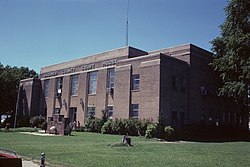
In 1905, the Sequoyah Convention proposed creating two counties from this area. The western half would be named Coweta and the eastern half would have been named Tumechichee. However, failure of the attempt to create the state of Sequoyah negated the proposal. In 1907 at Oklahoma statehood, Wagoner County was organized. The towns of Porter and Coweta vied with Wagoner as the county seat. The county was named after the town of Wagoner, which won the election. The town was named after Henry "Bigfoot" Wagoner, a Katy Railroad dispatcher from Parsons, Kansas. [1]

Geography

According to the U.S. Census Bureau, the county has a total area of 591 sq mi (1,530 km2), of which 29 sq mi (75 km2) (4.9%) are covered by water. [4] It is part of the Ozark Highlands. The Verdigris River divides the east and west parts of the county. The Arkansas River forms part of the western and southern boundaries. Grand River also flows south through the county. It was dammed in 1942 to create Fort Gibson Lake. [1]

Adjacent counties

Demographics

Historical population
CensusPop.Note
1910 22,086
1920 21,371−3.2%
1930 22,4284.9%
1940 21,642−3.5%
1950 16,741−22.6%
1960 15,673−6.4%
1970 22,16341.4%
1980 41,80188.6%
1990 47,88314.5%
2000 57,49120.1%
2010 73,08527.1%
2020 80,98110.8%
2021 (est.)84,050 [5] 3.8%
U.S. Decennial Census [6]
1790-1960 [7] 1900-1990 [8]
1990-2000 [9] 2010-2019 [10]

As of the census of 2010, 73,085 people were in the county. [11] The population density was 47.7/km2. The 29,694 housing units averaged 55.9/sq mi (19.4/km2). The racial makeup of the county was 80.07% White, 3.75% African American, 9.38% Native American, 0.51% Asian, 0.88% from other races, and 5.41% from two or more races. Hispanics or Latinos of any race were 2.50% of the population. By the 2020 census, its population was 80,981 with a 2022 census-estimated population of 86,644. Its racial and ethnic makeup as of 2021's census estimates were 69.4% non-Hispanic white, 3.8% African American, 10.9% Native American, 2% Asian, 0.1% Pacific Islander, 7.7% multiracial, and 7.6% Hispanic or Latino of any race. [2]

Of the 21,010 households in 2010, 37.40% had children under 18 living with them, 65.90% were married couples living together, 9.80% had a female householder with no husband present, and 20.50% were not families. About 17.70% of all households were made up of individuals, and 6.70% had someone living alone who was 65 or older. The average household size was 2.73, and the average family size was 3.08. As of 2010, the age distribution was 28.10% under 18, 7.90% from 18 to 24, 28.50% from 25 to 44, 25.40% from 45 to 64, and 10.20% who were 65 age or older. The median age was 36 years. For every 100 females, there were 97.70 males. For every 100 females age 18 and over, there were 94.90 males.

As of 2010, the median income for a household in the county was $56,819, and for a family was $62,997. The per capita income for the county was $24,976. About 8.3% of families and 12.1% of the population were below the poverty line, including 18.5% of those under age 18 and 5.8% of those age 65 or over. [12] As of 2021, its median household income grew to $68,906 with a poverty rate of 9.7%. [2]

Politics

Voter Registration and Party Enrollment as of July 31, 2022 [13]
PartyNumber of VotersPercentage
Republican 29,09260.51%
Democratic 11,51823.96%
Libertarian 3860.8%
Unaffiliated7,08414.73%
Total48,080100%
United States presidential election results for Wagoner County, Oklahoma [14]
Year Republican Democratic Third party
No.%No.%No.%
2020 26,16574.04%8,46423.95%7092.01%
2016 23,00573.50%6,72321.48%1,5725.02%
2012 20,90072.85%7,79127.15%00.00%
2008 21,44170.88%8,81029.12%00.00%
2004 19,08167.57%9,15732.43%00.00%
2000 12,98160.33%8,24438.31%2921.36%
1996 9,39248.02%7,74939.62%2,41712.36%
1992 9,05342.05%7,04132.70%5,43525.25%
1988 10,21957.68%7,37841.64%1210.68%
1984 12,53469.97%5,27129.43%1080.60%
1980 8,96960.90%5,23535.55%5233.55%
1976 5,07145.86%5,87953.17%1070.97%
1972 6,56972.13%2,25724.78%2813.09%
1968 3,18741.76%2,18328.60%2,26229.64%
1964 2,84041.78%3,95758.22%00.00%
1960 3,57056.87%2,70743.13%00.00%
1956 3,53758.16%2,54441.84%00.00%
1952 3,32152.82%2,96647.18%00.00%
1948 2,66644.03%3,38955.97%00.00%
1944 3,46759.29%2,37340.58%80.14%
1940 4,64761.00%2,94638.67%250.33%
1936 2,11941.41%2,97758.18%210.41%
1932 1,50527.26%4,01572.74%00.00%
1928 2,72660.62%1,74538.80%260.58%
1924 1,64642.17%1,98550.86%2726.97%
1920 1,43248.30%1,37546.37%1585.33%
1916 74935.80%1,04049.71%30314.48%
1912 55532.55%88852.08%26215.37%

Communities

Cities

Towns

Census-designated places

Other unincorporated places

Former community

Education

School districts (all full K-12) include: [15]

National Register of Historic Places

First Presbyterian Church of Coweta Mission Bell Museum.jpg
First Presbyterian Church of Coweta
The Cobb Building The Cobb Building.jpg
The Cobb Building

These in Wagoner County are listed on the National Register of Historic Places:

Related Research Articles

<span class="mw-page-title-main">Tulsa County, Oklahoma</span> County in the United States

Tulsa County is located in the U.S. state of Oklahoma. As of the 2020 census, the population was 669,279, making it the second-most populous county in the state, behind only Oklahoma County. Its county seat and largest city is Tulsa, the second-largest city in the state. Founded at statehood, in 1907, it was named after the previously established city of Tulsa. Before statehood, the area was part of both the Creek Nation and the Cooweescoowee District of Cherokee Nation in Indian Territory.

<span class="mw-page-title-main">Rogers County, Oklahoma</span> County in Oklahoma, United States

Rogers County is located in the northeastern part of the U.S. state of Oklahoma. As of the 2020 census, the population was 95,240, making it the sixth-most populous county in Oklahoma. The county seat is Claremore. Rogers County is included in the Tulsa, OK metropolitan statistical area.

<span class="mw-page-title-main">Muskogee County, Oklahoma</span> County in Oklahoma, United States

Muskogee County is a county located in the U.S. state of Oklahoma. As of the 2020 census, the population was 66,339. The county seat is Muskogee. The county and city were named for the Muscogee (Creek) Nation. The official spelling of the name was changed to Muskogee by the post office in 1900.

<span class="mw-page-title-main">Mayes County, Oklahoma</span> County in Oklahoma, United States

Mayes County is a county located in the U.S. state of Oklahoma. As of the 2020 census, the population was 39,046. Its county seat is Pryor Creek. Named for Samuel Houston Mayes, Principal Chief of the Cherokee Nation from 1895 to 1899, it was originally created at the Sequoyah Convention in August 1905.

<span class="mw-page-title-main">Cherokee County, Oklahoma</span> County in Oklahoma, United States

Cherokee County is a county located in the U.S. state of Oklahoma. As of the 2020 census, the population was 47,078. Its county seat is Tahlequah, which is also the capital of the Cherokee Nation.

<span class="mw-page-title-main">Muskogee, Oklahoma</span> City in Oklahoma, United States

Muskogee is the thirteenth-largest city in Oklahoma and the county seat of Muskogee County. Home to Bacone College, it lies approximately 48 miles (77 km) southeast of Tulsa. The population of the city was 36,878 as of the 2020 census, a 6.0 percent decrease from 39,223 in 2010.

<span class="mw-page-title-main">Jenks, Oklahoma</span> City in Oklahoma, United States

Jenks is a city in Tulsa County, Oklahoma, United States, and a suburb of Tulsa, in the northeastern part of the state. It is situated between the Arkansas River and U.S. Route 75. Jenks is one of the fastest-growing cities in Oklahoma. The city's population was 16,924 in the 2010 census, but by 2020, this had grown to 25,949. The Census estimated Jenks' population as 26,661 in 2021.

<span class="mw-page-title-main">Coweta, Oklahoma</span> City in Oklahoma, United States

Coweta is a city in Wagoner County, Oklahoma, United States, a suburb of Tulsa. As of 2010, its population was 9,943. Part of the Creek Nation in Indian Territory before Oklahoma became a U.S. state, the town was first settled in 1840.

<span class="mw-page-title-main">New Tulsa, Oklahoma</span> Defunct Town in Oklahoma, United States

New Tulsa was a town in Wagoner County, Oklahoma, United States. The population was 568 at the 2000 census. The town was dissolved in 2001 by a vote of the residents and is now part of the city of Broken Arrow.

<span class="mw-page-title-main">Porter, Oklahoma</span> Town in Oklahoma, United States

Porter is a town in Wagoner County, Oklahoma, United States. It promotes itself as "The Peach Capital of Oklahoma." The population was 566 at the 2010 census, a loss of 1.4 percent, compared to 574 at the 2000 census.

<span class="mw-page-title-main">Redbird, Oklahoma</span> Town in Oklahoma, United States

Redbird is a town in Wagoner County, Oklahoma, United States. The population was 137 at the 2010 census, a 10.5 percent decline from the figure of 153 in 2000. Founded at the turn of the 20th century, it was one of more than fifty all-black towns in Oklahoma Territory and Indian Territory and is one of thirteen surviving black communities in Oklahoma.

<span class="mw-page-title-main">Wagoner, Oklahoma</span> City in Oklahoma, United States

Wagoner is a city in Wagoner County, Oklahoma, United States. The population was 8,323 at the 2010 census, compared to the figure of 7,669 recorded in 2000. It is the county seat of Wagoner County. Wagoner became the first city incorporated in Indian Territory on January 4, 1896.

<span class="mw-page-title-main">Catoosa, Oklahoma</span> City in Oklahoma, United States

Catoosa is a city in Rogers and Wagoner counties in the U.S. state of Oklahoma. The population was 7,159 at the 2010 census compared to 5,449 at the 2000 census. This was a 31.2 percent increase during the decade.

<span class="mw-page-title-main">Fair Oaks, Oklahoma</span> Town in Oklahoma, United States

Fair Oaks is a town in Rogers and Wagoner counties in the U.S. state of Oklahoma. The population was 103 at the 2010 census, a 15.6 percent decline from the figure of 122 recorded in 2000. It is a suburb of Tulsa.

<span class="mw-page-title-main">Bixby, Oklahoma</span> City in Oklahoma, United States

Bixby is a city in Tulsa and Wagoner counties in the U.S. state of Oklahoma, and is a suburb of Tulsa. The population was 28,609 at the 2020 census and 20,884 in the 2010 census, an increase of 13.70 percent In 2010, Bixby became the 19th largest city in Oklahoma. It is nicknamed "The Garden Spot of Oklahoma" for its rich agrarian heritage. Though one of the fastest-growing communities in Oklahoma, it remains a sod-growing center and a popular location for purchasing fresh vegetables. The per capita income of $36,257 is the highest in the Tulsa Metropolitan area and is more than 50 percent higher than the state average. In 2009, CNN Money.com placed Bixby No. 67 on its list of 100 Best Places to Live.

<span class="mw-page-title-main">Broken Arrow, Oklahoma</span> City in Oklahoma, United States

Broken Arrow is a city located in the northeastern part of the U.S. state of Oklahoma, primarily in Tulsa County, with a portion in western Wagoner County. It is the largest suburb of Tulsa. According to the 2020 census, Broken Arrow has a population of 113,540 residents and is the fourth-largest city in the state. The city is part of the Tulsa Metropolitan Area, which has a population of 1,023,988 residents.

<span class="mw-page-title-main">Green Country</span>

Green Country, sometimes referred to as Northeast Oklahoma, is the northeastern portion of the U.S. state of Oklahoma, which lies west of the northern half of Arkansas, the southwestern corner the way of Missouri, and south of Kansas.

<span class="mw-page-title-main">Area codes 918 and 539</span> Telephone area codes in Oklahoma, USA

Area codes 918 and 539 are telephone area codes serving Tulsa and northeast Oklahoma. Besides Tulsa, these area codes cover cities such as Bartlesville, Broken Arrow, Claremore, Gore, Jenks, McAlester, Muskogee, Okmulgee, Pryor, Sapulpa, Tahlequah, and northeastern Oklahoma.

<span class="mw-page-title-main">Oklahoma's 1st congressional district</span> U.S. House district for Oklahoma

Oklahoma's 1st congressional district is in the northeastern corner of the state and borders Kansas. Anchored by Tulsa, it is largely coextensive with the Tulsa metropolitan area. It includes all of Tulsa, Washington and Wagoner counties, and parts of Rogers and Creek counties. Although it has long been reckoned as the Tulsa district, a small portion of Tulsa itself is located in the 3rd district.

<span class="mw-page-title-main">Tulsa metropolitan area</span> Metropolitan area in northeastern Oklahoma

The Tulsa metropolitan area, officially defined as the Tulsa metropolitan statistical area is a metropolis in northeastern Oklahoma centered around the city of Tulsa and encompassing Tulsa, Rogers, Wagoner, Osage, Creek, Okmulgee and Pawnee counties. It had a population of 1,023,988 according to the 2021 U.S. census estimates.

References

  1. 1 2 3 4 5 6 7 McMahan, Liz. "Wagoner County - Encyclopedia of Oklahoma History & Culture". Oklahoma Historical Society. Retrieved May 24, 2011.
  2. 1 2 3 "U.S. Census Bureau QuickFacts". United States Census Bureau. Retrieved August 6, 2022.
  3. "Find a County". National Association of Counties. Retrieved June 7, 2011.
  4. "2010 Census Gazetteer Files". United States Census Bureau. August 22, 2012. Retrieved February 22, 2015.
  5. "U.S. Census Bureau QuickFacts". United States Census Bureau. Retrieved August 6, 2022.
  6. "U.S. Decennial Census". United States Census Bureau. Retrieved February 22, 2015.
  7. "Historical Census Browser". University of Virginia Library. Retrieved February 22, 2015.
  8. Forstall, Richard L., ed. (March 27, 1995). "Population of Counties by Decennial Census: 1900 to 1990". United States Census Bureau. Retrieved February 22, 2015.
  9. "Census 2000 PHC-T-4. Ranking Tables for Counties: 1990 and 2000" (PDF). United States Census Bureau. April 2, 2001. Archived (PDF) from the original on October 9, 2022. Retrieved February 22, 2015.
  10. "State & County QuickFacts". United States Census Bureau. Archived from the original on October 10, 2013. Retrieved November 13, 2013.
  11. "U.S. Census website". United States Census Bureau . Retrieved January 31, 2008.
  12. American Factfinder. Accessed April 29, 2013.
  13. "Current Registration Statistics by County" (PDF). ok.gov. July 31, 2022. Archived (PDF) from the original on October 9, 2022. Retrieved August 6, 2022.
  14. Leip, David. "Dave Leip's Atlas of U.S. Presidential Elections". uselectionatlas.org. Retrieved March 30, 2018.
  15. "2020 CENSUS - SCHOOL DISTRICT REFERENCE MAP: Wagoner County, OK" (PDF). U.S. Census Bureau. Archived (PDF) from the original on October 9, 2022. Retrieved July 23, 2022. - Text list