Pawnee County, Oklahoma

Last updated

Pawnee County
PawneeCourthouse.jpg
Map of Oklahoma highlighting Pawnee County.svg
Location within the U.S. state of Oklahoma
Oklahoma in United States.svg
Oklahoma's location within the U.S.
Coordinates: 36°19′N96°42′W / 36.31°N 96.7°W / 36.31; -96.7
CountryFlag of the United States.svg United States
StateFlag of Oklahoma.svg  Oklahoma
Founded1893
Named for Pawnee Nation
Seat Pawnee
Largest city Cleveland
Area
  Total595 sq mi (1,540 km2)
  Land568 sq mi (1,470 km2)
  Water27 sq mi (70 km2)  4.5%
Population
 (2020)
  Total15,553
  Density26/sq mi (10/km2)
Congressional district 3rd
Website www.cityofpawnee.com/county-of-pawnee

Pawnee County is a county located in the U.S. state of Oklahoma. As of the 2020 census, the population was 15,553. [1] Its county seat is Pawnee. [2] The county is named after the Pawnee Nation, [3] whose reservation used to encompass the county prior to allotment in 1893.

Contents

Pawnee County is included in the Tulsa, OK metropolitan statistical area.

History

The Osage Nation used the area that contains present-day Pawnee County as buffalo hunting grounds. In 1825, The Osage ceded parts of present-day Missouri, Arkansas, and most of the future state of Oklahoma to the US federal government.

After their forced removal from the Southeastern United States, Cherokee people received land in Eastern Oklahoma as well as the Cherokee Outlet in 1828, which included present-day Pawnee County. After the Civil War, the Cherokee agreed to allow other American Indians to settle in the eastern portion of the outlet. According to the Tribal Historic Preservation Office of the Pawnee Nation, the Pawnee people sold their Nebraska reservation in 1874 and used those funds to purchase land from the Cherokee Nation and the Muscogee Nation to establish a home in the Indian Territory.

From the Pawnee Nation Historic Preservation Office, the Pawnee people were forced to sign an agreement in 1891 to take land allotments from the reservation or have their lands taken from them by eminent domain. The remaining lands were opened to non-Indian settlers in 1893. Pawnee County was organized as County Q, and the future town of Pawnee, Townsite Number 13, was designated the county seat. [3] In 1894, the voters chose the name Pawnee County over the name Platte County. [3]

The female bandit, Little Britches, companion in crime with Cattle Annie, lived for a time at Sinnett, site of the Muscogee (Creek) Nation in Pawnee County. [4]

Geography

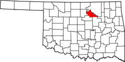
According to the U.S. Census Bureau, the county has a total area of 595 square miles (1,540 km2), of which 568 square miles (1,470 km2) is land and 27 square miles (70 km2) (4.5%) is water. [5]

The western third of the county is part of the Red Bed plains, while the remainder is in the Sandstone Hills region. The Cimarron and Arkansas Rivers drain the county. [3] Black Bear Creek also extends through the county. Lone Chimney Lake dam is also in Pawnee County, while the lake extends into Payne County. [6]

Adjacent counties

Earthquake

A magnitude 5.8 earthquake struck near the city of Pawnee, just after 7 a.m. (CST) on September 3, 2016. This was Oklahoma's strongest quake in history, exceeding the 5.7-magnitude quake near Prague on November 5, 2011. [7] [8] Buildings in Pawnee were damaged, but there were no reports of deaths. [9] A Pawnee resident was injured while shielding his child from debris falling from a chimney. [10] State regulators in Oklahoma ordered 37 petroleum production wastewater disposal wells in the vicinity of the earthquake (see map in citation) to be rapidly closed while assessments were made. [11]

Demographics

Historical population
CensusPop.Note
1900 12,366
1910 17,33240.2%
1920 19,12610.4%
1930 19,8824.0%
1940 17,395−12.5%
1950 13,616−21.7%
1960 10,884−20.1%
1970 11,3384.2%
1980 15,31035.0%
1990 15,5751.7%
2000 16,6126.7%
2010 16,577−0.2%
2020 15,553−6.2%
U.S. Decennial Census [12]
1790-1960 [13] 1900-1990 [14]
1990-2000 [15] 2010 [16]

As of the census [17] of 2000, there were 16,612 people, 6,383 households, and 4,748 families residing in the county. The population density was 11/km2 (28/sq mi). There were 7,464 housing units at an average density of 5/km2 (13/sq mi). The racial makeup of the county was 82.27% White, 0.69% Black or African American, 12.13% Native American, 0.20% Asian, 0.05% Pacific Islander, 0.24% from other races, and 4.42% from two or more races. 1.16% of the population were Hispanic or Latino of any race. In 2020, its population was 15,553. [16]

In 2000, there were 6,383 households, out of which 32.60% had children under the age of 18 living with them, 61.60% were married couples living together, 9.00% had a female householder with no husband present, and 25.60% were non-families. 22.80% of all households were made up of individuals, and 11.00% had someone living alone who was 65 years of age or older. The average household size was 2.58 and the average family size was 3.02.

In the county, the population was spread out, with 26.50% under the age of 18, 7.30% from 18 to 24, 26.20% from 25 to 44, 25.20% from 45 to 64, and 14.80% who were 65 years of age or older. The median age was 38 years. For every 100 females, there were 97.40 males. For every 100 females age 18 and over, there were 94.40 males.

The median income for a household in the county was $31,661, and the median income for a family was $37,274. Males had a median income of $29,946 versus $21,069 for females. The per capita income for the county was $15,261. About 9.60% of families and 13.00% of the population were below the poverty line, including 16.60% of those under age 18 and 13.80% of those age 65 or over.

Politics

Voter Registration and Party Enrollment as of June 30, 2023 [18]
PartyNumber of VotersPercentage
Democratic 2,24423.76%
Republican 5,66059.93%
Others1,54116.32%
Total9,445100%
United States presidential election results for Pawnee County, Oklahoma [19]
Year Republican Democratic Third party
No.%No.%No.%
2020 5,26777.62%1,36320.09%1562.30%
2016 4,72974.31%1,34421.12%2914.57%
2012 4,23270.01%1,81329.99%00.00%
2008 4,53368.72%2,06331.28%00.00%
2004 4,41263.25%2,56436.75%00.00%
2000 3,38657.15%2,43541.10%1041.76%
1996 2,56042.62%2,66344.34%78313.04%
1992 2,67538.36%2,61237.46%1,68624.18%
1988 3,32453.94%2,78145.13%570.93%
1984 4,69967.83%2,16531.25%640.92%
1980 3,90263.44%2,02032.84%2293.72%
1976 3,11150.17%3,03148.88%590.95%
1972 4,28077.30%1,13520.50%1222.20%
1968 2,43751.09%1,34328.16%99020.75%
1964 2,27848.81%2,38951.19%00.00%
1960 3,15365.80%1,63934.20%00.00%
1956 3,39059.96%2,26440.04%00.00%
1952 3,97563.61%2,27436.39%00.00%
1948 2,65149.35%2,72150.65%00.00%
1944 3,31057.21%2,46042.52%160.28%
1940 3,99153.47%3,43546.02%380.51%
1936 2,96141.92%4,03157.06%721.02%
1932 2,28031.32%5,00068.68%00.00%
1928 4,48968.82%1,94929.88%851.30%
1924 3,09351.37%2,37639.46%5529.17%
1920 2,97656.12%1,95536.87%3727.01%
1916 1,39640.44%1,49143.19%56516.37%
1912 1,33242.69%1,31642.18%47215.13%

Communities

NRHP sites

The following sites in Pawnee County are listed on the National Register of Historic Places:

Related Research Articles

<span class="mw-page-title-main">Rogers County, Oklahoma</span> County in Oklahoma, United States

Rogers County is located in the northeastern part of the U.S. state of Oklahoma. As of the 2020 census, the population was 95,240, making it the sixth-most populous county in Oklahoma. The county seat is Claremore. Rogers County is included in the Tulsa, OK metropolitan statistical area.

<span class="mw-page-title-main">Osage County, Oklahoma</span> County in Oklahoma, United States

Osage County is the largest county by area in the U.S. state of Oklahoma. Created in 1907 when Oklahoma was admitted as a state, the county is named for and is home to the federally recognized Osage Nation. The county is coextensive with the Osage Nation Reservation, established by treaty in the 19th century when the Osage relocated there from Kansas. The county seat is in Pawhuska, one of the first three towns established in the county. The total population of the county as of 2020 was 45,818.

<span class="mw-page-title-main">Nowata County, Oklahoma</span> County in Oklahoma, United States

Nowata County is a county located in northeastern Oklahoma, United States, on the Kansas border. As of the 2020 census, its population is 9,320. Its county seat is Nowata. Their name is derived from a Delaware word, no-we-ata, meaning "come here" or "welcome".

<span class="mw-page-title-main">Noble County, Oklahoma</span> County in Oklahoma, United States

Noble County is located in the north central part of Oklahoma. As of the 2020 census, the population was 10,924. Its county seat is Perry. It was part of the Cherokee Outlet in Indian Territory until Oklahoma Territory was created in 1890, and the present county land was designated as County P. After the U. S. government opened the area to non-Indian settlement in 1893, it was renamed Noble County for John Willock Noble, then the United States Secretary of the Interior.

<span class="mw-page-title-main">Mayes County, Oklahoma</span> County in Oklahoma, United States

Mayes County is a county located in the U.S. state of Oklahoma. As of the 2020 census, the population was 39,046. Its county seat is Pryor Creek. Named for Samuel Houston Mayes, Principal Chief of the Cherokee Nation from 1895 to 1899, it was originally created at the Sequoyah Convention in August 1905.

<span class="mw-page-title-main">Kay County, Oklahoma</span> County in Oklahoma, United States

Kay County is a county located in the U.S. state of Oklahoma. As of the 2020 census, its population was 43,700. Its county seat is Newkirk, and the largest city is Ponca City.

<span class="mw-page-title-main">Delaware County, Oklahoma</span> County in Oklahoma, United States

Delaware County is a county located in the U.S. state of Oklahoma. As of the 2020 census, the population was 40,397. Its county seat is Jay. The county was named for the Delaware Indians, who had established a village in the area prior to the Cherokees being assigned to relocate to Indian Territory in the 1830s. Delaware County was created in 1907. Prior to becoming Delaware County, a large portion of the area was known as the Delaware District of the Cherokee Nation. Today, Delaware County continues to be recognized by the Cherokee Nation as the Delaware District.

<span class="mw-page-title-main">Creek County, Oklahoma</span> County in Oklahoma, United States

Creek County is a county located in the U.S. state of Oklahoma. As of the 2020 census, the population was 71,754. Its county seat is Sapulpa.

<span class="mw-page-title-main">Craig County, Oklahoma</span> County in Oklahoma, United States

Craig County is a county in the U.S. state of Oklahoma. As of the 2020 census, the population was 14,107. Its county seat is Vinita. The county was organized in 1907, shortly before statehood, and named for Granville Craig, a prominent Cherokee farmer who lived in the Bluejacket area.

<span class="mw-page-title-main">Alfalfa County, Oklahoma</span> County in Oklahoma, United States

Alfalfa County is a county located in the U.S. state of Oklahoma. As of the 2020 census, the population was 5,699. The county seat is Cherokee.

<span class="mw-page-title-main">Shady Grove, Cherokee County, Oklahoma</span> Census-designated place in Oklahoma, United States

Shady Grove is an unincorporated community and census-designated place (CDP) in Cherokee County, Oklahoma, United States. The population was 556 at the 2010 census. This is not to be confused with the similarly-named Shady Grove in McIntosh County, or the Shady Grove in Pawnee County.

<span class="mw-page-title-main">Shattuck, Oklahoma</span> Town in Oklahoma, United States

Shattuck is a town in Ellis County, Oklahoma, United States. The population was 1,249 at the time of the 2020 census, a change from the 1,356 reported in the 2010 census.

<span class="mw-page-title-main">Sparks, Oklahoma</span> Town in Oklahoma, United States

Sparks is a town in Lincoln County, Oklahoma, United States. The population was 169 at the 2010 census, a 23.4 percent gain from the figure of 137 in 2000. The center of population of Oklahoma is located in Sparks.

<span class="mw-page-title-main">Morrison, Oklahoma</span> Town in Oklahoma, United States

Morrison is a town in southeastern Noble County, Oklahoma, United States. The population was 733 at the 2010 census, an increase from the figure of 636 in 2000.

<span class="mw-page-title-main">Cleveland, Oklahoma</span> City in Oklahoma, United States

Cleveland is a city in Pawnee County, Oklahoma, United States. The 2010 census population was 3,251, a decrease of 0.9 percent from the figure of 3,282 recorded in 2000.

<span class="mw-page-title-main">Maramec, Oklahoma</span> Town in Oklahoma, United States

Maramec is a town in Pawnee County, Oklahoma, United States. The population was 91 at the 2010 census, a decline of 12.5 percent from the figure 104 recorded in 2000.

<span class="mw-page-title-main">Pawnee, Oklahoma</span> City in Oklahoma, United States

Pawnee is a city and county seat of Pawnee County, Oklahoma, United States. The town is northeast of Stillwater at the junction of U.S. Route 64 and State Highway 18.

<span class="mw-page-title-main">Ralston, Oklahoma</span> Town in Oklahoma, United States

Ralston is a town in Pawnee County, Oklahoma, United States. The town is southeast of Ponca City on State Highway 18 near the west bank of the Arkansas River. The population was 330 at the 2010 census, a decline of 7 percent from the figure of 355 recorded in 2000.

<span class="mw-page-title-main">Claremore, Oklahoma</span> American city

Claremore is a city and the county seat of Rogers County in Green Country or northeastern Oklahoma, United States. The population was 19,580 at the 2020 census, a 5.4 percent increase over the figure of 18,581 recorded in 2010. Located in the foothills of the Ozark Mountains, the town is home to Rogers State University. It is best known as the home of early 20th-century entertainer Will Rogers.

<span class="mw-page-title-main">Vian, Oklahoma</span> Town in Oklahoma, United States

Vian is a town in Sequoyah County, Oklahoma, United States, adjacent to Interstate 40 at the intersection of U.S. Route 64 and Oklahoma State Highway 82. The population was 1,374 at the 2020 census, a 6.3 percent decline from the figure of 1,466 recorded in 2010. It is part of the Fort Smith Metropolitan Statistical Area.

References

  1. "Pawnee County, Oklahoma". United States Census Bureau . Retrieved May 20, 2023.
  2. "Find a County". National Association of Counties. Archived from the original on May 31, 2011. Retrieved June 7, 2011.
  3. 1 2 3 4 Wilson, Linda D. "Pawnee County," Encyclopedia of Oklahoma History and Culture, Oklahoma Historical Society, 2009. Accessed April 4, 2015.
  4. "Cattle Annie & Little Britches, taken from Lee Paul [http://www.theoutlaws.com]". ranchdivaoutfitters.com. Archived from the original on March 25, 2013. Retrieved December 27, 2012.{{cite web}}: External link in |title= (help)
  5. "2010 Census Gazetteer Files". United States Census Bureau. August 22, 2012. Retrieved February 22, 2015.
  6. "Lone Chimney Lake, Oklahoma." OutdoorsOK. Accessed September 5, 2015.
  7. "M5.8 - 15km NW of Pawnee, Oklahoma". United States Geological Survey. September 7, 2016. Retrieved September 7, 2016.
  8. "Magnitudes for Oklahoma Earthquakes Shift Upward". United States Geological Survey. September 7, 2016. Retrieved September 7, 2016.
  9. Campbell, Andy. "5.6 Magnitude Earthquake Rattles Oklahoma." Huffington Post. September 3, 2016. Accessed September 3, 2016.
  10. Duren, Dee. "Pawnee Man Injured Protecting Child In Earthquake" . Retrieved September 7, 2016.
  11. "USGS: 5.6 magnitude earthquake shakes Oklahoma". KFOR-TV. September 3, 2016. Retrieved September 7, 2016.
  12. "U.S. Decennial Census". United States Census Bureau. Retrieved February 22, 2015.
  13. "Historical Census Browser". University of Virginia Library. Retrieved February 22, 2015.
  14. Forstall, Richard L., ed. (March 27, 1995). "Population of Counties by Decennial Census: 1900 to 1990". United States Census Bureau. Retrieved February 22, 2015.
  15. "Census 2000 PHC-T-4. Ranking Tables for Counties: 1990 and 2000" (PDF). United States Census Bureau. April 2, 2001. Archived (PDF) from the original on October 9, 2022. Retrieved February 22, 2015.
  16. 1 2 "State & County QuickFacts". United States Census Bureau. Archived from the original on June 6, 2011. Retrieved November 12, 2013.
  17. "U.S. Census website". United States Census Bureau . Retrieved January 31, 2008.
  18. "Oklahoma Registration Statistics by County" (PDF). OK.gov. January 15, 2019. Retrieved February 27, 2019.
  19. Leip, David. "Dave Leip's Atlas of U.S. Presidential Elections". uselectionatlas.org. Retrieved March 29, 2018.

36°19′N96°42′W / 36.31°N 96.70°W / 36.31; -96.70