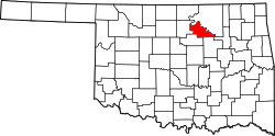
Terlton, Oklahoma

Last updated

Terlton, Oklahoma
Pawnee County Oklahoma Incorporated and Unincorporated areas Terlton highlighted.svg
Location of Terlton, Oklahoma
Coordinates: 36°11′15″N96°29′31″W / 36.18750°N 96.49194°W / 36.18750; -96.49194
Country United States
State Oklahoma
County Pawnee
Area
[1]
  Total0.16 sq mi (0.41 km2)
  Land0.16 sq mi (0.41 km2)
  Water0.00 sq mi (0.00 km2)
Elevation
[2]
778 ft (237 m)
Population
 (2020)
  Total77
  Density487.34/sq mi (187.85/km2)
Time zone UTC-6 (Central (CST))
  Summer (DST) UTC-5 (CDT)
ZIP code
74081
Area code(s) 539/918
FIPS code 40-72850 [3]
GNIS feature ID2413375 [2]

Terlton is a town in Pawnee County, Oklahoma, United States. It is located one-half mile south of US 412/US 64 on Terlton Road and County Road E0570. [4] The population was 77 at the time of the 2020 Census. [5]

Contents

History

The community started forming not long after the Cherokee Outlet opening on September 16, 1893. A post office was established November 30, 1894, and town was named Terlton for a member of the first territorial legislature, Ira N. Terrell. The Arkansas Valley and Western Railway (later the St. Louis and San Francisco Railway) built through town in the 1902-1903 timeframe, and Terlton developed into a trade center for the local agricultural industry. Oil was discovered in the vicinity about 1914, and oil-related industries like pipelines, tank farms and refining supported the town into the 1930s. In more recent years, Terlton has become a commuter town whose residents work in other locations and commute back to Terlton to live. [4]

On Thursday April 26, 1984, a large nighttime F4 tornado struck the small town, killing three people and injuring over 30. This happened the same night as a tornado killed eight and injured nearly 100 in Morris, Oklahoma in Okmulgee County, 60 miles (97 km) to the southeast.

In 1985 an explosion at the Aerlex Corp. fireworks plant in town killed 21 people, about one-quarter of the community at that time. A short-film documentary, “Terlton,” debuted in 2019, documenting how the town has dealt with the tragedy. [6]

Terlton was one of the filming sites for principal photography on Season One of the FX comedy series Reservation Dogs from filmmaker Sterlin Harjo, which concerns four Native American teens in rural Oklahoma. [7]

Geography

According to the United States Census Bureau, the town has a total area of 0.2 square miles (0.52 km2), all land.

Demographics

Historical population
CensusPop.Note
1930 234
1940 2454.7%
1950 122−50.2%
1960 90−26.2%
1970 11123.3%
1980 15539.6%
1990 121−21.9%
2000 85−29.8%
2010 10624.7%
2020 77−27.4%
U.S. Decennial Census [8]

As of the census [3] of 2000, there were 85 people, 30 households, and 21 families residing in the town. The population density was 344.3 inhabitants per square mile (132.9/km2). There were 37 housing units at an average density of 149.9 per square mile (57.9/km2). The racial makeup of the town was 97.65% White, 1.18% Native American, and 1.18% from two or more races. Hispanic or Latino of any race were 2.35% of the population.

There were 30 households, out of which 53.3% had children under the age of 18 living with them, 60.0% were married couples living together, 13.3% had a female householder with no husband present, and 26.7% were non-families. 26.7% of all households were made up of individuals, and 10.0% had someone living alone who was 65 years of age or older. The average household size was 2.83 and the average family size was 3.50.

In the town, the population was spread out, with 41.2% under the age of 18, 8.2% from 18 to 24, 28.2% from 25 to 44, 17.6% from 45 to 64, and 4.7% who were 65 years of age or older. The median age was 26 years. For every 100 females, there were 97.7 males. For every 100 females age 18 and over, there were 92.3 males.

The median income for a household in the town was $22,917, and the median income for a family was $30,536. Males had a median income of $31,458 versus $20,000 for females. The per capita income for the town was $7,862. There were 17.4% of families and 15.1% of the population living below the poverty line, including no under eighteens and 25.0% of those over 64.

Related Research Articles

<span class="mw-page-title-main">Henagar, Alabama</span> City in Alabama, United States

Henagar is a city in DeKalb County, Alabama, United States. At the 2020 census, the population was 2,292.

<span class="mw-page-title-main">Haysville, Kansas</span> City in Sedgwick County, Kansas

Haysville is a city in Sedgwick County, Kansas, United States, and a suburb of Wichita. As of the 2020 census, the population of the city was 11,262. Haysville is known as the "Peach Capital of Kansas".

<span class="mw-page-title-main">Hendrix, Oklahoma</span> Town in Oklahoma, United States

Hendrix is a town in Bryan County, Oklahoma, United States. The population was 79 at both the 2010 and the 2000 censuses. According to the Bryan County Genealogy Society, Hendrix was originally known as Kemp City. This led to it often being confused with the neighboring town that is simply named Kemp. Hendrix was largely destroyed by a 1916 tornado.

<span class="mw-page-title-main">Kiefer, Oklahoma</span> Town in Oklahoma, United States

Kiefer is a town in Creek County, Oklahoma, United States. The population was 2,187 at the 2020 census, a 30% increase over the 1,685 population recorded at the 2010 census, which itself was a 64 percent increase over the 1,026 figure recorded in 2000.

<span class="mw-page-title-main">Lawrence Creek, Oklahoma</span> Town in Oklahoma, United States

Lawrence Creek is a town in Creek County, Oklahoma, United States. Incorporated March 15, 1983, it is primarily a bedroom community whose employed residents work in Sapulpa and Tulsa. The population was 149 at the 2010 census, a gain of 25.2 percent over the figure of 119 recorded in 2000.

<span class="mw-page-title-main">Leedey, Oklahoma</span> Town in Oklahoma, United States

Leedey is a town in Dewey County, Oklahoma, United States. The population was 415 at the 2020 census.

<span class="mw-page-title-main">Fairmont, Oklahoma</span> Town in Oklahoma, United States

Fairmont is a town in Garfield County, Oklahoma, United States. The population was 134 at the 2010 census, a decrease from 147 at the 2000 census.

<span class="mw-page-title-main">Alex, Oklahoma</span> Town in Oklahoma, United States

Alex is a town in Grady County, Oklahoma, United States. The population was 482 at the 2020 census.

<span class="mw-page-title-main">Warwick, Oklahoma</span> Town in Oklahoma, United States

Warwick is a town in Lincoln County, Oklahoma, United States. The population was 184 at the 2020 census, up from 148 in 2010.

<span class="mw-page-title-main">Madill, Oklahoma</span> City in Oklahoma, United States

Madill is a city in and the county seat of Marshall County, Oklahoma, United States. It was named in honor of George Alexander Madill, an attorney for the St. Louis-San Francisco Railway. The population at the 2010 census was 3,770, an increase of 10.8 percent from 3,410 at the 2000 census. It is best known as the site of the annual National Sand Bass Festival. It is part of the Texoma region.

<span class="mw-page-title-main">Cole, Oklahoma</span> Town in Oklahoma, United States

Cole is a town in McClain County, Oklahoma, United States. The population was 624 at the 2020 census, up from 555 at the 2010 census.

<span class="mw-page-title-main">Red Rock, Oklahoma</span> Town in Oklahoma, United States

Red Rock is a town in northern Noble County, Oklahoma, United States. The population was 283 at the 2010 census, a decline from 293 at the 2000 census. The headquarters of the Otoe-Missouria Tribe of Indians is located in Red Rock.

<span class="mw-page-title-main">Westport, Oklahoma</span> Town in Oklahoma, United States

Westport is a town in Pawnee County, Oklahoma, United States. The population was 298 at the 2010 census, a gain of 12.9 percent over the figure of 264 in 2000.

<span class="mw-page-title-main">Bethel Acres, Oklahoma</span> Town in Oklahoma, United States

Bethel Acres is a town in Pottawatomie County, Oklahoma. The population was 2,895 at the time of the 2010 census, an increase of 5.9 percent from the figure of 2,735 in 2000. It is primarily a bedroom community for people who work in the three nearby larger cities of Shawnee, Tecumseh and Oklahoma City.

<span class="mw-page-title-main">Bowlegs, Oklahoma</span> Town in Oklahoma, United States

Bowlegs is a town in Seminole County, Oklahoma, United States. The population was 357 at the time of the 2020 census.

<span class="mw-page-title-main">Turley, Oklahoma</span> CDP in Oklahoma, United States

Turley is a census-designated place (CDP) in Tulsa County, Oklahoma, United States. The population was 2,756 at the 2010 census, a loss of 14.7 percent from the figure of 3,231 recorded in 2000.

<span class="mw-page-title-main">Clay Township, Lancaster County, Pennsylvania</span> Township in Pennsylvania, United States

Clay Township is a township in north central Lancaster County, Pennsylvania, United States. The population was 6,887 at the 2020 census.

<span class="mw-page-title-main">Woonsocket, South Dakota</span> City in South Dakota, United States

Woonsocket is a city in Sanborn County, South Dakota. The population was 631 at the 2020 census. It is the county seat of Sanborn County.

<span class="mw-page-title-main">Oakhurst, Oklahoma</span> Census-designated place in Oklahoma, United States

Oakhurst is an unincorporated community and census-designated place (CDP) in Creek and Tulsa counties in the U.S. state of Oklahoma. The population was 2,262 at the 2020 census, a slight increase from the 2010 population of 2,185.

<span class="mw-page-title-main">Fair Oaks, Oklahoma</span> Town in Oklahoma, United States

Fair Oaks is a town in Rogers and Wagoner counties in the U.S. state of Oklahoma. The population was 103 at the 2010 census, a 15.6 percent decline from the figure of 122 recorded in 2000. It is a suburb of Tulsa.

References

  1. "ArcGIS REST Services Directory". United States Census Bureau. Retrieved September 20, 2022.
  2. 1 2 U.S. Geological Survey Geographic Names Information System: Terlton, Oklahoma
  3. 1 2 "U.S. Census website". United States Census Bureau . Retrieved January 31, 2008.
  4. 1 2 "Terlton". Oklahoma Historical Society. Retrieved July 2, 2020.
  5. "Terlton (town), Oklahoma". US Census Bureau. Retrieved October 12, 2023.
  6. "'Terlton' short-film live-stream looks to benefit town where fireworks tragedy occurred in 1985". Michael Smith, Tulsa World, July 1, 2020.
  7. "Shot-in-Oklahoma FX series 'Reservation Dogs' set for Aug. 9 debut". Tulsa World, July 16, 2021. Retrieved July 16, 2021.
  8. "Census of Population and Housing". Census.gov. Retrieved June 4, 2015.