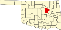
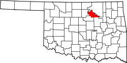
Mannford, Oklahoma

Last updated

Mannford, Oklahoma
City
City of Mannford Seal.jpg
Nickname: 
"Striped Bass Capital of the World"
Motto: 
"Growing Boon of the Lake"
Creek County Oklahoma incorporated and unincorporated areas Mannford highlighted.svg
Location within Creek County and Oklahoma
Coordinates: 36°07′50″N96°20′03″W / 36.13056°N 96.33417°W / 36.13056; -96.33417
CountryUnited States
State Oklahoma
Counties Creek
Government
   Town Administrator Gerald Haury
Area
[1]
  Total9.68 sq mi (25.06 km2)
  Land7.54 sq mi (19.52 km2)
  Water2.14 sq mi (5.54 km2)
Elevation
[2]
722 ft (220 m)
Population
 (2020)
  Total3,262
  Density432.74/sq mi (167.08/km2)
Time zone UTC-6 (Central (CST))
  Summer (DST) UTC-5 (CDT)
ZIP code
74044
Area code(s) 539/918
FIPS code 40-46200 [3]
GNIS feature ID2412944 [2]
Website cityofmannford.com

Mannford is a city in Creek County in the northeastern part of the U.S. state of Oklahoma. The population was 3,262 at the time of the 2020 census, [4] up from 3,076 in 2010. The city sits next to Keystone Lake and claims to be the "Striped Bass Capital of the World".

Contents

History

The town name is derived from "Mann's Ford", a crossing of the Cimarron River where Tom and Hazel Mann had received a Creek allotment. The Arkansas Valley and Western Railroad (later the St. Louis and San Francisco Railroad (commonly called "Frisco") built a line through this area in 1902–03, making it an important cattle shipping point. A post office was established April 11, 1903. [5]

When the Army Corps of Engineers began making plans for flood control that would flood the town of Mannford, citizens formed a plan to relocate several miles southeast of the original site. The move was completed in 1963. [6]

On August 3, 2012, a wildfire started several miles south of Mannford. Carried by strong south winds and extremely dry vegetation, the fire pushed up into the Mannford area and caused evacuations of the town. The fire burned over 78 square miles (200 km2), edging into the town and destroying dozens of buildings. [7]

Geography

Mannford is 22 miles (35 km) west of Tulsa on State Highway 51. [5] It is situated on both sides of a southwest arm of Keystone Lake, a reservoir on the Arkansas and Cimarron rivers. Most of the developed part of the town is on the west side of the lake arm, which fills the valley of Salt Creek.

According to the United States Census Bureau, the town has a total area of 8.9 square miles (23.0 km2), of which 6.9 square miles (17.8 km2) is land and 2.0 square miles (5.2 km2), or 22.53%, is water. [8]

Historical population
CensusPop.Note
1930 421
1940 403−4.3%
1950 4265.7%
1960 358−16.0%
1970 892149.2%
1980 1,61080.5%
1990 1,82613.4%
2000 2,09514.7%
2010 3,07646.8%
2020 3,2626.0%
[5]

Demographics

As of the census [3] of 2000, there were 2,095 people, 783 households, and 583 families residing in the town. The population density was 389.8 inhabitants per square mile (150.5/km2). There were 865 housing units at an average density of 160.9 per square mile (62.1/km2). The racial makeup of the town was 91.31% White, 0.10% African American, 4.39% Native American, 0.24% Asian, 0.24% Pacific Islander, 0.29% from other races, and 3.44% from two or more races. Hispanic or Latino of any race were 1.43% of the population.

There were 783 households, out of which 38.3% had children under the age of 18 living with them, 58.5% were married couples living together, 11.7% had a female householder with no husband present, and 25.5% were non-families. 23.1% of all households were made up of individuals, and 10.9% had someone living alone who was 65 years of age or older. The average household size was 2.57 and the average family size was 3.45.

In the town the population was spread out, with 28.4% under the age of 18, 7.2% from 18 to 24, 28.2% from 25 to 44, 22.0% from 45 to 64, and 14.3% who were 65 years of age or older. The median age was 36 years. For every 100 females, there were 89.8 males. For every 100 females age 18 and over, there were 85.5 males.

The median income for a household in the town was $34,306, and the median income for a family was $41,750. Males had a median income of $32,991 versus $20,625 for females. The per capita income for the town was $17,722. About 6.5% of families and 8.5% of the population were below the poverty line, including 6.5% of those under age 18 and 13.2% of those age 65 or over.

About 99 percent of the employed residents commuted to work in Sand Springs and Tulsa during 2000. [5]

The town currently has nineteen churches. [9]

Economy

In 2012, the city of Mannford contracted with Rickey Hayes of Retail Attractions to provide economic development consulting, due to retail leakage to surrounding communities. [10] A marina, a floating restaurant, improved campgrounds, new housing and expanded industrial and commercial venues are currently all in development. [11] Mannford's largest employer is the public school system followed by Webco Industries, and Care Fusion.

Education

The Mannford school district has five schools that include an Early Childhood Center, two elementary schools, a middle school, and a high school, and serves 1,486 students. [12] Mannford High School offers a variety of extracurricular activities. These activities include speech and debate, band, academic team, FFA and many other extracurricular programs.

Media

Mannford had one newspaper, The Mannford Reporter, which is no longer in regular circulation. The paper was a free paper published every other Wednesday. It is owned by CL Harmon. In the December 7, 2011 the Eagle, the previous newspaper, announced that it was "merging" with the Sand Springs Leader (owned by Community Publishers) and no longer delivering a Mannford Eagle paper. This is when CL Harmon stepped in and started providing The Mannford Reporter.

Notable people

Related Research Articles

<span class="mw-page-title-main">Tulsa County, Oklahoma</span> County in the United States

Tulsa County is located in the U.S. state of Oklahoma. As of the 2020 census, the population was 669,279, making it the second-most populous county in the state, behind only Oklahoma County. Its county seat and largest city is Tulsa, the second-largest city in the state. Founded at statehood, in 1907, it was named after the previously established city of Tulsa. Before statehood, the area was part of both the Creek Nation and the Cooweescoowee District of Cherokee Nation in Indian Territory.

<span class="mw-page-title-main">Payne County, Oklahoma</span> County in Oklahoma, United States

Payne County is located in the U.S. state of Oklahoma. As of the 2020 census, its population was 81,646. Its county seat is Stillwater. The county was created in 1890 as part of Oklahoma Territory and is named for Capt. David L. Payne, a leader of the "Boomers".

<span class="mw-page-title-main">Harmon County, Oklahoma</span> County in Oklahoma, United States

Harmon County is a county in the southwest corner of the U.S. state of Oklahoma. As of the 2020 Census, the population was 2,488, making it the second-least populous county in Oklahoma, behind only Cimarron County. It has lost population in every census since 1930. The county seat is Hollis.

<span class="mw-page-title-main">Creek County, Oklahoma</span> County in Oklahoma, United States

Creek County is a county located in the U.S. state of Oklahoma. As of the 2020 census, the population was 71,754. Its county seat is Sapulpa.

<span class="mw-page-title-main">Depew, Oklahoma</span> Town in Oklahoma, United States

Depew is a town in Creek County, Oklahoma, United States. It is 41 miles southwest of Tulsa. The population was 411 at the 2020 census. The town was named in honor of New York Senator Chauncey Depew.

<span class="mw-page-title-main">Kiefer, Oklahoma</span> Town in Oklahoma, United States

Kiefer is a town in Creek County, Oklahoma, United States. The population was 2,187 at the 2020 census, a 30% increase over the 1,685 population recorded at the 2010 census, which itself was a 64 percent increase over the 1,026 figure recorded in 2000.

<span class="mw-page-title-main">Lawrence Creek, Oklahoma</span> Town in Oklahoma, United States

Lawrence Creek is a town in Creek County, Oklahoma, United States. Incorporated March 15, 1983, it is primarily a bedroom community whose employed residents work in Sapulpa and Tulsa. The population was 149 at the 2010 census, a gain of 25.2 percent over the figure of 119 recorded in 2000.

<span class="mw-page-title-main">Mounds, Oklahoma</span> Town in Oklahoma, United States

Mounds is a town in Creek County, Oklahoma, United States. It is located just south of Tulsa; the town's population was 932 at the 2020 census.

<span class="mw-page-title-main">Oilton, Oklahoma</span> City in Oklahoma, United States

Oilton is a city in Creek County, Oklahoma, United States. The population was 885 at the 2020 census, a 12.6% decline from the 1,013 recorded in 2010.

<span class="mw-page-title-main">Cedar Valley, Oklahoma</span> City in Oklahoma, United States

Cedar Valley is a city in Logan County, Oklahoma, United States. The population was 405 as of the 2020 United States census, up about 40.6% from the 288 reported at the 2010 census, and up nearly seven times the figure of 58 reported in 2000. It is part of the Oklahoma City Metropolitan Statistical Area. It is primarily a bedroom community, since more than 90 percent of the employed inhabitants commute to work in other towns. The main attraction is Cedar Valley Golf Club, which is by far the largest business in town.

<span class="mw-page-title-main">Cimarron City, Oklahoma</span> Town in Oklahoma, United States

Cimarron City is a town in Logan County, Oklahoma, United States. The population was 150 at the 2010 census, a 39.4 percent gain over the figure of 110 in 2000. It is part of the Oklahoma City Metropolitan Statistical Area. Cimarron City is a combination bedroom and retirement community.

<span class="mw-page-title-main">Coyle, Oklahoma</span> Town in Oklahoma, United States

Coyle is a town in Logan County, Oklahoma, United States. The population was 325 at the 2010 census, compared to the figure of 337 in 2000. It is part of the Oklahoma City metropolitan area. The town was named for William Coyle, an influential Guthrie business man.

<span class="mw-page-title-main">Fairview, Oklahoma</span> City in Oklahoma, United States

Fairview is a city in Major County, Oklahoma, United States. Its population was 2,579 at the 2010 census. It is the county seat of Major County.

<span class="mw-page-title-main">Boynton, Oklahoma</span> Town in Oklahoma, United States

Boynton is a town in Muskogee County, Oklahoma, United States. The population was 248 at the 2010 census, a 9.5 percent decline from the figure of 274 recorded in 2000.

<span class="mw-page-title-main">Osage, Oklahoma</span> Town in Oklahoma, United States

Osage is a town in Osage County, Oklahoma, United States. Also known as Osage City, it lies within the Osage Reservation on the shore of Lake Keystone. The population was 156 at the 2010 census, down 17 percent from the figure of 188 recorded in 2000.

<span class="mw-page-title-main">Prue, Oklahoma</span> Town in Oklahoma, United States

Prue is a town in southern Osage County, Oklahoma, United States. The population was 465 at the 2010 census, up 7.4 percent from the figure of 433 recorded in 2000. The town was named for Henry Prue, who owned the original townsite. Prue was relocated when Lake Keystone was built, and is sometimes called "New Prue".

<span class="mw-page-title-main">Westport, Oklahoma</span> Town in Oklahoma, United States

Westport is a town in Pawnee County, Oklahoma, United States. The population was 298 at the 2010 census, a gain of 12.9 percent over the figure of 264 in 2000.

<span class="mw-page-title-main">Bowlegs, Oklahoma</span> Town in Oklahoma, United States

Bowlegs is a town in Seminole County, Oklahoma, United States. The population was 357 at the time of the 2020 census.

<span class="mw-page-title-main">Sperry, Oklahoma</span> Town in Oklahoma, United States

Sperry is a town in Tulsa County, Oklahoma, United States. The population was 1,115 at the time of the 2020 census. It is primarily a bedroom community, since approximately 85 percent of the employed residents commute to work in Tulsa and other nearby towns. Sperry also has an active retirement community.

<span class="mw-page-title-main">Oakhurst, Oklahoma</span> Census-designated place in Oklahoma, United States

Oakhurst is an unincorporated community and census-designated place (CDP) in Creek and Tulsa counties in the U.S. state of Oklahoma. The population was 2,262 at the 2020 census, a slight increase from the 2010 population of 2,185.

References

  1. "ArcGIS REST Services Directory". United States Census Bureau. Retrieved September 20, 2022.
  2. 1 2 U.S. Geological Survey Geographic Names Information System: Mannford, Oklahoma
  3. 1 2 "U.S. Census website". United States Census Bureau . Retrieved January 31, 2008.
  4. "Mannford (town), Oklahoma". United States Census Bureau. Retrieved August 31, 2023.
  5. 1 2 3 4 Linda D. Wilson, "Mannford." Encyclopedia of Oklahoma History and Culture. Accessed March 22, 2012.
  6. "About the Town of Mannford". City of Mannford official website
  7. Tulsa World (Retrieved August 5, 2012) [ dead link ]
  8. "Geographic Identifiers: 2010 Demographic Profile Data (G001): Mannford town, Oklahoma". U.S. Census Bureau, American Factfinder. Archived from the original on March 9, 2015. Retrieved March 6, 2015.
  9. "Mannford Area Churches". Archived January 11, 2014, at the Wayback Machine Mannford community website
  10. "Economic Development in Mannford". City of Mannford official website
  11. Tulsa World.[ dead link ]
  12. "Mannford School District". Education.com (accessed May 8, 2013)