Quay, Oklahoma

Last updated

Quay, Oklahoma
Pawnee County Oklahoma Incorporated and Unincorporated areas Quay highlighted.svg
Location within Pawnee County and Oklahoma
Coordinates: 36°09′35″N96°42′32″W / 36.15972°N 96.70889°W / 36.15972; -96.70889
Country United States
State Oklahoma
Counties Pawnee, Payne
Area
[1]
  Total0.23 sq mi (0.60 km2)
  Land0.23 sq mi (0.59 km2)
  Water0.01 sq mi (0.01 km2)
Elevation
[2]
915 ft (279 m)
Population
 (2020)
  Total39
  Density172.57/sq mi (66.54/km2)
Time zone UTC-6 (Central (CST))
  Summer (DST) UTC-5 (CDT)
FIPS code 40-61450 [3]
GNIS feature ID2412517 [2]

Quay is an unincorporated community and census-designated place (CDP) located on the boundary line between Pawnee and Payne counties in the U.S. state of Oklahoma. The population was 47 at the 2000 census, when it was still a town; the community disincorporated on August 23, 2000. [4] No population was recorded in the census of 2010. But the 2020 Census recorded 39 persons. [5]

Contents

History

This community was originally named Lawson, for the townsite owner, Stonewall J. Lawson. A post office was established here January 17, 1894. The post office was renamed Quay in honor of Pennsylvania Senator Matthew Quay on February 24, 1903. Initially, Quay was an agricultural center. The discovery of oil nearby caused the population to mushroom from about one hundred to about four thousand during the early 1920s. Oil production dried up and the town population declined to 186 at the 1930 census. [6] [lower-alpha 1] The post office closed in 1957 and the school closed in 1965. [6] Outlaw Bill Doolin was killed here in 1896 by Lawman Heck Thomas and his posse.

Geography

According to the United States Census Bureau, the town had a total area of 0.2 square miles (0.5 km2), all land.

Demographics

Historical population
CensusPop.Note
2020 39
U.S. Decennial Census [7]

As of the census [3] of 2000, there were 47 people, 15 households, and 15 families residing in the town. The population density was 250.5 inhabitants per square mile (96.7/km2). There were 20 housing units at an average density of 106.6 per square mile (41.2/km2). The racial makeup of the town was 87.23% White, 2.13% Native American, and 10.64% from two or more races.

There were 15 households, out of which 46.7% had children under the age of 18 living with them, 86.7% were married couples living together, 6.7% had a female householder with no husband present, and 0.0% were non-families. No households were made up of individuals, and none had someone living alone who was 65 years of age or older. The average household size was 3.13 and the average family size was 3.13.

In the town the population was spread out, with 25.5% under the age of 18, 8.5% from 18 to 24, 25.5% from 25 to 44, 34.0% from 45 to 64, and 6.4% who were 65 years of age or older. The median age was 38 years. For every 100 females, there were 113.6 males. For every 100 females age 18 and over, there were 94.4 males.

The median income for a household in the town was $23,438, and the median income for a family was $24,063. Males had a median income of $26,875 versus $0 for females. The per capita income for the town was $9,736. There were 13.3% of families and 25.0% of the population living below the poverty line, including 80.0% of under eighteens and none of those over 64.

Employed residents commute to work, primarily in Stillwater. [6]

Quay disincorporated in August 2000, and no 2010 census figures were recorded. [6]

Notes

  1. The first census to record Quay's population was in 1930. [6]

Related Research Articles

<span class="mw-page-title-main">Macedonia, Alabama</span> Census-designated place in Alabama, United States

Macedonia is a census-designated place and former town in Pickens County, Alabama, United States. The population was 292 at the 2010 census, up from 291 in 2000. The town was incorporated in 1994, but disincorporated in 2001. It was reclassified as a census-designated place (CDP) for 2010.

<span class="mw-page-title-main">Mignon, Alabama</span> CDP in Alabama, United States

Mignon is a census-designated place (CDP) in Talladega County, Alabama, United States. At the 2020 census, the population was 1,186.

<span class="mw-page-title-main">Tuluksak, Alaska</span> CDP in Alaska, United States

Tuluksak is a census-designated place (CDP) in Bethel Census Area, Alaska, United States. At the 2010 census the population was 373, down from 428 in 2000.

<span class="mw-page-title-main">Athelstan, Iowa</span> CDP in Iowa, United States

Athelstan is a tiny hamlet in Taylor County, Iowa, United States, along the Platte River, on the border with Missouri; it is majority owned by the Young family. The population was 18 at the 2000 census. As of the 2010 census, it had become included in a namesake census-designated place which had an overall population of 19.

<span class="mw-page-title-main">Hartwell, Missouri</span> Census-designated place in Missouri, US

Hartwell is a former village and census-designated place in Henry County, Missouri, United States. The population was 16 at the 2010 census.

<span class="mw-page-title-main">La Tour, Missouri</span> Census-designated place and Unincorporated Community in Missouri, United States

La Tour or Latour is an unincorporated community in southwestern Johnson County, Missouri, United States. The population was 65 at the 2000 census, at which time it was a village. La Tour disincorporated in 2009, and at the 2010 census the community, now listed as a census-designated place (CDP), had a population of 62.

<span class="mw-page-title-main">Hayward, Missouri</span> Census-designated place in Missouri, United States

Hayward is a census-designated place and former village in Pemiscot County, Missouri, United States. The population was 131 at the 2010 census.

<span class="mw-page-title-main">Putnam (CDP), Connecticut</span> Census-designated place in Connecticut, United States

Putnam District is a village and census-designated place (CDP) in Windham County, Connecticut, United States. The CDP was formed when the former city of Putnam disincorporated, and it consists of the main town center of the town of Putnam along the Quinebaug River. The population was 7,214 at the 2010 census.

<span class="mw-page-title-main">Northampton, Suffolk County, New York</span> Hamlet and census-designated place in New York, United States

Northampton is a hamlet and census-designated place (CDP) in Suffolk County, New York, United States on Long Island. The CDP population was 570 at the 2010 census.

<span class="mw-page-title-main">Cherry Tree, Oklahoma</span> Census-designated place in Oklahoma, USA

Cherry Tree is a census-designated place (CDP) in Adair County, Oklahoma, United States. The population was 883 at the 2010 census, a decline of 26.5 percent from the figure of 1,202 recorded in 2000.

<span class="mw-page-title-main">Pettit, Oklahoma</span> Census-designated place in Oklahoma, United States

Pettit is an unincorporated community and census-designated place (CDP) in Cherokee County, Oklahoma, United States. The population was 954 at the 2010 census, a 23.7 percent increase over the figure of 771 recorded in 2000. The town was named for Mark and Eliza Pettit, townsite allottees.

Rocky Ford is a census-designated place (CDP) in Delaware and Cherokee counties, Oklahoma, United States. The population was 61 at the 2010 census.

<span class="mw-page-title-main">Jamestown, Oklahoma</span> Unincorporated community in Oklahoma, United States

Jamestown is an unincorporated community in Rogers County, Oklahoma, United States. The population was 10 at the 2000 census, at which time it was a town; the community disincorporated in 1998, but the change was not reported to the Census Bureau until 2006.

Limestone is a census-designated place (CDP) in Rogers County, Oklahoma, United States, at an elevation of 705 feet. It is located less than 10 miles west of Claremore, Oklahoma on Oklahoma State Highway 20. The population was 753 as of July 2020.

Marble City Community is a census-designated place (CDP) in Sequoyah County, Oklahoma, United States. It is part of the Fort Smith, Arkansas-Oklahoma Metropolitan Statistical Area. The population was 420 at the 2000 census.

Lawson Heights is a census-designated place (CDP) in Unity Township, Westmoreland County, Pennsylvania, United States. The population was 2,339 at the 2000 census.

<span class="mw-page-title-main">Roswell, South Dakota</span> Census-designated place in South Dakota, United States

Roswell is a CDP in Miner County, South Dakota, United States. The population was 8 at the 2020 census. It disincorporated as a town in 2012.

<span class="mw-page-title-main">Jefferson, West Virginia</span> Census-designated place in West Virginia, United States

Jefferson is a census-designated place (CDP) in Kanawha County, West Virginia, United States, along the Kanawha River. The population was 676 at the 2010 census. Jefferson was incorporated on March 22, 1997, but was disincorporated less than a decade later on February 21, 2007.

<span class="mw-page-title-main">Mineral Ridge, Ohio</span> Census-designated place in Ohio, United States

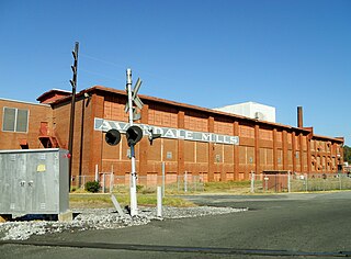
Mineral Ridge is an unincorporated community and census-designated place in southern Trumbull and northern Mahoning counties in the U.S. state of Ohio. The population was 3,951 at the 2020 census. It is a suburb of the Youngstown–Warren metropolitan area. Mineral Ridge was named for valuable coal deposits near the original town site.

<span class="mw-page-title-main">Milton (CDP), Vermont</span> Census-designated place in Vermont, United States

Milton is an unincorporated village within the town of Milton in Chittenden County, Vermont, United States. The village disincorporated in 2003 and became a census-designated place (CDP) in 2008. As of the 2020 census the population was 3,804, out of a population of 10,723 for the entire town.

References

  1. "ArcGIS REST Services Directory". United States Census Bureau. Retrieved September 20, 2022.
  2. 1 2 U.S. Geological Survey Geographic Names Information System: Quay, Oklahoma
  3. 1 2 "U.S. Census website". United States Census Bureau . Retrieved January 31, 2008.
  4. Population Estimates Boundary Changes, United States Census Bureau, 2007-07-01. Accessed 2008-11-06.
  5. "Quay (CDP), Oklahoma". US Census Bureau. Retrieved October 12, 2023.
  6. 1 2 3 4 5 Linda D. Wilson, "Quay." Encyclopedia of Oklahoma History and Culture. Accessed April 1, 2012.
  7. "Census of Population and Housing". Census.gov. Retrieved June 4, 2016.