Mulhall, Oklahoma

Last updated

Mulhall, Oklahoma
OKMap-doton-Mulhall.PNG
Location of Mulhall, Oklahoma
Coordinates: 36°03′48″N97°24′14″W / 36.06333°N 97.40389°W / 36.06333; -97.40389
Country United States
State Oklahoma
Counties Logan
Area
[1]
  Total0.81 sq mi (2.11 km2)
  Land0.81 sq mi (2.11 km2)
  Water0.00 sq mi (0.00 km2)
Elevation
[2]
994 ft (303 m)
Population
 (2020)
  Total212
  Density260.76/sq mi (100.65/km2)
Time zone UTC-6 (Central (CST))
  Summer (DST) UTC-5 (CDT)
ZIP code
73063
Area code(s) 405/572
FIPS code 40-49900 [3]
GNIS feature ID2413028 [2]

Mulhall is a town in Logan (mostly) and Payne counties in Oklahoma, United States. The population was 212 as of the 2020 United States census. [4] It is part of the Oklahoma City Metropolitan Statistical Area.

Contents

History

The town began as a railroad station for the Santa Fe railroad, and was originally named Alfred, for the son of an attorney. [5] The town is named for Zach Mulhall, father of Lucille Mulhall, who was the first official 'cowgirl' to actually compete against men in rodeo events and win. [lower-alpha 1] The town name was changed from Alfred to Mulhall shortly after the land run of 1889 because there were two towns named 'Alfred' at that time, according to a petition made by Zach to the railroad. [6]

Zach Mulhall hosted his own show for many years across the country, with Lucille starring in those shows along with her siblings. Zach and the Mulhall family were also friends with the Miller Brothers of 101 Ranch Fame in nearby Ponca City and often performed with them and shared talent for their shows when needed. Will Rogers and Tom Mix were also integral parts of the early years of the shows and Will (then performing under the stage name, "The Cherokee Kid}") is credited with teaching Lucille how to twirl-another talent for which she was known.

Carrie Nation visited Mulhall in 1901 to tell the town saloons about the evils of liquor and warning that she would return. The town immediately ordered the saloon out of business. [5]

In 1907, ''Leslie's Weekly'' carried a picture of Lucille, calling her the world's champion lariat thrower, a title she won in San Antonio. It also states that she entertained President Theodore Roosevelt.

About 80 percent of the town was destroyed on May 3, 1999, 110 years after the town's founding, by a violent high-end F4 tornado (possibly F5 before hitting the town) which was recorded to be well over one mile wide at times. The town's water tower collapsed due to the violent winds. [6]

Lucille's Restaurant, located in the old Bank Building, was one of the few original structures to survive the tornado. The restaurant boasted eclectic photographs of Lucille and her family during the heyday of their lives and performances in Wild West shows featured in the decor. On September 2, 2009, the restaurant was extensively damaged by fire. It was rebuilt and catered to a variety of customers from families to bikers. On October 21, 2018, it closed permanently. [7] On March 12, 2021, the restaurant was purchased by new owners and is being reopened under the name Lucille's Chuckwagon on May 20, 2021. The Methodist church also survived, and is pictured behind the old Mulhall School.
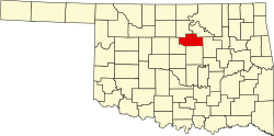
Geography

Mulhall is 13 miles (21 km) north of Guthrie. [6] According to the United States Census Bureau, the town has a total area of 0.2 square miles (0.52 km2), all land.

Demographics

Historical population
CensusPop.Note
1900 564
1910 441−21.8%
1920 385−12.7%
1930 374−2.9%
1940 4068.6%
1950 320−21.2%
1960 253−20.9%
1970 250−1.2%
1980 30120.4%
1990 199−33.9%
2000 23920.1%
2010 225−5.9%
2020 212−5.8%
U.S. Decennial Census [8]

As of the census [3] of 2000, there were 239 people, 88 households, and 69 families residing in the town. The population density was 957.3 inhabitants per square mile (369.6/km2). There were 94 housing units at an average density of 376.5 per square mile (145.4/km2). The racial makeup of the town was 91.63% White, 1.67% Native American, 1.26% Pacific Islander, 0.84% from other races, and 4.60% from two or more races. Hispanic or Latino of any race were 3.35% of the population.

There were 88 households, out of which 37.5% had children under the age of 18 living with them, 62.5% were married couples living together, 11.4% had a female householder with no husband present, and 20.5% were non-families. 17.0% of all households were made up of individuals, and 9.1% had someone living alone who was 65 years of age or older. The average household size was 2.72 and the average family size was 2.96.

In the town, the population was spread out, with 27.2% under the age of 18, 7.5% from 18 to 24, 28.0% from 25 to 44, 23.0% from 45 to 64, and 14.2% who were 65 years of age or older. The median age was 34 years. For every 100 females, there were 95.9 males. For every 100 females age 18 and over, there were 89.1 males.

The median income for a household in the town was $31,750, and the median income for a family was $37,969. Males had a median income of $30,500 versus $21,875 for females. The per capita income for the town was $13,804. About 14.1% of families and 15.4% of the population were below the poverty line, including 11.6% of those under the age of eighteen and 18.8% of those 65 or over.

Notable people

See also

Notes

  1. Zach Mulhall (1847-1931) was a local rancher, railway livestock agent and Wild West show proprietor. He was elected mayor of the town in 1890. [6]

Related Research Articles

<span class="mw-page-title-main">Logan County, Oklahoma</span> County in Oklahoma, United States

Logan County is a county located in the U.S. state of Oklahoma. As of the 2020 census, the population was 49,555. Its county seat is Guthrie.

<span class="mw-page-title-main">Hunnewell, Kansas</span> City in Sumner County, Kansas

Hunnewell is a city in Sumner County, Kansas, United States. As of the 2020 census, the population of the city was 44.

<span class="mw-page-title-main">Bennington, Oklahoma</span> Incorporated Town in Oklahoma, United States

Bennington is an incorporated town in Bryan County, Oklahoma, United States. The population was 334 at the 2010 census.

<span class="mw-page-title-main">Caddo, Oklahoma</span> Town in Oklahoma, United States

Caddo is a town in Bryan County, Oklahoma, United States. The population was 997 at the 2010 census, a 5.6 percent gain over the figure of 944 recorded in 2000. The name is derived from a Caddo word, ka do hada’ cho, meaning "real chief" in English. According to Encyclopedia of Oklahoma History and Culture, the town was named for the nearby Caddo Hills.

<span class="mw-page-title-main">Mead, Oklahoma</span> Town in Oklahoma, United States

Mead is a town in Bryan County, Oklahoma, United States. The population was 122 at the 2010 census, compared to 123 in 2000. Mead was originally named for C.W. Meade, the first postmaster, but the town later dropped the final "e" of the name.

<span class="mw-page-title-main">Silo, Oklahoma</span> Town in Oklahoma, United States

Silo is a town in Bryan County, Oklahoma, United States. The population was 331 at the 2010 census, an increase of 17.4 percent from the figure of 282 recorded in 2000.

<span class="mw-page-title-main">Keyes, Oklahoma</span> Town in Oklahoma, United States

Keyes is a town in Cimarron County, Oklahoma, United States. As of the 2020 census, the town’s population was 276.

<span class="mw-page-title-main">North Enid, Oklahoma</span> Town in Oklahoma, United States

North Enid is a town in Garfield County, Oklahoma, United States. The population was 860 at the 2010 census. The town is served by the Chisholm school district. North Enid was the original railroad town site in the Enid–Pond Creek Railroad War.

<span class="mw-page-title-main">Jefferson, Oklahoma</span> Town in Oklahoma, United States

Jefferson is a town in Grant County, Oklahoma, United States. The population was 12 at the 2010 census, a 67.6 percent decline from the figure of 37 in 2000.

<span class="mw-page-title-main">May, Oklahoma</span> Town in Oklahoma, United States

May is a town in Harper County, Oklahoma, United States. As of the 2020 census, the town’s population was 29.

<span class="mw-page-title-main">Milburn, Oklahoma</span> Town in Oklahoma, United States

Milburn is a town in Johnston County, Oklahoma, United States, along the Blue River. The population was 317 at the 2010 census, an increase of 1.6 percent from the figure of 312 in 2000. The town is notable as the location of the Chickasaw White House, the former home of Chickasaw Governor Douglas H. Johnston. This home is now a museum and is listed on the NRHP.

<span class="mw-page-title-main">Braman, Oklahoma</span> Town in Oklahoma, United States

Braman is a town in Kay County, Oklahoma, United States. The population was 217 at the 2010 census, a decline of 11.1 percent from the figure of 244 in 2000.

<span class="mw-page-title-main">LeFlore, Oklahoma</span> Town in Oklahoma, United States

LeFlore is a town in LeFlore County, Oklahoma, United States. It is part of the Fort Smith, Arkansas-Oklahoma Metropolitan Statistical Area. The population was 198 at the 2010 census, an increase of 13.1 percent over the figure of 168 in 2000. Although the legal town name is spelled in the two-word form, the official federal name for the place and the postal name used is Leflore.

<span class="mw-page-title-main">Agra, Oklahoma</span> Town in Oklahoma, United States

Agra is a town in northern Lincoln County, Oklahoma, United States. The population was 339 at the 2010 census. An early real estate developer coined the town's name from the word "agriculture".

<span class="mw-page-title-main">Fallis, Oklahoma</span> Town in Lincoln County, Oklahoma, United States

Fallis is a town in Lincoln County, Oklahoma, United States. The population was 27 at the 2010 census, a decline of 3.6 percent from the figure of 28 in 2000.

Meridian is a town in eastern Logan County, Oklahoma, United States. The population was 38 at the 2010 census, a decline of 29.5 percent from the figure of 54 in 2000. It is part of the Oklahoma City Metropolitan Statistical Area. The community name was chosen because of its location on the Indian meridian.

<span class="mw-page-title-main">Warner, Oklahoma</span> Town in Muskogee County, Oklahoma, United States

Warner is a town in Muskogee County, Oklahoma, United States. The population was 1,641 at the 2010 census, an increase of 14.8 percent over the figure of 1,430 recorded in 2000. The town is home to one of the two Connors State College campuses.

<span class="mw-page-title-main">Roland, Oklahoma</span> Town in Oklahoma, United States

Roland is a town in Sequoyah County, Oklahoma, United States. It is part of the Fort Smith, Arkansas-Oklahoma Metropolitan Statistical Area. The population was 3,169 at the 2010 census, compared to the figure of 2,842 recorded in 2000.

<span class="mw-page-title-main">Hydro, Oklahoma</span> Town in Oklahoma, United States

Hydro is a town in Caddo and Blaine counties in the U.S. state of Oklahoma. As of the 2010 census, the town population was 969.

<span class="mw-page-title-main">Fanshawe, Oklahoma</span> Town in Oklahoma, United States

Fanshawe is a town in Latimer and Le Flore counties in the U.S. state of Oklahoma. As of the 2020 Census, the town had a total population of 317. The Le Flore County portion of Fanshawe is part of the Fort Smith, Arkansas-Oklahoma Metropolitan Statistical Area.

References

  1. "ArcGIS REST Services Directory". United States Census Bureau. Retrieved September 20, 2022.
  2. 1 2 U.S. Geological Survey Geographic Names Information System: Mulhall, Oklahoma
  3. 1 2 "U.S. Census website". United States Census Bureau . Retrieved January 31, 2008.
  4. "Mulhall (town), Oklahoma". United States Census Bureau. Retrieved March 16, 2024.
  5. 1 2 Mulhall, Oklahoma. June 6, 2008. Retrieved January 31, 2012
  6. 1 2 3 4 Dianna Everett, "Mulhall." Encyclopedia of Oklahoma History and Culture. Retrieved January 15, 2012.
  7. "Lucille's Restaurant in Mulhall closes". October 22, 2018.
  8. "Census of Population and Housing". Census.gov. Retrieved June 4, 2015.

Commons-logo.svg Media related to Mulhall, Oklahoma at Wikimedia Commons