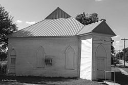
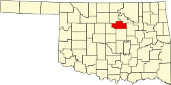
Ripley, Oklahoma

Last updated

Ripley, Oklahoma
Abandoned Ripley Church.jpg
Old church in Ripley (2013)
Payne County Oklahoma incorporated and unincorporated areas Ripley highlighted.svg
Location within Payne County and Oklahoma
Coordinates: 36°00′57″N96°54′14″W / 36.01583°N 96.90389°W / 36.01583; -96.90389
Country United States
State Oklahoma
County Payne
Area
[1]
  Total0.47 sq mi (1.23 km2)
  Land0.47 sq mi (1.23 km2)
  Water0.00 sq mi (0.00 km2)
Elevation
[2]
856 ft (261 m)
Population
 (2020)
  Total346
  Density729.96/sq mi (282.01/km2)
Time zone UTC-6 (Central (CST))
  Summer (DST) UTC-5 (CDT)
ZIP code
74062
Area code(s) 539/918
FIPS code 40-63500 [3]
GNIS feature ID2412554 [2]

Ripley is a town in southeastern Payne County, Oklahoma, United States. [4] The population was 423 at the 2010 census, a decline of 9.2 percent from the figure of 444 in 2000. [5] The town was named after Edward Ripley, the 14th president of the Atchison, Topeka and Santa Fe Railway. [4]

Contents

History

The Atchison, Topeka and Santa Fe Railway (often called simply the Santa Fe) developed Ripley and auctioned the first lots on January 13, 1900. Three months later, the Ripley Times, reported that the community's population had already reached 1,000 persons. [lower-alpha 1] The first wagon bridge across the Cimarron River was completed July 31, 1900, which was the excuse for a big party that lasted until the wee hours of the next morning. [4]

Agriculture became the main source of income besides the railroad. A large farm named Morehead Plantation hired many African-American laborers to produce cotton. The cotton business declined sharply after World War I, but oil discoveries in the county offset the cotton decline for a while. However, oil markets declined in the late 1920s and the beginning of the Great Depression caused the town economy to decline. Ripley's population declined from a peak of 487 in 1930 to 292 in 1950 and 263 in 1960. The population rebounded to 451 in 1980 and 376 in 1990. [4] It peaked again in 2009 at 510; by 2016, it dropped to 403 people.

Geography

According to the United States Census Bureau, the town has a total area of 0.4 square miles (1.0 km2), all land.

Ripley is on the Cimarron River; it is southeast of Stillwater (8 miles (13 km) east on State Highway 51 and 7 miles (11 km) south on State Highway 108), [4] and west-northwest of Cushing. [6] Cushing Lake, which offers a boat ramp, dock, and picnic area, [7] is just to the southeast. [6]

Demographics

Historical population
CensusPop.Note
1900 474
1910 368−22.4%
1920 40610.3%
1930 48720.0%
1940 415−14.8%
1950 292−29.6%
1960 263−9.9%
1970 30716.7%
1980 45146.9%
1990 376−16.6%
2000 44418.1%
2010 403−9.2%
2020 346−14.1%
U.S. Decennial Census [8]

As of the census [3] of 2000, there were 444 people, 158 households, and 118 families residing in the town. The population density was 1,189.9 inhabitants per square mile (459.4/km2). There were 180 housing units at an average density of 482.4 per square mile (186.3/km2). The racial makeup of the town was 89.64% White, 0.00% African American, 4.95% Native American, 0.00% Asian, 0.00% Pacific Islander, 0.00% from other races, and 5.41% from two or more races. 1.35% of the population were Hispanic or Latino of any race.

There were 158 households, out of which 40.5% had children under the age of 18 living with them, 51.3% were married couples living together, 15.8% had a female householder with no husband present, and 24.7% were non-families. 23.4% of all households were made up of individuals, and 10.8% had someone living alone who was 65 years of age or older. The average household size was 2.81 and the average family size was 3.21.

In the town, the population was spread out, with 32.9% under the age of 18, 9.5% from 18 to 24, 26.1% from 25 to 44, 19.6% from 45 to 64, and 11.9% who were 65 years of age or older. The median age was 32 years. For every 100 females, there were 88.1 males. For every 100 females age 18 and over, there were 86.3 males.

The median income for a household in the town was $24,643, and the median income for a family was $36,250. Males had a median income of $26,500 versus $15,250 for females. The per capita income for the town was $10,030. 18.9% of the population and 18.0% of families were below the poverty line. 19.7% of those under the age of 18 and 9.1% of those 65 and older were living below the poverty line.

Notable people

Landmarks

Notes

  1. The official U.S. Census for 1900 showed only 474 persons. No explanation for the discrepancy is available. Either the numbers were collected at different times, or the larger number included many people intending to file homestead claims near Ripley.

Related Research Articles

<span class="mw-page-title-main">Payne County, Oklahoma</span> County in Oklahoma, United States

Payne County is located in the U.S. state of Oklahoma. As of the 2020 census, its population was 81,646. Its county seat is Stillwater. The county was created in 1890 as part of Oklahoma Territory and is named for Capt. David L. Payne, a leader of the "Boomers".

<span class="mw-page-title-main">Logan County, Oklahoma</span> County in Oklahoma, United States

Logan County is a county located in the U.S. state of Oklahoma. As of the 2020 census, the population was 49,555. Its county seat is Guthrie.

<span class="mw-page-title-main">Harper County, Oklahoma</span> County in Oklahoma, United States

Harper County is a county located in the U.S. state of Oklahoma. As of the 2020 census, the population was 3,272, making it the third-least populous county in Oklahoma. The county seat is Buffalo. It was created in 1907 from the northwestern part of Woodward County, and named for Oscar Green Harper, who was clerk of the Oklahoma Constitutional Convention.

<span class="mw-page-title-main">Colfax County, New Mexico</span> County in New Mexico, United States

Colfax County is a county in the U.S. state of New Mexico. As of the 2020 census, the population was 12,387. Its county seat is Raton. It is south from the Colorado state line. This county was named for Schuyler Colfax (1823–1885), seventeenth Vice President of the United States under U.S. President Ulysses S. Grant.

<span class="mw-page-title-main">Elkhart, Kansas</span> City in Morton County, Kansas

Elkhart is a city in and the county seat of Morton County, Kansas, United States. As of the 2020 census, the population of the city was 1,888. The south edge of the city is the Kansas-Oklahoma state border, and the city is 8.5 miles (13.7 km) from the Kansas-Colorado border.

<span class="mw-page-title-main">Springer, New Mexico</span> Town in New Mexico, United States

Springer is a town in Colfax County, New Mexico, United States. Its population was 1,047 at the 2010 census.

<span class="mw-page-title-main">Keyes, Oklahoma</span> Town in Oklahoma, United States

Keyes is a town in Cimarron County, Oklahoma, United States. As of the 2020 census, the town’s population was 276.

<span class="mw-page-title-main">Oilton, Oklahoma</span> City in Oklahoma, United States

Oilton is a city in Creek County, Oklahoma, United States. The population was 885 at the 2020 census, a 12.6% decline from the 1,013 recorded in 2010.

<span class="mw-page-title-main">Maysville, Oklahoma</span> Town in Oklahoma, United States

Maysville is a town in Garvin and McClain counties, Oklahoma, United States. The population was 1,232 at the 2010 census, down from 1,313 in 2000.

<span class="mw-page-title-main">Deer Creek, Oklahoma</span> Town in Oklahoma, United States

Deer Creek is a town in Grant County, Oklahoma, United States. The population was 130 at the 2010 census, an 11.6 percent decrease from the figure of 147 in 2000. It was named for a nearby stream, which is a tributary of the Salt Fork of the Arkansas River.

<span class="mw-page-title-main">Manchester, Oklahoma</span> Town in Oklahoma, United States

Manchester is a town in Grant County, Oklahoma, United States. The population was 103 at the 2010 census, a decline of 1.0 percent from 104 at the 2000 census.

<span class="mw-page-title-main">Braman, Oklahoma</span> Town in Oklahoma, United States

Braman is a town in Kay County, Oklahoma, United States. The population was 217 at the 2010 census, a decline of 11.1 percent from the figure of 244 in 2000.

<span class="mw-page-title-main">Coyle, Oklahoma</span> Town in Oklahoma, United States

Coyle is a town in Logan County, Oklahoma, United States. The population was 325 at the 2010 census, compared to the figure of 337 in 2000. It is part of the Oklahoma City metropolitan area. The town was named for William Coyle, an influential Guthrie business man.

<span class="mw-page-title-main">Fairview, Oklahoma</span> City in Oklahoma, United States

Fairview is a city in Major County, Oklahoma, United States. Its population was 2,579 at the 2010 census. It is the county seat of Major County.

<span class="mw-page-title-main">Marland, Oklahoma</span> Town in Oklahoma, United States

Marland is a town in Noble County, Oklahoma, United States. The population was 225 at the 2010 census. It was named for Ernest W. Marland, an oilman from nearby Ponca City who later became a governor of Oklahoma. Marland is on SH-156, south-southwest of Ponca City.

<span class="mw-page-title-main">Red Rock, Oklahoma</span> Town in Oklahoma, United States

Red Rock is a town in northern Noble County, Oklahoma, United States. The population was 283 at the 2010 census, a decline from 293 at the 2000 census. The headquarters of the Otoe-Missouria Tribe of Indians is located in Red Rock.

<span class="mw-page-title-main">Macomb, Oklahoma</span> Town in Oklahoma, United States

Macomb is a town in Pottawatomie County, Oklahoma, United States. The population was 32 at the 2010 census, which represented a decline of 47.5 percent from the figure of 61 in 2000.

<span class="mw-page-title-main">Wanette, Oklahoma</span> Town in Oklahoma, United States

Wanette is a town in Pottawatomie County, Oklahoma, United States. The population was 350 at the 2010 census, a decline of 13 percent from the figure of 402 in 2000. Wanette is part of the Purcell-Lexington retail trade area and is within the Greater Oklahoma City Metropolitan Area.

<span class="mw-page-title-main">Waynoka, Oklahoma</span> City in Oklahoma, United States

Waynoka is a city in Woods County, Oklahoma, United States. It is located on U.S. Highway 281 and State Highway 14, seventy miles west of Enid. The population, which peaked at 2018 in 1950, stood at 927 according to the 2010 census.

<span class="mw-page-title-main">Drumright, Oklahoma</span> City in Oklahoma, United States

Drumright is a city in Creek and Payne counties in the U.S. state of Oklahoma. It began as an oil boom town. However, the population has declined as oil production has waned in the area. The population was 2,907 at the 2010 census, a figure almost unchanged from 2,905 in 2000. Drumright and nearby Cushing were at the center of the large, productive Cushing-Drumright Oil Field in the 1910s and 1920s. Now Drumright is home to a festival called The Drumright Monthly Market, where hundreds of visitors come, seeking crafts and delicacies from all over the region. First Saturday of every month.

References

  1. "ArcGIS REST Services Directory". United States Census Bureau. Retrieved September 20, 2022.
  2. 1 2 U.S. Geological Survey Geographic Names Information System: Ripley, Oklahoma
  3. 1 2 "U.S. Census website". United States Census Bureau . Retrieved January 31, 2008.
  4. 1 2 3 4 5 6 Carla S. Chlouber, "Ripley," Encyclopedia of Oklahoma History and Culture. Accessed May 31, 2015.
  5. CensusViewer: Population of the City of Ripley, Oklahoma
  6. 1 2 "Ripley, Oklahoma". Mapquest. Retrieved June 3, 2020.
  7. "Cushing Lake". TravelOK.com. Retrieved June 3, 2020.
  8. "Census of Population and Housing". Census.gov. Retrieved June 4, 2015.