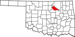
Cleveland, Oklahoma | |
---|---|
Nickname: Oklahoma's Pioneer Oil City | |
Coordinates: 36°18′44″N96°28′18″W / 36.31222°N 96.47167°W | |
Country | United States |
State | Oklahoma |
County | Pawnee |
Area | |
• Total | 2.69 sq mi (6.96 km2) |
• Land | 2.68 sq mi (6.95 km2) |
• Water | 0.00 sq mi (0.01 km2) |
Elevation | 791 ft (241 m) |
Population (2020) | |
• Total | 3,205 |
• Density | 1,194.11/sq mi (461.03/km2) |
Time zone | UTC-6 (Central (CST)) |
• Summer (DST) | UTC-5 (CDT) |
ZIP code | 74020 |
Area code(s) | 539/918 |
FIPS code | 40-15350 [3] |
GNIS feature ID | 2409481 [2] |
Website | City website |
Cleveland is a city in Pawnee County, Oklahoma, United States. The population was 3,205 as of the 2020 Census. [4]
After the Cherokee Outlet opening, a homesteader by the name of Willis H. Herbert established a town named Herbert by opening a post office on the current townsite of Cleveland on October 28, 1893. The Post Office department subsequently withdrew the approval of the Herbert post office. The post office was then moved 100 feet, and reestablished under the name Cleveland, named in honor of then President Grover Cleveland on April 19, 1894. By 1900, the town's population was 211. Before the discovery of oil in the area, the town served as a trade center between the local farmers and the Osage Tribe who lived on the reservation on the other side of the Arkansas river. [5]
In 1904, a railroad line owned by the Missouri, Kansas and Oklahoma Railroad (later known as Missouri, Kansas and Texas Railway or Katy) from Oklahoma City reached Cleveland and crossed the Arkansas River into Osage County. On May 27, 1904, the first oil well was spudded near the community, and it caused an influx of oil workers and other people. At the time of statehood in 1907, Cleveland had 1,441 residents. [5]
According to the United States Census Bureau, the city has a total area of 2.6 square miles (6.7 km2), of which 2.6 square miles (6.7 km2) is land and 0.38% is water.
Census | Pop. | Note | %± |
---|---|---|---|
1900 | 211 | — | |
1910 | 1,310 | 520.9% | |
1920 | 2,717 | 107.4% | |
1930 | 2,959 | 8.9% | |
1940 | 2,510 | −15.2% | |
1950 | 2,464 | −1.8% | |
1960 | 2,519 | 2.2% | |
1970 | 2,573 | 2.1% | |
1980 | 2,972 | 15.5% | |
1990 | 3,156 | 6.2% | |
2000 | 3,282 | 4.0% | |
2010 | 3,251 | −0.9% | |
2020 | 3,205 | −1.4% | |
U.S. Decennial Census [6] |
As of the census [3] of 2000, there were 3,282 people, 1,322 households, and 913 families residing in the city. The population density was 1,264.1 inhabitants per square mile (488.1/km2). There were 1,483 housing units at an average density of 571.2 per square mile (220.5/km2). The racial makeup of the city was 85.19% White, 0.21% African American, 8.96% Native American, 0.46% Asian, 0.06% Pacific Islander, 0.34% from other races, and 4.78% from two or more races. Hispanic or Latino of any race were 1.04% of the population.
There were 1,322 households, out of which 30.9% had children under the age of 18 living with them, 54.2% were married couples living together, 10.2% had a female householder with no husband present, and 30.9% were non-families. 28.7% of all households were made up of individuals, and 16.6% had someone living alone who was 65 years of age or older. The average household size was 2.43 and the average family size was 2.97.
In the city, the population was spread out, with 25.9% under the age of 18, 8.8% from 18 to 24, 25.1% from 25 to 44, 20.5% from 45 to 64, and 19.7% who were 65 years of age or older. The median age was 38 years. For every 100 females, there were 87.7 males. For every 100 females age 18 and over, there were 83.8 males.
The median income for a household in the city was $28,861, and the median income for a family was $36,585. Males had a median income of $30,099 versus $19,122 for females. The per capita income for the city was $14,996. About 10.3% of families and 14.1% of the population were below the poverty line, including 17.3% of those under age 18 and 12.2% of those age 65 or over.
The Mullendore Mansion, a two-and-one-half story Greek Revival structure built in 1910, is located at 910 N. Phillips St.
Cleveland is adjacent to Keystone Lake. [7]
Cleveland City Lake is 7 miles W of town on US-64. [8]
Cleveland City Parks and Recreation Department maintains three parks, with more than 50 picnic areas, 3 tennis courts, and 1 gymnasium. [9]
Montgomery County is a county located in Southeast Kansas. Its county seat is Independence, and its most populous city is Coffeyville. As of the 2020 census, the county population was 31,486. The county was named after Richard Montgomery, a major general during the American Revolutionary War.
Washington County is a county located in the northeastern part of the U.S. state of Oklahoma. As of the 2020 census, the population was 52,455. Its county seat is Bartlesville. Named for President George Washington, it is the smallest county in Oklahoma in total area, adjacent to the largest county in Oklahoma, Osage County. Washington County comprises the Bartlesville, OK micropolitan statistical area, which is also included in the Tulsa-Muskogee-Bartlesville, OK combined statistical area. It is located along the border with Kansas.
Pawnee County is a county located in the U.S. state of Oklahoma. As of the 2020 census, the population was 15,553. Its county seat is Pawnee. The county is named after the Pawnee Nation, whose reservation used to encompass the county prior to allotment in 1893.
Osage County is the largest county by area in the U.S. state of Oklahoma. Created in 1907 when Oklahoma was admitted as a state, the county is named for and is home to the federally recognized Osage Nation. The county is coextensive with the Osage Nation Reservation, established by treaty in the 19th century when the Osage relocated there from Kansas. The county seat is in Pawhuska, one of the first three towns established in the county. The total population of the county as of 2020 was 45,818.
Noble County is a county located in the north central part of Oklahoma. As of the 2020 census, the population was 10,924. Its county seat is Perry. It was part of the Cherokee Outlet in Indian Territory until Oklahoma Territory was created in 1890, and the present county land was designated as County P. After the U. S. government opened the area to non-Indian settlement in 1893, it was renamed Noble County for John Willock Noble, then the United States Secretary of the Interior.
Kay County is a county located in the U.S. state of Oklahoma. As of the 2020 census, its population was 43,700. Its county seat is Newkirk, and the largest city is Ponca City.
Creek County is a county located in the U.S. state of Oklahoma. As of the 2020 census, the population was 71,754. Its county seat is Sapulpa.
Vernon is a village in Marion County, Illinois, United States. The population was 103 at the 2020 census.
Oilton is a city in Creek County, Oklahoma, United States. The population was 885 at the 2020 census, a 12.6% decline from the 1,013 recorded in 2010.
Kaw City is a city in eastern Kay County, Oklahoma, United States. The population was 325 as of the 2020 United States census. Kaw City was named for the Kanza Indians, called the Kaw by locals.
Avant is an incorporated community in eastern Osage County, Oklahoma, United States. The population was 320 at the 2010 census, a decline of 14.0 percent from the figure of 372 recorded in 2000.
Burbank is a town in western Osage County, Oklahoma, United States. The population was 141 at the 2010 census, a 9 percent decrease from the figure of 155 recorded in 2000.
Fairfax is a town in Osage County, Oklahoma, United States. The Osage Nation reservation is coterminous with the county. The population was 1,380 at the 2010 census, down 11.3 percent from the figure of 1,555 recorded in 2000. It was the home of the ballerinas Maria and Marjorie Tallchief.
McCord is a census-designated place (CDP) in Osage County, Oklahoma, United States. The population was 1,440 at the 2010 census, a decrease of 15.8 percent from the figure of 1,711 reported in 2000.
Osage is a town in Osage County, Oklahoma, United States. Also known as Osage City, it lies within the Osage Reservation on the shore of Lake Keystone. The population was 156 at the 2010 census, down 17 percent from the figure of 188 recorded in 2000.
Prue is a town in southwestern Osage County, Oklahoma, United States. The population was 465 at the 2010 census, up 7.4 percent from the figure of 433 recorded in 2000. The town was named for Henry Prue, who owned the original townsite. Prue was relocated when Lake Keystone was built, and is sometimes called "New Prue".
Shidler is a city in Osage County, Oklahoma, United States. The population was 328 in the 2020 census, a decline from the figure of 441 recorded in 2010.
Webb City is an unincorporated town in northwestern Osage County, Oklahoma, United States. The population was 62 at the 2010 census, a 34.7 percent decline from the figure of 95 recorded in 2000. It was named for its founder, Horace Webb, on whose land the town was founded. The Webb City post office opened December 16, 1922.
Wynona is an incorporated town in central Osage County, Oklahoma, United States. It was founded by a local Osage-Cherokee rancher, Antoine Rogers, in 1903. The population was 437 at the 2010 census, a 17.7 percent decline from 531 in 2000.
Skedee is a town in Pawnee County, Oklahoma, United States. Skedee is northwest of Tulsa, northeast of Stillwater, and southeast of Ponca City. The population was 62 at the time of the 2020 Census, a 21.6% increase from the figure of 51 recorded in the 2010 Census.