Bowden | |
|---|---|
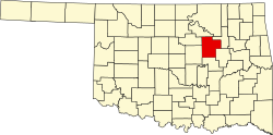
 Bowden Location within the state of Oklahoma  Bowden Bowden (the United States) | |
| Coordinates: 36°03′46″N96°05′14″W / 36.06278°N 96.08722°W | |
| Country | United States |
| State | Oklahoma |
| County | Creek |
| Elevation | 774 ft (236 m) |
| Time zone | UTC-6 (Central (CST)) |
| • Summer (DST) | UTC-5 (CDT) |
| GNIS feature ID | 1090424 [1] |
Bowden, originally known as Taneha, [2] is an unincorporated community in Creek County, Oklahoma, United States. [1] It is located four miles north of Sapulpa, [3] and is bisected by 433rd West Avenue and West 41st St. South. A post office operated in Bowden from June 9, 1909 to November 1, 1957. [3] The community was named after Sapulpa merchant Rollandus A. Bowden. [3] It developed as a boom town after the discovery of the Glenn Pool Oil Reserve. [2] but today is a small town with approximately 225 people.