Liberty, Oklahoma

Last updated

Liberty
Town
Tulsa County Oklahoma incorporated and unincorporated areas Liberty highlighted.svg
Location within Tulsa County and the state of Oklahoma
Coordinates: 35°51′06″N95°58′47″W / 35.85167°N 95.97972°W / 35.85167; -95.97972
Country United States
State Oklahoma
County Okmulgee and Tulsa
Area
[1]
  Total6.14 sq mi (15.91 km2)
  Land6.14 sq mi (15.91 km2)
Elevation
[2]
673 ft (205 m)
Population
 (2020)
  Total153
  Density24.91/sq mi (9.62/km2)
Time zone UTC-6 (CST)
  Summer (DST) UTC-5 (CDT)
FIPS code 40-42860
GNIS feature ID2412894 [2]

Liberty is a town that sits astride the line dividing Okmulgee and Tulsa counties in the U.S. state of Oklahoma. [3] As of the 2020 census, the population is 153. [4]

Contents

History

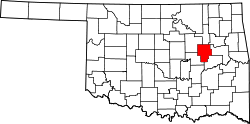
The earliest settler recorded in this area was Wallace W. Baird, a farmer from Illinois, who arrived in Tulsa County in 1912, and settled on a 40-acre (16 ha) farm. Liberty was incorporated as a dispersed rural community on October 1, 1978. It incorporated a second time on June 29, 1982. [3]

Geography

Liberty is east of Mounds, south of both Tulsa and Glenpool, and north of both Okmulgee and Preston, directly on the east side of U.S. Route 75. [5]

According to the United States Census Bureau, the town has a total area of 6.1 square miles (15.8 km2), all land.

Demographics

According to the 2020 census, Liberty has a population of 153 people in 77 households. 62% of the town's population is White. Liberty has 24.9 inhabitants per square mile (9.6/km2). The town's median income is $54,417, and 5.1% of its population is below the poverty line.

Historical population
CensusPop.Note
1980 19
1990 155715.8%
2000 18418.7%
2010 22019.6%
2020 153−30.5%
U.S. Decennial Census [6]

Economy

Agriculture has been the base of the town economy. By 2000, over 86 percent of the inhabitants commuted to work in other towns. [3]

"Liberty Mounds"

The signs on US Route 75 pointing in the direction of Liberty east of the highway refer to "Liberty Mounds". The Liberty town name was taken from the nearby Liberty School District. Given the district's proximity to Mounds, Oklahoma on the west side of US-75, a former school superintendent referred to the district as "Liberty Mounds" to distinguish it from another Liberty school district near Morris in Okmulgee County. So the highway signs reference the school, although both the town and the school district are actually named Liberty. [7] [8]

Related Research Articles

<span class="mw-page-title-main">Tulsa County, Oklahoma</span> County in the United States

Tulsa County is located in the U.S. state of Oklahoma. As of the 2020 census, the population was 669,279, making it the second-most populous county in the state, behind only Oklahoma County. Its county seat and largest city is Tulsa, the second-largest city in the state. Founded at statehood, in 1907, it was named after the previously established city of Tulsa. Before statehood, the area was part of both the Creek Nation and the Cooweescoowee District of Cherokee Nation in Indian Territory.

<span class="mw-page-title-main">Texas County, Oklahoma</span> County in Oklahoma, United States

Texas County is a county located in the panhandle of the U.S. state of Oklahoma. Its county seat is Guymon. As of the 2020 census, the population was 21,384. It is the second largest county in Oklahoma, based on land area, and is named for Texas, the state that adjoins the county to its south. Texas County comprises the Guymon, OK Micropolitan Statistical Area. The county economy is largely based on farming and cattle production. It is one of the top-producing counties in the U.S. for wheat, cattle, and hogs. It also lies within the noted Hugoton-Panhandle natural gas field.

<span class="mw-page-title-main">Okmulgee County, Oklahoma</span> County in Oklahoma, United States

Okmulgee County is a county in the U.S. state of Oklahoma. As of the 2020 census, the population was 36,706. The county seat is Okmulgee. Located within the Muscogee Nation Reservation, the county was created at statehood in 1907. The name Okmulgee is derived from the Hitchita word okimulgi, meaning "boiling waters".

<span class="mw-page-title-main">Creek County, Oklahoma</span> County in Oklahoma, United States

Creek County is a county located in the U.S. state of Oklahoma. As of the 2020 census, the population was 71,754. Its county seat is Sapulpa.

<span class="mw-page-title-main">Amorita, Oklahoma</span> Town in Oklahoma, United States

Amorita is a town in Alfalfa County, Oklahoma, United States. The population was 37 at the time of the 2010 census.

<span class="mw-page-title-main">Byron, Oklahoma</span> Town in Oklahoma, United States

Byron is a town in Alfalfa County, Oklahoma, United States. The population was 35 at the time of the 2010 census.

<span class="mw-page-title-main">Goltry, Oklahoma</span> Town in Oklahoma, United States

Goltry is a town in Alfalfa County, Oklahoma, United States. The population was 249 at the 2010 census.

<span class="mw-page-title-main">Helena, Oklahoma</span> Town in Oklahoma, United States

Helena is a town in southeastern Alfalfa County, Oklahoma, United States. Residents pronounce the town's name with a long E: "Heh-LEE'-nuh." The population was 1,403 at the 2010 census.

<span class="mw-page-title-main">Kiefer, Oklahoma</span> Town in Oklahoma, United States

Kiefer is a town in Creek County, Oklahoma, United States. The population was 2,187 at the 2020 census, a 30% increase over the 1,685 population recorded at the 2010 census, which itself was a 64 percent increase over the 1,026 figure recorded in 2000.

<span class="mw-page-title-main">Mounds, Oklahoma</span> Town in Oklahoma, United States

Mounds is a town in Creek County, Oklahoma, United States. It is located just south of Tulsa; the town's population was 932 at the 2020 census.

<span class="mw-page-title-main">Sapulpa, Oklahoma</span> City in Oklahoma, United States

Sapulpa is a city in Creek and Tulsa counties in the U.S. state of Oklahoma. The population was 21,929 at the time of the 2020 census, compared with 20,544 at the 2010 census. It is the county seat of Creek County.

<span class="mw-page-title-main">Carrier, Oklahoma</span> Town in Oklahoma, United States

Carrier is a town in Garfield County, Oklahoma, United States. The population was 85 at the 2010 census.

<span class="mw-page-title-main">Drummond, Oklahoma</span> Town in Oklahoma, United States

Drummond is a town in Garfield County, Oklahoma, United States. The population was 455 at the 2010 census, up from 405 in 2000.

<span class="mw-page-title-main">Beggs, Oklahoma</span> City in Oklahoma, United States

Beggs is a city in Okmulgee County, Oklahoma, United States. The population was 1,179 as of the 2020 Census. Beggs was named for C.H. Beggs, vice president of the St. Louis-San Francisco (Frisco) Railway.

<span class="mw-page-title-main">Henryetta, Oklahoma</span> City in Oklahoma, United States

Henryetta is a city in Okmulgee County, Oklahoma, United States. The population was 5,927 at the 2010 census, down 2.8 percent from the figure of 6,096 recorded in 2000.

<span class="mw-page-title-main">Okmulgee, Oklahoma</span> City in Oklahoma, United States

Okmulgee is a city in, and the county seat of, Okmulgee County, Oklahoma. The name is from the Mvskoke word okimulgee, which means "boiling waters". The site was chosen because of the nearby rivers and springs. Okmulgee is 38 miles south of Tulsa and 13 miles north of Henryetta via US-75.

<span class="mw-page-title-main">Winchester, Oklahoma</span> Town in Oklahoma, United States

Winchester is a town in Okmulgee County, Oklahoma, United States. The population was 546 at the 2020 census, an increase of 5.8% from the figure of 516 recorded in 2010. It is a recently built residential community, having incorporated February 18, 1974.

<span class="mw-page-title-main">Claremore, Oklahoma</span> American city

Claremore is a city and the county seat of Rogers County in Green Country or northeastern Oklahoma, United States. The population was 19,580 at the 2020 census, a 5.4 percent increase over the figure of 18,581 recorded in 2010. Located in the foothills of the Ozark Mountains, the town is home to Rogers State University. It is best known as the home of early 20th-century entertainer Will Rogers.

<span class="mw-page-title-main">Sperry, Oklahoma</span> Town in Oklahoma, United States

Sperry is a town in Tulsa County, Oklahoma, United States. The population was 1,205 in the 2010 U. S. census, compared to 1,351 in 2000. It is primarily a bedroom community, since approximately 85 percent of the employed residents commute to work in Tulsa and other nearby towns. Sperry also has an active retirement community.

<span class="mw-page-title-main">Tulsa metropolitan area</span> Metropolitan area in northeastern Oklahoma

The Tulsa metropolitan area, officially defined as the Tulsa metropolitan statistical area is a metropolis in northeastern Oklahoma centered around the city of Tulsa and encompassing Tulsa, Rogers, Wagoner, Osage, Creek, Okmulgee and Pawnee counties. It had a population of 1,023,988 according to the 2021 U.S. census estimates.

References

  1. "ArcGIS REST Services Directory". United States Census Bureau. Retrieved September 20, 2022.
  2. 1 2 U.S. Geological Survey Geographic Names Information System: Liberty, Oklahoma
  3. 1 2 3 Everett, Dianna. "Liberty". Oklahoma Historical Society . Retrieved May 19, 2015.
  4. "Liberty town, Oklahoma". United States Census Bureau . Retrieved March 23, 2023.
  5. "Liberty, Oklahoma". Google Maps. Retrieved July 1, 2020.
  6. "Census of Population and Housing". Census.gov. Retrieved June 4, 2015.
  7. "Liberty Found in Hearts, Souls of Locals". P.J. Lassek, Tulsa World, October 24, 1994. Retrieved July 20, 2020.
  8. "Liberty". Dianna Everett, Oklahoma Historical Society. Retrieved July 20, 2020.

Further reading