Winchester, Oklahoma

Last updated

Winchester, Oklahoma
OKMap-doton-Winchester.PNG
Location of Winchester, Oklahoma
Coordinates: 35°47′26″N95°59′53″W / 35.79056°N 95.99806°W / 35.79056; -95.99806
Country United States
State Oklahoma
County Okmulgee
Area
[1]
  Total5.45 sq mi (14.13 km2)
  Land5.45 sq mi (14.13 km2)
  Water0.00 sq mi (0.00 km2)
Elevation
[2]
840 ft (260 m)
Population
 (2020)
  Total546
  Density100.11/sq mi (38.65/km2)
Time zone UTC-6 (Central (CST))
  Summer (DST) UTC-5 (CDT)
FIPS code 40-81575 [3]
GNIS feature ID2413493 [2]

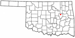
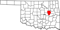
Winchester is a town in Okmulgee County, Oklahoma, United States. The population was 546 at the 2020 census, an increase of 5.8% from the figure of 516 recorded in 2010. [4] It is a recently built residential community, having incorporated February 18, 1974. [5]

Contents

This is not to be confused with the old settlement of Winchester [6] in Woods County, Oklahoma [7] near the Kansas border, west of the present-day U.S. Route 281 and west-southwest of Hardtner, Kansas. [8]

History

Winchester began as a residential community on 2,500 acres of land acquired by William D. Crews in 1959. It was intended to attract people who were "tired and frustrated" with life in Tulsa. [5] It incorporated February 18, 1974. By 1980, it had a population of 150. However, by 2000 it still had no retail businesses or municipal services. Telephone, mail, school, and fire-fighting services are supplied by the town of Beggs. [5]

Geography

Winchester is located approximately 25 miles (40 km) south of downtown Tulsa. [9] The town's fenceline runs approximately from U.S. Route 75, a major national north/south artery, [10] on the west side to approximately 3 miles (4.8 km) east of the highway, and from 241st St. in the north to Oklahoma State Highway 16 in the south. [11] Winchester residents have a Beggs mailing address, but the town of Beggs is actually southwest of Winchester and on the opposite side of U.S. 75. [12]

According to the United States Census Bureau, the town has a total area of 4.5 square miles (11.7 km2), all land.

Demographics

Historical population
CensusPop.Note
1980 150
1990 301100.7%
2000 42440.9%
2010 51621.7%
2020 5465.8%
U.S. Decennial Census [13]

As of the census [3] of 2000, there were 424 people, 153 households, and 123 families residing in the town. The population density was 94.0 inhabitants per square mile (36.3/km2). There were 169 housing units at an average density of 37.5 per square mile (14.5/km2). The racial makeup of the town was 83.73% White, 0.71% African American, 6.37% Native American, 0.24% Asian, 2.83% from other races, and 6.13% from two or more races. Hispanic or Latino of any race were 6.60% of the population.

There were 153 households, out of which 31.4% had children under the age of 18 living with them, 68.0% were married couples living together, 6.5% had a female householder with no husband present, and 19.6% were non-families. 17.0% of all households were made up of individuals, and 3.9% had someone living alone who was 65 years of age or older. The average household size was 2.77 and the average family size was 3.08.

In the town, the population was spread out, with 27.4% under the age of 18, 7.3% from 18 to 24, 30.0% from 25 to 44, 26.2% from 45 to 64, and 9.2% who were 65 years of age or older. The median age was 37 years. For every 100 females, there were 103.8 males. For every 100 females age 18 and over, there were 96.2 males.

The median income for a household in the town was $37,031, and the median income for a family was $49,444. Males had a median income of $34,792 versus $20,833 for females. The per capita income for the town was $14,614. About 4.0% of families and 10.4% of the population were below the poverty line, including 2.0% of those under age 18 and 21.7% of those age 65 or over.

In the news

William D. Crews on behalf of the Green Country Racing Association applied to the Oklahoma Horse Racing Commission to build a $120 million pari-mutuel horse racetrack in the town, to be called Winchester Park, on December 16, 1983. [14] However, that application was turned down twice, once in 1984 based on insufficient financing and unrealistic attendance and wagering projections, and finally in 1985 as incomplete. [15]

Winchester again made the news in March 1989 when the Institute for the Study of American Wars (ISAW), a Delaware-based nonprofit organization, chose Winchester over competing sites in Oklahoma, Arizona, Pennsylvania and New Mexico [16] for a proposed $150 million war museum complex. [17] However, the selection was withdrawn in April after a disagreement regarding donation of the land. ISAW claimed the State of Oklahoma could not or would not follow through on an earlier pledge of immediate donation in fee of 300 acres of land, and was instead offering only a 200-year lease of the land and/or was demanding proof that ISAW had the funding to build the museum prior to transfer of the land. [18] ISAW later admitted to having raised only $65,000. [19] ISAW then selected the Phoenix area [19] and on July 17, 1989 announced the exact site as a donated 300 acres of a 7,500-acre cotton farm between Phoenix and Tucson once owned by movie star John Wayne, known as John Wayne's Red River Ranch, in Casa Grande, Arizona. [20] In the end, the museum was never built in any location, and ISAW's entity status was voided effective March 1, 1998 by the Delaware Secretary of State. [21]

Ordinances and land covenants

The town's website indicates Winchester is a "restricted residential community"; i.e., the town is subject to land covenants and zoning ordinances which restrict, among other things, mobile homes in many locations. [11] At least one lawsuit to enforce the ordinances and covenants against a homeowner placing a mobile home in an unauthorized location has been successfully prosecuted. [22]

Related Research Articles

<span class="mw-page-title-main">Washington County, Oklahoma</span> County in Oklahoma, United States

Washington County is a county located in the northeastern part of the U.S. state of Oklahoma. As of the 2020 census, the population was 52,455. Its county seat is Bartlesville. Named for President George Washington, it is the second smallest county in Oklahoma in total area, adjacent to the largest county in Oklahoma, Osage County.

<span class="mw-page-title-main">Okmulgee County, Oklahoma</span> County in Oklahoma, United States

Okmulgee County is a county in the U.S. state of Oklahoma. As of the 2020 census, the population was 36,706. The county seat is Okmulgee. Located within the Muscogee Nation Reservation, the county was created at statehood in 1907. The name Okmulgee is derived from the Hitchita word okimulgi, meaning "boiling waters".

<span class="mw-page-title-main">Creek County, Oklahoma</span> County in Oklahoma, United States

Creek County is a county located in the U.S. state of Oklahoma. As of the 2020 census, the population was 71,754. Its county seat is Sapulpa.

<span class="mw-page-title-main">Watonga, Oklahoma</span> City in the United States

Watonga is a city in Blaine County, Oklahoma. It is 70 miles northwest of Oklahoma City. The population was 5,111 at the 2010 census. It is the county seat of Blaine County.

<span class="mw-page-title-main">Mounds, Oklahoma</span> Town in Oklahoma, United States

Mounds is a town in Creek County, Oklahoma, United States. It is located just south of Tulsa; the town's population was 932 at the 2020 census.

<span class="mw-page-title-main">Colcord, Oklahoma</span> Town in Oklahoma, United States

Colcord is a town in southern Delaware County, Oklahoma, United States. The community lies in the northeastern part of the state in a region known as Green Country. The population was 815 at the 2010 census, a decline of 0.5 percent from the figure of 819 recorded in 2000.

<span class="mw-page-title-main">Ninnekah, Oklahoma</span> Town in Oklahoma, United States

Ninnekah is a town in Grady County, Oklahoma, United States. The population was 775 at the 2020 census, a 22.7% decrease from 2010.

<span class="mw-page-title-main">Locust Grove, Oklahoma</span> Town in Oklahoma, United States

Locust Grove is a town in Mayes County, Oklahoma, United States. The population was 1,423 at the 2010 census, a 4.2 percent increase over the figure of 1,366 recorded in 2000.

<span class="mw-page-title-main">Washington, Oklahoma</span> Town in Oklahoma, United States

Washington is a town in McClain County, Oklahoma, United States. The population was 673 as of the 2020 census, a 0.2% increase from 2010.

<span class="mw-page-title-main">Luther, Oklahoma</span> Town in Oklahoma, United States

Luther is a town in Oklahoma County, Oklahoma, United States, and a part of the Oklahoma City Metropolitan Area. The population was 1,221 at the 2010 census. Sperling Best Places lists the population of 4073 for the 73054 Luther zip code, which includes the town and immediate surrounding area of rural residents.

<span class="mw-page-title-main">Valley Brook, Oklahoma</span> Town in Oklahoma, United States

Valley Brook is a town in Oklahoma County, Oklahoma, United States, and is part of the Oklahoma City Metropolitan Area. The population was 765 at the 2010 census.

<span class="mw-page-title-main">Beggs, Oklahoma</span> City in Oklahoma, United States

Beggs is a city in Okmulgee County, Oklahoma, United States. The population was 1,179 as of the 2020 census. Beggs was named for C.H. Beggs, vice president of the St. Louis-San Francisco (Frisco) Railway.

<span class="mw-page-title-main">Henryetta, Oklahoma</span> City in Oklahoma, United States

Henryetta is a city in Okmulgee County, Oklahoma, United States. The population was 5,640 at the 2020 census.

<span class="mw-page-title-main">Ralston, Oklahoma</span> Town in Oklahoma, United States

Ralston is a town in Pawnee County, Oklahoma, United States. The town is southeast of Ponca City on State Highway 18 near the west bank of the Arkansas River. The population was 330 at the 2010 census, a decline of 7 percent from the figure of 355 recorded in 2000.

<span class="mw-page-title-main">Ripley, Oklahoma</span> Town in Oklahoma, United States

Ripley is a town in southeastern Payne County, Oklahoma, United States. The population was 423 at the 2010 census, a decline of 9.2 percent from the figure of 444 in 2000. The town was named after Edward Ripley, the 14th president of the Atchison, Topeka and Santa Fe Railway.

<span class="mw-page-title-main">Glenpool, Oklahoma</span> City in Oklahoma, United States

Glenpool is a city in Tulsa County, Oklahoma, United States. It is part of the Tulsa Metropolitan Statistical Area (TMSA). As of 2020, the population was 14,040, which represented an increase of 29.9% since the 2010 census, which reported the total population as 10,808.

<span class="mw-page-title-main">New Tulsa, Oklahoma</span> Defunct Town in Oklahoma, United States

New Tulsa was a town in Wagoner County, Oklahoma, United States. The population was 568 at the 2000 census. The town was dissolved in 2001 by a vote of the residents and is now part of the city of Broken Arrow.

<span class="mw-page-title-main">Copan, Oklahoma</span> Town in Oklahoma, United States

Copan is a town in Washington County, Oklahoma, United States. The population was 733 at the 2010 census, a decline of 7.9 percent from the figure of 796 recorded in 2000.

<span class="mw-page-title-main">Clinton, Oklahoma</span> City in Oklahoma, United States

Clinton is a city in Custer and Washita counties in the U.S. state of Oklahoma. The population was 8,521 at the time of the 2020 census.

<span class="mw-page-title-main">Skiatook, Oklahoma</span> City in Oklahoma, United States

Skiatook is a city in Osage and Tulsa counties in the U.S. state of Oklahoma located in the northeastern part of the state, approximately 20 miles north and west of Tulsa. Due to its location on the border between Osage County and Tulsa County, Skiatook has been referred to as "the Gateway to the Osage." The town includes the state highway junction of Oklahoma State Highway 11 and Oklahoma State Highway 20. The population was 8,450 at the 2020 census, an increase of 14.24 percent over the figure of 7,397 recorded in 2010.

References

  1. "ArcGIS REST Services Directory". United States Census Bureau. Retrieved September 20, 2022.
  2. 1 2 U.S. Geological Survey Geographic Names Information System: Winchester, Oklahoma
  3. 1 2 "U.S. Census website". United States Census Bureau . Retrieved January 31, 2008.
  4. "Winchester (town), Oklahoma". United States Census Bureau. Retrieved September 28, 2023.
  5. 1 2 3 Coleman, Glynis. Encyclopedia of Oklahoma History and Culture. "Winchester."
  6. "The Coming Back of Denver Boggs". Thomas Allen McNeal, When Kansas was Young, pages 254-258, as posted on Rootsweb.com. Retrieved April 22, 2020.
  7. "Winchester, Oklahoma (Woods County)". RoadsideThoughts. Retrieved June 23, 2021.
  8. "Winchester, OK 73717". Google Maps. Retrieved April 22, 2020.
  9. "Map of Winchester on Mapquest" . Retrieved September 26, 2019.
  10. U.S. Route 75
  11. 1 2 "Town of Winchester website" . Retrieved June 16, 2011.
  12. "Map of Beggs on Mapquest" . Retrieved September 26, 2019.
  13. "Census of Population and Housing". Census.gov. Retrieved June 4, 2015.
  14. http://newsok.com/article/2050739 Mike Hammer, “Winchester Park Application Filed for Horse Track Near Tulsa,” December 17, 1983, NewsOK (The Oklahoman) website. Accessed August 24, 2017.
  15. http://newsok.com/article/2124494 Aleta Walther & Nolan Clay, “Plan to Build Southwest Oklahoma City Racetrack Scrapped,” October 15, 1985, NewsOK (The Oklahoman) website. Accessed August 24, 2017.
  16. ""Institute Officially Rejects State, Picks Arizona for War Museum", June 29, 1989". The Tulsa World . Retrieved July 24, 2012.
  17. "Winchester, taken from Oklahoma Historical Society's Encyclopedia of Oklahoma History & Culture" . Retrieved July 24, 2012.
  18. "" Conflicting Offers Led to Loss of War Site, Official Says", July 7, 1989". The Tulsa World . Retrieved July 24, 2012.
  19. 1 2 ""War Museum to be Built in Arizona", July 16, 1989". The Deseret News . Retrieved July 24, 2012.
  20. ""Red River Ranch Chosen as Site of War Museum", July 17, 1989". The Associated Press . Retrieved July 24, 2012.
  21. Entity Details report on the Institute for the Study of American Wars (ISAW), File Number 2038270, from the Delaware Secretary of State, accessed July 24, 2012.
  22. "Parrish v. Flinn". 1996 OK CIV APP 104, 925 P.2nd 89 (1996). Retrieved March 8, 2024.