Schulter, Oklahoma

Last updated

Schulter, Oklahoma
OKMap-doton-Schulter.PNG
Location of Schulter, Oklahoma
Coordinates: 35°30′40″N95°57′23″W / 35.51111°N 95.95639°W / 35.51111; -95.95639
Country United States
State Oklahoma
County Okmulgee
Area
[1]
  Total0.85 sq mi (2.20 km2)
  Land0.85 sq mi (2.20 km2)
  Water0.00 sq mi (0.00 km2)
Elevation
[2]
699 ft (213 m)
Population
 (2020)
  Total422
  Density497.06/sq mi (192.01/km2)
Time zone UTC-6 (Central (CST))
  Summer (DST) UTC-5 (CDT)
ZIP code
74460
Area code(s) 539/918
FIPS code 40-65900 [3]
GNIS feature ID2413265 [2]

Schulter is a town in Okmulgee County, Oklahoma, United States. The population was 422 at the time of the 2020 census. [4]

Contents

History

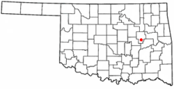
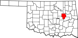
Located approximately eight miles south of Okmulgee and six miles north of Henryetta in Okmulgee County, just off U.S. routes 75 and 62, the original name of the town may have been Winchell. [5] The town was added along the route of the St. Louis, Oklahoma and Southern Railway (later the St. Louis–San Francisco Railway, or Frisco) built between Okmulgee and Henryetta in 1900. [5] The post office built in August 1903 was named for Matt Schulter, said to be a resident of St. Louis, Missouri. [5] Coal mining in the Henryetta Coal Formation was an important early industry in the area, and attracted many nationalities of European immigrants. [5] Early Schulter, circa 1909, had three coal company offices, phone service, a school, a general store, and even a pool hall for its 200 residents. [5] Later, the town benefitted from oil exploration, production, and refining. The town's peak population may have been circa 1930, at 650 people. [5] The town did not officially incorporate until May 5, 1998. [5]

Geography

Okmulgee is north of town, while Henryetta is south. U.S. routes 75 and 62 run concurrently north and south through Schulter. Lake Eufaula is east-southeast of town. [6]

According to the United States Census Bureau, the town has a total area of 0.9 square miles (2.3 km2), all land.

Demographics

Historical population
CensusPop.Note
2000 600
2010 509−15.2%
2020 422−17.1%
U.S. Decennial Census [7]

As of the census [3] of 2000, there were 600 people, 234 households, and 169 families residing in the town. The population density was 681.3 inhabitants per square mile (263.1/km2). There were 253 housing units at an average density of 287.3 per square mile (110.9/km2). The racial makeup of the town was 84.50% White, 8.33% Native American, and 7.17% from two or more races. Hispanic or Latino of any race were 1.67% of the population.

There were 234 households, out of which 35.0% had children under the age of 18 living with them, 57.3% were married couples living together, 12.0% had a female householder with no husband present, and 27.4% were non-families. 24.8% of all households were made up of individuals, and 12.8% had someone living alone who was 65 years of age or older. The average household size was 2.56 and the average family size was 3.04.

In the town, the population was spread out, with 26.8% under the age of 18, 8.5% from 18 to 24, 24.2% from 25 to 44, 27.7% from 45 to 64, and 12.8% who were 65 years of age or older. The median age was 39 years. For every 100 females, there were 89.9 males. For every 100 females age 18 and over, there were 91.7 males.

The median income for a household in the town was $26,818, and the median income for a family was $35,500. Males had a median income of $31,667 versus $20,417 for females. The per capita income for the town was $12,539. About 8.6% of families and 15.9% of the population were below the poverty line, including 13.9% of those under age 18 and 23.2% of those age 65 or over.

Related Research Articles

<span class="mw-page-title-main">Okmulgee County, Oklahoma</span> County in Oklahoma, United States

Okmulgee County is a county in the U.S. state of Oklahoma. As of the 2020 census, the population was 36,706. The county seat is Okmulgee. Located within the Muscogee Nation Reservation, the county was created at statehood in 1907. The name Okmulgee is derived from the Hitchita word okimulgi, meaning "boiling waters".

<span class="mw-page-title-main">Creek County, Oklahoma</span> County in Oklahoma, United States

Creek County is a county located in the U.S. state of Oklahoma. As of the 2020 census, the population was 71,754. Its county seat is Sapulpa.

<span class="mw-page-title-main">Lehigh, Oklahoma</span> City in Oklahoma, United States

Lehigh is a city in Coal County, Oklahoma, United States. Its population was 356 at the 2010 census.

<span class="mw-page-title-main">Phillips, Oklahoma</span> Town in Oklahoma, United States

Phillips is a town in Coal County, Oklahoma, United States. The population was 135 at the 2010 census.

<span class="mw-page-title-main">Mounds, Oklahoma</span> Town in Oklahoma, United States

Mounds is a town in Creek County, Oklahoma, United States. It is located just south of Tulsa; the town's population was 932 at the 2020 census.

<span class="mw-page-title-main">Covington, Oklahoma</span> Town in Oklahoma, United States

Covington is a town in Garfield County, Oklahoma, United States. The population was 477 at the 2020 census.

<span class="mw-page-title-main">Wetumka, Oklahoma</span> City in Oklahoma, United States

Wetumka is a city in northern Hughes County, Oklahoma, United States. The population was 1,282 at the 2010 census, a decline of 11.7 percent from the figure of 1,451 recorded in 2000. First settled by the Muscogee Creek after removal in the 1830s, they named it for their ancestral town of Wetumpka, in Alabama. Wetumka is a Muskogee language word meaning "rumbling waters."

<span class="mw-page-title-main">Arkoma, Oklahoma</span> Town in Oklahoma, United States

Arkoma is a town in Le Flore County, Oklahoma, United States. It is part of the Fort Smith, Arkansas-Oklahoma Metropolitan Statistical Area. The population was 1,989 at the 2010 census, a decline from 2,180 in 2000. The name of the town is a portmanteau of Arkansas and Oklahoma. Throughout its history, Arkoma has served as a "bedroom community" because many residents commuted to work in Fort Smith.

<span class="mw-page-title-main">Shady Point, Oklahoma</span> Town in Oklahoma, United States

Shady Point, sometimes referred to as Shadypoint, is a town in Le Flore County, Oklahoma, United States. It is part of the Fort Smith, Arkansas-Oklahoma Metropolitan Statistical Area. The population was 1,026 at the 2010 census, a 21.0 percent increase over the figure of 848 recorded in 2000.

<span class="mw-page-title-main">Wister, Oklahoma</span> Town in Oklahoma, United States

Wister is a town in Le Flore County, Oklahoma, United States. It is part of the Fort Smith metropolitan area. The population was 1,102 at the 2010 census. Wister is named for Gutman G. Wister, an official with the Choctaw, Oklahoma and Gulf Railroad.

<span class="mw-page-title-main">Hitchita, Oklahoma</span> Town in Oklahoma, United States

Hitchita is a town in McIntosh County, Oklahoma, United States. The Encyclopedia of Oklahoma History and Culture says that the town was named for a band of Muskhogean Indians that had been absorbed into the Creek tribe. The population was 88 at the 2010 census, a decline of 22.1 percent from 113 in 2000.

Texanna is a census-designated place (CDP) in McIntosh County, Oklahoma, United States. The population was 2,083 at the 2000 census.

<span class="mw-page-title-main">Beggs, Oklahoma</span> City in Oklahoma, United States

Beggs is a city in Okmulgee County, Oklahoma, United States. The population was 1,179 as of the 2020 census. Beggs was named for C.H. Beggs, vice president of the St. Louis-San Francisco (Frisco) Railway.

<span class="mw-page-title-main">Dewar, Oklahoma</span> Town in Oklahoma, United States

Dewar is a town in Okmulgee County, Oklahoma, United States. The population was 763 at the 2020 census. Founded in 1909 by workers for the Missouri, Oklahoma and Gulf Railway (MO&G), it was named for William Peter Dewar, a railroad official. It incorporated in 1909.

<span class="mw-page-title-main">Grayson, Oklahoma</span> Town in Oklahoma, United States

Grayson is a town in Okmulgee County, Oklahoma, United States. The population was 127 at the 2020 census.

<span class="mw-page-title-main">Henryetta, Oklahoma</span> City in Oklahoma, United States

Henryetta is a city in Okmulgee County, Oklahoma, United States. The population was 5,640 at the 2020 census.

<span class="mw-page-title-main">Hoffman, Oklahoma</span> Town in Oklahoma, United States

Hoffman is a town in Okmulgee County, Oklahoma, United States. The population was 81 at the 2020 census.

<span class="mw-page-title-main">Morris, Oklahoma</span> City in Oklahoma, United States

Morris is a city in Okmulgee County, Oklahoma, United States. The population was 1,299 at the 2020 census.

<span class="mw-page-title-main">Terlton, Oklahoma</span> Town in Oklahoma, United States

Terlton is a town in Pawnee County, Oklahoma, United States. It is located one-half mile south of US 412/US 64 on Terlton Road and County Road E0570. The population was 77 at the time of the 2020 Census.

<span class="mw-page-title-main">Bramwell, West Virginia</span> Town in West Virginia, United States

Bramwell is a town in Mercer County, West Virginia, United States, along the Bluestone River. The population was 277 at the 2020 census. It is part of the Bluefield, WV-VA micropolitan area which has a population of 107,578.

References

  1. "ArcGIS REST Services Directory". United States Census Bureau. Retrieved September 20, 2022.
  2. 1 2 U.S. Geological Survey Geographic Names Information System: Schulter, Oklahoma
  3. 1 2 "U.S. Census website". United States Census Bureau . Retrieved January 31, 2008.
  4. "Schulter (town), Oklahoma". US Census Bureau. Retrieved October 15, 2023.
  5. 1 2 3 4 5 6 7 "Schulter". Oklahoma Historical Society. Retrieved February 6, 2020.
  6. "Schulter, OK". Google Maps. Retrieved September 7, 2020.
  7. "Census of Population and Housing". Census.gov. Retrieved June 4, 2015.