Hoffman, Oklahoma

Last updated

Hoffman, Oklahoma
OKMap-doton-Hoffman.PNG
Location of Hoffman, Oklahoma
Coordinates: 35°29′20″N95°50′41″W / 35.48889°N 95.84472°W / 35.48889; -95.84472
Country United States
State Oklahoma
County Okmulgee
Area
[1]
  Total0.25 sq mi (0.65 km2)
  Land0.25 sq mi (0.65 km2)
  Water0.00 sq mi (0.00 km2)
Elevation
[2]
623 ft (190 m)
Population
 (2020)
  Total81
  Density321.43/sq mi (124.12/km2)
Time zone UTC-6 (Central (CST))
  Summer (DST) UTC-5 (CDT)
ZIP code
74437
Area code(s) 539/918
FIPS code 40-35300 [3]
GNIS feature ID2412759 [2]

Hoffman is a town in Okmulgee County, Oklahoma, United States. The population was 81 at the 2020 census. [4]

Contents

History

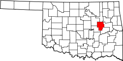
Hoffman was apparently settled before December 18, 1905, when a post office was established. It was originally in McIntosh County until Okmulgee annexed the community in 1918. [5]

The origin of the town name is unclear. The Encyclopedia of Oklahoma History and Culture says that the namesake was either W. Hoffman, vice president of the Missouri, Oklahoma and Gulf Railway, or Roy V. Hoffman, an Oklahoma City attorney. [5]

The population at statehood in 1907 was 344. It fell to 307 in 1910, then rose to a peak of 432 in 1940. [5]

Geography

Hoffman is located northeast of Henryetta off US-266.

According to the United States Census Bureau, the town has a total area of 0.3 square miles (0.78 km2), all land.

Demographics

Historical population
CensusPop.Note
1910 307
1920 36518.9%
1930 3752.7%
1940 43215.2%
1950 302−30.1%
1960 248−17.9%
1970 2625.6%
1980 40755.3%
1990 175−57.0%
2000 148−15.4%
2010 127−14.2%
2020 81−36.2%
U.S. Decennial Census [6]

As of the census [3] of 2000, there were 148 people, 58 households, and 42 families residing in the town. The population density was 566.5 inhabitants per square mile (218.7/km2). There were 82 housing units at an average density of 313.9 per square mile (121.2/km2). The racial makeup of the town was 68.92% White, 18.24% African American, 10.14% Native American, and 2.70% from two or more races. Hispanic or Latino of any race were 1.35% of the population.

There were 58 households, out of which 32.8% had children under the age of 18 living with them, 53.4% were married couples living together, 13.8% had a female householder with no husband present, and 25.9% were non-families. 22.4% of all households were made up of individuals, and 10.3% had someone living alone who was 65 years of age or older. The average household size was 2.55 and the average family size was 2.91.

In the town, the population was spread out, with 28.4% under the age of 18, 5.4% from 18 to 24, 29.7% from 25 to 44, 25.0% from 45 to 64, and 11.5% who were 65 years of age or older. The median age was 37 years. For every 100 females, there were 100.0 males. For every 100 females age 18 and over, there were 86.0 males.

The median income for a household in the town was $21,607, and the median income for a family was $25,625. Males had a median income of $17,083 versus $20,250 for females. The per capita income for the town was $9,227. There were 28.9% of families and 36.8% of the population living below the poverty line, including 36.8% of under eighteens and 23.1% of those over 64.

Related Research Articles

<span class="mw-page-title-main">Okmulgee County, Oklahoma</span> County in Oklahoma, United States

Okmulgee County is a county in the U.S. state of Oklahoma. As of the 2020 census, the population was 36,706. The county seat is Okmulgee. Located within the Muscogee Nation Reservation, the county was created at statehood in 1907. The name Okmulgee is derived from the Hitchita word okimulgi, meaning "boiling waters".

<span class="mw-page-title-main">Creek County, Oklahoma</span> County in Oklahoma, United States

Creek County is a county located in the U.S. state of Oklahoma. As of the 2020 census, the population was 71,754. Its county seat is Sapulpa.

<span class="mw-page-title-main">Etowah, Oklahoma</span> Town in Oklahoma, United States

Etowah is a town in Cleveland County, Oklahoma, United States. The population was 159 at the 2020 census, a 72.8% increase from 2010.

<span class="mw-page-title-main">Breckinridge, Oklahoma</span> Town in Oklahoma, United States

Breckinridge is a town in Garfield County, Oklahoma, United States. The population was 245 at the 2010 census.

<span class="mw-page-title-main">Hunter, Oklahoma</span> Town in Oklahoma, United States

Hunter is a town in Garfield County, Oklahoma, United States. The population was 165 at the 2010 census, a 4.6 percent decline from the figure of 173 in 2000.

<span class="mw-page-title-main">Amber, Oklahoma</span> Town in Oklahoma, United States

Amber is a town in Grady County, Oklahoma, United States. The population was 413 at the 2020 census, a 1.4% decrease from 2010.

<span class="mw-page-title-main">Bradley, Oklahoma</span> Town in Oklahoma, United States

Bradley is a town in Grady County, Oklahoma, United States. The population was 78 at the 2020 United States census.

<span class="mw-page-title-main">Carney, Oklahoma</span> Town in Oklahoma, United States

Carney is a town in Lincoln County, Oklahoma, United States. As of the 2020 census, the population of the town was 545.

<span class="mw-page-title-main">Davenport, Oklahoma</span> Town in Oklahoma, United States

Davenport is a town in Lincoln County, Oklahoma, United States. The population was 814 at the 2010 census.

<span class="mw-page-title-main">Hanna, Oklahoma</span> Town in Oklahoma, United States

Hanna is a town in southwestern McIntosh County, Oklahoma, United States. Its population was 102 at the time of the 2020 Census. It was named for Hanna Bullett, the daughter of a prominent early resident.

<span class="mw-page-title-main">Hitchita, Oklahoma</span> Town in Oklahoma, United States

Hitchita is a town in McIntosh County, Oklahoma, United States. The Encyclopedia of Oklahoma History and Culture says that the town was named for a band of Muskhogean Indians that had been absorbed into the Creek tribe. The population was 88 at the 2010 census, a decline of 22.1 percent from 113 in 2000.

<span class="mw-page-title-main">Clearview, Oklahoma</span> Town in Oklahoma, United States

Clearview is a town in Okfuskee County, Oklahoma, United States. The population was 41 at the 2020 Census. It was historically an all-black freedmen's town and was platted by the Lincoln Townsite Company and designated as Lincoln.

<span class="mw-page-title-main">Forest Park, Oklahoma</span> Town in Oklahoma, United States

Forest Park is a town in Oklahoma County, Oklahoma, United States, and a part of the Oklahoma City metropolitan area. The population was 998 at the 2010 census.

<span class="mw-page-title-main">Dewar, Oklahoma</span> Town in Oklahoma, United States

Dewar is a town in Okmulgee County, Oklahoma, United States. The population was 763 at the 2020 census. Founded in 1909 by workers for the Missouri, Oklahoma and Gulf Railway (MO&G), it was named for William Peter Dewar, a railroad official. It incorporated in 1909.

<span class="mw-page-title-main">Grayson, Oklahoma</span> Town in Oklahoma, United States

Grayson is a town in Okmulgee County, Oklahoma, United States. The population was 127 at the 2020 census.

<span class="mw-page-title-main">Morris, Oklahoma</span> City in Oklahoma, United States

Morris is a city in Okmulgee County, Oklahoma, United States. The population was 1,299 at the 2020 census.

<span class="mw-page-title-main">Schulter, Oklahoma</span> Town in Oklahoma, United States

Schulter is a town in Okmulgee County, Oklahoma, United States. The population was 422 at the time of the 2020 census.

<span class="mw-page-title-main">Foyil, Oklahoma</span> Town in Oklahoma, United States

Foyil is a town in Rogers County, Oklahoma, United States. It was named for Alfred Foyil, a local landowner and the first postmaster of the town. The population was 344 at the 2010 census, a 47.0 percent increase over the figure of 234 recorded in 2000.

<span class="mw-page-title-main">Bray, Oklahoma</span> Town in Oklahoma, United States

Bray is a town in Stephens County, Oklahoma, United States. The population was 1,209 at the 2010 census.

<span class="mw-page-title-main">Fair Oaks, Oklahoma</span> Town in Oklahoma, United States

Fair Oaks is a town in Rogers and Wagoner counties in the U.S. state of Oklahoma. The population was 103 at the 2010 census, a 15.6 percent decline from the figure of 122 recorded in 2000. It is a suburb of Tulsa.

References

  1. "ArcGIS REST Services Directory". United States Census Bureau. Retrieved September 20, 2022.
  2. 1 2 U.S. Geological Survey Geographic Names Information System: Hoffman, Oklahoma
  3. 1 2 "U.S. Census website". United States Census Bureau . Retrieved January 31, 2008.
  4. "Hoffman (town), Oklahoma". United States Census Bureau. Retrieved September 28, 2023.
  5. 1 2 3 Townsend, Lynn Marie. Encyclopedia of Oklahoma History and Culture. "Hoffman." Retrieved January 20, 2013.
  6. "Census of Population and Housing". Census.gov. Retrieved June 4, 2015.