References
- ↑ "Gulftown". Geographic Names Information System . United States Geological Survey, United States Department of the Interior . Retrieved July 11, 2021.
- ↑ "Gulftown, Oklahoma". RoadsideThoughts. Retrieved June 23, 2021.
- 1 2 "Dewar, Oklahoma to Gulftown, Oklahoma". Google Maps. Retrieved June 23, 2021.
- ↑ "Four Corners, Okmulgee County, Oklahoma". HomeTownLocator.com. Retrieved June 24, 2021.
Municipalities and communities of Okmulgee County, Oklahoma, United States | ||
|---|---|---|
| Cities | 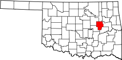 | |
| Towns | ||
| CDPs | ||
| Other communities | ||
| Indian reservation | ||
| Footnotes | ‡This populated place also has portions in an adjacent county or counties | |
35°27′23″N95°54′40″W / 35.45639°N 95.91111°W
| | This Okmulgee County, Oklahoma location article is a stub. You can help Wikipedia by expanding it. |