U.S. Route 281

Last updated • 9 min readFrom Wikipedia, The Free Encyclopedia

US 281.svg
U.S. Route 281
U.S. Route 281
US 281 highlighted in red
Route information
Auxiliary route of US 81
Length1,875 mi [1]  (3,018 km)
Existed1931 [2] –present
Major junctions
South end
Major intersections
North endND-3 (2015).svgManitoba Highway 10.svg ND 3  / PTH 10 at the U.S.–Canada border near Dunseith, ND
Location
Country United States
States Texas, Oklahoma, Kansas, Nebraska, South Dakota, North Dakota
Highway system

U.S. Route 281 (US 281) is a north–south United States Numbered Highway. At 1,875 miles (3,018 km) [3] it is the longest continuous three-digit U.S. Route.

Contents

The highway's northern terminus is at the International Peace Garden, north of Dunseith, North Dakota, at the Canadian border, where it continues as Highway 10. The route between Dunseith and the border is shared with North Dakota Highway 3. US 281 has two southern termini. The western terminus, known as International Blvd. in Hidalgo, begins from the McAllen-Hidalgo International Bridge. The southern eastern terminus of US 281 is in Brownsville, Texas, just short of the Mexican border ending on Bus. 77. The two spurs come together at South Cage Blvd in Las Milpas, Texas going north into Pharr, Texas. Thus, US 281 is the only continuous three-digit US route to extend from the Canadian border to the Mexican border.

The original Military Telegraph Road was incorporated into the US-281 route. [4]

US 281 is a "child" of US 81. As a result of decommissioning portions of the parent route that have been superseded by concurrent Interstate Highways, the length of US 281 is 672 miles (1,081 km) greater than that of its parent. US 281 no longer connects to its "parent", US 81.

Route description

Texas

US 281, beginning at the west, or the lower Rio Grande Valley, at an intersection with Business US 77 and SH 48 about two miles (3.2 km) from the Mexico border. [5] It travels along close to the border through the Rio Grande Valley. At the east, or Upper Rio Grande Valley, turning north from Hidalgo, travelling through Las Milpas, Pharr, Edinburg, and many small towns while also having a Border Patrol checkpoint in Brooks County south of Falfurrias, Texas. It is alternating as a divided highway and main street, until joining I-37. It splits with I-37 and travels through Pleasanton as Business 281, travelling north to San Antonio. In San Antonio, US 281 overlaps I-410 on the south side of the city until the interchange with I-37. US 281 and I-37 then overlap north into downtown San Antonio until I-37 ends at I-35. US 281 continues north from downtown San Antonio as a freeway, intersecting I-410 again on the north side of the city, with access to the San Antonio International Airport. A project to construct a stack interchange at I-410 (the "San Antonio Web" [6] ) was completed June 9, 2008; [7] formerly there was no direct access between the two freeways and surface streets were required travel between the freeways. North of San Antonio, US 281 is not a freeway and forms the Main Street of Blanco. It overlaps US 290 south of Johnson City. US 290 continues toward Austin, so US 281 and US 290 between San Antonio and Austin are available as a scenic and less congested alternate to I-35.

North of San Antonio, US 281 continues through central and north-central Texas, passing through many towns, including Stephenville, Mineral Wells and Jacksboro before reaching Wichita Falls, where the highway begins a concurrency with I-44 north across the Red River into Oklahoma.

Oklahoma

US 281 enters the state of Oklahoma at the Red River bridge north of Burkburnett, Texas on a route concurrent with I-44 starting in Wichita Falls. About six miles (9.7 km) north of the Red River, US 281 leaves I-44 at Randlett and follows a two-lane roadway parallel to the newer I-44, which becomes the Wichita Falls–Lawton section of the H.E. Bailey Turnpike, from Randlett to a point six miles (9.7 km) south of Lawton.

Through the Lawton/Fort Sill metropolitan area, US 281 again overlaps a toll-free section of I-44, while the former US 281 alignment through the city of Lawton is designated as Business US 281 between I-44 exits 34 and 39B. About eight miles (13 km) north of downtown Lawton, US 281 departs from I-44 to continue north through the cities of Apache, Anadarko, Gracemont, Binger and Hinton. About two miles (3.2 km) north of its junction with I-40 near Hinton, US 281 crosses a 1930s-vintage 38-span steel pony truss bridge over the South Canadian River that served traffic of the former east–west US 66 before that highway was superseded by I-40 in the 1960s. A four-mile (6.4 km) section of US 281's paving from north of I-40 to a point south of Geary is the original 18-foot (5.5 m) concrete surface of US 66.

Through central and northern Oklahoma, US 281 then proceeds through the cities of Geary, Watonga, Seiling, Waynoka and Alva. The highway crosses the Kansas state line about 14 miles (23 km) north of Alva at Hardtner, Kansas.

Kansas

Passing largely through sparsely populated areas of central Kansas, US 281 enters the state at Hardtner in Barber County and passes through Medicine Lodge, Pratt, St. John and Great Bend, the only city along the route in Kansas which has more than 7,000 people. Along its venture through southern Kansas, US 281 intersects several major east–west routes: first US 54 and US 400, which heads east to Wichita and west to Dodge City, Garden City and Liberal; US 50, which veers east to Hutchinson and west to Garden City; and US 56, heading to Dodge City westbound and Overland Park eastbound.

Following a four-mile (6 km) concurrency with K-4 near Hoisington, the highway intersects I-70 at Russell before joining K-18 near Paradise for an eight-mile (13 km) concurrency.

The two highways split at Luray, and US 281 turns north into Osborne County, passing through the town of Osborne before joining US 24 and K-9 for another concurrency. US 281 joins US 36 at Smith Center, turning east before the two highways split; US 281 turns north for its final stretch in the state, passing through Lebanon. All sections of US 281 in Kansas are two-lane. The last stretches of the highway overlaid with bricks, through downtown Pratt and Hoisington, were recently resurfaced with concrete.

Nebraska

US 281 enters Nebraska south of Red Cloud and meets US 136 there. It continues north to Hastings and meets US 6 and US 34. Between Hastings and Grand Island, US 281 overlaps US 34 and is designated as the Tom Osborne Expressway after the former Nebraska Cornhuskers football coach and U.S. Representative, who is a native of Hastings.

At Grand Island, US 281 intersects I-80, loses US 34 and intersects US 30. US 281 continues north of Grand Island to St. Libory as American Legion Memorial Highway. From there northward, US 281 is a two-lane undivided highway passing mostly through unpopulated areas, with the exception of the regional trade center O'Neill, where it junctions US 20 and US 275. US 281 exits the state north of Spencer.

South Dakota

US 281 enters South Dakota in Gregory County. Just north of the South Dakota-Nebraska border, it is cosigned with US 18. It crosses the Missouri River at Fort Randall Dam. Just south of Armour, US 18 leaves the US 281 alignment. North of Armour, US 281 makes a short jaunt west on South Dakota Highway 44, then continues north. US 281 and I-90 intersect at Plankinton. On both sides of Wolsey, US 14 is cosigned with US 281 for a stretch of seven miles (11 km) - from 3 miles south of Wolsey to 4 miles north of town. US 281 becomes an expressway at South Dakota Highway 20. This expressway continues through Aberdeen to a point near Westport. South Dakota Highway 10 is cosigned with US 281 for three miles (4.8 km) near Barnard. It exits the state north of Frederick.

US 281 was recently realigned in the city of Aberdeen. A bypass was built that travels on the west side of Aberdeen, and the US 281 designation was moved onto that new roadway. It runs north from US 12 and connects with the old alignment south of 24th Avenue Northeast.

The South Dakota section of US 281, with the exception of concurrencies with US 18 and US 14, is defined at South Dakota Codified Laws § 31-4-229. [8]

North Dakota

In North Dakota, US 281 is a major north–south artery. It enters south of Ellendale and intersects I-94 and US 52 at Jamestown. US 281 and US 52 remain paired together to Carrington. From there, US 281 continues northward through Sheyenne. Ten miles (16 km) north of Sheyenne, the highway curves in order to go around Devil's Lake, and it then continues to west of Minnewaukan, North Dakota. From there it goes to North Dakota Highway 5 at Rocklake. US 281 follows ND 5 westward to Dunseith, where the highway turns north in concurrence with North Dakota Highway 3 to its end at the Canadian border in the International Peace Garden. The northernmost section of US 281 passes through North Dakota's Turtle Mountains. Recently, US 281 was rebuilt near Minnewaukan, North Dakota to accommodate flooding close to the city.

Future

US 281 will be upgraded between US 59 in George West in Texas to I-2 in Pharr to become I-69C, a spur of I-69. An 18-mile (29 km) segment exists running from Business US 281 in Edinburg to I-2 in Pharr.[ citation needed ]

US 281 between Grand Island and St. Paul in Nebraska is planned to be a four-lane expressway for its entire length. Currently, some sections are still two lanes, with stubs and grading in place for expansion to four lanes in these areas. [9]

Major intersections

US 281 between San Antonio and Johnson City, Texas U.S. 281 west of San Antonio, TX IMG 1918.JPG
US 281 between San Antonio and Johnson City, Texas
Texas
Business plate.svg
US 77.svg
Texas 48.svg Bus. US 77  / SH 48 in Brownsville
I-2.svgI-69C.svgUS 83.svg I-2  / I-69C  / US 83 in Pharr. I-69C/US 281 travels concurrently to Edinburg. They will travel concurrently to George West
Future plate blue.svg
I-69W.svg
US 59.svgFuture plate blue.svg
I-69C.svg
Future I-69W  / US 59  / Future I-69C in George West
I-37.svg I-37 north of Three Rivers. The highways travel concurrently to southeast of Pleasanton.
I-410.svg I-410 in San Antonio. The highways travel concurrently through San Antonio.
I-37.svgI-410.svg I-37  / I-410 in San Antonio. I-37/US 281 travels concurrently through San Antonio.
I-10.svgUS 87.svgUS 90.svg I-10  / US 87  / US 90 in San Antonio
I-35.svgI-37.svg I-35  / I-37 in San Antonio
I-410.svg I-410 in San Antonio
US 290.svg US 290 south-southeast of Johnson City. The highways travel concurrently to Johnson City.
US 183.svgUS 190.svg US 183  / US 190 in Lampasas. The highways travel concurrently through Lampasas.
US 84.svg US 84 in Evant
US 67.svg US 67 in Stephenville
US 377.svg US 377 in Stephenville
I-20.svg I-20 south-southeast of Brazos
US 180.svg US 180 in Mineral Wells
US 380.svg US 380 south-southeast of Jacksboro. The highways travel concurrently to Jacksboro.
US 82.svgUS 287.svg US 82  / US 287 in Wichita Falls. The highways travel concurrently through Wichita Falls.
US 82.svgUS 277.svg US 82  / US 277 in Wichita Falls. US 277/US 281 travels concurrently to east of Medicine Park, Oklahoma.
I-44.svg I-44 in Wichita Falls. The highways travel concurrently to west-southwest of Randlett, Oklahoma.
Oklahoma
I-44.svgUS 70.svg I-44  / US 70 west-southwest of Randlett. US 70/US 281 travels concurrently to Randlett.
I-44.svg I-44 in Walters
I-44.svg I-44 northwest of Geronimo. The highways travel concurrently to east of Medicine Park.
US 62.svg US 62 in Lawton. The highways travel concurrently to Anadarko.
I-40.svg I-40 in Hinton
US 270.svg US 270 in Geary. The highways travel concurrently to Seiling.
US 60.svg US 60 in Seiling. The highways travel concurrently to Chester.
US 412.svg US 412 south of Waynoka
US 64.svg US 64 in Alva. The highways travel concurrently through Alva.
Kansas
US 160.svg US 160 west-southwest of Medicine Lodge. The highways travel concurrently to Medicine Lodge.
US 54.svgUS 400.svg US 54  / US 400 in Pratt
US 50.svg US 50 south of St. John
US 56.svg US 56 in Great Bend
I-70.svgUS 40.svg I-70  / US 40 south of Russell
US 24.svg US 24 in Osborne. The highways travel concurrently to south of Portis.
US 36.svg US 36 in Smith Center. The highways travel concurrently to south of Lebanon.
Nebraska
US 136.svg US 136 in Red Cloud
US 6.svgUS 34.svg US 6  / US 34 in Hastings. US 6/US 281 travels concurrently through Hastings. US 34/US 281 travels concurrently to Grand Island.
I-80.svg I-80 south of Grand Island
N-2.svg N-2 in Grand Island. The highways travel concurrently from the junction of US 34/US 281 to the north end of Grand Island.
US 20.svgUS 275.svg US 20  / US 275 in O'Neill. US 20/US 281 travels concurrently through O'Neill.
South Dakota
US 18.svg US 18 east-southeast of Fairfax. The highways travel concurrently to south of Armour.
I-90.svg I-90 southeast of Plankinton
US 14.svg US 14 south-southeast of Wolsey. The highways travel concurrently to north-northwest of Wolsey.
US 212.svg US 212 in Redfield. The highways travel concurrently through Redfield.
US 12.svg US 12 in Aberdeen
North Dakota
I-94.svgUS 52.svg I-94  / US 52 in Jamestown. I-94/US 281 travels concurrently through Jamestown. US 52/US 281 travels concurrently to Carrington.
US 2.svg US 2 west-northwest of Churchs Ferry. The highways travel concurrently to west of Churchs Ferry.
ND-3 (2015).svgManitoba Highway 10.svg ND 3  / PTH 10 at the Canada–United States border north-northeast of Dunseith

[10]

Bypass

Alt plate.svg
US 281.svg
U.S. Highway 281 Alternate
Location Great Bend, Kansas
Length1.4 mi (2.3 km)
Existedc.1955c.1983

U.S. Route 281 Alternate was a 1.4-mile (2.3 km) long alternate of U.S. Route 281 running within the northeastern and eastern portions of Great Bend, Kansas. US-281 Alternate was formed in 1955 and was decommissioned about 1983. Since then it has been known as US 281 Bypass, which is mostly unsigned, two-lane surface highway bypasses downtown Great Bend. The only visible indication of this being a bypass is via street signs along intersecting streets; thus it is not a true bypass route, but a local street that is named as a bypass.[ citation needed ]

Route description

281 Bypass begins its journey near the intersection of 10th (US-56/K-96/K-156) and Pine Streets. 10th Street, which is normally east–west, travels slightly southwest-northeast for one block with its intersection with the bypass.[ citation needed ]

The bypass travels mostly to the northwest until near Park and Frey Streets. Then, it steers towards the north-northwest.[ citation needed ]

After intersecting with 22nd Street, 281 Bypass starts to curve to the west until it intersects with 24th Street. It remains unsigned on 24th Street until its northwestern terminus with its parent route on Main Street (US-281).[ citation needed ] The northwestern terminus of U.S. Highway 281 Bypass is directly adjacent to Brit Spaugh Park in Great Bend. [11]

See also

Related Research Articles

<span class="mw-page-title-main">Interstate 35</span> Interstate Highway from Texas to Minnesota

Interstate 35 (I-35) is a major Interstate Highway in the central United States. As with most primary Interstates that end in a five, it is a major cross-country, north–south route. It stretches from Laredo, Texas, near the Mexican border to Duluth, Minnesota, at Minnesota State Highway 61 and 26th Avenue East. The highway splits into I-35E and I-35W in two separate places, the Dallas–Fort Worth metroplex in Texas and at the Minnesota twin cities of Minneapolis–Saint Paul.

<span class="mw-page-title-main">Interstate 44</span> Interstate Highway mostly in Oklahoma and Missouri

Interstate 44 (I-44) is an Interstate Highway in the central United States. Although it is nominally an east–west road as it is even-numbered, it follows a more southwest–northeast alignment. Its western terminus is in Wichita Falls, Texas, at a concurrency with U.S. Route 277 (US 277), US 281, and US 287; its eastern terminus is at I-70 in St. Louis, Missouri. I-44 is one of five Interstates built to bypass US 66; this highway covers the section between Oklahoma City and St. Louis. Virtually the entire length of I-44 east of Springfield, Missouri, was once US 66, which was upgraded from two to four lanes from 1949 to 1955. The section of I-44 west of Springfield was built farther south than US 66 in order to connect Missouri's section with the already completed Will Rogers Turnpike, which Oklahoma wished to carry their part of I-44.

<span class="mw-page-title-main">U.S. Route 81</span> Numbered U.S. Highway in the United States

U.S. Route 81 or U.S. Highway 81 (US 81) is a major north–south U.S. highway that extends for 1,220 miles (1,960 km) in the central United States and is one of the original United States Numbered Highways established in 1926 by the American Association of State Highway Officials.

<span class="mw-page-title-main">U.S. Route 67</span> Highway in the United States

U.S. Route 67 is a major north–south U.S. highway which extends for 1,560 miles (2,511 km) in the Central United States. The southern terminus of the route is at the United States-Mexico border in Presidio, Texas, where it continues south as Mexican Federal Highway 16 upon crossing the Rio Grande. The northern terminus is at U.S. Route 52 in Sabula, Iowa. US 67 crosses the Mississippi River twice along its routing. The first crossing is at West Alton, Missouri, where US 67 uses the Clark Bridge to reach Alton, Illinois. About 240 miles (390 km) to the north, US 67 crosses the river again at the Rock Island Centennial Bridge between Rock Island, Illinois, and Davenport, Iowa. Additionally, the route crosses the Missouri River via the Lewis Bridge a few miles southwest of the Clark Bridge.

<span class="mw-page-title-main">U.S. Route 287</span> U.S. Highway in the United States

U.S. Route 287 (US 287) is a north–south United States highway. At 1,791 miles (2,882 km) long, it is the second longest three-digit U.S. Route, behind US 281. It serves as the major truck route between Dallas-Fort Worth and Amarillo, Texas, and between Fort Collins, Colorado, and Laramie, Wyoming. The highway is broken into two segments by Yellowstone National Park, where unnumbered park roads serve as a connector.

<span class="mw-page-title-main">U.S. Route 84</span> United States Numbered Highway in the United States

U.S. Route 84 (US 84) is an east–west United States Numbered Highway that started as a short Georgia–Alabama route in the original 1926 scheme. Later, in 1941, it had been extended all the way to Colorado. The highway's eastern terminus is a short distance east of Midway, Georgia, at an Interchange with I-95. The road continues toward the nearby Atlantic Ocean as a county road. Its northern terminus is in Pagosa Springs, Colorado, at an intersection with US 160.

<span class="mw-page-title-main">U.S. Route 82</span> Highway in the United States

U.S. Route 82 is an east–west United States highway in the Southern United States. Created on July 1, 1931 across central Mississippi and southern Arkansas, US 82 eventually became a 1,625-mile-long (2,615 km) route extending from the White Sands of New Mexico to Georgia's Atlantic coast.

<span class="mw-page-title-main">U.S. Route 83</span> Highway in the United States

U.S. Route 83 (US 83) is a major north–south United States Numbered Highway that extends 1,885 miles (3,034 km) in the central United States. Only four other north–south routes are longer: US 1, US 41, US 59, and US 87, while US 83 follows a straighter north-south path than all of these. Nearly half of its mileage is in the state of Texas. The highway's northern terminus is north of Westhope, North Dakota, at the Canadian border, where it continues as Manitoba Highway 83 (PTH 83). The southern terminus is at the Veterans International Bridge in Brownsville, Texas. Together, US 83 and PTH 83 form a continuously numbered north-south highway with a combined distance of 3,450 kilometres (2,140 mi).

<span class="mw-page-title-main">U.S. Route 183</span> Numbered Highway in the United States

U.S. Route 183 (US 183) is a north–south United States highway. The highway's northern terminus is in Presho, South Dakota, at an intersection with Interstate 90. Its southern terminus is in Refugio, Texas, at the southern intersection of U.S. Highway 77 and Alternate US 77.

<span class="mw-page-title-main">U.S. Route 62</span> Highway in the United States

U.S. Route 62 or U.S. Highway 62 (US 62) is an east–west United States Highway in the southern and northeastern United States. It runs from the Mexican border at El Paso, Texas, to Niagara Falls, New York, near the Canadian border. It is the only east–west United States Numbered Highway that connects Mexico and Canada. Parts of US 62 follow what once was the Ozark Trail, including the historic bridge across the South Canadian River in Newcastle, Oklahoma. This bridge was damaged beyond repair by the 2013 Moore tornado that struck Newcastle and Moore, Oklahoma. The highway runs north–south in New York and Pennsylvania.

<span class="mw-page-title-main">U.S. Route 54</span> Highway in the United States

U.S. Route 54 is an east–west United States Highway that runs northeast–southwest for 1,197 miles (1,926 km) from El Paso, Texas, to Griggsville, Illinois. The Union Pacific Railroad's Tucumcari Line runs parallel to US 54 from El Paso to Pratt, Kansas, which comprises about two-thirds of the route. Truckers refer to this road as "The Bee Line."

<span class="mw-page-title-main">U.S. Route 70</span> Highway in the United States

U.S. Route 70 or U.S. Highway 70 is an east–west United States highway that runs for 2,381 miles (3,832 km) from eastern North Carolina to east-central Arizona. It is a major east–west highway of the Southeastern, Southern and Southwestern United States. Established as one of the original highways of 1926, it originally ran only to Holbrook, Arizona, then was extended in 1934 as a coast to coast route, with the current eastern terminus near the Atlantic Ocean in Atlantic, North Carolina, and the former western terminus near the Pacific Ocean in Los Angeles, California. The current western terminus was then truncated to US 60 / SR 77 in Globe, Arizona. Before the completion of the Interstate system, U.S. Highway 70 was sometimes referred to as the "Broadway of America", due to its status as one of the main east–west thoroughfares in the nation. It was also promoted as the "Treasure Trail" by the U.S. Highway 70 Association as of 1951.

<span class="mw-page-title-main">U.S. Route 87</span> Numbered U.S. Highway in the United States

U.S. Highway 87 is a north–south United States highway that runs for 1,998 miles (3,215 km) from northern Montana to southern Texas, making it the longest north-south road to not have a "1" in its number and the third longest north-south road in the country, behind U.S. 41 and U.S. 1. Most of the portion from Billings, Montana to Raton, New Mexico is co-signed along Interstates 90 and 25. It is also co-signed along the majority of I-27 in Texas and future plans call for the interstate to be extended along the US 87 corridor. As of 2004, the highway's northern terminus is in Havre, Montana, at US 2 and its southern terminus is in Port Lavaca, Texas, at SH 238.

<span class="mw-page-title-main">U.S. Route 277</span> Highway in the United States

U.S. Route 277 is a north–south United States Highway that is a spur route of U.S. Route 77. It no longer connects to its parent route, US 77, although it does intersect another one of its spur. It runs for 633 miles (1,019 km) across Oklahoma and Texas. US 277's northern terminus is in Newcastle, Oklahoma at Interstate 44, which is also the northern terminus of the H.E. Bailey Turnpike. Its southern terminus is in Carrizo Springs, Texas at U.S. Route 83. It passes through the states of Oklahoma and Texas.

<span class="mw-page-title-main">Oklahoma State Highway 8</span> Highway in Oklahoma

State Highway 8, also abbreviated as SH-8 or OK-8, is a highway maintained by the U.S. state of Oklahoma. Because it runs mainly north–south, it has an even number. Highway 8 runs from U.S. Highway 277 in Cyril, Oklahoma to the state line south of Kiowa, Kansas, for a total length of 179.1 miles (288.2 km) The highway has two lettered spur routes.

<span class="mw-page-title-main">North Dakota Highway 3</span> State highway in North Dakota, United States

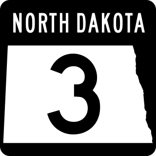
North Dakota Highway 3 (ND 3) is a 247.530-mile-long (398.361 km) major north–south state highway in North Dakota, United States, that spans the entire state. It travels from South Dakota Highway 45 (SD 45) at the South Dakota state line, south of Ashley north to Manitoba Highway 10 (PTH 10) at the International Peace Garden on the Canada–United States border.

<span class="mw-page-title-main">U.S. Route 59 in Texas</span> Section of U.S. Numbered Highway in Texas, United States

U.S. Highway 59 (US 59) in the U.S. state of Texas is named the Lloyd Bentsen Highway, after Lloyd Bentsen, former U.S. senator from Texas. In northern Houston, US 59, co-signed with Interstate 69 (I-69), is the Eastex Freeway. To the south, which is also co-signed with I-69, it is the Southwest Freeway. The stretch of the Southwest Freeway just west of The Loop was formerly one of the busiest freeways in North America, with a peak AADT of 371,000 in 1998.

<span class="mw-page-title-main">U.S. Route 281 in Texas</span> Section of U.S. Highway in Texas, United States

U.S. Route 281 (US 281) is a United States Numbered Highway that runs from the Mexican border in the Rio Grande Valley to the Canadian border near Dunseith, North Dakota. In the state of Texas, the highway is a major south–north corridor, connecting Brownsville to the Oklahoma state line at the Red River in Burkburnett. Several segments of U.S. 281 are concurrent with Interstate routes, including I-69C in the Rio Grande Valley, I-37 in San Antonio, and I-44 north of Wichita Falls.

<span class="mw-page-title-main">U.S. Route 70 in Oklahoma</span> Highway in Oklahoma

U.S. Route 70 is a transcontinental U.S. highway extending from Globe, Arizona to Atlantic, North Carolina. Along the way, 289.81 miles (466.40 km) of its route passes through the state of Oklahoma. Entering the state south of Davidson, the highway serves Oklahoma's southern tier before exiting the state east of Broken Bow. It serves the cities of Ardmore, Durant, Hugo, and Idabel, as well as Tillman, Cotton, Jefferson, Carter, Marshall, Bryan, Choctaw, and McCurtain counties.

<span class="mw-page-title-main">U.S. Route 281 in Kansas</span> Segment of American highway

U.S. Route 281 (US-281) is a part of the U.S. Highway System that runs from near the Mexican border north to the International Peace Garden, north of Dunseith, North Dakota, at the Canadian border, where it continues as Highway 10. In the state of Kansas, US-281 is a main north–south highway that runs from the Oklahoma border north to the Nebraska border. US-281 passes within one mile (1.6 km) to the east of the Geographic center of the contiguous United States, which its connected to via K-191 (K-191).

References

  1. "U.S. Route Number Database". Transportation.org. Retrieved February 7, 2019.
  2. "Highway Renumbered". The Bismarck Tribune. July 24, 1931. p. 7. Retrieved December 18, 2021 via Newspapers.com. Open Access logo PLoS transparent.svg
  3. "U.S. Route Number Database". Transportation.org. Retrieved February 7, 2019.
  4. Lincoln, Laura; Gerhardt, Karen (2002). Donna, Texas. Arcadia Publishing. ISBN   978-0-7385-1943-2.
  5. Transportation Planning and Programming Division (2018). Texas County Mapbook (PDF) (Map) (2018 ed.). 1:72,224. Texas Department of Transportation. p. 2265. Retrieved December 23, 2022.
  6. Driscoll, Patrick (January 16, 2006). "Now there's a name for it". San Antonio Express-News . Archived from the original on February 23, 2008. Retrieved June 20, 2008.
  7. Driscoll, Patrick (June 10, 2008). "U.S. 281/Loop 410 interchange ramps are complete". San Antonio Express-News . Archived from the original on June 11, 2008. Retrieved June 20, 2008.
  8. "SDLRC - Codified Law 31-4-229". sdlegislature.gov.
  9. "Archived copy" (PDF). Archived from the original (PDF) on February 17, 2019. Retrieved February 16, 2019.{{cite web}}: CS1 maint: archived copy as title (link)
  10. Rand McNally (2014). The Road Atlas (Walmart ed.). Chicago: Rand McNally. pp. 40, 63, 77, 82–83, 93, 100–101. ISBN   978-0-528-00771-2.
  11. "U.S. Highway 281 Bypass" (Map). Google Maps . Retrieved June 8, 2009.
Template:Attached KML/U.S. Route 281
KML is from Wikidata
Browse numbered routes
US 277.svg US 277 OK US 283.svg US 283
K-279.svg K-279 KS US 283.svg US-283
US 275.svg US 275 NE US 283.svg US 283
SD 273.svg SD 273 SD SD 296.svg SD 296