St. Libory, Nebraska

Last updated

St. Libory, Nebraska
St. Libory, Nebraska Spruce Street 3.JPG
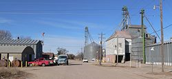
Spruce Street, St. Libory
USA Nebraska location map.svg
Red pog.svg
St. Libory
Usa edcp location map.svg
Red pog.svg
St. Libory
Coordinates: 41°04′56″N98°21′33″W / 41.08222°N 98.35917°W / 41.08222; -98.35917
Country United States
State Nebraska
County Howard
Area
[1]
  Total
0.33 sq mi (0.86 km2)
  Land0.33 sq mi (0.86 km2)
  Water0.00 sq mi (0.00 km2)
Elevation
[2]
1,864 ft (568 m)
Population
 (2020)
  Total
241
  Density725.90/sq mi (280.25/km2)
Time zone UTC-6 (Central (CST))
  Summer (DST) UTC-5 (CDT)
ZIP code
68872
FIPS code 31-43160
GNIS feature ID2583897 [2]

St. Libory or Saint Libory [2] is an unincorporated community and census-designated place (CDP) in southeastern Howard County, Nebraska, United States. As of the 2010 census it had a population of 264. [3]

Contents

It lies along U.S. Route 281, 11 miles (18 km) southeast of the city of St. Paul, the county seat of Howard County. [4] Its elevation is 1,863 feet (568 m) above sea level. [5] Although St. Libory is unincorporated, it has a post office, with the ZIP code of 68872. [6] St. Libory is known in the region for its fresh melon market. [7]

Demographics

Historical population
CensusPop.Note
2020 241
U.S. Decennial Census [8]

History

St. Libory got its start when the Union Pacific Railroad was extended to that point. [9] It was named after the village of St. Libory, Illinois. [10] The first post office in St. Libory was established in 1878. [11]

References

  1. "ArcGIS REST Services Directory". United States Census Bureau. Retrieved September 18, 2022.
  2. 1 2 3 U.S. Geological Survey Geographic Names Information System: St. Libory, Nebraska
  3. "Geographic Identifiers: 2010 Census Summary File 1 (G001): St. Libory CDP, Nebraska". American Factfinder. U.S. Census Bureau. Archived from the original on February 13, 2020. Retrieved August 24, 2017.
  4. Rand McNally. The Road Atlas '08. Chicago: Rand McNally, 2008, p. 63.
  5. U.S. Geological Survey Geographic Names Information System: St. Libory, Nebraska, Geographic Names Information System, 1979-03-09. Accessed 2008-04-26.
  6. Zip Code Lookup
  7. Meyer, Diana Lambdin (July 1, 2010). Nebraska: A Guide to Unique Places. Globe Pequot. p. 150. ISBN   978-0-7627-6616-1.
  8. "Census of Population and Housing". Census.gov. Retrieved June 4, 2016.
  9. Burr, George L. (1921). History of Hamilton and Clay Counties, Nebraska, Volume 1. S.J. Clarke Publishing Company. p. 120.
  10. Guide to the Union Pacific Railroad Lands. Union Pacific Railroad Company Land Department. 1878. p.  21.
  11. "Howard County". Jim Forte Postal History. Retrieved August 13, 2014.