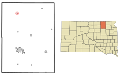
Frederick, South Dakota | |
---|---|
Coordinates: 45°49′55″N98°30′24″W / 45.83194°N 98.50667°W | |
Country | United States |
State | South Dakota |
County | Brown |
Incorporated | 1882 [1] |
Area | |
• Total | 1.35 sq mi (3.51 km2) |
• Land | 1.35 sq mi (3.51 km2) |
• Water | 0.00 sq mi (0.00 km2) |
Elevation | 1,378 ft (420 m) |
Population | |
• Total | 215 |
• Density | 158.79/sq mi (61.29/km2) |
Time zone | UTC-6 (Central (CST)) |
• Summer (DST) | UTC-5 (CDT) |
ZIP code | 57441 |
Area code | 605 |
FIPS code | 46-22860 [5] |
GNIS feature ID | 1267395 [3] |
Frederick is a town in northwestern Brown County, South Dakota, United States. The population was 215 at the 2020 census. [6] Home to the annual Frederick Finn Fest, the town is part of the Aberdeen Micropolitan Statistical Area.
Frederick was a railway town platted and sold to pioneers by the Chicago, Milwaukee & St. Paul Railroad, which completed track into it on September 12, 1881. Its grid of blocks was aligned by compass, with numbered avenues running north–south, and numbered streets running east–west. Main Street and Railway Avenue intersect at the grid's core. Incorporated on June 21, 1882, Frederick was named after the railroad's Finnish immigration agent and sales clerk—Kustaa "Frederick" Bergstadius.
On July 2, 1921, a tornado swept through the downtown and "practically every building in the town was demolished", but only one resident was killed, after his home was torn from its foundation while he was trying to get his family into the storm cellar. [7]
According to the United States Census Bureau, the town has a total area of 0.39 square miles (1.01 km2), all land. [8]
Frederick is on U.S. Route 281 and is drained by the Maple River.
Census | Pop. | Note | %± |
---|---|---|---|
1890 | 281 | — | |
1900 | 251 | −10.7% | |
1910 | 433 | 72.5% | |
1920 | 424 | −2.1% | |
1930 | 461 | 8.7% | |
1940 | 422 | −8.5% | |
1950 | 408 | −3.3% | |
1960 | 381 | −6.6% | |
1970 | 359 | −5.8% | |
1980 | 307 | −14.5% | |
1990 | 241 | −21.5% | |
2000 | 255 | 5.8% | |
2010 | 199 | −22.0% | |
2020 | 215 | 8.0% | |
U.S. Decennial Census [9] 2017 Estimate [10] [4] |
As of the census [11] of 2010, there were 199 people, 101 households, and 56 families living in the town. The population density was 510.3 inhabitants per square mile (197.0/km2). There were 119 housing units at an average density of 305.1 per square mile (117.8/km2). The racial makeup of the town was 98.5% White, 0.5% Asian, and 1.0% from two or more races.
There were 101 households, of which 22.8% had children under the age of 18 living with them, 47.5% were married couples living together, 2.0% had a female householder with no husband present, 5.9% had a male householder with no wife present, and 44.6% were non-families. 41.6% of all households were made up of individuals, and 18.8% had someone living alone who was 65 years of age or older. The average household size was 1.97 and the average family size was 2.66.
The median age in the town was 51.4 years. 19.6% of residents were under the age of 18; 2.4% were between the ages of 18 and 24; 21.5% were from 25 to 44; 29.1% were from 45 to 64; and 27.1% were 65 years of age or older. The gender makeup of the town was 55.3% male and 44.7% female.
As of the census [5] of 2000, there were 255 people, 119 households, and 76 families living in the town. The population density was 699.7 inhabitants per square mile (270.2/km2). There were 140 housing units at an average density of 384.2 per square mile (148.3/km2). The racial makeup of the town was 97.65% White, 1.18% Native American, 0.39% from other races, and 0.78% from two or more races. Hispanic or Latino of any race were 0.39% of the population. 45.2% were of German, 22.6% Norwegian and 7.5% Finnish ancestry.
There were 119 households, out of which 27.7% had children under the age of 18 living with them, 51.3% were married couples living together, 8.4% had a female householder with no husband present, and 35.3% were non-families. 33.6% of all households were made up of individuals, and 19.3% had someone living alone who was 65 years of age or older. The average household size was 2.14 and the average family size was 2.69.
In the town, the population was spread out, with 22.7% under the age of 18, 5.9% from 18 to 24, 23.9% from 25 to 44, 25.1% from 45 to 64, and 22.4% who were 65 years of age or older. The median age was 42 years. For every 100 females, there were 91.7 males. For every 100 females age 18 and over, there were 95.0 males.
The median income for a household in the town was $31,500, and the median income for a family was $34,688. Males had a median income of $25,288 versus $18,214 for females. The per capita income for the town was $13,881. About 11.1% of families and 11.4% of the population were below the poverty line, including 13.4% of those under the age of eighteen and 18.8% of those 65 or over.
Wolsey is a town in Beadle County, South Dakota, United States. The population was 459 at the 2020 census.
Claremont is a town in Brown County, South Dakota, United States. The population was 108 at the 2020 census.
Stratford is a town in southern Brown County, South Dakota, United States. The population was 57 at the 2020 census.
Westport is a town in western Brown County, South Dakota, United States. The population was 88 at the 2020 census.
Mound City is a town in and the county seat of Campbell County, South Dakota, United States. The population was 69 at the 2020 census.
Wagner is a city in Charles Mix County, South Dakota, United States. The population was 1,490 at the 2020 census. The city is served by Wagner Municipal Airport as well as YST Transit buses.
Bradley is a town in Clark County, South Dakota, United States. The population was 65 at the 2020 census.
Florence is a town in northwestern Codington County, South Dakota, United States. It is part of the Watertown, South Dakota Micropolitan Statistical Area. The population was 337 at the 2020 census.
Onaka is a town in Faulk County, South Dakota, United States. The population was 13 at the 2020 census.
Orient is a town in Faulk County, South Dakota, United States. The population was 51 at the 2020 census.
Revillo is a town in southeastern Grant County, South Dakota, United States. The population was 99 at the 2020 census.
Strandburg is a town in southern Grant County, South Dakota, United States. The population was 63 at the 2020 census. Its name is derived from the town's founder, the Swedish John Strandburg.
Hudson is a town in Lincoln County, South Dakota, United States. The population was 311 at the 2020 census. It is the easternmost community in South Dakota.
Lake City is a town in Marshall County, South Dakota, United States. The population was 45 at the 2020 census. Fort Sisseton Historic State Park, whose fort is listed on the National Register of Historic Places, is located nearby.
Langford is a town in Marshall County, South Dakota, United States. The population was 283 at the 2020 census.
Crooks is a city in Minnehaha County, South Dakota, United States and is a suburb of Sioux Falls. The population was 1,362 at the 2020 census. Crooks was named New Hope until 1904. The town's present name honors W. A. Crooks, a local politician.
Sherman is a town in Minnehaha County, South Dakota, United States. The population was 81 at the 2020 census.
Corona is a town in Roberts County, South Dakota, United States. The population was 69 at the 2020 census.
Ortley is a town in Roberts County, South Dakota, United States. The population was 50 according to the 2020 census.
Tulare is a town in Spink County, South Dakota, United States. The population was 211 at the 2020 census.