
Washington County is a county located in the northeastern part of the U.S. state of Oklahoma. As of the 2020 census, the population was 52,455. Its county seat is Bartlesville. Named for President George Washington, it is the smallest county in Oklahoma in total area, adjacent to the largest county in Oklahoma, Osage County.

Roger Mills County is a county located in the western part of the U.S. state of Oklahoma. As of the 2020 census, the population was 3,442, making it the fourth-least populous county in Oklahoma. Its county seat is Cheyenne. The county was created in 1891.
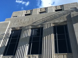
Garfield County is a county located in the U.S. state of Oklahoma. As of the 2020 census, the population was 62,846. Enid is the county seat and largest city within Garfield County. The county is named after President James A. Garfield.

Dewey County is a county in the western part of the U.S. state of Oklahoma. As of the 2020 census, the population was 4,484. Its county seat is Taloga. The county was created in 1891 as "County D". In an 1898 election, county voters chose the name Dewey, honoring Admiral George Dewey.
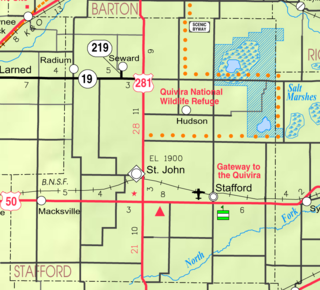
Hudson is a city in Stafford County, Kansas, United States. As of the 2020 census, the population of the city was 95.

Okeene is a town in Blaine County, Oklahoma, United States. The population was 1,090 as of the 2020 United States census. The name was created by combining the last letters of Cherokee and Cheyenne.

Yukon is a city in eastern Canadian County, Oklahoma, United States. The population was 23,630 at the 2020 census. Founded in the 1890s, the town was named in reference to a gold rush in Yukon Territory, Canada, at the time. Historically, Yukon served as an urban center for area farmers and the site of a milling operation. Currently, it is primarily a residential community for people who work in the Oklahoma City Metropolitan Area.

West Siloam Springs is a town in Delaware County, Oklahoma, United States. The population was 1,000 at the 2020 census, an 18.2 percent increase from the figure of 846 recorded in 2010. A bedroom community for Siloam Springs, Arkansas, it is notable for its Cherokee casino, and is the closest town to Natural Falls State Park.

Oakwood is a town in Dewey County, Oklahoma, United States. The population was 74 as of the 2020 United States census, an increase of about 13.8% from the population of 65 reported by the 2010 census.
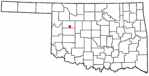
Putnam is a town in Dewey County, Oklahoma, United States. The population was 30 as of the 2020 United States census. The community lies along U.S. Route 183.
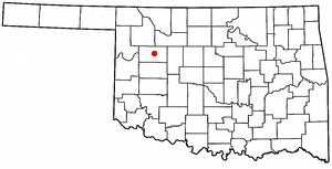
Taloga is a town in Dewey County, Oklahoma, United States. The population was 288 at the time of the 2020 census.

Vici is a town in Dewey County, Oklahoma, United States. The population was 611 at the time of the 2020 census. No information appears on the origins of the town name, but Vici is Latin for “I conquered.”

Shattuck is a town in Ellis County, Oklahoma, United States. The population was 1,249 at the time of the 2020 census, a change from the 1,356 reported in the 2010 census.

Medford is a city in and the county seat of Grant County, Oklahoma, United States. As of the 2010 census, the city population was 996.

Buffalo is a town and county seat of Harper County, Oklahoma, United States. As of the 2020 census, the town's population was 1,039. It was named after the Buffalo Creek valley, in which it is located.

Ryan is a town in Jefferson County, Oklahoma, United States, located just north of the Texas state line. The population was 667 at the 2020 census.
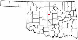
Cedar Valley is a city in Logan County, Oklahoma, United States. The population was 405 as of the 2020 United States census, up about 40.6% from the 288 reported at the 2010 census, and up nearly seven times the figure of 58 reported in 2000. It is part of the Oklahoma City Metropolitan Statistical Area. It is primarily a bedroom community, since more than 90 percent of the employed inhabitants commute to work in other towns. The main attraction is Cedar Valley Golf Club, which is by far the largest business in town.

Strong City is a town in Roger Mills County, Oklahoma, United States. As of the 2020 census, the town’s population was 33.
Dewey is a city in Washington County, Oklahoma, United States. The population was 3,179 at the 2000 census and 3,432 at the 2010 census, an increase of 8 percent. It is located near the north side of Bartlesville.

Mutual is a town in Woodward County, Oklahoma, United States. The population was 61 at the 2010 census. Incorporated in 1908, the town suffered under the agricultural depression after World War I and saw only minimal growth during the 1970s and 1980s.


