Smith Center, Kansas | |
---|---|
City and County seat | |
Coordinates: 39°46′26″N98°47′00″W / 39.77389°N 98.78333°W [1] | |
Country | United States |
State | Kansas |
County | Smith |
Founded | 1871 |
Incorporated | 1886 |
Named for | Maj. J. Nelson Smith |
Area | |
• Total | 1.28 sq mi (3.33 km2) |
• Land | 1.28 sq mi (3.33 km2) |
• Water | 0.00 sq mi (0.00 km2) |
Elevation | 1,808 ft (551 m) |
Population | |
• Total | 1,571 |
• Density | 1,200/sq mi (470/km2) |
Time zone | UTC-6 (CST) |
• Summer (DST) | UTC-5 (CDT) |
ZIP code | 66967 [4] |
Area code | 785 |
FIPS code | 20-65925 |
GNIS ID | 2395900 [1] |
Website | smithcenterks.com |
Smith Center is a city in and the county seat of Smith County, Kansas, United States. [1] As of the 2020 census, the population of the city was 1,571. [3]
Smith Center was founded in 1871. [5] The first post office in Smith Center was established in January 1873. [6] Like Smith County, Smith Center was named for Maj. J. Nelson Smith of the 2nd Colorado Cavalry, a pre-war native of Elwood, Kansas, who died leading his regiment on October 21, 1864 at the Battle of the Little Blue River. [7] [8]
According to the United States Census Bureau, the city has a total area of 1.24 square miles (3.21 km2), all land. [9]
Smith Center is located at the junction of U.S. Routes 281 and 36, approximately 100 miles south of Grand Island, Nebraska and 77 miles north of Russell and Interstate 70.
Climate data for Smith Center, Kansas (1991–2020 normals, extremes 1910–present) | |||||||||||||
---|---|---|---|---|---|---|---|---|---|---|---|---|---|
Month | Jan | Feb | Mar | Apr | May | Jun | Jul | Aug | Sep | Oct | Nov | Dec | Year |
Record high °F (°C) | 79 (26) | 85 (29) | 91 (33) | 102 (39) | 105 (41) | 113 (45) | 112 (44) | 111 (44) | 105 (41) | 98 (37) | 87 (31) | 77 (25) | 113 (45) |
Mean maximum °F (°C) | 62.4 (16.9) | 68.8 (20.4) | 79.7 (26.5) | 87.7 (30.9) | 94.2 (34.6) | 100.4 (38.0) | 104.0 (40.0) | 101.4 (38.6) | 97.1 (36.2) | 89.0 (31.7) | 74.8 (23.8) | 62.5 (16.9) | 104.8 (40.4) |
Mean daily maximum °F (°C) | 38.9 (3.8) | 43.7 (6.5) | 55.4 (13.0) | 65.7 (18.7) | 75.7 (24.3) | 87.1 (30.6) | 92.1 (33.4) | 89.1 (31.7) | 81.7 (27.6) | 68.1 (20.1) | 53.4 (11.9) | 40.9 (4.9) | 66.0 (18.9) |
Daily mean °F (°C) | 27.3 (−2.6) | 31.2 (−0.4) | 41.6 (5.3) | 51.8 (11.0) | 63.0 (17.2) | 74.1 (23.4) | 79.1 (26.2) | 76.3 (24.6) | 68.0 (20.0) | 54.4 (12.4) | 40.5 (4.7) | 29.8 (−1.2) | 53.1 (11.7) |
Mean daily minimum °F (°C) | 15.7 (−9.1) | 18.8 (−7.3) | 27.9 (−2.3) | 37.9 (3.3) | 50.2 (10.1) | 61.0 (16.1) | 66.1 (18.9) | 63.4 (17.4) | 54.4 (12.4) | 40.7 (4.8) | 27.7 (−2.4) | 18.6 (−7.4) | 40.2 (4.6) |
Mean minimum °F (°C) | −1.7 (−18.7) | 1.7 (−16.8) | 11.2 (−11.6) | 23.9 (−4.5) | 36.0 (2.2) | 49.4 (9.7) | 57.2 (14.0) | 54.4 (12.4) | 40.0 (4.4) | 24.5 (−4.2) | 11.6 (−11.3) | 2.2 (−16.6) | −6.2 (−21.2) |
Record low °F (°C) | −26 (−32) | −20 (−29) | −18 (−28) | 11 (−12) | 27 (−3) | 38 (3) | 43 (6) | 40 (4) | 23 (−5) | 3 (−16) | −6 (−21) | −26 (−32) | −26 (−32) |
Average precipitation inches (mm) | 0.59 (15) | 0.70 (18) | 1.45 (37) | 2.12 (54) | 4.00 (102) | 3.64 (92) | 4.39 (112) | 3.42 (87) | 1.98 (50) | 1.86 (47) | 1.16 (29) | 0.79 (20) | 26.10 (663) |
Average snowfall inches (cm) | 4.4 (11) | 5.9 (15) | 2.3 (5.8) | 0.7 (1.8) | 0.0 (0.0) | 0.0 (0.0) | 0.0 (0.0) | 0.0 (0.0) | 0.0 (0.0) | 0.5 (1.3) | 1.5 (3.8) | 3.0 (7.6) | 18.3 (46) |
Average precipitation days (≥ 0.01 in) | 3.9 | 4.2 | 6.7 | 8.2 | 11.0 | 10.1 | 10.0 | 8.8 | 6.2 | 6.1 | 4.6 | 4.0 | 83.8 |
Average snowy days (≥ 0.1 in) | 2.9 | 3.1 | 1.6 | 0.5 | 0.0 | 0.0 | 0.0 | 0.0 | 0.0 | 0.2 | 1.0 | 2.6 | 11.9 |
Source: NOAA [10] [11] |
Census | Pop. | Note | %± |
---|---|---|---|
1880 | 254 | — | |
1890 | 767 | 202.0% | |
1900 | 1,142 | 48.9% | |
1910 | 1,292 | 13.1% | |
1920 | 1,567 | 21.3% | |
1930 | 1,736 | 10.8% | |
1940 | 1,686 | −2.9% | |
1950 | 2,026 | 20.2% | |
1960 | 2,379 | 17.4% | |
1970 | 2,389 | 0.4% | |
1980 | 2,240 | −6.2% | |
1990 | 2,016 | −10.0% | |
2000 | 1,931 | −4.2% | |
2010 | 1,665 | −13.8% | |
2020 | 1,571 | −5.6% | |
U.S. Decennial Census |
As of the census [12] of 2010, there were 1,665 people, 779 households, and 470 families living in the city. The population density was 1,342.7 inhabitants per square mile (518.4/km2). There were 928 housing units at an average density of 748.4 per square mile (289.0/km2). The racial makeup of the city was 97.7% White, 0.1% African American, 0.4% Native American, 0.1% Asian, 0.2% Pacific Islander, 0.4% from other races, and 1.1% from two or more races. Hispanic or Latino of any race were 1.0% of the population.
There were 779 households, of which 23.2% had children under the age of 18 living with them, 49.8% were married couples living together, 7.1% had a female householder with no husband present, 3.5% had a male householder with no wife present, and 39.7% were non-families. 36.8% of all households were made up of individuals, and 21.1% had someone living alone who was 65 years of age or older. The average household size was 2.10 and the average family size was 2.71.
The median age in the city was 48.7 years. 20.6% of residents were under the age of 18; 5.4% were between the ages of 18 and 24; 18% were from 25 to 44; 26.8% were from 45 to 64; and 28.9% were 65 years of age or older. The gender makeup of the city was 47.2% male and 52.8% female.
As of the census [13] of 2000, there were 1,931 people, 852 households, and 534 families living in the city. The population density was 1,659.9 inhabitants per square mile (640.9/km2). There were 987 housing units at an average density of 848.4 per square mile (327.6/km2). The racial makeup of the city was 99.17% White, 0.21% Native American, 0.26% Pacific Islander, 0.10% from other races, and 0.26% from two or more races. Hispanic or Latino of any race were 0.47% of the population.
There were 852 households, out of which 24.2% had children under the age of 18 living with them, 54.0% were married couples living together, 6.1% had a female householder with no husband present, and 37.3% were non-families. 34.4% of all households were made up of individuals, and 21.9% had someone living alone who was 65 years of age or older. The average household size was 2.17 and the average family size was 2.77.
In the city, the age distribution of the population shows 21.0% under the age of 18, 4.7% from 18 to 24, 21.7% from 25 to 44, 20.5% from 45 to 64, and 32.1% who were 65 years of age or older. The median age was 47 years. For every 100 females, there were 84.3 males. For every 100 females age 18 and over, there were 79.2 males.
The median income for a household in the city was $26,857, and the median income for a family was $36,316. Males had a median income of $25,833 versus $20,667 for females. The per capita income for the city was $15,500. About 8.7% of families and 10.7% of the population were below the poverty line, including 14.0% of those under age 18 and 12.5% of those age 65 or over.
The Smith Center government consists of a mayor and five council members. [14]
The community is served by Smith Center USD 237 public school district. [15] The district has two schools in Smith Center:
Meade County is a county located in the U.S. state of Kansas. Its county seat and largest city is Meade. As of the 2020 census, the county population was 4,055. The county was created in 1873 and named in honor of George Meade, a general during the American Civil War.
Everest is a city in Brown County, Kansas, United States. As of the 2020 census, the population of the city was 265.
Clay Center is a city in and the county seat of Clay County, Kansas, United States. As of the 2020 census, the population of the city was 4,199.
Mankato is a city in and the county seat of Jewell County, Kansas, United States. As of the 2020 census, the population of the city was 836.
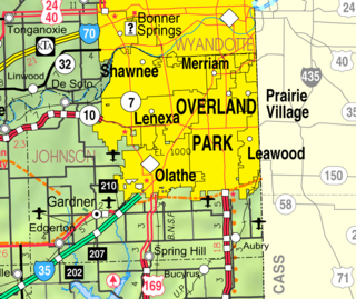
Merriam is a city in Johnson County, Kansas, United States, and part of the Kansas City Metropolitan Area. As of the 2020 census, the population of the city was 11,098. Merriam is included in the Shawnee Mission postal designation. It is also the headquarters of Seaboard Corporation.
Spivey is a city in Kingman County, Kansas, United States. As of the 2020 census, the population of the city was 61.
Beloit is a city in and the county seat of Mitchell County, Kansas, United States. As of the 2020 census, the population of the city was 3,404.
Phillipsburg is a city in, and the county seat of, Phillips County, Kansas, United States. As of the 2020 census, its population was 2,337.
Atwood is a city in and the county seat of Rawlins County, Kansas, United States. As of the 2020 census, the population of the city was 1,290.
Leonardville is a city in Riley County, Kansas, United States. As of the 2020 census, the population of the city was 432.
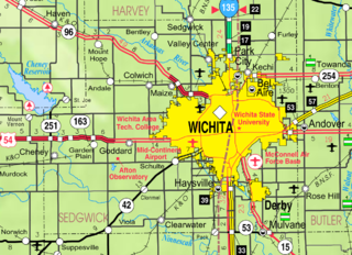
Valley Center is a city in Sedgwick County, Kansas, United States, and a suburb of Wichita. As of the 2020 census, the population of the city was 7,340.
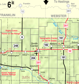
Cedar is a city in Smith County, Kansas, United States. As of the 2020 census, the population of the city was 11.
Gaylord is a city in Smith County, Kansas, United States. As of the 2020 census, the population of the city was 87.
Lebanon is a city in Smith County, Kansas, United States. As of the 2020 census, the population of the city was 178.
Hugoton is a city in and the county seat of Stevens County, Kansas, United States. As of the 2020 census, the population of the city was 3,747.
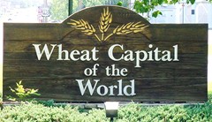
Wellington is a city in and the county seat of Sumner County, Kansas, United States. As of the 2020 census, the population of the city was 7,715.
Yates Center is a city in and the county seat of Woodson County, Kansas, United States. As of the 2020 census, the population of the city was 1,352.
Geuda Springs is a city in Cowley and Sumner counties in the U.S. state of Kansas. As of the 2020 census, the population of the city was 158.
Clayton is a city in Decatur and Norton counties in the U.S. state of Kansas. As of the 2020 census, the population of the city was 44.
Mulvane is a city in Sedgwick and Sumner counties in the U.S. state of Kansas. As of the 2020 census, the population of the city was 6,286.
{{cite web}}
: CS1 maint: unfit URL (link)