Related Research Articles

Mankato is a city in and the county seat of Jewell County, Kansas, United States. As of the 2010 census, the city population was 869.

Cedar is a city in Smith County, Kansas, United States. As of the 2020 census, the population of the city was 11.

Smith Center is a city in and the county seat of Smith County, Kansas, United States. As of the 2020 census, the population of the city was 1,571.
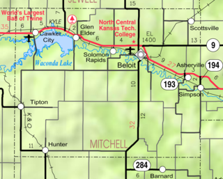
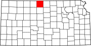
Solomon Rapids is an unincorporated community in Mitchell County, Kansas, United States.

Byron is a small unincorporated community in southeastern Bath Township, Greene County, Ohio, United States. It sits at the intersection of Linebaugh and Dayton-Yellow Springs Roads, between Fairborn and Xenia. Byron is located at 39°47′10″N83°58′51″W, at an elevation of 915 feet (279 m).
Monmouth is an unincorporated community in Root Township, Adams County, in the U.S. state of Indiana.
Disko is an unincorporated community in Fulton and Wabash counties, in the U.S. state of Indiana.
Mexico is an unincorporated community in Carroll County, Maryland, United States. It lies at an elevation of 968 feet.
Garden City National Forest was established as the Garden City Forest Reserve by the U.S. Forest Service in Kansas on July 25, 1905 with 97,280 acres (393.7 km2). It became a National Forest on March 4, 1907. On May 15, 1908 it was expanded and renamed Kansas National Forest, and on December 1, 1915 it was abolished. As Kansas National Forest the lands encompassed Finney, Grant, Hamilton, Haskell and Kearny counties, with 302,387 acres (122,372 ha).
Bellaire is an unincorporated community in Smith County, Kansas, United States. It was named after Bellaire, Ohio.

The geographic center of the United States is a point approximately 20 mi (32 km) north of Belle Fourche, South Dakota at 44°58′2.07622″N103°46′17.60283″W. It has been regarded as such by the U.S. National Geodetic Survey (NGS) since the additions of Alaska and Hawaii to the United States in 1959.
Claudell is an unincorporated community in Valley Township, Smith County, Kansas, United States.
Ash Grove is an unincorporated community in Lincoln County, Kansas, United States.
Shady Bend is an unincorporated community in Lincoln County, Kansas, United States. Shady Bend is located at 39°01′06″N98°01′18″W.
Cairo is an unincorporated community in Pratt County, Kansas, United States. It is located between the cities of Pratt and Cunningham.
Natrona is an unincorporated community in Pratt County, Kansas, United States. It is located several miles northeast of Pratt.
Dispatch is an unincorporated community in Smith County, Kansas, United States.
Reamsville is an unincorporated community in Smith County, Kansas, United States.
Womer is an unincorporated community in Smith County, Kansas, United States.
Volland is an unincorporated community in Wabaunsee County, Kansas, United States.
References
- ↑ "Thornburg, Kansas", Geographic Names Information System , United States Geological Survey
- ↑ "Kansas Post Offices, 1828-1961, page 2". Kansas Historical Society. Retrieved 23 June 2014.