Muscotah is a city in Atchison County, Kansas, United States. As of the 2020 census, the population of the city was 155. Muscotah was named after the Kickapoo Native American word for "prairie".
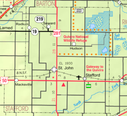
Ellinwood is a city in the southeast corner of Barton County, Kansas, United States. As of the 2020 census, the population of the city was 2,011.

Horton is a city in Brown County, Kansas, United States. As of the 2020 census, the population of the city was 1,523.

Chautauqua is a city in Chautauqua County, Kansas, United States. As of the 2020 census, the population of the city was 108.

Elgin is a city in Chautauqua County, Kansas, United States. As of the 2020 census, the population of the city was 60. The south edge of the city is the Kansas-Oklahoma state line.
Lewis is a city in Edwards County, Kansas, United States. As of the 2020 census, the population of the city was 400. It is located along Highway 50.

Copeland is a city in Gray County, Kansas, United States. As of the 2020 census, the population of the city was 251.

Climax is a city in Greenwood County, Kansas, United States. As of the 2020 census, the population of the city was 45.

Harper is a city in Harper County, Kansas, United States. As of the 2020 census, the population of the city was 1,313.

Netawaka is a city in Jackson County, Kansas, United States. As of the 2020 census, the population of the city was 139.

Meriden is a city in Jefferson County, Kansas, United States. As of the 2020 census, the population of the city was 744.

Centralia is a city in Nemaha County, Kansas, United States. As of the 2020 census, the population of the city was 485.

Burlingame is a city in Osage County, Kansas, United States. As of the 2020 census, the population of the city was 971.

Portis is a city in Osborne County, Kansas, United States. As of the 2020 census, the population of the city was 86.

Minneapolis is a city in and the county seat of Ottawa County, Kansas, United States. As of the 2020 census, the population of the city was 1,946.

Emmett is a city in Pottawatomie County, Kansas, United States. As of the 2020 census, the population of the city was 170.

Munden is a city in Republic County, Kansas, United States. As of the 2020 census, the population of the city was 96.
Otis is a city in Rush County, Kansas, United States. As of the 2020 census, the population of the city was 296.

Milan is a city in Sumner County, Kansas, United States. As of the 2020 census, the population of the city was 56.

Hanover is a city in Washington County, Kansas, United States. As of the 2020 census, the population of the city was 690.