Zenith, Kansas | |
|---|---|
 | |
 Zenith  Zenith | |
| Coordinates: 37°57′26″N98°29′31″W / 37.9572°N 98.4920°W [1] | |
| Country | United States |
| State | Kansas |
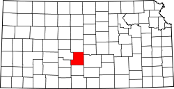
| County | Stafford |
| Elevation | 1,805 ft (550 m) |
| Time zone | UTC-6 (CST) |
| • Summer (DST) | UTC-5 (CDT) |
| Area code | 620 |
| FIPS code | 20-80950 [1] |
| GNIS ID | 473601 [1] |
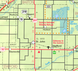
Zenith is an unincorporated community in Stafford County, Kansas, United States. [1] It is located east of Stafford, next to a railroad and U.S. Route 50 highway at NE 140th Ave.