Johnson City, Texas | |
---|---|
Motto: "The Crossroads Of The Texas Hill Country" [1] | |
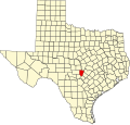
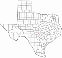
Coordinates: 30°16′35″N98°24′29″W / 30.27639°N 98.40806°W | |
Country | United States |
State | Texas |
County | Blanco |
Founded by | James P. Johnson |
Named for | Sam E. Johnson, Sr. |
Government | |
• Mayor | Stephanie Fisher |
Area | |
• Total | 1.81 sq mi (4.69 km2) |
• Land | 1.81 sq mi (4.68 km2) |
• Water | 0.00 sq mi (0.01 km2) |
Elevation | 1,198 ft (365 m) |
Population | |
• Total | 1,627 |
• Density | 900.89/sq mi (347.83/km2) |
Time zone | UTC-6 (Central (CST)) |
• Summer (DST) | UTC-5 (CDT) |
ZIP code | 78636 |
Area code | 830 |
FIPS code | 48-37780 [4] |
GNIS feature ID | 1338790 [5] |
Website | www |
Johnson City is a city and the county seat of Blanco County, Texas, United States. [6] The population was 1,627 at the 2020 census. [3] [7] Founded in 1879, it was named for early settler James Polk Johnson, nephew to Sam E. Johnson, Sr. [8] Johnson City is part of the Texas-German belt region.
Johnson City was founded by James P. Johnson who donated a 320-acre (130 ha) site on the Pedernales River for the founding of the town in 1879. [7] [9] [10] It was the hometown of Lyndon B. Johnson, 36th president of the United States. The county seat of Blanco County was moved to Johnson City in 1890. [10]
Johnson City is located in central Blanco County at 30°16′35″N98°24′29″W / 30.276427°N 98.408105°W , [11] about 1 mile (2 km) south of the Pedernales River. U.S. Routes 281 and 290 join near the center of town; U.S. 281 leads north 23 miles (37 km) to Marble Falls, and U.S. 290 leads west 30 miles (48 km) to Fredericksburg. The two highways run south out of town together; U.S. 290 soon turns east and leads 47 miles (76 km) to Austin, while U.S. 281 continues south 64 miles (103 km) to San Antonio.
According to the United States Census Bureau, Johnson City has a total area of 1.8 square miles (4.7 km2), all land. [2]
Johnson City experiences a humid subtropical climate, with hot summers and a generally comfortable winter. Temperatures range from 82 °F or 27.8 °C in the summer to 47 °F or 8.3 °C during winter.
Climate data for Johnson City, Texas (2 miles north) (1991–2020 normals, extremes 1964–present) | |||||||||||||
---|---|---|---|---|---|---|---|---|---|---|---|---|---|
Month | Jan | Feb | Mar | Apr | May | Jun | Jul | Aug | Sep | Oct | Nov | Dec | Year |
Record high °F (°C) | 89 (32) | 100 (38) | 102 (39) | 101 (38) | 104 (40) | 110 (43) | 110 (43) | 110 (43) | 110 (43) | 98 (37) | 93 (34) | 89 (32) | 110 (43) |
Mean daily maximum °F (°C) | 62.3 (16.8) | 65.8 (18.8) | 72.9 (22.7) | 79.9 (26.6) | 86.1 (30.1) | 92.4 (33.6) | 95.5 (35.3) | 96.6 (35.9) | 90.2 (32.3) | 81.8 (27.7) | 71.2 (21.8) | 63.9 (17.7) | 79.9 (26.6) |
Daily mean °F (°C) | 48.7 (9.3) | 52.2 (11.2) | 59.8 (15.4) | 66.5 (19.2) | 74.5 (23.6) | 80.8 (27.1) | 83.4 (28.6) | 83.7 (28.7) | 77.3 (25.2) | 68.1 (20.1) | 58.1 (14.5) | 50.5 (10.3) | 67.0 (19.4) |
Mean daily minimum °F (°C) | 35.1 (1.7) | 38.7 (3.7) | 46.7 (8.2) | 53.1 (11.7) | 63.0 (17.2) | 69.2 (20.7) | 71.4 (21.9) | 70.8 (21.6) | 64.3 (17.9) | 54.4 (12.4) | 44.9 (7.2) | 37.1 (2.8) | 54.1 (12.3) |
Record low °F (°C) | 7 (−14) | 3 (−16) | 13 (−11) | 27 (−3) | 36 (2) | 50 (10) | 55 (13) | 50 (10) | 37 (3) | 22 (−6) | 17 (−8) | 1 (−17) | 1 (−17) |
Average precipitation inches (mm) | 2.25 (57) | 2.01 (51) | 2.56 (65) | 2.77 (70) | 4.03 (102) | 3.23 (82) | 2.15 (55) | 2.21 (56) | 3.36 (85) | 3.62 (92) | 2.98 (76) | 1.85 (47) | 33.02 (839) |
Average snowfall inches (cm) | 0.1 (0.25) | 0.1 (0.25) | 0.0 (0.0) | 0.0 (0.0) | 0.0 (0.0) | 0.0 (0.0) | 0.0 (0.0) | 0.0 (0.0) | 0.0 (0.0) | 0.0 (0.0) | 0.0 (0.0) | 0.0 (0.0) | 0.2 (0.51) |
Average precipitation days (≥ 0.01 in) | 7.2 | 7.5 | 8.3 | 6.1 | 7.5 | 7.1 | 5.0 | 5.0 | 6.5 | 7.4 | 6.4 | 6.4 | 80.4 |
Average snowy days (≥ 0.1 in) | 0.1 | 0.1 | 0.0 | 0.0 | 0.0 | 0.0 | 0.0 | 0.0 | 0.0 | 0.0 | 0.0 | 0.1 | 0.3 |
Source: NOAA [12] [13] |
Census | Pop. | Note | %± |
---|---|---|---|
1950 | 648 | — | |
1960 | 611 | −5.7% | |
1970 | 767 | 25.5% | |
1980 | 872 | 13.7% | |
1990 | 932 | 6.9% | |
2000 | 1,191 | 27.8% | |
2010 | 1,656 | 39.0% | |
2020 | 1,627 | −1.8% | |
U.S. Decennial Census [14] |
Race | Number | Percentage |
---|---|---|
White (NH) | 1,181 | 72.59% |
Black or African American (NH) | 6 | 0.31% |
Native American or Alaska Native (NH) | 2 | 0.12% |
Asian (NH) | 9 | 0.55% |
Some Other Race (NH) | 10 | 0.61% |
Mixed/Multi-Racial (NH) | 61 | 3.75% |
Hispanic or Latino | 359 | 22.07% |
Total | 1,627 |
As of the 2020 United States census, there were 1,627 people, 725 households, and 415 families residing in the city.
As of the census [4] of 2000, there were 1,191 people, 442 households, and 317 families residing in the city. The population density was 891.7 inhabitants per square mile (344.3/km2). There were 490 housing units at an average density of 366.9 per square mile (141.7/km2). The racial makeup of the city was 89.67% White, 0.84% Native American, 0.17% Asian, 8.23% from other races, and 1.09% from two or more races. Hispanic or Latino of any race were 20.57% of the population.
There were 442 households, out of which 36.9% had children under the age of 18 living with them, 56.6% were married couples living together, 11.3% had a female householder with no husband present, and 28.1% were non-families. 24.0% of all households were made up of individuals, and 12.7% had someone living alone who was 65 years of age or older. The average household size was 2.57 and the average family size was 3.07.
In the city, the population was spread out, with 28.0% under the age of 18, 6.5% from 18 to 24, 27.3% from 25 to 44, 21.2% from 45 to 64, and 17.1% who were 65 years of age or older. The median age was 37 years. For every 100 females, there were 88.2 males. For every 100 females age 18 and over, there were 84.5 males.
The median income for a household in the city was $34,148, and the median income for a family was $39,375. Males had a median income of $30,529 versus $21,607 for females. The per capita income for the city was $14,977. About 9.2% of families and 12.5% of the population were below the poverty line, including 17.8% of those under age 18 and 11.8% of those age 65 or over.
The Lyndon B. Johnson National Historical Park, operated by the National Park Service, is 12 miles (19 km) west of Johnson City. [17]
Pedernales Falls State Park is located 10 miles (16 km) east of Johnson City.
Selah, Bamberger Ranch Preserve is a nearby wildlife sanctuary with a man-made batcave.
Johnson City is served by the Johnson City Independent School District. The district has an elementary school, middle school and high school. Students attend Lyndon B. Johnson High School. [18]
The Johnson City Record Courier is a weekly newspaper published in Johnson City. [19] It was established in 1883. [20]
KFAN-FM/107.9 is licensed to serve Johnson City.
McMullen County is a county located in the U.S. state of Texas. As of the 2020 census, its population was 600, making it the fourth-least populous county in Texas. Its county seat is Tilden. The county was established from parts of Bexar County, Atascosa County, and Live Oak County in 1858 and later organized in 1877. It is named for John McMullen, founder of a colony in Texas. The McMullen County Courthouse was designed by the architect W.C. Stephenson, originally from Buffalo, New York. Stephenson also designed some 50 buildings in Beeville, including the Bee County Courthouse.
Blanco County is a United States county located in the U.S. state of Texas. It is located in Central Texas and its county seat is Johnson City.
Lyndon is a city in, and the county seat of Osage County, Kansas, United States. As of the 2020 census, the population of the city was 1,037.
Bangs is a city located in Brown County in west-central Texas, United States. The population was 1,540 at the 2020 census.
Cottonwood Shores is a city in Burnet County, Texas, United States. The population was 1,403 at the 2020 census.
Granite Shoals is a city in Burnet County, Texas, United States with a 2020 census population of 5,129.
Highland Haven is a city in Burnet County, Texas, United States. The population was 418 at the 2020 census.
Stonewall is an unincorporated community and census-designated place (CDP) in Gillespie County, Texas, United States. The population was 451 at the 2020 census. It was named for Confederate General Thomas J. (Stonewall) Jackson, by Israel P. Nunez, who established a stage station near the site in 1870.
Crosby is a census-designated place in Harris County, Texas, United States. The population was 3,417 at the 2020 census.
César Chávez is a census-designated place (CDP) in Hidalgo County, Texas, United States. The population was 1,929 at the 2010 United States Census. It is part of the McAllen–Edinburg–Mission Metropolitan Statistical Area.
Murillo, previously recorded as Nurillo, is a census-designated place (CDP) in Hidalgo County, Texas, United States. The population was 9,158 at the 2020 census. It is part of the McAllen–Edinburg–Mission Metropolitan Statistical Area.
Keene is a city in Johnson County, Texas, United States. The population was 6,387 in 2020.
Karnes City is a city in and county seat of Karnes County, Texas, United States. The population was 3,111 at the 2020 census, up from 3,042 at the 2010 census. The town was named after Henry Karnes of the Texas Revolution. Karnes is 24 miles (39 km) southeast of Floresville and 54 miles (87 km) southeast of San Antonio on U.S. Highway 181.
Junction is a city in and the seat of Kimble County, Texas, United States. Its population was 2,451 at the 2020 census.
Knox City is a town in Knox County, Texas, United States. The population was 1,065 at the 2020 census.
Sunrise Beach Village is a city in Llano County, Texas, United States. The village was established in 1973. The population was 739 at the 2020 census.
El Cenizo is a city in Webb County, Texas, United States. The population was 2,540 at the 2020 census. El Cenizo is the third-largest city in Webb County. It is located about 20 miles south of the county seat of Laredo.
La Presa is a census-designated place (CDP) in Webb County, Texas, United States. The population was 241 at the 2020 census.
Rio Bravo is a city in Webb County, Texas, United States. It lies16 miles (26 km) south of Laredo on U.S. Route 83, on the left bank of the Rio Grande. Founded in 1982 by Cecil McDonald, a property developer who also founded neighboring El Cenizo, Rio Bravo was incorporated as a city in 1989. It had a population of 4,450 at the time of the 2020 census.
Horseshoe Bay is a city in Llano and Burnet counties in the U.S. state of Texas.