Hondo, Texas

Last updated

Hondo, Texas
Downtown Hondo Wiki (1 of 1).jpg
Downtown Hondo
TXMap-doton-Hondo.PNG
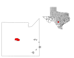
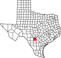
Location of Hondo, Texas
Medina County Hondo.svg
Coordinates: 29°20′49″N99°8′44″W / 29.34694°N 99.14556°W / 29.34694; -99.14556
Country Flag of the United States.svg United States
State Flag of Texas.svg Texas
County Medina
Government
  Type Council-Manager
   City Council Mayor James W. Danner, Sr.
John McAnelly
Sammy Nooner
Eric A. Torres
Ann Michelle Long
Johnny Villa
   City Manager Kim Davis
Area
[1]
  Total10.08 sq mi (26.10 km2)
  Land10.05 sq mi (26.03 km2)
  Water0.03 sq mi (0.07 km2)
Elevation
[2]
892 ft (272 m)
Population
 (2010)
  Total8,803
  Estimate 
(2019) [3]
9,436
  Density939.09/sq mi (362.57/km2)
Time zone UTC-6 (Central (CST))
  Summer (DST) UTC-5 (CDT)
ZIP code
78861
Area code 830
FIPS code 48-34676 [4]
GNIS feature ID1359487 [2]
Website hondo-tx.org

Hondo is a city in and the county seat of Medina County, Texas, United States. [5] According to the 2010 Census, the population was 8,803. It is part of the San Antonio Metropolitan Statistical Area.

Contents

History

Original inhabitants of the area, now Medina County, were the Coahuiltecan people. Non-indigenous settlers to the area came from Alsace-Lorraine, Germany, Belgium and Mexico. Many family-owned businesses, farms, and ranches are still owned by descendants of the non-indigenous families.

The first Spaniard to explore the area was Cabeza de Vaca in the early 1530s, some 40 years after Columbus arrived in the New World.

The city of Hondo was first settled in 1881 and incorporated in 1942.

Hondo was the scene of two bank robberies in the early 1920s. The crooks were the famed Newton Gang, the most successful outlaws in U.S. history. Both bank heists occurred the same night.

Sign in Hondo, 1941 44 12 HondoTX 1.jpg
Sign in Hondo, 1941

In 1930, the local Hondo Lions Club erected the now somewhat famous sign reading "This is God's Country, Don't Drive Thru It Like Hell" at the city limits with the intention of slowing down those speeding while traveling through town. Later, in the 1940s the sign was changed to "This is God's Country, Please Don't Drive Through It Like Hell" to satisfy those in the town who were displeased with the tone of the old sign. The sign has been in news and print in many magazines, including on the cover of National Geographic, and in the music video of Little Texas' song "God Blessed Texas."

The U.S. Army built an air field in the town in 1942 to train new pilots; at one time the largest air navigation school in the world, Hondo Army Air Field trained over 14,000 navigators for service during World War II before closing in 1946.

Geography

Hondo is located approximately 40 miles (64 km) west of Downtown San Antonio.

According to the United States Census Bureau, the city has a total area of 9.6 square miles (25 km2), of which, 9.6 square miles (25 km2) of it is land and 0.04 square miles (0.10 km2) of it (0.21%) is covered with water. Hondo was mentioned in Season 2 Episode 13 of The Night Shift and described as "a two stoplight town down I-90".

Climate

The climate in this area is characterized by hot, humid summers and generally mild to cool winters. According to the Köppen Climate Classification system, Hondo has a humid subtropical climate, abbreviated "Cfa" on climate maps. [6]

Climate data for Hondo, Texas (South Texas Regional Airport at Hondo) (1991–2020 normals, extremes 1900–present) [lower-alpha 1]
MonthJanFebMarAprMayJunJulAugSepOctNovDecYear
Record high °F (°C)90
(32)
98
(37)
102
(39)
105
(41)
106
(41)
107
(42)
112
(44)
111
(44)
112
(44)
102
(39)
99
(37)
93
(34)
112
(44)
Mean maximum °F (°C)81.3
(27.4)
85.9
(29.9)
89.8
(32.1)
93.6
(34.2)
96.8
(36.0)
99.6
(37.6)
101.2
(38.4)
102.5
(39.2)
99.1
(37.3)
94.1
(34.5)
85.9
(29.9)
81.2
(27.3)
103.9
(39.9)
Mean daily maximum °F (°C)65.3
(18.5)
69.7
(20.9)
75.8
(24.3)
82.7
(28.2)
88.3
(31.3)
94.4
(34.7)
96.7
(35.9)
97.2
(36.2)
91.4
(33.0)
83.8
(28.8)
73.3
(22.9)
65.6
(18.7)
82.0
(27.8)
Daily mean °F (°C)52.0
(11.1)
56.6
(13.7)
63.0
(17.2)
69.8
(21.0)
76.9
(24.9)
82.8
(28.2)
84.7
(29.3)
84.8
(29.3)
79.6
(26.4)
71.4
(21.9)
60.6
(15.9)
52.9
(11.6)
69.6
(20.9)
Mean daily minimum °F (°C)38.7
(3.7)
43.4
(6.3)
50.2
(10.1)
56.9
(13.8)
65.6
(18.7)
71.2
(21.8)
72.6
(22.6)
72.3
(22.4)
67.7
(19.8)
58.9
(14.9)
47.9
(8.8)
40.1
(4.5)
57.1
(13.9)
Mean minimum °F (°C)22.5
(−5.3)
26.2
(−3.2)
30.9
(−0.6)
39.0
(3.9)
50.2
(10.1)
62.9
(17.2)
67.2
(19.6)
66.4
(19.1)
54.7
(12.6)
39.5
(4.2)
29.1
(−1.6)
23.6
(−4.7)
19.8
(−6.8)
Record low °F (°C)4
(−16)
4
(−16)
13
(−11)
29
(−2)
38
(3)
47
(8)
57
(14)
55
(13)
43
(6)
23
(−5)
19
(−7)
7
(−14)
4
(−16)
Average precipitation inches (mm)1.21
(31)
1.27
(32)
1.88
(48)
2.10
(53)
3.43
(87)
2.94
(75)
2.06
(52)
1.93
(49)
2.76
(70)
2.59
(66)
1.56
(40)
1.18
(30)
24.91
(633)
Average precipitation days (≥ 0.01 in)5.95.77.05.67.76.04.94.56.85.55.95.971.4
Source: NOAA [7] [8]

Demographics

Historical population
CensusPop.Note
1950 4,188
1960 4,99219.2%
1970 5,4879.9%
1980 6,05710.4%
1990 6,018−0.6%
2000 7,89731.2%
2010 8,80311.5%
2019 (est.)9,436 [3] 7.2%
U.S. Decennial Census [9]

2020 census

Hondo racial composition [10]
(NH = Non-Hispanic) [lower-alpha 2]
RaceNumberPercentage
White (NH)2,37628.66%
Black or African American (NH)6247.53%
Native American or Alaska Native (NH)30.04%
Asian (NH)460.55%
Pacific Islander (NH)30.04%
Some Other Race (NH)180.22%
Mixed/Multi-Racial (NH)881.06%
Hispanic or Latino 5,13161.9%
Total8,289

As of the 2020 United States census, there were 8,289 people, 2,574 households, and 1,846 families residing in the city.

2000 census

As of the census [4] of 2000, there were 7,897 people, 2,207 households, and 1,664 families residing in the city. The population density was 823.8 inhabitants per square mile (318.1/km2). There were 2,474 housing units at an average density of 258.1 per square mile (99.7/km2). The racial makeup of the city was 73.33% White (includes Hispanic or Latino of any race were 59.92% of the population), 8.33% African American, 0.47% Native American, 0.25% Asian, 15.23% from other races, and 2.38% from two or more races.

There were 2,207 households, of which 39.0% had children under the age of 18 living with them, 56.1% were married couples living together, 14.0% had a female householder with no husband present, and 24.6% were not families. About 21.3% of all households were made up of individuals, and 10.7% had someone living alone who was 65 years of age or older. The average household size was 2.91 and the average family size was 3.38.

In the city, the population was distributed as 26.0% under the age of 18, 12.0% from 18 to 24, 33.1% from 25 to 44, 16.6% from 45 to 64, and 12.3% who were 65 years of age or older. The median age was 30 years. For every 100 females, there were 132.7 males. For every 100 females age 18 and over, there were 145.5 males.

The median income for a household in the city was $27,917, and the median income for a family was $34,856. Males had a median income of $21,639 versus $17,868 for females. The per capita income for the city was $12,635. About 18.9% of families and 22.6% of the population were below the poverty line, including 31.8% of those under age 18 and 17.1% of those age 65 or over.

Government

Hondo is the home of the 38th Judicial District of Texas.

Hondo is governed by a six-member city council, whose members, including the mayor, are elected by the city's residents. [13]

Education

The City of Hondo is served by the Hondo Independent School District and home to the Hondo High School Owls.

Transportation

Hondo has a public airport named South Texas Regional Airport at Hondo. [14]

Notable people

Related Research Articles

<span class="mw-page-title-main">Medina County, Texas</span> County in Texas, United States

Medina County is a county located in the U.S. state of Texas. As of the 2020 census, its population was 50,748. Its county seat is Hondo. The county is named for the Medina River. The extreme northern part of the county lies within the Edwards Plateau, which elevates into the Texas Hill Country. The Medina Dam, the fourth largest in the nation when completed in 1913, is listed on the National Register of Historic Places. The irrigation project, creating Medina Lake, was built by 1500 skilled workers who worked in shifts operating 24 hours a day to complete the dam in two years. Medina County is part of the San Antonio, TX Metropolitan Statistical Area.

<span class="mw-page-title-main">Diboll, Texas</span> City in Texas, United States

Diboll is a city in Angelina County, Texas, United States. The population was 4,457 at the 2020 census. Diboll is named for J. C. Diboll, a local timber salesman.

<span class="mw-page-title-main">Jourdanton, Texas</span> City in Texas, United States

Jourdanton is a city in and the county seat of Atascosa County, Texas, United States. The population is 4,094. It is part of the San Antonio metropolitan statistical area. The mayor is Robert "Doc" Williams. The city manager is Bobby J. Martinez. The police chief is Eric Kaiser. The fire chief is Jay Fojtik.

<span class="mw-page-title-main">Troy, Texas</span> City in Texas, United States

Troy is a city in Bell County, Texas, United States. The population was 2,375 at the 2020 census. It is part of the Killeen–Temple–Fort Hood Metropolitan Statistical Area.

<span class="mw-page-title-main">Meridian, Texas</span> City in Texas, United States

Meridian is a city and the county seat of Bosque County in central Texas, United States. It is forty-seven miles northwest of Waco. The population was 1,493 at the 2010 census.

<span class="mw-page-title-main">Quitaque, Texas</span> City in Texas, United States

Quitaque is a city in southeastern Briscoe County, Texas, United States. The town lies directly south of Caprock Canyon State Park and is a ranching and farming area in West Texas. The population was 411 at the 2010 census.

<span class="mw-page-title-main">Caldwell, Texas</span> City in Texas, United States

Caldwell is a city in and the county seat of Burleson County, Texas, United States. The population was 3,993 at the 2020 census. It is part of the Bryan-College Station metropolitan area.

<span class="mw-page-title-main">Rio Hondo, Texas</span> City in Texas, United States

Rio Hondo is a city in Cameron County, Texas, United States. The population was 2,356 at the 2010 census. It may be included as part of the Brownsville–Harlingen–Raymondville and the Matamoros–Brownsville metropolitan areas.

<span class="mw-page-title-main">Dickens, Texas</span> City in Texas, United States

Dickens is a city in and the county seat of Dickens County, Texas, United States. The population was 286 at the 2010 census, down from 332 at the 2000 census.

<span class="mw-page-title-main">Fairfield, Texas</span> City in Texas, United States

Fairfield is a city and county seat of Freestone County, Texas, United States. The population was 2,850 at the 2020 census, down from 3,094 at the 2000 census. It was founded in 1851.

<span class="mw-page-title-main">Malakoff, Texas</span> City in Texas, United States

Malakoff is a city in Henderson County, Texas, United States. The population was 2,179 at the 2020 census. The city is named after a Russian fort of Malakoff, which played a pivotal role during the siege of Sevastopol during the Crimean War.

<span class="mw-page-title-main">Itasca, Texas</span> City in Texas, United States

Itascaeye-TAS-kə is a city in Hill County in Northern Central Texas, United States. As of the 2010 census, the city population was 1,644.

<span class="mw-page-title-main">Buffalo, Texas</span> City in Texas, United States

Buffalo is a city in Leon County, Texas, United States. The population was 1,767 at the 2020 census.

<span class="mw-page-title-main">Madisonville, Texas</span> City in Texas, United States

Madisonville is a city in Madison County, Texas, United States. The population was 4,420 at the 2020 census. It is the county seat of Madison County. Both the City of Madisonville and the County of Madison were named for U.S. President James Madison, the fourth chief executive.

<span class="mw-page-title-main">Devine, Texas</span> City in Texas, United States

Devine is a city in Medina County, Texas, United States. The population was 4,324 at the 2020 census. It is part of the San Antonio Metropolitan Statistical Area.

<span class="mw-page-title-main">Natalia, Texas</span> City in Texas, United States

Natalia is a city in Medina County, Texas, United States. The population was 1,202 at the 2020 census. It was founded in 1912 and was named after Natalie Pearson Nicholson, daughter of Frederick Stark Pearson, engineer, designer and builder of the Medina Dam.

<span class="mw-page-title-main">San Augustine, Texas</span> City in Texas, United States

San Augustine is the county seat city of San Augustine County, Texas, in East Texas, United States. The population was 1,920 at the 2020 census.

<span class="mw-page-title-main">Riverside, Texas</span> City in Texas, United States

Riverside is a small city in Walker County, Texas, United States. The population was 522 at the 2020 census. Two famous natives of Riverside are the singer-actress Jennifer Holliday, who is best known for her creation of the role of Effie in the successful Tony-award-winning Broadway musical "Dreamgirls", and Eugene C. Barker, a Texas historian, who was affiliated with the University of Texas at Austin from 1895, when he arrived as a student, until his death.

<span class="mw-page-title-main">Liberty Hill, Texas</span> City in Williamson County, Texas, United States

Liberty Hill is a city in Williamson County, Texas, United States. The population was 3,646 at the 2020 census. Liberty Hill is part of the Greater Austin metropolitan area.

<span class="mw-page-title-main">Horseshoe Bay, Texas</span> City in Texas, United States

Horseshoe Bay is a city in Llano and Burnet counties in the U.S. state of Texas.

References

  1. "2019 U.S. Gazetteer Files". United States Census Bureau. Retrieved August 7, 2020.
  2. 1 2 U.S. Geological Survey Geographic Names Information System: Hondo, Texas
  3. 1 2 "Population and Housing Unit Estimates". United States Census Bureau. May 24, 2020. Retrieved May 27, 2020.
  4. 1 2 "U.S. Census website". United States Census Bureau . Retrieved January 31, 2008.
  5. "Find a County". National Association of Counties. Archived from the original on May 31, 2011. Retrieved June 7, 2011.
  6. Climate Summary for Hondo, Texas
  7. "NOWData - NOAA Online Weather Data". National Oceanic and Atmospheric Administration. Retrieved November 7, 2023.
  8. "Summary of Monthly Normals 1991-2020". National Oceanic and Atmospheric Administration. Retrieved November 7, 2023.
  9. "Census of Population and Housing". Census.gov. Retrieved June 4, 2015.
  10. "Explore Census Data". data.census.gov. Retrieved May 20, 2022.
  11. https://www.census.gov/ [ not specific enough to verify ]
  12. "About the Hispanic Population and its Origin". www.census.gov. Retrieved May 18, 2022.
  13. "Mayor & City Council". hondo-tx.org. Retrieved November 6, 2023.
  14. "South Texas Regional Airport at Hondo". City of Hondo. Retrieved November 7, 2023.
  15. Wisconsin Blue Book 1956, Biographical Sketch of George C. Windrow, pg. 58
  1. extremes from 1900–1974 are taken from the city site
  2. Note: the US Census treats Hispanic/Latino as an ethnic category. This table excludes Latinos from the racial categories and assigns them to a separate category. Hispanics/Latinos can be of any race. [11] [12]