Ozona is an unincorporated community and census-designated place (CDP) that serves as the county seat of Crockett County, Texas, United States. [3] The population was 2,663 at the time of the 2020 census. [4] Ozona is the only Census Bureau–recognized community in Crockett County, which is named for Colonel Davy Crockett, a hero of the Alamo. [5] [6]
Ozona was known as "Powell Well", after land surveyor E. M. Powell, when it was founded in 1891. In 1897, it was renamed "Ozona" for the high quantity of its open air, or "ozone". [5] A flood in 1954 killed 16 people and destroyed about half of the homes in the town.
Census | Pop. | Note | %± |
---|---|---|---|
1950 | 2,885 | — | |
1960 | 3,361 | 16.5% | |
1970 | 2,864 | −14.8% | |
1980 | 3,766 | 31.5% | |
1990 | 3,181 | −15.5% | |
2000 | 3,436 | 8.0% | |
2010 | 3,225 | −6.1% | |
2020 | 2,663 | −17.4% | |
U.S. Decennial Census [7] 1850–1900 [8] 1910 [9] 1920 [10] 1930 [11] 1940 [12] 1950 [13] 1960 [14] 1970 [15] 1980 [16] 1990 [17] 2000 [18] 2010 [19] |
Ozona first appeared as an unincorporated community in the 1950 U.S. Census; [13] and then as a census designated place in the 1980 U.S. Census. [16]
Race / Ethnicity (NH = Non-Hispanic) | Pop 2000 [20] | Pop 2010 [21] | Pop 2020 [22] | % 2000 | % 2010 | % 2020 |
---|---|---|---|---|---|---|
White alone (NH) | 1,313 | 979 | 788 | 38.21% | 30.36% | 29.59% |
Black or African American alone (NH) | 18 | 10 | 15 | 0.52% | 0.31% | 0.56% |
Native American or Alaska Native alone (NH) | 16 | 8 | 9 | 0.47% | 0.25% | 0.34% |
Asian alone (NH) | 10 | 8 | 6 | 0.29% | 0.25% | 0.23% |
Pacific Islander alone (NH) | 0 | 0 | 0 | 0.00% | 0.00% | 0.00% |
Other race alone (NH) | 0 | 3 | 7 | 0.00% | 0.09% | 0.26% |
Mixed race or Multiracial (NH) | 13 | 16 | 36 | 0.38% | 0.50% | 1.35% |
Hispanic or Latino (any race) | 2,066 | 2,201 | 1,802 | 60.13% | 68.25% | 67.67% |
Total | 3,436 | 3,225 | 2,663 | 100.00% | 100.00% | 100.00% |
As of the 2020 United States census, 2,663 people, 1,214 households, and 842 families were residing in the CDP.
As of the census of 2010, [6] 3,225 people and 1,273 households were in Crockett County (of which Ozona is the only town and county seat), with 1,859 housing units. The racial makeup of Crockett County was 94.7% White, 1.7% African American, 0.8% Asian, 1.8% American Indian and Alaska Native, 0.1% Pacific Islander, and 0.9% from two or more races. Hispanics or Latinos of any race were 64.2% of the population and 33.9% were White, not Hispanic or Latino, in the county. [23]
Of the 1,255 households in 2000, 38.4% had children under 18 living with them, 58.7% were married couples living together, 10.7% had a female householder with no husband present, and 26.7% were not families. About 24.8% of all households were made up of individuals, and 12.7% had someone living alone who was 65 or older. The average household size in 2010 in Crockett County was 2.81. Females were 50.6% of the population.
In 2000 within the CDP, the population was distributed as 30.3% under the age of 18, 7.4% from 18 to 24, 26.8% from 25 to 44, 23.1% from 45 to 64, and 12.4% who were 65 years of age or older. The median age was 36 years.
The median income for a household in the county as of 2010 was $49,850. In 2000, males had a median income of $30,988 versus $14,024 for females. The per capita income for the CDP was $13,152. About 16.8% of families and 21.5% of the population were below the poverty line, including 27.0% of those under age 18 and 20.5% of those age 65 or over.
Ozona is served by the Crockett County Consolidated Common School District; the district is designated as Class 2A D1 [24] by the University Interscholastic League. District students are active in University Interscholastic League academic and athletic activities. Due to the small student numbers, they often participate in more than one concurrently offered sport in addition to other UIL academic events and school-sponsored events and clubs.[ citation needed ]
Ozona High School students have won or placed in the top three at state competitions in debate, speaking events, and journalism. The Ozona High School Band has been awarded numerous honors at both the regional and state levels. The Ozona Lady Lions have been Class 2A state champions in 1995 and 1996 in basketball and in 1997 in golf. [25] The Ozona Lions have been state champions as a team in cross-country running in Class 2A in 2004 and then Class 1A in 2013. [26] [27]
Ozona is located in east-central Crockett County at 30°42′32″N101°12′15″W / 30.70889°N 101.20417°W (30.708972, -101.204069). [28] According to the United States Census Bureau, the CDP has a total area of 4.7 square miles (12.1 km2), all land. [29] Most of the town is in the valley called Johnson Draw, while a portion extends east up Gurley Draw. Johnson Draw runs south to the Devils River, a tributary of the Rio Grande in Val Verde County.
Interstate 10 passes just south of the center of town, with access from exits 363, 365, and 368. I-10 leads east 35 miles (56 km) to Sonora and west 108 miles (174 km) to Fort Stockton. Texas State Highway 163 runs through the center of Ozona, leading north 30 miles (48 km) to Barnhart and south 82 miles (132 km) to Comstock.
According to the Köppen Climate Classification system, Ozona has a hot semi-arid climate, abbreviated "BSh" on climate maps. The hottest temperature recorded in Ozona was 109 °F (42.8 °C) on August 8, 1951, August 21, 1951, and August 18, 1969, while the coldest temperature recorded was −8 °F (−22.2 °C) on February 2, 1951. [30]
Climate data for Ozona, Texas, 1991–2020 normals, extremes 1948–2013 | |||||||||||||
---|---|---|---|---|---|---|---|---|---|---|---|---|---|
Month | Jan | Feb | Mar | Apr | May | Jun | Jul | Aug | Sep | Oct | Nov | Dec | Year |
Record high °F (°C) | 87 (31) | 93 (34) | 97 (36) | 102 (39) | 107 (42) | 108 (42) | 108 (42) | 109 (43) | 107 (42) | 98 (37) | 90 (32) | 90 (32) | 109 (43) |
Mean maximum °F (°C) | 76.3 (24.6) | 80.9 (27.2) | 86.5 (30.3) | 93.4 (34.1) | 98.5 (36.9) | 100.0 (37.8) | 99.9 (37.7) | 100.1 (37.8) | 95.9 (35.5) | 90.0 (32.2) | 82.7 (28.2) | 75.8 (24.3) | 102.9 (39.4) |
Mean daily maximum °F (°C) | 59.9 (15.5) | 64.3 (17.9) | 71.4 (21.9) | 79.8 (26.6) | 86.8 (30.4) | 92.9 (33.8) | 94.4 (34.7) | 94.0 (34.4) | 88.7 (31.5) | 78.9 (26.1) | 67.4 (19.7) | 60.1 (15.6) | 78.2 (25.7) |
Daily mean °F (°C) | 44.9 (7.2) | 49.2 (9.6) | 56.8 (13.8) | 65.2 (18.4) | 74.0 (23.3) | 80.8 (27.1) | 82.4 (28.0) | 81.8 (27.7) | 75.8 (24.3) | 65.2 (18.4) | 53.3 (11.8) | 45.8 (7.7) | 64.6 (18.1) |
Mean daily minimum °F (°C) | 30.0 (−1.1) | 34.1 (1.2) | 42.2 (5.7) | 50.6 (10.3) | 61.1 (16.2) | 68.7 (20.4) | 70.3 (21.3) | 69.5 (20.8) | 62.8 (17.1) | 51.6 (10.9) | 39.2 (4.0) | 31.6 (−0.2) | 51.0 (10.6) |
Mean minimum °F (°C) | 15.7 (−9.1) | 18.4 (−7.6) | 23.6 (−4.7) | 32.2 (0.1) | 44.7 (7.1) | 57.1 (13.9) | 61.1 (16.2) | 61.1 (16.2) | 45.2 (7.3) | 34.0 (1.1) | 21.5 (−5.8) | 14.8 (−9.6) | 11.7 (−11.3) |
Record low °F (°C) | −4 (−20) | −8 (−22) | 8 (−13) | 19 (−7) | 31 (−1) | 45 (7) | 50 (10) | 51 (11) | 34 (1) | 20 (−7) | 8 (−13) | −2 (−19) | −8 (−22) |
Average precipitation inches (mm) | 0.96 (24) | 0.88 (22) | 1.96 (50) | 1.78 (45) | 2.81 (71) | 1.95 (50) | 1.25 (32) | 1.81 (46) | 2.14 (54) | 2.24 (57) | 1.26 (32) | 0.80 (20) | 19.84 (503) |
Average snowfall inches (cm) | 0.1 (0.25) | 0.0 (0.0) | 0.0 (0.0) | 0.0 (0.0) | 0.0 (0.0) | 0.0 (0.0) | 0.0 (0.0) | 0.0 (0.0) | 0.0 (0.0) | 0.1 (0.25) | 0.2 (0.51) | 0.0 (0.0) | 0.4 (1.01) |
Average precipitation days (≥ 0.01 in) | 2.9 | 3.0 | 3.6 | 3.1 | 3.5 | 3.7 | 3.3 | 4.4 | 3.4 | 3.1 | 2.5 | 2.9 | 39.4 |
Average snowy days (≥ 0.1 in) | 0.0 | 0.0 | 0.0 | 0.0 | 0.0 | 0.0 | 0.0 | 0.0 | 0.0 | 0.0 | 0.1 | 0.0 | 0.1 |
Source 1: NOAA (snow/snow days 1981–2010) [31] [32] | |||||||||||||
Source 2: XMACIS2 (mean maxima/minima 1981–2010) [30] |
In the Criminal Minds season-two episode, "Boogeyman", the BAU travels to Ozona as part of a murder investigation involving a boy who was killed in the "woods" on the outskirts of town.
British rock band Goldrush recorded an album called Ozona, based on their experiences when their tour bus broke down in the town. [33]
In Cormac McCarthy's All the Pretty Horses , John Grady Cole is held in Ozona after Redbo, Junior, and Blevins' horses are impounded after three men swear they have paperwork confirming ownership of the animals. He is eventually given the horses after John Grady tells the story of the plot to the local judge. In the film adaptation of the novel, the hearing takes place in another town.
New Orleans jazzrock trio, Royal Fingerbowl, featured a song called "Ozona, TX" on their 1997 album Happy Birthday, Sabo, about a hallucinating, dying cowboy.
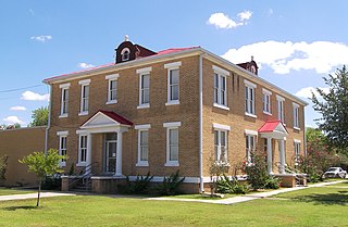
Crockett County is a county located on the Edwards Plateau in the U.S. state of Texas. As of the 2020 census, its population was 3,098. The county seat is Ozona. The county was founded in 1875 and later organized in 1891. It is named in honor of Davy Crockett, the legendary frontiersman who died at the Battle of the Alamo.
Tornillo is a border town in El Paso County, Texas, United States. The population was 1,568 at the 2010 census. For statistical purposes, the United States Census Bureau has defined this unincorporated community as a census-designated place (CDP). It is part of the El Paso Metropolitan Statistical Area. The Tornillo and Guadalupe, Chihuahua, area is connected by the Tornillo–Guadalupe International Bridge.
Crosby is a census-designated place in Harris County, Texas, United States. The population was 3,417 at the 2020 census.
Doffing is a census-designated place (CDP) in Hidalgo County, Texas, United States. The population was 5,091 at the 2010 United States Census. It is part of the McAllen–Edinburg–Mission Metropolitan Statistical Area.
Doolittle is a census-designated place (CDP) in Hidalgo County, Texas, United States. The population was 4,061 at the 2020 United States Census. It is part of the McAllen–Edinburg–Mission Metropolitan Statistical Area.
Heidelberg is a census-designated place (CDP) in Hidalgo County, Texas, United States. The population was 1,507 at the 2020 United States Census. It is part of the McAllen–Edinburg–Mission Metropolitan Statistical Area.
Midway North is a census-designated place (CDP) in Hidalgo County, Texas, United States. The population was 4,232 at the 2020 United States Census. It is part of the McAllen–Edinburg–Mission Metropolitan Statistical Area.
Muniz is a census-designated place (CDP) in Hidalgo County, Texas, United States. The population was 1,593 at the 2020 United States Census. It is part of the McAllen–Edinburg–Mission Metropolitan Statistical Area.
San Carlos is a community and census-designated place (CDP) in Hidalgo County, Texas. The population was 3,087 at the 2020 United States Census. It is part of the McAllen–Edinburg–Mission Metropolitan Statistical Area.
Linn, formerly San Manuel-Linn, is a census-designated place (CDP) in Hidalgo County, Texas, United States. The population was 801 at the 2010 census, down from 958 at the 2000 census. It is part of the McAllen–Edinburg–Mission Metropolitan Statistical Area.
Evadale is an unincorporated community and census-designated place (CDP) in Jasper County, Texas, United States. The population was 1,246 at the 2020 census.
Fort Davis is an unincorporated community and census-designated place (CDP) in Jeff Davis County, Texas, United States. The population was 1,201 at the 2010 census, up from 1,050 at the 2000 census. It is the county seat of Jeff Davis County.
Lipscomb is an unincorporated community and census-designated place (CDP) in Lipscomb County, Texas, United States. It is the Lipscomb county seat. The population was 66 at the 2020 census.
El Refugio is a census-designated place (CDP) in Starr County, Texas, United States. The population was 407 at the 2020 census. El Refugio gained area in the 2010 census.
La Rosita is a census-designated place (CDP) in Starr County, Texas, United States. The population was 85 at the 2010 census, a decline from the figure of 1,729 tabulated in 2000 due to the Census Bureau redefining the CDP. By the 2020 census, the population further decreased to 82.
Sarita is a census-designated place (CDP) in, and the county seat of Kenedy County, Texas, United States. It is the only settlement of note in the county, and as of the 2010 census had a population of 238.
Tilden is an unincorporated community, census-designated place (CDP), and the county seat of McMullen County, Texas, United States. The population was 190 at the 2020 census.
Guthrie is an unincorporated town and census-designated place (CDP) in, and the county seat of, King County in the U.S. state of Texas. It is in the northern part of the state, 93 miles (150 km) east of Lubbock and 117 miles (188 km) west of Wichita Falls. It serves as the principal headquarters of the Four Sixes Ranch. As of the 2020 census, its population was 151, down from 160 at 2010.
Gail is a census-designated place in and the county seat of Borden County, Texas, United States, that is ocated at the junction of U.S. Route 180 and Farm to Market Road 669. As of the 2010 Census, the population was 231.
Macdona is an unincorporated community and census-designated place in Bexar County, Texas, United States. As of the 2010 census, it had a population of 559. Macdona lies along the Union Pacific rail line near Loop 1604 in southwest Bexar County. It is part of the San Antonio Metropolitan Statistical Area.