Crosbyton, Texas

Last updated

Crosbyton, Texas
Crosbyton01 courthouse.jpg
The Crosby County Courthouse in Crosbyton
Motto: 
"Where the 19th century meets the 21st century"
TXMap-doton-Crosbyton.PNG
Location of Crosbyton, Texas
Crosby County Crosbyton.svg
Coordinates: 33°38′29″N101°14′16″W / 33.64139°N 101.23778°W / 33.64139; -101.23778
CountryUnited States
State Texas
County Crosby
Incorporated (city)1917
Government
  TypeMayor-Council
  MayorDusty Cornelius [ citation needed ]
Area
[1]
  Total2.11 sq mi (5.47 km2)
  Land2.11 sq mi (5.47 km2)
  Water0.00 sq mi (0.00 km2)
Elevation
[2]
3,009 ft (917 m)
Population
 (2010)
  Total1,741
  Estimate 
(2019) [3]
1,612
  Density763.62/sq mi (294.90/km2)
   Demonym
Crosbytonian
Time zone UTC−6 (Central (CST))
  Summer (DST) UTC−5 (CDT)
ZIP code
79322
Area code 806
FIPS code 48-17768 [4]
GNIS feature ID2410267 [2]
Website www.cityofcrosbyton.org

Crosbyton is a city in and the county seat of Crosby County, Texas, United States. [5] The population was 1,741 at the 2010 census. [6] Crosbyton is part of the Lubbock Metropolitan Statistical Area.

Contents

History

The city was named for land office commissioner Stephen Crosby. [7] [8]

In 1902, the C. B. Livestock Company purchased 90,000 acres. By 1912, a 10,000-acre demonstration farm, managed by Judge L. Gough, showcased the area's potential for cotton cultivation, leading to significant land sales from 1907 to 1915. [8]

The town's foundation began in 1908 when the C. B. Livestock Company surveyed a townsite, subsequently opening Crosbyton for settlement. The Crosbyton post office was established in July 1908. The Crosbyton Inn, a three-story hotel, was erected the same year. [8]

In 1910, Crosbyton secured the county seat designation after winning a vote against Emma. The Crosbyton-South Plains Railroad commenced operations on April 10, 1911. [8]

The town's first hospital opened in 1947, and in 1975, the Crosbyton Municipal Airport was dedicated. In 1976, Texas Tech University built a 65-foot diameter solar dish, the world's largest at the time, to harvest solar power. [8] [9]

Recognizing the town's heritage, Zina Lamar established the Crosby County Pioneer Memorial Museum in 1958. This facility serves as a community center and museum, preserving artifacts of area pioneers. [8]

Geography

Crosbyton is located slightly northeast of the center of Crosby County along U.S. Route 82, approximately 2 miles (3 km) west of Blanco Canyon at the eastern edge of the Llano Estacado. US 82 leads east 24 miles (39 km) to Dickens and west 38 miles (61 km) to Lubbock.

According to the United States Census Bureau, Crosbyton has a total area of 2.1 square miles (5.5 km2), all land. [6]

Demographics

Historical population
CensusPop.Note
1920 809
1930 1,25054.5%
1940 1,61529.2%
1950 1,87916.3%
1960 2,08811.1%
1970 2,2517.8%
1980 2,2891.7%
1990 2,026−11.5%
2000 1,874−7.5%
2010 1,741−7.1%
2019 (est.)1,612 [3] −7.4%
U.S. Decennial Census [10]

2020 census

Crosbyton racial composition [11]
(NH = Non-Hispanic) [lower-alpha 1]
RaceNumberPercentage
White (NH)54736.66%
Black or African American (NH)503.35%
Native American or Alaska Native (NH)10.07%
Asian (NH)20.13%
Mixed/Multi-Racial (NH)110.74%
Hispanic or Latino 88159.05%
Total1,492

As of the 2020 United States census, there were 1,492 people, 667 households, and 498 families residing in the city.

2000 census

As of the census [4] of 2000, 1,874 people, 677 households, and 482 families resided in the city. The population density was 886.9 inhabitants per square mile (342.4/km2). The 781 housing units averaged 369.6 per square mile (142.9/km2). The racial makeup of the city was 62.49% White, 5.71% African American, 0.21% Native American, 0.05% Asian, 30.15% from other races, and 1.39% from two or more races. Hispanics or Latinos of any race were 47.65% of the population.

Of the 677 households, 34.6% had children under the age of 18 living with them, 55.8% were married couples living together, 11.1% had a female householder with no husband present, and 28.8% were not families. About 27.3% of all households were made up of individuals, and 17.6% had someone living alone who was 65 years of age or older. The average household size was 2.68 and the average family size was 3.26.

In the city, the population was distributed as 28.8% under the age of 18, 8.8% from 18 to 24, 24.3% from 25 to 44, 20.8% from 45 to 64, and 17.4% who were 65 years of age or older. The median age was 36 years. For every 100 females, there were 85.9 males. For every 100 females age 18 and over, there were 82.4 males.

The median income for a household in the city was $24,722, and for a family was $30,900. Males had a median income of $22,647 versus $18,000 for females. The per capita income for the city was $16,329. About 23.7% of families and 28.0% of the population were below the poverty line, including 36.9% of those under age 18 and 25.9% of those age 65 or over.

Education

The city is served by the Crosbyton Consolidated Independent School District.

Climate

Crosbyton gets about 23 inches of rain each year. As a comparison, the US average is 39 inches. Snowfall averages seven inches, compared to the average of 26 inches of snow in American cities. The city receives some measurable precipitation approximately 40 days a year.

Sunny weather typically occurs 263 days per year. The Sperling comfort index for Crosbyton is 62 out of 100 (the higher score indicates a more comfortable year-round climate. [13]

Climate data for Crosbyton, Texas (1991–2020 normals, extremes 1893–present)
MonthJanFebMarAprMayJunJulAugSepOctNovDecYear
Record high °F (°C)87
(31)
92
(33)
96
(36)
103
(39)
111
(44)
113
(45)
110
(43)
110
(43)
108
(42)
101
(38)
92
(33)
84
(29)
113
(45)
Mean maximum °F (°C)75.9
(24.4)
80.4
(26.9)
88.3
(31.3)
92.8
(33.8)
98.5
(36.9)
101.1
(38.4)
101.4
(38.6)
100.0
(37.8)
97.1
(36.2)
92.1
(33.4)
82.9
(28.3)
75.2
(24.0)
104.3
(40.2)
Mean daily maximum °F (°C)54.0
(12.2)
58.7
(14.8)
67.2
(19.6)
75.6
(24.2)
83.0
(28.3)
89.9
(32.2)
92.7
(33.7)
92.0
(33.3)
84.8
(29.3)
75.4
(24.1)
63.5
(17.5)
54.6
(12.6)
74.3
(23.5)
Daily mean °F (°C)40.0
(4.4)
43.8
(6.6)
51.9
(11.1)
60.0
(15.6)
69.1
(20.6)
77.0
(25.0)
80.1
(26.7)
79.3
(26.3)
72.0
(22.2)
61.6
(16.4)
49.7
(9.8)
41.2
(5.1)
60.5
(15.8)
Mean daily minimum °F (°C)26.1
(−3.3)
28.9
(−1.7)
36.5
(2.5)
44.3
(6.8)
55.2
(12.9)
64.1
(17.8)
67.5
(19.7)
66.6
(19.2)
59.1
(15.1)
47.7
(8.7)
36.0
(2.2)
27.8
(−2.3)
46.6
(8.1)
Mean minimum °F (°C)13.5
(−10.3)
16.2
(−8.8)
21.5
(−5.8)
30.9
(−0.6)
42.3
(5.7)
56.6
(13.7)
61.8
(16.6)
60.4
(15.8)
47.2
(8.4)
32.7
(0.4)
21.3
(−5.9)
14.0
(−10.0)
9.3
(−12.6)
Record low °F (°C)−10
(−23)
−14
(−26)
−2
(−19)
17
(−8)
28
(−2)
39
(4)
48
(9)
42
(6)
32
(0)
16
(−9)
4
(−16)
−6
(−21)
−14
(−26)
Average precipitation inches (mm)0.79
(20)
0.86
(22)
1.40
(36)
1.82
(46)
2.88
(73)
2.98
(76)
2.40
(61)
2.01
(51)
2.73
(69)
1.73
(44)
1.12
(28)
0.98
(25)
21.70
(551)
Average precipitation days (≥ 0.01 in)3.03.75.14.46.87.35.65.96.25.43.53.560.4
Source: NOAA [14] [15]

Notable people

See also

Related Research Articles

<span class="mw-page-title-main">Tyler County, Texas</span> County in Texas, United States

Tyler County is a county located in the U.S. state of Texas. It is in East Texas and its seat is Woodville.

<span class="mw-page-title-main">Lynn County, Texas</span> County in Texas, United States

Lynn County is a county in the U.S. state of Texas. As of the 2020 census, its population was 5,596. Its county seat is Tahoka. The county was created in 1876 and organized in 1903.

<span class="mw-page-title-main">Lubbock County, Texas</span> County in Texas, United States

Lubbock County is a county located in the U.S. state of Texas. The 2020 census placed the population at 310,639. Its county seat and largest city is Lubbock. The county was created in 1876 and organized in 1891. It is named for Thomas Saltus Lubbock, a Confederate colonel and Texas Ranger.

<span class="mw-page-title-main">Kent County, Texas</span> County in Texas, United States

Kent County is a county located in the U.S. state of Texas. As of the 2020 census, its population was 753, making it the sixth-least populous county in Texas. Its county seat is Jayton. The county was created in 1876 and later organized in 1892. It is named for Andrew Kent, who died at the Battle of the Alamo. Kent County is a prohibition or entirely dry county, one of four remaining in the state.

<span class="mw-page-title-main">Garza County, Texas</span> County in Texas, United States

Garza County is a county located in the U.S. state of Texas. As of the 2020 census, its population was 5,816, of which most of the population were residing in its county seat, and only incorporated municipality, Post. The county was created in 1876 and later organized in 1907. Garza is named for a pioneer Bexar County family, as it was once a part of that county.

<span class="mw-page-title-main">Floyd County, Texas</span> County in Texas, United States

Floyd County is a county in the U.S. state of Texas. As of the 2020 census, its population was 5,402. The seat of the county is Floydada. The county was created in 1876 and later organized in 1890. It is named for Dolphin Ward Floyd, who died on his 32nd birthday, March 6, 1836, defending the Alamo.

<span class="mw-page-title-main">Dickens County, Texas</span> County in Texas, United States

Dickens County is a county located in the U.S. state of Texas. As of the 2020 census, its population was 1,770. Its county seat is Dickens. The county was created in 1876 and later organized in 1891. Both the county and its seat are named for J. Dickens, who died at the Battle of the Alamo.

<span class="mw-page-title-main">Crosby County, Texas</span> County in Texas, United States

Crosby County is a county located in the U.S. state of Texas. As of the 2020 census, its population was 5,133. The county seat is Crosbyton. The county was founded in 1876 and later organized in 1886. Both the county and its seat are named for Stephen Crosby, a land commissioner in Texas.

<span class="mw-page-title-main">Cooke County, Texas</span> County in Texas, United States

Cooke County is a county in the U.S. state of Texas. At the 2020 census, its population was 41,668. The county seat is Gainesville. The county was founded in 1848 and organized the next year. It is named for William Gordon Cooke, a soldier during the Texas Revolution. It is a part of the Texoma region.

<span class="mw-page-title-main">Lorenzo, Texas</span> City in Texas, United States

Lorenzo is a city in Crosby County, Texas, United States. As of the 2010 census, the city population was 1,147, down from 1,372 in 2000. It is part of the Lubbock Metropolitan Statistical Area.

<span class="mw-page-title-main">Ralls, Texas</span> City in Texas, United States

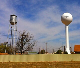
Ralls is a city in Crosby County, Texas, United States. It was named after John Robinson Ralls, who, with the help of W.E. McLaughlin, laid out the townsite in July 1911. As of the 2010 census, it had a population of 1,944, down from 2,252 at the 2000 census. Ralls is surrounded by productive farmlands that primarily produce cotton and grains, with lesser amounts of soybean, sunflower seed, and vegetables.

<span class="mw-page-title-main">Dickens, Texas</span> City in Texas, United States

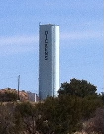
Dickens is a city in and the county seat of Dickens County, Texas, United States. The population was 286 at the 2010 census, down from 332 at the 2000 census.

<span class="mw-page-title-main">Waskom, Texas</span> City in Texas, United States

Waskom is a city in the U.S. state of Texas with a 2020 census-tabulated population of 1,910, down from 2,160 residents in 2010. It is located in Harrison County and lies approximately 19 miles (31 km) east of the county seat, Marshall, on U.S. 80 and Interstate 20. Waskom forms part of Greater Marshall, which is also included in the Longview–Marshall combined statistical area in the Ark-La-Tex region. To the east are the cities of Greenwood and Shreveport, Louisiana.

<span class="mw-page-title-main">Jayton, Texas</span> City in Texas, United States

Jayton is a city in and the county seat of Kent County, Texas, United States. It is located in the northeastern portion of the county, and the population was 511 as of the 2020 census.

<span class="mw-page-title-main">Idalou, Texas</span> City in Texas, United States

Idalou is a city in Lubbock County, Texas, United States. It is located 7 miles (11 km) northeast of Lubbock near the intersection of Farm to Market Road 400 and US 62/US 82/SH 114. The population was 2,250 at the 2010 census. It is part of the Lubbock Metropolitan Statistical Area.

New Deal is a U.S. town in Lubbock County, Texas. The population was 794 at the 2010 census. It is part of the Lubbock Metropolitan Statistical Area and the Llano Estacado region.

<span class="mw-page-title-main">Wolfforth, Texas</span> City in Texas, United States

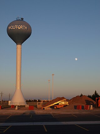
Wolfforth is a town located in Lubbock County, Texas, United States. It is a southwestern suburb of Lubbock. The population was 3,670 at the 2010 census.

<span class="mw-page-title-main">Miami, Texas</span> Town in Texas, United States

Miami is a town in Roberts County, Texas, United States. It is part of the Pampa, Texas micropolitan statistical area. Its population was 597 at the 2010 census. It is the county seat of Roberts County and the only municipality in the county.

<span class="mw-page-title-main">Wheeler, Texas</span> City in Texas, United States

Wheeler is a city, and the county seat of Wheeler County, Texas, United States, located on the eastern border of the Texas Panhandle. The population was last reported at 1,592 in the 2010 census.

<span class="mw-page-title-main">Lubbock metropolitan area</span> Metropolitan statistical area in Texas, United States

The Lubbock metropolitan area is a metropolitan statistical area (MSA) in the South Plains region of West Texas, United States, that covers three counties – Crosby, Lubbock, and Lynn. As of the 2010 census, the Lubbock MSA had a population of 290,805, though a 2019 estimate placed the population at 322,257, which ranks it the 157th-most populated MSA in the United States. It is also part of the larger Lubbock-Plainview-Levelland combined statistical area.

References

  1. "2019 U.S. Gazetteer Files". United States Census Bureau. Retrieved August 7, 2020.
  2. 1 2 U.S. Geological Survey Geographic Names Information System: Crosbyton, Texas
  3. 1 2 "Population and Housing Unit Estimates". United States Census Bureau. May 24, 2020. Retrieved May 27, 2020.
  4. 1 2 "U.S. Census website". United States Census Bureau . Retrieved January 31, 2008.
  5. "Find a County". National Association of Counties. Archived from the original on May 31, 2011. Retrieved June 7, 2011.
  6. 1 2 "Geographic Identifiers: 2010 Census Summary File 1 (G001): Crosbyton city, Texas". U.S. Census Bureau, American Factfinder. Archived from the original on February 13, 2020. Retrieved August 6, 2015.
  7. "Profile for Crosbyton, Texas". ePodunk . Retrieved June 15, 2010.
  8. 1 2 3 4 5 6 Jenkins, Edloe A. "Crosbyton, TX". Handbook Of Texas. Texas State Historical Association. Retrieved December 20, 2023.
  9. "Crosbyton Solar Power Project". Texas Tech University Southwest Collection/Special Collections Library. Texas Tech University. Retrieved December 20, 2023.
  10. "Census of Population and Housing". Census.gov. Retrieved June 4, 2015.
  11. "Explore Census Data". data.census.gov. Retrieved May 20, 2022.
  12. "About the Hispanic Population and its Origin". www.census.gov. Retrieved May 18, 2022.
  13. "Sperling's Best Places - Crosbyton, Texas".
  14. "NOWData - NOAA Online Weather Data". National Oceanic and Atmospheric Administration. Retrieved December 20, 2023.
  15. "Summary of Monthly Normals 1991-2020". National Oceanic and Atmospheric Administration. Retrieved December 20, 2023.
  16. "Sonicbids Randy Crouch Biography".
  1. Note: the US Census treats Hispanic/Latino as an ethnic category. This table excludes Latinos from the racial categories and assigns them to a separate category. Hispanics/Latinos can be of any race. [12]