Seminole, Texas

Last updated

Seminole, Texas
City
Seminole courhouse.JPG
The Gaines County Courthouse in Seminole.
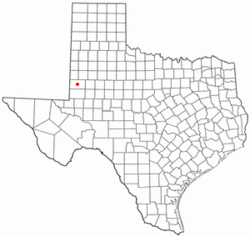
TXMap-doton-Seminole.PNG
Location of Seminole, Texas
Gaines County Seminole.svg
Coordinates: 32°43′7″N102°39′0″W / 32.71861°N 102.65000°W / 32.71861; -102.65000
CountryUnited States
State Texas
County Gaines
Area
[1]
  Total3.80 sq mi (9.83 km2)
  Land3.80 sq mi (9.83 km2)
  Water0.00 sq mi (0.00 km2)
Elevation
[2]
3,297 ft (1,005 m)
Population
 (2020)
  Total6,988
  Density2,058.20/sq mi (794.74/km2)
Time zone UTC-6 (Central (CST))
  Summer (DST) UTC-5 (CDT)
ZIP code
79360
Area code 432
FIPS code 48-66764 [3]
GNIS feature ID2411866 [2]

Seminole is a city in and the county seat of Gaines County, Texas, United States. [4] Its population was 6,430 at the 2010 census. Seminole and Gaines County are home to a large population of German Mennonites from Russia that came to West Texas in the 1980s. [5]

Contents

It is the birthplace of country music singers Larry Gatlin and Tanya Tucker.

History

The land for Seminole was donated by nonresident landowners to become the county seat for Gaines County. In 1906, the first move to Seminole was made by W. B. Austin and his wife Emma, who moved their general store there, which was located in Caput, Texas. During this time, several post offices found a new home in Seminole. Seminole National Bank opened its doors in 1906, followed by First State Bank in 1907. In 1912, Seminole National Bank lost over $3,000 when it was robbed. In 1914, the two banks merged to form First State Bank. In 1950, Seminole's population surpassed Seagraves, Texas, for the first time. [6]

Plautdietsch-speaking Mennonites became an ethnoreligious group in the Russian Empire and migrated from there to Canada and then to Mexico. In 1977, some 100 families from Mexico bought land southwest of Seminole to settle there, but faced difficulties with immigration. In 1980, President Jimmy Carter signed legislation allowing the original 100 families to gain full citizenship. In 2016, about 6,000 Plautdietsch speakers lived around Seminole. [7]

Geography

Seminole is located at 32°43′7″N102°39′00″W / 32.71861°N 102.65000°W / 32.71861; -102.65000 . [8]

According to the United States Census Bureau, the city has a total area of 3.3 square miles (8.5 km2), all land.

Climate

The climate is cold semiarid (Köppen: BSk) affected by elevation with well defined seasons, more extreme and drier than most of the great cities of Texas. [9] The lowest temperature measured in the state was in the city with −23 °F (−31 °C), recorded on February 8, 1933. [10]

Climate data for Seminole, Texas (1991–2020 normals, [11] extremes 1922–present)
MonthJanFebMarAprMayJunJulAugSepOctNovDecYear
Record high °F (°C)83
(28)
88
(31)
95
(35)
99
(37)
109
(43)
114
(46)
113
(45)
110
(43)
106
(41)
102
(39)
89
(32)
83
(28)
114
(46)
Mean maximum °F (°C)75.4
(24.1)
79.5
(26.4)
86.4
(30.2)
92.0
(33.3)
99.1
(37.3)
104.2
(40.1)
102.3
(39.1)
101.3
(38.5)
97.5
(36.4)
91.8
(33.2)
81.8
(27.7)
74.3
(23.5)
106.1
(41.2)
Average high °F (°C)56.2
(13.4)
61.2
(16.2)
69.1
(20.6)
77.8
(25.4)
85.8
(29.9)
93.2
(34.0)
94.0
(34.4)
93.1
(33.9)
85.6
(29.8)
77.1
(25.1)
64.9
(18.3)
56.7
(13.7)
76.2
(24.6)
Daily mean °F (°C)42.1
(5.6)
46.0
(7.8)
53.4
(11.9)
61.4
(16.3)
70.5
(21.4)
78.6
(25.9)
80.6
(27.0)
79.6
(26.4)
72.4
(22.4)
62.5
(16.9)
50.5
(10.3)
42.6
(5.9)
61.7
(16.5)
Average low °F (°C)27.9
(−2.3)
30.7
(−0.7)
37.6
(3.1)
44.9
(7.2)
55.2
(12.9)
64.1
(17.8)
67.2
(19.6)
66.2
(19.0)
59.3
(15.2)
48.0
(8.9)
36.0
(2.2)
28.6
(−1.9)
47.1
(8.4)
Mean minimum °F (°C)15.6
(−9.1)
18.0
(−7.8)
23.4
(−4.8)
32.0
(0.0)
42.1
(5.6)
56.1
(13.4)
61.6
(16.4)
60.7
(15.9)
47.6
(8.7)
33.1
(0.6)
21.7
(−5.7)
15.0
(−9.4)
11.2
(−11.6)
Record low °F (°C)−9
(−23)
−23
(−31)
8
(−13)
20
(−7)
28
(−2)
44
(7)
50
(10)
51
(11)
34
(1)
20
(−7)
5
(−15)
−1
(−18)
−23
(−31)
Average precipitation inches (mm)0.69
(18)
0.72
(18)
1.01
(26)
1.05
(27)
2.23
(57)
1.92
(49)
2.05
(52)
1.78
(45)
2.75
(70)
1.33
(34)
1.00
(25)
0.68
(17)
17.21
(438)
Average snowfall inches (cm)1.7
(4.3)
1.3
(3.3)
0.1
(0.25)
0.1
(0.25)
0.0
(0.0)
0.0
(0.0)
0.0
(0.0)
0.0
(0.0)
0.0
(0.0)
0.0
(0.0)
0.8
(2.0)
0.8
(2.0)
4.8
(12.1)
Average precipitation days (≥ 0.01 in)3.94.13.73.04.85.25.25.15.84.63.63.152.1
Average snowy days (≥ 0.1 in)1.00.70.00.10.00.00.00.00.00.00.30.72.8
Source 1: NOAA [12]
Source 2: National Weather Service [13]

Demographics

Historical population
CensusPop.Note
1940 1,761
1950 3,47997.6%
1960 5,73764.9%
1970 5,007−12.7%
1980 6,08021.4%
1990 6,3424.3%
2000 5,910−6.8%
2010 6,4308.8%
2020 6,9888.7%
U.S. Decennial Census [14] [15]

2020 census

Seminole Racial Composition [16]
RaceNum.Perc.
White 3,32347.55%
Black or African American 1081.55%
Native American 290.41%
Asian 600.86%
Pacific Islander 10.01%
Other/mixed 1101.57%
Hispanic or Latino 3,35748.04%

As of the 2020 United States Census, 6,988 people, 2,326 households, and 1,727 families were residing in the city.

2000 census

As of the census [3] of 2000, 5,910 people, 2,082 households, and 1,590 families resided in the city. The population density was 1,762.3 inhabitants per square mile (680.4/km2) . The 2,337 housing units had an average density of 696.9 per square mile (269.1/km2). The racial makeup of the city was 80.64% White, 1.98% African American, 0.98% Native American, 0.29% Asian, 0.02% Pacific Islander, 13.52% from other races, and 2.57% from two or more races. Hispanics or Latinos of any race were 39.59% of the population.

Of the 2,082 households, 41.3% had children under 18 living with them, 61.6% were married couples living together, 11.2% had a female householder with no husband present, and 23.6% were not families. About 21.8% of all households were made up of individuals, and 10.2% had someone living alone who was 65 or older. The average household size was 2.79, and the average family size was 3.28.

In the city, the population was distributed as 31.9% under 18, 8.9% from 18 to 24, 27.2% from 25 to 44, 19.0% from 45 to 64, and 13.0% who were 65 or older. The median age was 32 years. For every 100 females, there were 92.5 males. For every 100 females age 18 and over, there were 89.4 males.

The median income for a household in the city was $32,063, and for a family was $36,019. Males had a median income of $31,563 versus $17,010 for females. The per capita income for the city was $14,624. About 14.6% of families and 18.2% of the population were below the poverty line, including 24.1% of those under 18 and 13.4% of those 65 or over.

Education and library

The City of Seminole is served by the Seminole Independent School District. The Gaines County Library celebrated its 50th anniversary in 2008. [17]

Notable people

Related Research Articles

<span class="mw-page-title-main">Trinity County, Texas</span> County in Texas, United States

Trinity County is a county located in the U.S. state of Texas. As of the 2020 census, the population was 13,602. Its county seat is Groveton. The county is named for the Trinity River.

<span class="mw-page-title-main">Gaines County, Texas</span> County in Texas, United States

Gaines County is a county in the U.S. state of Texas. As of the 2020 census, its population was 21,598. The county seat is Seminole.

<span class="mw-page-title-main">Seminole County, Georgia</span> County in Georgia, United States

Seminole County is a county located in the southwestern corner of U.S. state of Georgia. As of the 2020 census, the population was 9,147. The county seat is Donalsonville.

<span class="mw-page-title-main">Goessel, Kansas</span> City in Marion County, Kansas

Goessel is a city in Marion County, Kansas, United States. It was named after Captain Kurt von Goessel (1852–1895) who went down with his ship, the Elbe, in the English Channel after it was rammed. As of the 2020 census, the population of the city was 556. It is located about 11 miles north of North Newton on the west side of K-15 highway.

<span class="mw-page-title-main">Alto, Texas</span> Town in Texas, United States

Alto is a town in Cherokee County, Texas, United States. With a population of 1,027 at the 2020 U.S. census, Alto is the closest municipality to the Caddo Mounds State Historic Site, an archaeological site dating back to 800 CE, featuring a prehistoric village and ceremonial center.

<span class="mw-page-title-main">Columbus, Texas</span> City in Texas, United States

Columbus is a city in and the county seat of Colorado County in southeastern Texas. The population was 3,699 as of the 2020 census. It is located on the Colorado River. The Colorado County Courthouse is listed on the National Register of Historic Places.

<span class="mw-page-title-main">Lamesa, Texas</span> City in Texas, United States

Lamesa is a city in and the county seat of Dawson County, Texas, United States. The population was 8,674 at the 2020 census, down from 9,952 at the 2000 census. Located south of Lubbock on the Llano Estacado, Lamesa was founded in 1903. Most of its economy is based on cotton farming. The Preston E. Smith prison unit, named for the former governor of Texas, is located just outside Lamesa.

<span class="mw-page-title-main">Roby, Texas</span> City in Texas, United States

Roby is a city in and the county seat of Fisher County, Texas, United States. The population was 643 at the 2010 census.

<span class="mw-page-title-main">Rotan, Texas</span> City in Texas, United States

Rotan is a city in Fisher County, Texas, United States. The population was 1,508 at the 2010 census, down from 1,611 at the 2000 census.

<span class="mw-page-title-main">Seagraves, Texas</span> City in Texas, United States

Seagraves is a city in Gaines County, Texas, United States. Its population was 2,417 at the 2010 census.

<span class="mw-page-title-main">Grapeland, Texas</span> City in Texas, United States

Grapeland is a city in Houston County, Texas, United States. Its population was 1,465 as of the 2020 census.

<span class="mw-page-title-main">Quinlan, Texas</span> City in Texas, United States

Quinlan is a rural city in the southern part of Hunt County, Texas, United States, within the Dallas–Fort Worth metropolitan area. As of the 2010 census, it had a population of 1,394. It is 5 miles (8 km) west of Lake Tawakoni.

<span class="mw-page-title-main">Brackettville, Texas</span> City in Texas, United States

Brackettville is a city in Kinney County, Texas, United States. The population was 1,688 at the 2010 census, down from 1,876 at the 2000 census. It is the county seat of Kinney County.

<span class="mw-page-title-main">Willow Park, Texas</span> City in Texas, United States

Willow Park is a city in Parker County, Texas, United States. The population was 4,936 in 2020.

<span class="mw-page-title-main">Emory, Texas</span> City in Texas, United States

Emory is a city in Rains County, Texas, United States. The population was 1,239 at the 2010 census. It is the county seat of Rains County. Previously known as Springville, the city and county are named after Emory Rains who was a legislator from the area. Rains was the author of the Homestead Law of Texas which was later used as a model for the protection of homesteads throughout the United States. Special legislation passed to create Rains County called for the citizens to vote on the location of the county seat and for that selected town to be named Emory.

<span class="mw-page-title-main">Leakey, Texas</span> City in Texas, United States

Leakey is a city in and the county seat of Real County, Texas, United States. The population was 425 at the 2010 census.

<span class="mw-page-title-main">Albany, Texas</span> City in Texas, United States

Albany is a city in Shackelford County, Texas, United States. The population was 2,034 at the 2010 Census. It is the county seat of Shackelford County.

<span class="mw-page-title-main">Glen Rose, Texas</span> City in Texas, United States

Glen Rose is a city in and the county seat of Somervell County, Texas, United States. As of the 2012 census estimate, the city population was 2,502.

<span class="mw-page-title-main">Tye, Texas</span> City in Texas, United States

Tye is a city in Taylor County, Texas, United States. The population was 1,242 at the 2010 census. It is part of the Abilene, Texas Metropolitan Statistical Area.

<span class="mw-page-title-main">Ackerly, Texas</span> City in Texas, United States

Ackerly is a city in Dawson and Martin Counties in the U.S. state of Texas. As of the 2010 Census, the population was 220. The Martin county portion of Ackerly is part of the Midland-Odessa metropolitan area.

References

  1. "2019 U.S. Gazetteer Files". United States Census Bureau. Retrieved August 7, 2020.
  2. 1 2 U.S. Geological Survey Geographic Names Information System: Seminole, Texas
  3. 1 2 "U.S. Census website". United States Census Bureau . Retrieved January 31, 2008.
  4. "Find a County". National Association of Counties. Retrieved June 7, 2011.
  5. "Mennonites in Texas".
  6. "Seminole Texas Chamber of Commerce |".
  7. Roslyn Cherie Burns: New World Mennonite Low German. An Investigating of Changes in Progress.Berkeley, 2016, page 26.
  8. "US Gazetteer files: 2010, 2000, and 1990". United States Census Bureau. February 12, 2011. Retrieved April 23, 2011.
  9. "Seminole, Texas Köppen Climate Classification (Weatherbase)". Weatherbase. Retrieved March 4, 2019.
  10. "UNITED STATES EXTREME RECORD TEMPERATURES & RANGES". ggweather.com. Retrieved March 4, 2019.
  11. Mean monthly maxima and minima (i.e. the highest and lowest temperature readings during an entire month or year) calculated based on data at said location from 1991 to 2020.
  12. "U.S. Climate Normals Quick Access – Station: Seminole, TX". National Oceanic and Atmospheric Administration. Retrieved March 2, 2023.
  13. "NOAA Online Weather Data – NWS Midland". National Weather Service. Retrieved March 2, 2023.
  14. "Census of Population and Housing". Census.gov. Retrieved June 4, 2015.
  15. "Explore Census Data". data.census.gov. Retrieved January 15, 2023.
  16. "Explore Census Data". data.census.gov. Retrieved December 7, 2021.
  17. "Who We Are — Gaines County Library System". gainescountylibrary.org. Retrieved February 13, 2017.
  18. "Ira Martin - Boxer". boxrec.com. Archived from the original on January 6, 2014.