Silverton, Texas

Last updated

Silverton, Texas
City Hall - Silverton, Texas.jpg
City Hall (2014)
TXMap-doton-Silverton.PNG
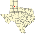
Location of Silverton, Texas
Briscoe County Silverton.svg
Coordinates: 34°28′17″N101°18′17″W / 34.47139°N 101.30472°W / 34.47139; -101.30472
Country United States
State Texas
County Briscoe
Area
[1]
  Total1.00 sq mi (2.60 km2)
  Land1.00 sq mi (2.60 km2)
  Water0.00 sq mi (0.00 km2)
Elevation
3,278 ft (999 m)
Population
 (2020)
  Total629
  Density629/sq mi (241.92/km2)
Time zone UTC-6 (Central (CST))
  Summer (DST) UTC-5 (CDT)
ZIP code
79257
Area code 806
FIPS code 48-67904 [2]
GNIS feature ID1368288 [3]

Silverton is a city in Briscoe County, Texas, United States. The population was 629 at the 2020 census.

Contents

History

Silverton was established when Thomas J. Braidfoot and associates formed a townsite company, with the name reportedly derived from the silvery reflections of nearby lakes. The town quickly developed with a post office, stores, a blacksmith shop, and a school by the fall of 1891. In 1892, Silverton won a special election, becoming the county seat over two rival townsites. The construction of a two-story courthouse and a stone jail followed. The town saw the opening of the first bank in 1909 and the construction of a new brick schoolhouse in 1911. [4]

Silverton became the northern terminus of the Fort Worth and Denver South Plains Railway in 1928, leading to its incorporation. [4]

A F4 tornado in 1957 killed twenty-one people and injured 80 others. [4] [5]

Geography

Silverton is located in west-central Briscoe County at 34°28′17″N101°18′17″W / 34.47139°N 101.30472°W / 34.47139; -101.30472 (34.471256, –101.304749). [6] Texas State Highway 86 passes through the city, leading southeast 17 miles (27 km) to Quitaque and west 27 miles (43 km) to Tulia near Interstate 27. Texas State Highway 207 leads south from Silverton 35 miles (56 km) to Floydada and north 52 miles (84 km) to Claude.

According to the United States Census Bureau, Silverton has a total area of 1.0 square mile (2.6 km2), all land. [7] It is the county seat of Briscoe County. [8]

Climate

According to the Köppen Climate Classification system, Silverton has a semi-arid climate, abbreviated "BSk" on climate maps. [9]

Climate data for Silverton, Texas (1991–2020 normals, extremes 1961–present)
MonthJanFebMarAprMayJunJulAugSepOctNovDecYear
Record high °F (°C)80
(27)
87
(31)
94
(34)
102
(39)
107
(42)
111
(44)
110
(43)
108
(42)
103
(39)
100
(38)
88
(31)
81
(27)
111
(44)
Mean maximum °F (°C)73.5
(23.1)
77.9
(25.5)
85.6
(29.8)
89.5
(31.9)
95.9
(35.5)
100.5
(38.1)
100.7
(38.2)
99.1
(37.3)
96.1
(35.6)
90.5
(32.5)
80.9
(27.2)
74.0
(23.3)
103.5
(39.7)
Mean daily maximum °F (°C)52.2
(11.2)
56.3
(13.5)
64.7
(18.2)
72.7
(22.6)
80.6
(27.0)
89.0
(31.7)
92.1
(33.4)
90.7
(32.6)
83.5
(28.6)
73.8
(23.2)
62.0
(16.7)
52.6
(11.4)
72.5
(22.5)
Daily mean °F (°C)37.9
(3.3)
41.5
(5.3)
49.5
(9.7)
57.4
(14.1)
66.8
(19.3)
75.8
(24.3)
79.2
(26.2)
77.9
(25.5)
70.5
(21.4)
59.4
(15.2)
47.7
(8.7)
38.9
(3.8)
58.5
(14.7)
Mean daily minimum °F (°C)23.7
(−4.6)
26.6
(−3.0)
34.2
(1.2)
42.1
(5.6)
53.0
(11.7)
62.6
(17.0)
66.4
(19.1)
65.1
(18.4)
57.6
(14.2)
45.1
(7.3)
33.5
(0.8)
25.3
(−3.7)
44.6
(7.0)
Mean minimum °F (°C)9.6
(−12.4)
11.8
(−11.2)
17.8
(−7.9)
27.2
(−2.7)
38.8
(3.8)
53.1
(11.7)
59.5
(15.3)
57.6
(14.2)
44.6
(7.0)
28.5
(−1.9)
16.3
(−8.7)
9.7
(−12.4)
3.9
(−15.6)
Record low °F (°C)−9
(−23)
−8
(−22)
4
(−16)
19
(−7)
27
(−3)
43
(6)
53
(12)
50
(10)
30
(−1)
15
(−9)
1
(−17)
−10
(−23)
−10
(−23)
Average precipitation inches (mm)0.69
(18)
0.76
(19)
1.26
(32)
1.64
(42)
2.87
(73)
3.65
(93)
2.42
(61)
2.64
(67)
2.31
(59)
1.82
(46)
0.85
(22)
0.78
(20)
21.69
(551)
Average snowfall inches (cm)1.9
(4.8)
2.3
(5.8)
1.0
(2.5)
0.3
(0.76)
0.0
(0.0)
0.0
(0.0)
0.0
(0.0)
0.0
(0.0)
0.0
(0.0)
0.1
(0.25)
1.8
(4.6)
1.8
(4.6)
9.2
(23)
Average precipitation days (≥ 0.01 in)3.03.44.44.36.67.65.86.35.35.03.53.358.5
Average snowy days (≥ 0.1 in)1.11.30.50.10.00.00.00.00.00.10.51.04.6
Source: NOAA [10] [11]

Demographics

Historical population
CensusPop.Note
1920 416
1930 873109.9%
1940 684−21.6%
1950 85725.3%
1960 1,09828.1%
1970 1,026−6.6%
1980 918−10.5%
1990 779−15.1%
2000 771−1.0%
2010 731−5.2%
2020 629−14.0%
U.S. Decennial Census [12]

2020 census

Silverton racial composition [13]
(NH = Non-Hispanic) [lower-alpha 1]
RaceNumberPercentage
White (NH)38861.69%
Black or African American (NH)91.43%
Native American or Alaska Native (NH)30.48%
Some Other Race (NH)20.32%
Mixed/Multi-Racial (NH)162.54%
Hispanic or Latino 21133.55%
Total629

As of the 2020 United States census, there were 629 people, 277 households, and 165 families residing in the city.

2000 census

As of the census [2] of 2000, there were 771 people, 303 households, and 217 families living in the city. The population density was 766.4 inhabitants per square mile (295.9/km2). There were 362 housing units at an average density of 359.8 per square mile (138.9/km2). The racial makeup of the city was 79.51% White, 0.52% African American, 0.78% Native American, 15.69% from other races, and 3.50% from two or more races. Hispanic or Latino of any race were 28.15% of the population.

There were 303 households, out of which 31.7% had children under the age of 18 living with them, 60.7% were married couples living together, 7.6% had a female householder with no husband present, and 28.1% were non-families. 26.4% of all households were made up of individuals, and 16.5% had someone living alone who was 65 years of age or older. The average household size was 2.54 and the average family size was 3.09.

In the city, the population was spread out, with 28.7% under the age of 18, 7.3% from 18 to 24, 22.7% from 25 to 44, 21.1% from 45 to 64, and 20.2% who were 65 years of age or older. The median age was 38 years. For every 100 females, there were 86.7 males. For every 100 females age 18 and over, there were 88.4 males.

The median income for a household in the city was $27,014, and the median income for a family was $32,308. Males had a median income of $23,750 versus $16,750 for females. The per capita income for the city was $13,416. About 12.1% of families and 17.6% of the population were below the poverty line, including 29.4% of those under age 18 and 12.3% of those age 65 or over.

Education

The community of Silverton is served by the Silverton Independent School District and home to the Silverton High School Owls.

Related Research Articles

<span class="mw-page-title-main">Wheeler County, Texas</span> County in Texas, United States

Wheeler County is a county located in the U.S. state of Texas. As of the 2020 census, its population was 4,990. Its county seat is Wheeler. The county was formed in 1876 and organized in 1879. It is named for Royall Tyler Wheeler, a chief justice of the Texas Supreme Court.

<span class="mw-page-title-main">Swisher County, Texas</span> County in Texas, United States

Swisher County is a county in the U.S. state of Texas. As of the 2020 census, its population was 6,971. Its county seat is Tulia. The county was created in 1876 and later organized in 1890. It is named for James G. Swisher, a soldier of the Texas Revolution and signer of the Texas Declaration of Independence.

<span class="mw-page-title-main">Randall County, Texas</span> County in Texas, United States

Randall County is a county located in the U.S. state of Texas. As of the 2020 census, its population was 140,753. Its county seat is Canyon. The county was created in 1876 and later organized in 1889. It is named for Horace Randal, a Confederate brigadier general killed at the Battle of Jenkins Ferry. The reason the county name differs from his is because the bill creating the county misspelled Randal's name.

<span class="mw-page-title-main">Motley County, Texas</span> County in Texas, United States

Motley County is a county located in the U.S. state of Texas. As of the 2020 census, its population was 1,063, making it the 10th-least populous county in Texas. Its county seat is Matador. The county was created in 1876 and organized in 1891. It is named for Junius William Mottley, a signer of the Texas Declaration of Independence. Mottley's name is spelled incorrectly because the bill establishing the county misspelled his name. Motley County was one of 30 prohibition, or entirely dry, counties in Texas, but is now a wet county.

<span class="mw-page-title-main">Hall County, Texas</span> County in Texas, United States

Hall County is a county located in the U.S. state of Texas. As of the 2020 census, the population is 2,825. Its county seat is Memphis. The county was created in 1876 and later organized in 1890. It is named for Warren D. C. Hall, a secretary of war for the Republic of Texas.

<span class="mw-page-title-main">Floyd County, Texas</span> County in Texas, United States

Floyd County is a county in the U.S. state of Texas. As of the 2020 census, its population was 5,402. The seat of the county is Floydada. The county was created in 1876 and later organized in 1890. It is named for Dolphin Ward Floyd, who died on his 32nd birthday, March 6, 1836, defending the Alamo.

<span class="mw-page-title-main">Donley County, Texas</span> County in Texas, United States

Donley County is a county located in the U.S. state of Texas. As of the 2020 census, its population was 3,258. Its county seat is Clarendon. The county was created in 1876 and later organized in 1882.

<span class="mw-page-title-main">Cooke County, Texas</span> County in Texas, United States

Cooke County is a county in the U.S. state of Texas. At the 2020 census, its population was 41,668. The county seat is Gainesville. The county was founded in 1848 and organized the next year. It is named for William Gordon Cooke, a soldier during the Texas Revolution. It is a part of the Texoma region.

<span class="mw-page-title-main">Callahan County, Texas</span> County in Texas, United States

Callahan County is a county located in the U.S. state of Texas. As of the 2020 census, the population was 13,708. Its county seat is Baird. The county was founded in 1858 and later organized in 1877. It is named for James Hughes Callahan, an American soldier in the Texas Revolution. Callahan County is included in the Abilene, Texas metropolitan statistical area.

<span class="mw-page-title-main">Briscoe County, Texas</span> County in Texas, United States

Briscoe County is a county located in the U.S. state of Texas. As of the 2020 census, the population was 1,435. Its county seat is Silverton. The county was created in 1876 and later organized in 1892. It is named for Andrew Briscoe, a soldier during the Texas Revolution.

<span class="mw-page-title-main">Silverton, Ohio</span> Village in Ohio, United States

Silverton is a village in Hamilton County, Ohio, United States. The village was formed out of Columbia and Sycamore townships, but withdrew from both and formed a paper township. The population was 4,908 at the 2020 census.

<span class="mw-page-title-main">Rouseville, Pennsylvania</span> Borough in Pennsylvania, United States

Rouseville is a borough in Venango County, Pennsylvania, United States. The population was 456 at the 2020 census.

<span class="mw-page-title-main">Quitaque, Texas</span> City in Texas, United States

Quitaque is a city in southeastern Briscoe County, Texas, United States. The town lies directly south of Caprock Canyon State Park and is a ranching and farming area in West Texas. The population was 342 at the 2020 census, and 411 at the 2010 census.

<span class="mw-page-title-main">Caldwell, Texas</span> City in Texas, United States

Caldwell is a city in and the county seat of Burleson County, Texas, United States. The population was 3,993 at the 2020 census. It is part of the Bryan-College Station metropolitan area.

<span class="mw-page-title-main">Dickens, Texas</span> City in Texas, United States

Dickens is a city in and the county seat of Dickens County, Texas, United States. The population was 219 at the 2020 census, down from 286 at the 2010 census.

Benavides is a city in Duval County, Texas, United States. The population was 1,183 at the 2020 census.

<span class="mw-page-title-main">Coahoma, Texas</span> Town in Texas, United States

Coahoma is a town in Howard County, Texas, United States. The population was 945 at the 2020 census, 817 at the 2010 census, and 932 at the 2000 census.

<span class="mw-page-title-main">Springlake, Texas</span> Town in Texas, United States

Springlake is a town in Lamb County, Texas, United States. The population was 145 at the 2020 census. The community is known for its agricultural processing and its yearly Independence Day parade and celebration culminating in a fireworks display headed by the Springlake Volunteer Fire Department. This celebration usually draws several thousand participants who come together to enjoy free food, a free live band, a bake auction, and fellowship.

<span class="mw-page-title-main">Stratford, Texas</span> Town in Texas, US

Stratford is a town and county seat of Sherman County, Texas, United States. The population was 1,939 at the 2020 census, down from 2,017 in 2010.

<span class="mw-page-title-main">Uvalde, Texas</span> City in Texas, United States

Uvalde is a city in and the county seat of Uvalde County, Texas, United States. The population was 15,217 at the 2020 census. Uvalde is located in the Texas Hill Country, 80 miles (130 km) west of downtown San Antonio and 54 miles (87 km) east of the Mexico–United States border.

References

  1. "2019 U.S. Gazetteer Files". United States Census Bureau. Archived from the original on October 17, 2020. Retrieved August 7, 2020.
  2. 1 2 "U.S. Census website". United States Census Bureau. Archived from the original on December 27, 1996. Retrieved January 31, 2008.
  3. "US Board on Geographic Names". United States Geological Survey. October 25, 2007. Archived from the original on February 4, 2012. Retrieved January 31, 2008.
  4. 1 2 3 Anderson, H. Allen. "Silverton, TX". Handbook of Texas. Texas State Historical Association. Retrieved December 29, 2023.
  5. "Storm Events Database - Event Details". National Centers for Environmental Information. Retrieved December 29, 2023.
  6. "US Gazetteer files: 2010, 2000, and 1990". United States Census Bureau. February 12, 2011. Archived from the original on August 24, 2019. Retrieved April 23, 2011.
  7. "Geographic Identifiers: 2010 Demographic Profile Data (G001): Silverton city, Texas". U.S. Census Bureau, American Factfinder. Archived from the original on February 12, 2020. Retrieved April 22, 2014.
  8. "Find a County". National Association of Counties. Archived from the original on July 12, 2012. Retrieved June 7, 2011.
  9. "Silverton, Texas Koppen Climate Classification (Weatherbase)". Weatherbase.com. Archived from the original on March 3, 2016. Retrieved February 8, 2022.
  10. "NOWData – NOAA Online Weather Data". National Oceanic and Atmospheric Administration. Retrieved December 29, 2023.
  11. "Summary of Monthly Normals 1991–2020". National Oceanic and Atmospheric Administration. Retrieved December 29, 2023.
  12. "Census of Population and Housing". Census.gov. Archived from the original on July 1, 2021. Retrieved June 4, 2015.
  13. "Explore Census Data". data.census.gov. Archived from the original on May 19, 2022. Retrieved May 19, 2022.
  14. https://www.census.gov/ Archived 1996-12-27 at the Wayback Machine [ not specific enough to verify ]
  15. "About the Hispanic Population and its Origin". www.census.gov. Archived from the original on May 20, 2022. Retrieved May 18, 2022.
  1. Note: the US Census treats Hispanic/Latino as an ethnic category. This table excludes Latinos from the racial categories and assigns them to a separate category. Hispanics/Latinos can be of any race. [14] [15]