Hamilton County is a county located on the Edwards Plateau in the U.S. state of Texas. As of the 2020 census, its population was 8,222. The county seat is Hamilton. The county was created in 1858. It is named for James Hamilton Jr., a former governor of South Carolina who gave financial aid to the Republic of Texas.

Archer City is a city in and the county seat of Archer County, Texas, United States. The city lies at the junction of State Highway 79 and State Highway 25. It is located 25 miles (40 km) south of Wichita Falls, and is part of the Wichita Falls metropolitan statistical area. Its population was 1,601 at the 2020 census.

Jourdanton is a city in and the county seat of Atascosa County, Texas, United States. The population is 4,094. It is part of the San Antonio metropolitan statistical area.

Caldwell is a city in and the county seat of Burleson County, Texas, United States. The population was 3,993 at the 2020 census. It is part of the Bryan-College Station metropolitan area.

Burnet is a city in and the county seat of Burnet County, Texas, United States. Its population was 6,436 at the 2020 census.

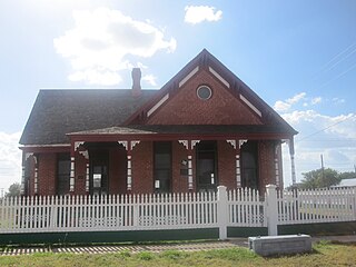
Baird is a city and the county seat of Callahan County, Texas, United States. Its population was 1,479 at the 2020 census. The city is named after Matthew Baird, the owner and director of the Texas and Pacific Railway. The railway depot is now operated as the visitor center and a transportation museum.
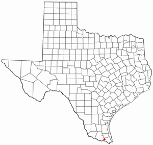
La Feria is a city in Cameron County, Texas, United States. Its population was 6,817 at the time of the 2020 census. It is part of the Brownsville–Harlingen–Raymondville, the Matamoros–Brownsville, and the McAllen–Edinburg–Mission metropolitan areas.

Dickens is a city in and the county seat of Dickens County, Texas, United States. The population was 219 at the 2020 census, down from 286 at the 2010 census.

Dublin is a city located in southwestern Erath County in Central Texas, United States. Its population was 3,359 at the 2020 census, down from 3,654 at the 2010 census.
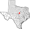
Hico is a small city located in Hamilton County in central Texas, United States. The population was 1,335 at the time of the 2020 census, down from 1,341 in the 2010 census. Over the years, it became a cattle and cotton market. Today, ranching and tourism dominate the local economy.
Channing is a town in Hartley County, Texas, in the United States. It is the county seat of Hartley County. As of the 2020 United States census, the town's population was 281.

Linn, formerly San Manuel-Linn, is a census-designated place (CDP) in Hidalgo County, Texas, United States. The population was 801 at the 2010 census, down from 958 at the 2000 census. It is part of the McAllen–Edinburg–Mission Metropolitan Statistical Area.

Jacksboro is a city in Jack County, Texas, in the United States. Its population was 4,184 at the 2020 census. U.S. Highways 281 and 380, and Texas State Highways 114 and 199 intersect at Jacksboro, which is the county seat of Jack County.

Jayton is a city in and the county seat of Kent County, Texas, United States. It is located in the northeastern portion of the county, and the population was 511 as of the 2020 census.

Benjamin is a city in and the county seat of Knox County, Texas, United States. Its population was 196 at the 2020 census, making it the least-populated county seat in Texas.

Lipscomb is an unincorporated community and census-designated place (CDP) in Lipscomb County, Texas, United States. It is the Lipscomb county seat. The population was 66 at the 2020 census.
Aransas Pass is a city in Aransas, Nueces, and San Patricio counties in Texas, United States. The population was 8,011 at the 2021 Census.

Evant is a town in Coryell and Hamilton counties in central Texas, United States. The population was 426 at the 2010 census. The Coryell County portion of Evant is part of the Killeen–Temple–Fort Hood Metropolitan Statistical Area.

Winnsboro is a city in Franklin and Wood counties in northeastern Texas, United States, north of Tyler. The population was 3,455 at the 2020 census. Settlement of Winnsboro began in the 1850s with a post office established between 1854 and 1855.

Gorman is a city in Eastland County, Texas, United States. Its population was 976 at the 2020 census, down from 1,083 at the 2010 census.