"},"elevation_ft":{"wt":"289"},"population_total":{"wt":"120511"},"population_as_of":{"wt":"[[2020 United States Census|2020]]"},"population_footnotes":{"wt":""},"pop_est_as_of":{"wt":""},"pop_est_footnotes":{"wt":""},"population_est":{"wt":""},"population_density_sq_mi":{"wt":"auto"},"population_density_km2":{"wt":"auto"},"population_urban":{"wt":"206,137 (US: [[List of United States urban areas|184th]]){{cite web |url=https://www.census.gov/programs-surveys/geography/guidance/geo-areas/urban-rural.html|title=List of 2020 Census Urban Areas|website=census.gov|publisher=United States Census Bureau|access-date=January 8, 2023}}"},"population_density_urban_sq_mi":{"wt":"auto"},"population_metro":{"wt":"268,248 (US: [[List of Metropolitan Statistical Areas|186th]])"},"demographics_type2":{"wt":"GDP"},"demographics2_footnotes":{"wt":"{{Cite web|title=Total Gross Domestic Product for Duluth, MN-WI (MSA)|url=https://fred.stlouisfed.org/series/NGMP20260|work=[[Federal Reserve Economic Data]] |publisher=[[Federal Reserve Bank of St. Louis]]}}"},"demographics2_title1":{"wt":"Metro"},"demographics2_info1":{"wt":"$18.181 billion (2022)"},"postal_code_type":{"wt":"[[ZIP code]]s"},"postal_code":{"wt":"77840-77845"},"area_code":{"wt":"[[Area code 979|979]]"},"website":{"wt":"{{URL|www.cstx.gov}}"},"footnotes":{"wt":"[[Image:CollegeStationLogo.JPG|200px]]"},"leader_title2":{"wt":"[[City Manager]]"},"leader_name2":{"wt":"Bryan Woods"},"timezone":{"wt":"[[North American Central Time Zone|CST]]"},"utc_offset":{"wt":"−6"},"timezone_DST":{"wt":"[[North American Central Time Zone|CDT]]"},"utc_offset_DST":{"wt":"−5"},"blank_name":{"wt":"[[Federal Information Processing Standard|FIPS code]]"},"blank_info":{"wt":"48-15976"},"blank1_name":{"wt":"[[Geographic Names Information System|GNIS]] feature ID"},"blank1_info":{"wt":"2410193{{GNIS|2410193}}"}},"i":0}}]}" id="mwBQ">City in Texas, United States
College Station, Texas | |
---|---|
Coordinates: 30°36′05″N96°18′52″W / 30.60139°N 96.31444°W | |
Country | United States |
State | Texas |
County | Brazos |
Incorporated | October 19, 1938 |
Government | |
• Type | Council-Manager |
• Mayor | John Nichols |
• City Council | Council members
|
• City Manager | Bryan Woods |
Area | |
51.30 sq mi (132.87 km2) | |
• Land | 51.16 sq mi (132.50 km2) |
• Water | 0.14 sq mi (0.37 km2) |
Elevation | 289 ft (88 m) |
Population (2020) | |
120,511 | |
• Density | 2,300/sq mi (910/km2) |
• Urban | 206,137 (US: 184th) [3] |
• Metro | 268,248 (US: 186th) |
GDP | |
• Metro | $18.181 billion (2022) |
Time zone | UTC−6 (CST) |
• Summer (DST) | UTC−5 (CDT) |
ZIP codes | 77840-77845 |
Area code | 979 |
FIPS code | 48-15976 |
GNIS feature ID | 2410193 [2] |
Website | www |
College Station is a city in Brazos County, Texas, United States, situated in East-Central Texas in the Brazos Valley, towards the eastern edge of the region known as the Texas Triangle. It is 83 miles (130 kilometers) northwest of Houston and 87 miles (140 km) east-northeast of Austin. As of the 2020 census, College Station had a population of 120,511. [5] College Station and Bryan make up the Bryan-College Station metropolitan area, the 15th-largest metropolitan area in Texas with 268,248 people as of 2020. [6]
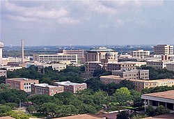
College Station is home to the main campus of Texas A&M University, the flagship institution of the Texas A&M University System. The city owes its name and existence to the university's location along a railroad. Texas A&M's triple designation as a land-grant university, National Sea Grant College Program, and National Space Grant College and Fellowship Program reflects the broad scope of the research endeavors it brings to the city, with ongoing projects funded by agencies such as NASA, the National Institutes of Health, the National Science Foundation, and the Office of Naval Research.
College Station's origins date from 1860, when the Houston and Texas Central Railway began to build through the region. [7] Eleven years later, the site was chosen as the location for the proposed Agricultural and Mechanical College of Texas, a land-grant school. [7] In 1876, as the nation celebrated its centennial, the school (renamed Texas A&M University in 1963) opened its doors as the first public institution of higher education in the state of Texas. [7]
College Station's population grew slowly, reaching 350 in 1884 and 391 at the turn of the century. [7] However, during this time, transportation improvements took place in the town. In 1900, the I&GN Railroad was extended to College Station [8] (the Missouri Pacific Railroad Company abandoned the line in 1965), [9] and 10 years later, electric interurban service was established between Texas A&M and the neighboring town of Bryan. [7] A city bus system replaced the interurban in the 1920s. [7]
In 1930, the community to the north of College Station, known as North Oakwood, was incorporated as part of Bryan. [7] College Station did not incorporate until October 19, 1938, after a 217-39 vote, [10] with John H. Binney as the first mayor. [7] Within a year, the city established a zoning commission, and by 1940, the population had reached 2,184. [7]
The city grew under the leadership of Ernest Langford, called by some the "Father of College Station", who began a 26-year stretch as mayor in 1942. Early in his first term, the city adopted a council-manager system of city government. [7]
Population growth accelerated following World War II as the nonstudent population reached 7,898 in 1950, 11,396 in 1960, 17,676 in 1970, 30,449 in 1980, 52,456 in 1990, and 67,890 in 2000. [7] The Bryan-College Station metropolitan area's population crossed 270,000 people in 2018.
In the 1990s, College Station and Texas A&M University drew national attention when the George Bush Presidential Library opened in 1997. Attention was drawn again in 1999, when 12 people were killed and 27 injured when the Aggie Bonfire collapsed while being constructed.
In 2022, it became one of the first areas served by Amazon's Prime Air drone delivery service, along with Lockeford, California.
College Station is south of the center of Brazos County at 30°36′5″N96°18′52″W / 30.60139°N 96.31444°W (30.601433, –96.314464). [11] It is bordered by the city of Bryan to the northwest.
According to the United States Census Bureau, the city has an area of 49.6 sq mi (128.5 km2), of which 49.4 sq mi (128.0 km2) is land and 0.19 sq mi (0.5 km2), or 0.35%, is covered by water. [12]
College Station has a humid subtropical climate (Köppen: Cfa). Winters are mild with periods of low temperatures usually lasting less than two months, while summers are hot and humid.
Snow and ice are rare; most recently, College Station received three to five inches of snowfall on February 15, 2021. [13]
Summers are hot and humid with occasional showers and thunderstorms being the only real variation in weather. [14]
Climate data for College Station, Texas (Easterwood Airport), 1991–2020 normals, [a] extremes 1882–present [b] | |||||||||||||
---|---|---|---|---|---|---|---|---|---|---|---|---|---|
Month | Jan | Feb | Mar | Apr | May | Jun | Jul | Aug | Sep | Oct | Nov | Dec | Year |
Record high °F (°C) | 90 (32) | 99 (37) | 96 (36) | 98 (37) | 101 (38) | 108 (42) | 111 (44) | 112 (44) | 112 (44) | 102 (39) | 94 (34) | 89 (32) | 112 (44) |
Mean maximum °F (°C) | 78.9 (26.1) | 82.0 (27.8) | 85.8 (29.9) | 89.4 (31.9) | 93.7 (34.3) | 97.9 (36.6) | 100.9 (38.3) | 102.8 (39.3) | 98.8 (37.1) | 92.9 (33.8) | 84.6 (29.2) | 79.9 (26.6) | 104.0 (40.0) |
Mean daily maximum °F (°C) | 61.7 (16.5) | 65.5 (18.6) | 72.5 (22.5) | 79.2 (26.2) | 86.3 (30.2) | 92.2 (33.4) | 95.4 (35.2) | 96.6 (35.9) | 91.2 (32.9) | 81.9 (27.7) | 71.1 (21.7) | 63.4 (17.4) | 79.8 (26.5) |
Daily mean °F (°C) | 51.5 (10.8) | 55.3 (12.9) | 62.1 (16.7) | 68.7 (20.4) | 76.4 (24.7) | 82.6 (28.1) | 85.1 (29.5) | 85.7 (29.8) | 80.6 (27.0) | 71.1 (21.7) | 60.4 (15.8) | 53.1 (11.7) | 69.4 (20.8) |
Mean daily minimum °F (°C) | 41.3 (5.2) | 45.1 (7.3) | 51.7 (10.9) | 58.1 (14.5) | 66.4 (19.1) | 73.0 (22.8) | 74.9 (23.8) | 74.7 (23.7) | 70.0 (21.1) | 60.2 (15.7) | 49.8 (9.9) | 42.8 (6.0) | 59.0 (15.0) |
Mean minimum °F (°C) | 25.1 (−3.8) | 28.6 (−1.9) | 33.1 (0.6) | 41.2 (5.1) | 52.4 (11.3) | 65.4 (18.6) | 70.3 (21.3) | 69.7 (20.9) | 57.4 (14.1) | 42.6 (5.9) | 32.1 (0.1) | 27.4 (−2.6) | 22.5 (−5.3) |
Record low °F (°C) | −3 (−19) | 1 (−17) | 17 (−8) | 28 (−2) | 42 (6) | 53 (12) | 58 (14) | 55 (13) | 41 (5) | 29 (−2) | 19 (−7) | 2 (−17) | −3 (−19) |
Average precipitation inches (mm) | 3.43 (87) | 2.90 (74) | 3.41 (87) | 2.87 (73) | 4.60 (117) | 4.01 (102) | 1.98 (50) | 3.10 (79) | 3.50 (89) | 4.93 (125) | 3.31 (84) | 3.71 (94) | 41.75 (1,061) |
Average precipitation days (≥ 0.01 in) | 9.0 | 8.5 | 8.1 | 7.2 | 7.8 | 7.8 | 5.3 | 6.3 | 7.1 | 7.2 | 8.3 | 9.3 | 91.9 |
Source: NOAA [16] [17] |
Northgate is a mixed-use district north of Texas A&M University that features a combination of businesses, restaurants, apartments, churches, and entertainment. It is known for its eclectic mix of restaurants and bars. [18] [19] A large portion of the stores, bars, and restaurants in Northgate are frequented, patronized, and staffed by Texas A&M students. [19] In total, the district spans about 145 acres (0.59 km2), bounded by Wellborn Road to the west, South College Avenue to the east, the College Station city limits to the north, and University Drive to the south. The district is the home of the Dixie Chicken.
Northgate's roots started in the 1930s as the city began enjoying rapid population growth from the influx of Texas A&M University students, professors, and their families. Realizing that proximity to the campus would be a boon for revenues, the first business district was established in College Station near the campus, taking its name for the closest on-campus landmark: the north gate. When the city was incorporated in 1938, its first City Hall was opened in the new district. In 1994, restoration efforts began to revitalize the ailing area. A four-day music festival, "North By Northgate", was introduced in 1998 and has become an annual tradition, renamed the "Northgate Music Festival" in 2002. In 2006, the city council incorporated Northgate as a special tax zone to finance additional improvements and expansions. [20]
Live music is a major draw to the Northgate area. Many well-known musicians, especially in the Texas country music scene, initially performed in the Northgate area. Notable names include Robert Earl Keen, Grammy award-winner Lyle Lovett, Dub Miller, and Roger Creager. The district is bisected to the north by Church Street, made famous by the Robert Earl Keen and Lyle Lovett duet "The Front Porch Song". [21]
Wolf Pen Creek District is a large commercial development adjacent to Post Oak Mall and between two of the city's main commercial thoroughfares: Earl Rudder Freeway and Texas Avenue. The area consists of a greenway with trails, a $1.5 million amphitheater and entertainment area, a small lake, the Spirit Ice Arena, and is the home of the Arts Council of the Brazos Valley. The amphitheater has hosted a variety of musical events, including the annual Starlight Music Series, a concert series that starts in late spring and runs through late summer. Wolf Pen also has a sidewalk for a scenic run that when completed is about 1 mi (2 km).
Wellborn became a community in 1867 as a construction camp on the Houston and Texas Central Railroad. The town's name has been attributed to a well at the construction camp, a foreman named E.W. Wellborn, or a landowner named W.W. Willburn. Also in 1867, a post office opened in the community under the name Wellborn Station. In 1870, the name was shortened to Wellborn. [22] On April 14, 2011, the City Council of College Station voted 5–2 to annex Wellborn, thus making the community the Wellborn district. Wellborn is often mispronounced as 'well-born' but is pronounced by locals as 'Well-burn'. [23]
Census | Pop. | Note | %± |
---|---|---|---|
1940 | 2,184 | — | |
1950 | 7,925 | 262.9% | |
1960 | 11,396 | 43.8% | |
1970 | 17,676 | 55.1% | |
1980 | 37,272 | 110.9% | |
1990 | 52,456 | 40.7% | |
2000 | 67,890 | 29.4% | |
2010 | 93,857 | 38.2% | |
2020 | 120,511 | 28.4% | |
U.S. Decennial Census [24] 1850–1900 [25] 1910 [26] 1920 [27] 1930 [28] 1940 [29] 1950 [30] 1960 [31] 1970 [32] 1980 [33] 1990 [34] 2000 [35] 2010 [36] |
Race / Ethnicity (NH = Non-Hispanic) | Pop 2000 [37] | Pop 2010 [38] | Pop 2020 [39] | % 2000 | % 2010 | % 2020 |
---|---|---|---|---|---|---|
White alone (NH) | 51,362 | 64,060 | 70,255 | 75.65% | 68.25% | 58.30% |
Black or African American alone (NH) | 3,647 | 6,161 | 9,479 | 5.37% | 6.56% | 7.87% |
Native American or Alaska Native alone (NH) | 161 | 247 | 280 | 0.24% | 0.26% | 0.23% |
Asian alone (NH) | 4,932 | 8,518 | 12,224 | 7.26% | 9.08% | 10.14% |
Pacific Islander alone (NH) | 36 | 36 | 117 | 0.05% | 0.04% | 0.10% |
Some Other Race alone (NH) | 107 | 149 | 475 | 0.16% | 0.16% | 0.39% |
Mixed race or Multiracial (NH) | 886 | 1,521 | 4,324 | 1.31% | 1.62% | 3.59% |
Hispanic or Latino (any race) | 6,759 | 13,165 | 23,357 | 9.96% | 14.03% | 19.38% |
Total | 67,890 | 93,857 | 120,511 | 100.00% | 100.00% | 100.00% |
As of the 2020 United States census, there were 120,511 people, 41,682 households, and 20,487 families residing in the city.
As of the census of 2000, 67,890 people, 24,691 households, and 10,370 families resided in the city. Of the 24,691 households, 21.0% had children under the age of 18 living with them, 32.2% were married couples living together, 6.8% had a female householder with no husband present, and 58.0% were not families. About 27.1% of all households were made up of individuals, and 2.4% had someone living alone who was 65 years of age or older. The average household size was 2.32 and the average family size was 2.98. The racial makeup of the city as of 2019 was 77.45% White, 7.74% African American, 0.30% Native American, 10.25% Asian, 0.08% Pacific Islander, 6.32% from other races, and 2.3% from two or more races. Hispanic or Latino of any ethnicity/nationality were 15.6% of the population.
In the city, the population was distributed as 14.4% under the age of 18, 51.2% from 18 to 24, 21.3% from 25 to 44, 9.4% from 45 to 64, and 3.6% who were 65 years of age or older. The median age was 22 years. For every 100 females, there were 104.3 males. For every 100 females age 18 and over, there were 104.0 males.
Data from the ACS 1-year estimates indicates that the median income for a household in College Station was $47,632, [40] a decrease from $52,397 reported in the 2020 census. [41] According to Forbes, approximately 28.5% of the population lived below the poverty line in 2021, [42] including 16.4% of those under age 18 and 7.7% of those aged 65 or older. The ACS 1-year estimates suggest this percentage may be as high as 30.2%, [40] the highest poverty rate among U.S. cities with populations over 100,000. [42] However, this statistic is likely impacted by the fact that Texas A&M University has the largest student enrollment in the U.S.. The U.S. Census Bureau has noted that "both in small counties with a large university and in large counties with multiple universities, the presence of college students who live off campus raises the community’s poverty rate." [43]
The city of College Station has a council-manager form of government. Voters elect the members of a city council, who pass laws and make policy. The council hires a professional city manager who is responsible for day-to-day operations of the city and its public services. [44]
The Texas Department of Criminal Justice (TDCJ) operates the Bryan District Parole Office in College Station. [45]
The United States Postal Service operates the College Station and Northgate College Station post offices. [46] [47]
As of May 2008, the local unemployment hovered around 3 to 4%, among the lowest in Texas. This rate is largely attributed to the significant role the university plays in the local economy. [48] [49] However, underemployment is an ongoing issue. [50]
Post Oak Mall was the city's first mall and is currently the largest mall in the Brazos Valley. The 82-acre (330,000 m2) mall is home to 125 stores; its opening on February 17, 1982, helped create the impetus for growing economic and commercial developments for College Station. [52] It is currently the largest taxpayer in College Station and the second-largest in the Brazos Valley, though the anchor stores are free-standing units that are privately owned and taxed separate from the mall proper. [53] Over 75% of retail sales in the Brazos Valley come from sales at the mall's stores. [52]
Two full power local commercial television stations included CBS affiliate KBTX-TV (which also includes subchannels affiliated with CW and Telemundo) and MyNetworkTV affiliate KYLE-TV which also airs Fox programming (via Waco-based KWKT-TV) on its second digital subchannel. Low power television stations KAGS-LD and KRHD-CD respectively air programming from NBC (via Temple-based KCEN-TV) and ABC (via Waco-based KXXV). PBS member station KAMU, which is owned by Texas A&M University, is also based in College Station.
College Station is part of the Bryan-College Station Arbitron market #238.
The service area of Blinn College includes all of Brazos County. [56] Blinn operates a campus in nearby Bryan. [57]
Almost all of College Station is within the College Station Independent School District, while small sections are in Bryan Independent School District. [58] College Station ISD operates two high schools: A&M Consolidated High School and College Station High School.
Students living in the portion of Bryan ISD located in the City of College Station are zoned for: Stephen F. Austin Middle School, [59] and Bryan High School. [60]
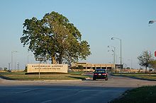
Easterwood Airport, owned by Texas A&M, is located 3 miles (4.8 km) southwest of the center of College Station and has flights to Dallas/Fort Worth International Airport.
The following people have lived or are currently living in College Station:
Washington County is a county in Texas. As of the 2020 census, the population was 35,805. Its county seat is Brenham, which is located along U.S. Highway 290, 72 miles northwest of Houston. The county was created in 1835 as a municipality of Mexico and organized as a county in 1837. It is named for George Washington, the first president of the United States.
Robertson County is a county in the U.S. state of Texas. As of the 2020 census, its population was 16,757. Its county seat is Franklin. The county was created in 1837 and organized the following year. It is named for Sterling C. Robertson, an early settler who signed the Texas Declaration of Independence.
Burleson County is a county located in the U.S. state of Texas. As of the 2020 census, the population was 17,642. Its county seat is Caldwell. The county is named for Edward Burleson, a general and statesman of the Texas Revolution.
Brazos County is a county in the U.S. state of Texas. As of the 2020 census, its population was 233,849. The county seat is Bryan. Along with Brazoria County, the county is named for the Brazos River, which forms its western border. The county was formed in 1841 and organized in 1843.
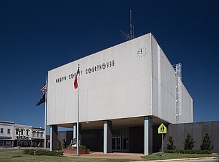
Austin County is a rural, agricultural dominated county in the U.S. state of Texas. As of the 2020 census, the population was 30,167. Its seat is Bellville. The county and region was settled primarily by German emigrants in the 1800s.
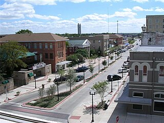
Bryan is a city in and the county seat of Brazos County, Texas, United States. It is located in the heart of the Brazos Valley. As of the 2020 census, the city had a population of 83,980. Bryan borders the city of College Station, which lies to its south. Together they make up the Bryan-College Station metropolitan area, the 15th-largest metropolitan area in Texas with 268,248 people as of 2020.
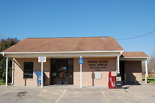
Millican is an unincorporated community and former municipality in Brazos County, Texas, United States. The population was 240 at the 2010 census, up from 108 at the 2000 census. It is part of the Bryan–College Station metropolitan area. Millican is named after Robert Millican, the first white settler of the region that would come to be known as Brazos County.
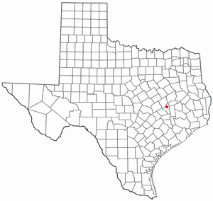
Wixon Valley is a city in Brazos County, Texas, United States. The population was 228 at the 2020 census. It is part of the Bryan-College Station metropolitan area.
Navasota is a city primarily in Grimes County, Texas, United States. The population was 7,643 at the 2020 census. In 2005, the Texas Legislature designated Navasota as the "Blues Capital of Texas" in honor of the late Mance Lipscomb, a Navasota native and blues musician. Technically, a sliver of Navasota is in Brazos County, which is part of the Bryan-College Station Metropolitan area.
Brookshire is a city in Waller County, Texas, United States, with a population of 5,066 as of the 2020 census.
Prairie View is a city in Waller County, Texas, United States, situated on the northwestern edge of the Houston–The Woodlands–Sugar Land metropolitan area. The population was 8,184 at the 2020 census.
Waller is a city in Harris and Waller counties in Texas, United States, that is within the Houston–Cypress metropolitan area. Its population was 2,682 at the 2020 U.S. census. The Waller area is located along U.S. Route 290 41 miles (66 km) northwest of downtown Houston.
Blinn College is a public junior college in Brenham, Texas, with additional campuses in Bryan, Schulenburg, Sealy and Waller. Brenham is Blinn's original and main campus, with housing and athletics.
Kurten is a town located along U.S. Highway 190 in Brazos County, Texas, United States. As of the 2020 census, it had a population of 395. It was incorporated in 2000 and is part of the Bryan–College Station metropolitan area.
College Station Independent School District is a public school district based in College Station, Texas (USA).
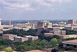
Bryan–College Station is a metropolitan area centering on the twin cities of Bryan and College Station, Texas, in the Brazos Valley region of Texas. The 2010 census placed the population of the three-county metropolitan area at 255,519. The 2019 population estimate was 273,101.
The campus of Texas A&M University, also known as Aggieland, is situated in College Station, Texas, United States. Texas A&M is centrally located within 200 miles (320 km) of three of the 10 largest cities in the United States and 75% of the Texas and Louisiana populations. Aggieland's major roadway is State Highway 6, and several smaller state highways and Farm to Market Roads connect the area to larger highways such as Interstate 45.
Post Oak Mall is a regional shopping mall in College Station, Texas, United States, owned by CBL & Associates Properties. Construction on the mall began in summer 1979 and it opened February 17, 1982. It initially housed 80 stores with four anchors. A second phase, planned before the mall even opened, was completed in 1985, adding more floor space and bringing the mall up to 125 stores and six anchor stores. As of 2015, it also houses a small food court and two restaurants. The anchor stores are two Dillard's stores, JCPenney, and Conn's. There are two vacant anchor stores that were once Gordmans and Macy's.
Wellborn is an unincorporated community in Brazos County, Texas, United States. According to the Handbook of Texas, the community had an estimated population of 100 in 2000. It is part of the Bryan–College Station Metropolitan Statistical Area.
Lake Bryan is a census-designated place (CDP) in Brazos County, Texas, United States, situated around a reservoir of the same name managed by Bryan Texas Utilities. The population was 2,060 at the 2020 census. It is part of the Bryan–College Station metropolitan area.
{{cite news}}
: CS1 maint: unfit URL (link){{cite news}}
: CS1 maint: unfit URL (link){{cite web}}
: CS1 maint: unfit URL (link){{cite news}}
: CS1 maint: unfit URL (link)