Mission, Texas

Last updated • 6 min readFrom Wikipedia, The Free Encyclopedia

Mission
Mission,TX.jpg
Mission, Texas
Motto: 
Home Of The Grapefruit
Hidalgo County Mission.svg
Location of Mission, Texas
Coordinates: 26°12′41″N98°19′17″W / 26.21139°N 98.32139°W / 26.21139; -98.32139
CountryUnited States
State Texas
County Hidalgo
Founded1907
Incorporated 1910 [1]
Government
  Type Council-manager
   City council Mayor Norie Gonzalez Garza
Jessica Ortega Ochoa
Ruben Plata
Jose Alberto Vela
Abiel Flores
   City manager Mike Perez
Area
[2]
   City
36.39 sq mi (94.26 km2)
  Land36.34 sq mi (94.11 km2)
  Water0.07 sq mi (0.18 km2)
Elevation
[3]
141 ft (43 m)
Population
 (2020) [4]
   City
85,778
  Estimate 
(2022) [5]
86,635
  RankUS: 403rd
TX: 46th
  Density2,384/sq mi (920.6/km2)
   Urban
779,553 (US: 56th)
  Urban density2,389.7/sq mi (922.7/km2)
   Metro
888,367 (US: 65th)
Time zone UTC–6 (Central (CST))
  Summer (DST) UTC–5 (CDT)
ZIP codes
78503, 78572, 78573, 78174
Area code 956
Sales tax 8.25% [6]
GNIS feature ID1341738 [3]
Website missiontexas.us

Mission is a city in Hidalgo County, in the US state of Texas, United States. The population was 85,778 at the 2020 census [4] and an estimated 86,635 in 2022. [5] Mission is part of the McAllen–Edinburg–Mission and Reynosa–McAllen metropolitan areas.

Contents

Geography

Mission in 1933 Texas - Mission through Nixon - NARA - 68149606 (cropped).jpg
Mission in 1933

Mission is in southern Hidalgo County. It is bordered to the east by McAllen, the largest city in the county, to the north by Palmhurst, to the west by Palmview, and to the south by the Mexico–United States border along the Rio Grande.

The Interstate 2/U.S. Route 83 freeway passes through Mission, south of the center of town. The highway leads east 5 miles (8 km) to downtown McAllen and 41 miles (66 km) to Harlingen. Interstate 2 ends 7 miles (11 km) west of Mission; US 83 leads west 34 miles (55 km) to Rio Grande City.

According to the United States Census Bureau, Mission has a total area of 34.1 square miles (88.2 km2), of which 0.1 square miles (0.2 km2), or 0.20%, is covered by water.

Demographics

Historical population
CensusPop.Note
1920 3,847
1930 5,12033.1%
1940 5,98216.8%
1950 2,940−50.9%
1960 14,081378.9%
1970 13,043−7.4%
1980 22,58973.2%
1990 31,10037.7%
2000 45,40846.0%
2010 77,05869.7%
2020 85,77811.3%
2022 (est.)86,635 [5] 1.0%
U.S. Decennial Census [7]
2020 Census [4]

2020 census

Mission city, Texas – Racial and ethnic composition
Note: the US Census treats Hispanic/Latino as an ethnic category. This table excludes Latinos from the racial categories and assigns them to a separate category. Hispanics/Latinos may be of any race.
Race / Ethnicity (NH = Non-Hispanic)Pop 2000 [8] Pop 2010 [9] Pop 2020 [10] % 2000% 2010% 2020
White alone (NH)8,0339,4657,62517.69%12.28%8.89%
Black or African American alone (NH)1153213490.25%0.42%0.41%
Native American or Alaska Native alone (NH)3771510.08%0.09%0.06%
Asian alone (NH)2661,1351,2320.59%1.47%1.44%
Pacific Islander alone (NH)211150.00%0.01%0.02%
Some Other Race alone (NH)13571900.03%0.07%0.22%
Mixed race or Multiracial (NH)1481863600.33%0.24%0.42%
Hispanic or Latino (any race)36,79465,81275,95681.03%85.41%88.55%
Total45,40877,05885,778100.00%100.00%100.00%

As of the census of 2020, there were 85,778 people, 25,172 households, and 20,139 families were residing in the city.

2010 census

As of the census of 2010, there were 77,058 people, _ households, and _ families resided in the city.

2000 census

As of the census of 2000, there were 45,408 people, 13,766 households, and 11,384 families resided in the city. The population density was 1,881.9 inhabitants per square mile (726.6/km2). The 17,723 housing units had an average density of 734.5 per square mile (283.6/km2). The racial makeup of the city was 77.63% White, 0.37% African American, 0.38% Native American, 1.63% Asian, 18.65% from other races, and 2.34% from two or more races. Hispanics or Latinos of any race were 81.03% of the population.

Of the 13,766 households, 43.4% had children under 18 living with them, 64.8% were married couples living together, 14.5% had a female householder with no husband present, and 17.3% were not families; 15.3% of all households were made up of individuals, and 9.1% had someone living alone who was 65 or older. The average household size was 3.29, and the average family size was 3.68.

In the city, the age distribution was 32.1% under 18, 9.8% from 18 to 24, 26.8% from 25 to 44, 17.1% from 45 to 64, and 14.2% who were 65 or older. The median age was 30 years. For every 100 females, there were 91.1 males. For every 100 females 18 and over, there were 85.3 males.

The median income for a household in the city was $30,647, and the median income for a family was $33,465. Males had a median income of $25,710 versus $20,718 for females. The per capita income for the city was $12,796. About 22.6% of families and 26.8% of the population were below the poverty line, including 37.4% of those under age 18 and 15.6% of those age 65 or over.

The United States Postal Service operates in the city of Mission. [11] Local zip codes include 78571, 78572, 78573, and 78574.

Economy

Mission shares the same economic growth that nearby McAllen is experiencing. The Mission Economic Development Corporation promotes development in the area. [12]

The city has been advertised as the "Home of the Ruby Red Grapefruit" since 1921, due to the fruit being commonly grown in the area. [13] The city is also home to the Texas Citrus Exchange. The city holds the annual Texas Citrus Fiesta Parade along Conway Avenue, which features fruit-decorated floats, bands, law enforcement agencies, fire departments, and many local and city government officials.

Moore Air Force Base (deactivated) is located 15 miles (24 km) north of the city. It is the location of the First Lift Station of the Mission Canal Company that once irrigated 15,000 acres (61 km2) of farmland in the Rio Grande Valley.

Education

Primary and secondary schools

Most of Mission is a part of the Mission Consolidated Independent School District. Other portions extend into the La Joya Independent School District and the Sharyland Independent School District. [14]

Mission CISD operates Mission High School and Veterans Memorial High School. [15] Sharyland ISD Mission is divided between Sharyland High School and Sharyland Pioneer High School. [16] LJISD Mission is zoned to Palmview High School. [17]

In addition, South Texas Independent School District operates magnet schools that serve the community.

Mission is also the site of San Juan Diego Academy, a Catholic high school operated by the Roman Catholic Diocese of Brownsville.

Public libraries

The Speer Memorial Library serves Mission. [18] The facility has 48,760 square feet (4,530 m2) of space. [19]

The library originated in March 1914, when the Civic League of Mission was formed to maintain a park and form a library. The first library board included officers from the civic league. In 1929, the city of Mission passed an ordinance making the library a part of the city government. In 1930, the library was in a room in the First National Bank. Later, it moved to the Mission City Hall. From the early 1930s until 1947, the city library shared facilities with the school library. By 1960, it outgrew the building it had occupied. In 1976, Juanita Speer Farley donated the deed to her property to the city. A new library, designed by Warren Suter, an architect from Mission, was constructed in 1976 and 1977. The official completion date of the 14,000 square feet (1,300 m2) library was June 1, 1977. An addition in 1988 increased the library's area to 18,660 square feet (1,734 m2). An additional expansion of 30,100 square feet (2,800 m2), designed by architect TAG International, LLP, and constructed by Velasco Construction, was scheduled to be completed in March 2005, and the renovation of the older portions of the library was scheduled to begin afterwards. [19]

Media

Radio

Notable people

Sister cities

See also

Related Research Articles

<span class="mw-page-title-main">Webb County, Texas</span> County in Texas, United States

Webb County is a county located in the U.S. state of Texas. As of the 2020 census, its population was 267,114. Its county seat is Laredo. The county was named after James Webb (1792–1856), who served as secretary of the treasury, secretary of state, and attorney general of the Republic of Texas, and later judge of the United States District Court following the admission of Texas to statehood. By area, Webb County is the largest county in South Texas and the sixth-largest in the state. Webb County comprises the Laredo metropolitan area. Webb County is the only county in the United States to border three foreign states or provinces, sharing borders with Coahuila, Nuevo Leon, and Tamaulipas.

<span class="mw-page-title-main">Victoria County, Texas</span> County in Texas, United States

Victoria County is a county located in the U.S. state of Texas. As of the 2020 census, its population was 91,319. Its county seat is also named Victoria. Victoria County is included in the Victoria, TX Metropolitan Statistical Area, and comprises the entirety of the Victoria, TX media market.

<span class="mw-page-title-main">Hidalgo County, Texas</span> County in Texas, United States

Hidalgo County is located in the U.S. state of Texas. As of the 2020 census, its population was 870,781, making it the ninth-most populous county in Texas, and the most populous county outside of the counties in the Texas Triangle. The county seat is Edinburg and the largest city is McAllen. The county is named for Miguel Hidalgo y Costilla, the priest who raised the call for Mexico's independence from Spain. It is located in the Rio Grande Valley of South Texas and is one of the fastest-growing counties in the United States. Hidalgo County is designated by the U.S. Census Bureau as the McAllen–Edinburg–Mission metropolitan statistical area, which itself is part of the McAllen-Edinburg-Mission-Rio Grande City, Texas combined statistical area with neighboring Starr County.

<span class="mw-page-title-main">Cameron County, Texas</span> County in Texas, United States

Cameron County, officially the County of Cameron, is the southernmost county in the U.S. state of Texas. As of the 2020 census, its population was 421,017. Its county seat is Brownsville.

<span class="mw-page-title-main">Leon Valley, Texas</span> City in Texas, United States

Leon Valley is a city in Bexar County, Texas, United States. It is an enclave on the northwestern side of San Antonio and is part of the San Antonio-New Braunfels metropolitan statistical area. Its population was 11,542 at the 2020 census. Leon Valley is an independent municipality surrounded by the city of San Antonio.

<span class="mw-page-title-main">Port Isabel, Texas</span> City in Texas, United States

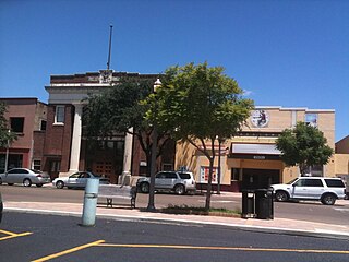
Port Isabel is a city in Cameron County, Texas, United States. It is part of the Brownsville–Harlingen–Raymondville and the Matamoros–Brownsville metropolitan areas. The population was 5,028 at the 2020 census.

Alamo, located in the Rio Grande Valley in what is nicknamed the "Land of Two Summers", is a city in the irrigated area of southern Hidalgo County, Texas, United States. Known as the "Refuge to the Valley", it is located in an area of abundant vegetable farming and citrus groves, and is a noted winter resort/retirement town near the Mexico–U.S. border. Alamo is one of the Rio Grande Valley's gateways to Mexico, via U.S. Route 281 and Nuevo Progreso, Tamaulipas, as well as a gateway to the Santa Ana National Wildlife Refuge. Alamo's population was 19,493 at the 2020 census.

Alton is a city in Hidalgo County, Texas, United States. The population was 18,198 at the 2020 census.

Alton North is a former census-designated place (CDP) in Hidalgo County, Texas, United States. The population was 5,051 at the 2000 census. It is part of the McAllen–Edinburg–Mission Metropolitan Statistical Area.

<span class="mw-page-title-main">Hidalgo, Texas</span> City in Texas, United States

Hidalgo is a city in Hidalgo County, Texas, United States. The population was 11,198 at the 2010 census, and in 2019 the estimated population was 14,183.

<span class="mw-page-title-main">Mercedes, Texas</span> City in Texas, United States

Mercedes is a U.S. city in Hidalgo County, Texas. The population was 15,570 at the 2010 census. It is part of the McAllen–Edinburg–Mission and Reynosa–McAllen metropolitan areas.

<span class="mw-page-title-main">Palmhurst, Texas</span> City in Texas

Palmhurst is a city in Hidalgo County, Texas, United States. The population was 2,607 at the 2010 United States Census. It is part of the McAllen–Edinburg–Mission and Reynosa–McAllen metropolitan areas.

<span class="mw-page-title-main">Pharr, Texas</span> City in Texas

Pharr is a city in Hidalgo County, Texas, United States. As of the 2020 census, the city population was 79,715, and in 2022, the estimated population was 80,187. Pharr is connected by bridge to the Mexican city of Reynosa, Tamaulipas. Pharr is part of the McAllen–Edinburg–Mission and Reynosa–McAllen metropolitan areas.

<span class="mw-page-title-main">Progreso, Texas</span> City in Texas, United States

Progreso is a city in Hidalgo County, Texas, United States. The population was 5,507 at the time of the 2010 United States Census. It is part of the McAllen–Edinburg–Mission and Reynosa–McAllen metropolitan areas.

<span class="mw-page-title-main">Progreso Lakes, Texas</span> City in Texas

Progreso Lakes is a city in Hidalgo County, Texas, United States. The population was 240 at the 2010 United States Census. The city, incorporated in 1979, is centered on Lion and Moon Lakes, two resacas or ox-bow lakes.

<span class="mw-page-title-main">San Juan, Texas</span> City in Texas

San Juan is a city in Hidalgo County, Texas, United States. As of the 2020 census the population was 35,294, an increase over the figure of 33,856 tabulated in 2010. It is part of the McAllen–Edinburg–Mission and Reynosa–McAllen metropolitan areas.

<span class="mw-page-title-main">West Sharyland, Texas</span> Census-designated place in Texas

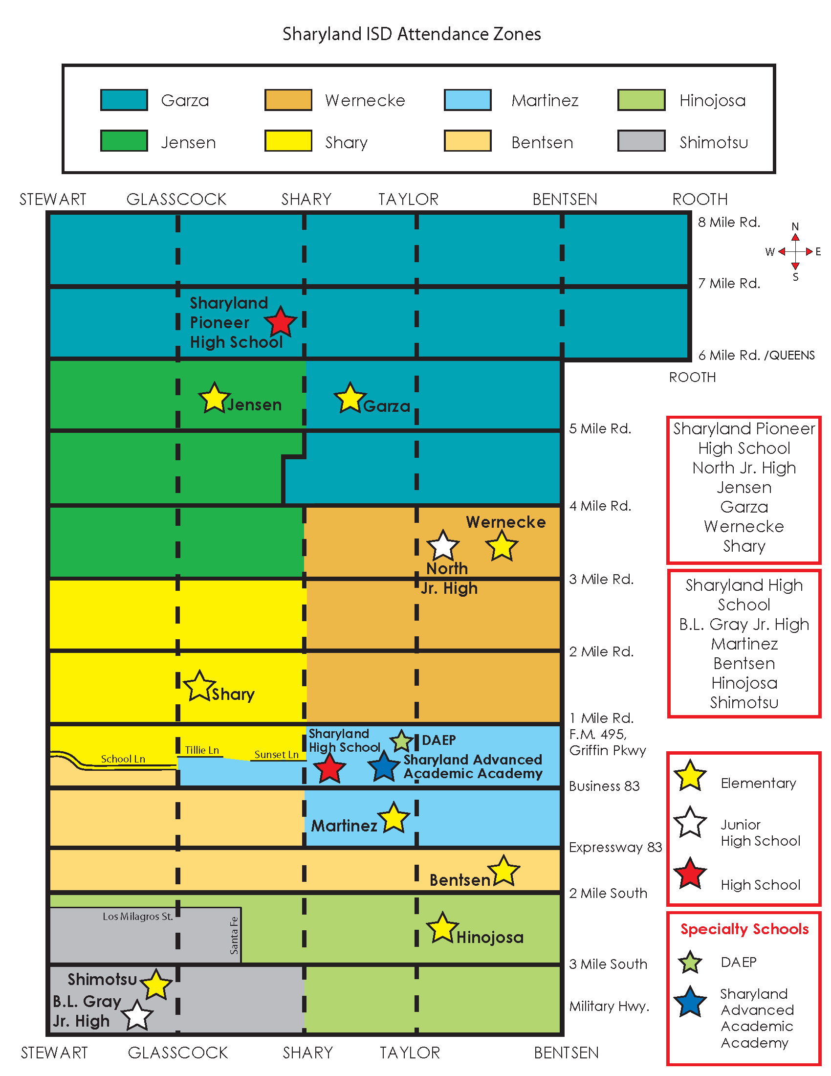
West Sharyland is a census-designated place (CDP) in Hidalgo County, Texas, United States. The population was 2,004 at the 2020 United States Census. It is part of the McAllen–Edinburg–Mission Metropolitan Statistical Area.

<span class="mw-page-title-main">Escobares, Texas</span> City in Texas, United States

Escobares is a city in Starr County, Texas, United States. The population was 2,588 at the 2020 census. The city was formed in 2005 from part of the deleted Escobares CDP, and parts of Garceno, and North Escobares CDPs, and additional area. Prior to its 2005 incorporation as a city, it was a census-designated place (CDP). The population of the CDP was 1,954 at the 2000 census.

<span class="mw-page-title-main">Zapata, Texas</span> CDP in Texas, United States

Zapata is a census-designated place (CDP) in and the county seat of Zapata County, Texas, United States. The population was 5,383 at the 2020 census. As an unincorporated community, Zapata has no municipal government, but like all 254 Texas counties has four elected county commissioners chosen by single-member districts and a countywide elected administrative judge.

<span class="mw-page-title-main">Greater San Antonio</span> Metropolitan statistical area in Texas, United States

Greater San Antonio, officially designated San Antonio–New Braunfels, is an eight-county metropolitan area in the U.S. state of Texas defined by the Office of Management and Budget (OMB). The metropolitan area straddles South Texas and Central Texas and is on the southwestern corner of the Texas Triangle. The official 2020 U.S. census showed the metropolitan area's population at 2,558,143—up from a reported 1,711,103 in 2000—making it the 24th largest metropolitan area in the United States. Downtown Austin and Downtown San Antonio are approximately 80 miles (129 km) apart, and both fall along the Interstate 35 corridor. This combined metropolitan region of San Antonio–Austin has approximately 5 million people.

References

  1. "History of Mission". City of Mission.
  2. "2020 U.S. Gazetteer Files". United States Census Bureau. Retrieved July 24, 2022.
  3. 1 2 U.S. Geological Survey Geographic Names Information System: Mission, Texas
  4. 1 2 3 "Explore Census Data". United States Census Bureau . Retrieved December 17, 2023.
  5. 1 2 3 "City and Town Population Totals: 2020-2022". United States Census Bureau. December 17, 2023. Retrieved December 17, 2023.
  6. "Mission (TX) sales tax rate" . Retrieved November 10, 2022.
  7. "U.S. Decennial Census". U.S. Census Bureau. Retrieved June 4, 2015.
  8. "P004: Hispanic or Latino, and Not Hispanic or Latino by Race – 2000: DEC Summary File 1 – Mission city, Texas". United States Census Bureau.
  9. "P2: Hispanic or Latino, and Not Hispanic or Latino by Race – 2010: DEC Redistricting Data (PL 94-171) – Mission city, Texas". United States Census Bureau.
  10. "P2: Hispanic or Latino, and Not Hispanic or Latino by Race – 2020: DEC Redistricting Data (PL 94-171) – Mission city, Texas". United States Census Bureau.
  11. "Post Office Location - MISSION Archived May 16, 2010, at the Wayback Machine ." United States Postal Service. Retrieved on May 9, 2010.
  12. Hennessy-Fiske, Molly (February 8, 2019). "A border fence could seal off this tiny Texas chapel, but its worshipers aren't giving up". Los Angeles Times . Retrieved February 16, 2019.
  13. "Home of the Grapefruit (Mission slogan)".
  14. "SCHOOL DISTRICT REFERENCE MAP (2010 CENSUS): Hidalgo County, TX." U.S. Census Bureau. Retrieved on August 2, 2018.
  15. "Mission CISD School Zones." Mission Consolidated Independent School District. Retrieved on August 2, 2018. See HTML version. Junior-high boundaries are determined by the elementary school zoning, with some optional exceptions, while high school boundaries are described by text.
  16. Attendance boundary map. Sharyland Independent School District. Retrieved on August 2, 2018. See also simplified map which also has a chart stating which elementary schools feed into which secondary schools.
  17. "High School Zones 2017-2018 Archived September 16, 2018, at archive.today ." La Joya Independent School District. Retrieved on September 16, 2018.
  18. "Welcome to the Speer Memorial Library." City of Mission. Retrieved on May 9, 2010.
  19. 1 2 "About the Library." Speer Memorial Library. Retrieved on May 9, 2010.
  20. "Aldine thrashes mission 54-21 despite Detmer's 364 yards". December 9, 1990. ProQuest   256140979.{{cite journal}}: Cite journal requires |journal= (help)
  21. Rocha, IV, Samuel (June 11, 2024). "Rio Grande Valley chef named 'Best Chef in Texas' during James Beard Awards". NPR . Retrieved June 12, 2024.
  22. "During their stay in Mission, City Leaders from Mission's Sister Cities, took a tour of our great City" . Retrieved January 15, 2025.
  23. "Homepage". www.oem.com.mx. Retrieved March 18, 2018.
  24. http://www.interdiario.info/?p=62596/%5B‍%5D
  25. 1 2 3 4 "Teotihuacan en línea: Álvaro Sánchez Mendoza, Presidente Municipal de Teotihuacan asistió al Segundo Encuentro Nacional de Municipios Turísticos". Archived from the original on March 11, 2016. Retrieved February 12, 2018.
  26. "As part of Mission's Cinco De Mayo celebrations, the City of Mission held a special event signing with its newest Sister City of General Terán, Nuevo León, Mexico. - City of Mission". missiontexas.us. Retrieved March 18, 2018.
  27. "The City of Mission signed Sister City Agreements on Saturday, October 21st, with Almolonga, Guatemala" . Retrieved January 15, 2025.