
Hidalgo County is located in the U.S. state of Texas. The county seat is Edinburg and the largest city is McAllen. The county is named for Miguel Hidalgo y Costilla, the priest who raised the call for Mexico's independence from Spain. It is located in the Rio Grande Valley of South Texas and is one of the fastest-growing counties in the United States. As of the 2020 census, its population was 870,781, making it the ninth-most populous county in Texas, and the most populous county outside of the counties in the Texas Triangle. Hidalgo County is designated by the U.S. Census Bureau as the McAllen–Edinburg–Mission metropolitan statistical area, which itself is part of the McAllen-Edinburg-Mission-Rio Grande City, Texas combined statistical area with neighboring Starr County.
Alamo, located in the Rio Grande Valley in what is nicknamed the "Land of Two Summers", is a city in the irrigated area of southern Hidalgo County, Texas, United States. Known as the "Refuge to the Valley", it is located in an area of abundant vegetable farming and citrus groves, and is a noted winter resort/retirement town near the Mexico–U.S. border. Alamo is one of the Rio Grande Valley's gateways to Mexico, via U.S. Route 281 and Nuevo Progreso, Tamaulipas, as well as a gateway to the Santa Ana National Wildlife Refuge. Alamo's population was 19,493 at the 2020 census.

César Chávez is a census-designated place (CDP) in Hidalgo County, Texas, United States. The population was 1,929 at the 2010 United States Census. It is part of the McAllen–Edinburg–Mission Metropolitan Statistical Area.

Citrus City is a census-designated place (CDP) in Hidalgo County, Texas, United States. The population was 3,291 at the 2020 census. It is part of the McAllen–Edinburg–Mission Metropolitan Statistical Area. The town was founded in 1943 during World War II by Howard Moffitt, a builder known for his vernacular Moffitt cottage architectural style, as part of a planned regional orange and grapefruit growing community. The local irrigation system proved to be too saline for fruit production, and the plans for a large town were revised. A few Moffitt houses survive in Citrus City.

Doolittle is a census-designated place (CDP) in Hidalgo County, Texas, United States. The population was 4,061 at the 2020 United States Census. It is part of the McAllen–Edinburg–Mission Metropolitan Statistical Area.

Faysville is a former census-designated place (CDP) in Hidalgo County, Texas. It was annexed into the city of Edinburg in 2015. The population was 439 at the 2010 United States Census. It is part of the McAllen–Edinburg–Mission Metropolitan Statistical Area.
La Blanca is a census-designated place (CDP) in Hidalgo County, Texas, United States. The population was 2,078 at the 2020 United States Census. It is part of the McAllen–Edinburg–Mission Metropolitan Statistical Area.

North Alamo is a census-designated place (CDP) in Hidalgo County, Texas, United States. The population was 3,722 at the 2020 United States Census. It is part of the McAllen–Edinburg–Mission Metropolitan Statistical Area.

Murillo, previously recorded as Nurillo, is a census-designated place (CDP) in Hidalgo County, Texas, United States. The population was 9,158 at the 2020 census. It is part of the McAllen–Edinburg–Mission Metropolitan Statistical Area.

Pharr is a city in Hidalgo County, Texas, United States. As of the 2020 census, the city population was 79,715, and in 2022, the estimated population was 80,187. Pharr is connected by bridge to the Mexican city of Reynosa, Tamaulipas. Pharr is part of the McAllen–Edinburg–Mission and Reynosa–McAllen metropolitan areas.

San Carlos is a community and census-designated place (CDP) in Hidalgo County, Texas. The population was 3,087 at the 2020 United States Census. It is part of the McAllen–Edinburg–Mission Metropolitan Statistical Area.

San Juan is a city in Hidalgo County, Texas, United States. As of the 2020 census the population was 35,294, an increase over the figure of 33,856 tabulated in 2010. It is part of the McAllen–Edinburg–Mission and Reynosa–McAllen metropolitan areas.

Linn, formerly San Manuel-Linn, is a census-designated place (CDP) in Hidalgo County, Texas, United States. The population was 801 at the 2010 census, down from 958 at the 2000 census. It is part of the McAllen–Edinburg–Mission Metropolitan Statistical Area.
Pharr-San Juan-Alamo Independent School District is a public school district based in Pharr, Texas (U.S.) in the Rio Grande Valley.
Pharr-San Juan-Alamo (PSJA) Early College High School is a public school in San Juan, Texas. It is part of the Pharr-San Juan-Alamo Independent School District and is one of the district's six high schools. It educates over 2,500 students.
Pharr-San Juan-Alamo North Early College High School is a public school in Pharr, Texas. It is part of the Pharr-San Juan-Alamo Independent School District and is one of the district's six high schools.

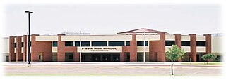
Edinburg High School (EHS) is a comprehensive public high school in Murillo, a census-designated place in Hidalgo County, Texas, east of Edinburg. It is operated by the Edinburg Consolidated Independent School District along with Edinburg North High School, Robert Vela High School, and Johnny G. Economedes High School. It has enrolled 2,927 students and 175 staff, with 35% holding advanced degrees; its enrollment is 95% Hispanic, 4% White, and 1% Asian/Pacific Islander.
Hargill is a census-designated place (CDP) in Hidalgo County, Texas, United States. As of the 2010 United States Census, it had a population of 877.
Harding Gill Tract is an unincorporated community and census-designated place (CDP) in Hidalgo County, Texas, United States. It was first listed as a CDP prior to the 2020 census.
La Coma Heights is an unincorporated community and census-designated place (CDP) in Hidalgo County, Texas, United States. It was first listed as a CDP prior to the 2020 census.


