
Grimes County is a county located in southeastern Texas, United States. As of the 2020 census, its population was 29,268. The seat of the county is Anderson. The county was formed from Montgomery County in 1846. It is named for Jesse Grimes, a signer of the Texas Declaration of Independence and early European-American settler of the county.

Brazos County is a county in the U.S. state of Texas. As of the 2020 census, its population was 233,849. The county seat is Bryan. Along with Brazoria County, the county is named for the Brazos River, which forms its western border. The county was formed in 1841 and organized in 1843.
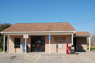
Millican is an unicorporated community and former municipality in Brazos County, Texas, United States. The population was 240 at the 2010 census, up from 108 at the 2000 census. It is part of the Bryan–College Station metropolitan area. Millican is named after Robert Millican, the first white settler of the region that would come to be known as Brazos County.

Navasota is a city primarily in Grimes County, Texas, United States. The population was 7,643 at the 2020 census. In 2005, the Texas Legislature designated Navasota as the "Blues Capital of Texas" in honor of the late Mance Lipscomb, a Navasota native and blues musician. Technically, a sliver of Navasota is in Brazos County, which is part of the Bryan-College Station Metropolitan area.

The Brazos River, called the Río de los Brazos de Dios by early Spanish explorers, is the 14th-longest river in the United States at 1,280 miles (2,060 km) from its headwater source at the head of Blackwater Draw, Roosevelt County, New Mexico to its mouth at the Gulf of Mexico with a 45,000-square-mile (116,000 km2) drainage basin. Being one of the largest rivers in Texas, it is sometimes used to mark the boundary between East Texas and West Texas.

Washington-on-the-Brazos is an unincorporated community along the Brazos River in Washington County, Texas, United States. The town is best known for being the site of the Convention of 1836 and the signing of the Texas Declaration of Independence.
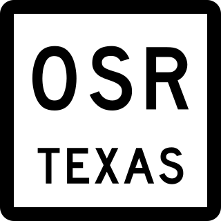
State Highway OSR (SH OSR) is a 61.918-mile (99.647 km) non-numbered state highway in southeastern Texas, United States, that forms a northern loop off of Texas State Highway 21 (SH 21).
Boonville was the first county seat of Brazos County, Texas, United States. It is now located in the city of Bryan, Texas.

State Highway 105 is a state highway in the U.S. state of Texas that runs from Brenham to the outskirts of Beaumont. The route was originally proposed in 1925 and took its current routing in 1984.

Iola is a city in Grimes County, Texas, United States, on Farm to Market Road 39 and the Burlington-Rock Island Railroad, at the headwaters of Ragan Creek in northwestern Grimes County. As of the 2020 census the population was 311.

Navasota Independent School District is a public school district based in Navasota, Texas (USA) that enrolls approximately 3,000 students.
Navasota High School is a public high school located in the city of Navasota, Texas, USA and classified as a 4A school by the University Interscholastic League. It is a part of the Navasota Independent School District located in south central Grimes County. In 2016, the school was rated "Met Standard" by the Texas Education Agency.
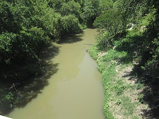
The Navasota River is a river in east Texas, United States. It is about 125 miles (201 km) long, beginning near Mount Calm and flowing south into the Brazos River at a point where Brazos, Grimes, and Washington counties converge.
Allenfarm is an unincorporated community in Brazos County, in the U.S. state of Texas. According to the Handbook of Texas, the community had a population of 30 in 2000. It is located within the Bryan-College Station metropolitan area.
Cawthon is an unincorporated community in Brazos County, in the U.S. state of Texas. According to the Handbook of Texas, the community had a population of 75 in 2000. It is located within the Bryan-College Station metropolitan area.
Dallam is a ghost town in Brazos County, in the U.S. state of Texas. It is located within the Bryan-College Station metropolitan area.
Nelleva is an unincorporated community in Brazos County, in the U.S. state of Texas. According to the Handbook of Texas, no population estimates were available for the community in 2000. It is located within the Bryan-College Station metropolitan area.
Cottonwood is a ghost town in Brazos County, in the U.S. state of Texas. It is located within the Bryan-College Station metropolitan area.
Union is a ghost town in Brazos County, in the U.S. state of Texas. It is located within the Bryan-College Station metropolitan area.


