Wixon Valley, Texas

Last updated
Wixon Valley, Texas
TXMap-doton-WixonValley.PNG
Location of Wixon Valley, Texas
Brazos County WixonValley.svg
Coordinates: 30°45′42″N96°19′22″W / 30.76167°N 96.32278°W / 30.76167; -96.32278
Country United States
State Texas
County Brazos
Area
[1]
  Total1.81 sq mi (4.70 km2)
  Land1.79 sq mi (4.65 km2)
  Water0.02 sq mi (0.05 km2)
Elevation
[2]
335 ft (102 m)
Population
 (2010)
  Total254
  Estimate 
(2019) [3]
253
  Density141.03/sq mi (54.46/km2)
Time zone UTC-6 (Central (CST))
  Summer (DST) UTC-5 (CDT)
FIPS code 48-79919 [4]
GNIS feature ID2412290 [2]

Wixon Valley is a city in Brazos County, Texas, United States. The population was 254 at the 2010 census. [5] It is part of the Bryan-College Station metropolitan area.

Contents

Geography

Wixon Valley is located in north-central Brazos County at 30°45′42″N96°19′22″W / 30.76167°N 96.32278°W / 30.76167; -96.32278 (30.761566, –96.322682), [6] along U.S. Route 190 and extending to the northwest. It is 7 miles (11 km) northeast of downtown Bryan.

According to the United States Census Bureau, Wixon Valley has a total area of 1.8 square miles (4.7 km2), of which 0.02 square miles (0.05 km2), or 1.12%, is water. [5]

Demographics

Historical population
CensusPop.Note
1990 186
2000 23526.3%
2010 2548.1%
2019 (est.)253 [3] −0.4%
U.S. Decennial Census [7]

As of the census [4] of 2000, there were 235 people, 85 households, and 70 families residing in the city. The population density was 131.0 inhabitants per square mile (50.6/km2). There were 88 housing units at an average density of 49.1 per square mile (19.0/km2). The racial makeup of the city was 91.06% White, 7.66% African American, 0.43% from other races, and 0.85% from two or more races. Hispanic or Latino of any race were 2.55% of the population.

There were 85 households, out of which 34.1% had children under the age of 18 living with them, 68.2% were married couples living together, 15.3% had a female householder with no husband present, and 16.5% were non-families. 12.9% of all households were made up of individuals, and 9.4% had someone living alone who was 65 years of age or older. The average household size was 2.76 and the average family size was 3.03.

In the city, the population was spread out, with 30.2% under the age of 18, 6.4% from 18 to 24, 28.9% from 25 to 44, 19.6% from 45 to 64, and 14.9% who were 65 years of age or older. The median age was 36 years. For every 100 females, there were 85.0 males. For every 100 females age 18 and over, there were 76.3 males.

The median income for a household in the city was $53,750, and the median income for a family was $59,063. Males had a median income of $35,417 versus $25,938 for females. The per capita income for the city was $33,915. None of the families and 3.0% of the population were living below the poverty line, including no under eighteens and 6.5% of those over 64.

Education

Wixon Valley is served by Bryan Independent School District (BISD). [8]

Wixon Valley is split between the zones of Houston Elementary School and Bonham Elementary School. [9] Bilingual students zoned to Bonham attend Bonham while bilingual students zoned to Houston attend Henderson Elementary School. [10] All students are zoned to: Rayburn Intermediate School, [11] Davila Middle School, [12] and Rudder High School. [13]

Related Research Articles

<span class="mw-page-title-main">Brazos County, Texas</span> County in Texas, United States

Brazos County is a county in the U.S. state of Texas. As of the 2020 census, its population was 233,849. The county seat is Bryan. Along with Brazoria County, the county is named for the Brazos River, which forms its western border. The county was formed in 1841 and organized in 1843.

<span class="mw-page-title-main">St. Augustine Shores, Florida</span> CDP in Florida, United States

St. Augustine Shores is a census-designated place (CDP) in St. Johns County, Florida, United States. As of the 2000 census, the CDP population was 4,922.

<span class="mw-page-title-main">Timberwood Park, Texas</span> Census-designated place in Texas, United States

Timberwood Park is a census-designated place (CDP) in far Northern unincorporated Bexar County, Texas, United States and located within the southern edge of the Texas Hill Country. The district has roughly 42 miles of roads and encompasses over 2,000 acres. The overall plan shows 3,263 platted lots. The population was 35,217 at the 2020 census, up from 13,447 at the 2010 census. It is part of the San Antonio Metropolitan Statistical Area.

<span class="mw-page-title-main">Freeport, Texas</span> City in Texas, United States

Freeport is a city in Brazoria County, Texas, United States, located on the Gulf of Mexico. According to the 2020 census, the city population was 10,696, down from 12,049 in 2010.

<span class="mw-page-title-main">Jones Creek, Texas</span> Village in Texas, United States

Jones Creek is a village in Brazoria County, Texas, United States. The population was 2,020 at the 2010 census. It is the first location in Texas where Stephen F. Austin settled.

<span class="mw-page-title-main">Oyster Creek, Texas</span> City in Texas, United States

For the river in Fort Bend and Brazoria Counties, Texas see: Oyster Creek (Texas).

<span class="mw-page-title-main">Quintana, Texas</span> Town in Texas, United States

Quintana is a town in Brazoria County, Texas, United States. Its population was 56 at the 2010 census.

<span class="mw-page-title-main">Richwood, Texas</span> City in Texas, United States

Richwood is a city in Brazoria County, Texas, United States. The population was 4,781 at the 2020 census.

<span class="mw-page-title-main">Surfside Beach, Texas</span> City in Texas, United States

Surfside Beach, also known locally as Surfside, is a city in Brazoria County, Texas, United States, that is situated on Follet's Island by the Gulf of Mexico near the city of Freeport. The population was 482 at the 2010 census. The city has claimed the "Cradle of Texas Liberty" title due to the fact that the Treaty of Velasco which ended hostilities between Texas and Mexico was signed at Fort Velasco, which was located near the city's current City Hall.
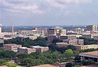
<span class="mw-page-title-main">Cumings, Texas</span> Census-designated place in Texas, United States

Cumings is an unincorporated community and census-designated place (CDP) in Fort Bend County, Texas, United States. The population was 981 at the 2010 census.

<span class="mw-page-title-main">Fifth Street, Texas</span> Census-designated place in Texas, United States

Fifth Street is a census-designated place (CDP) located in the extraterritorial jurisdiction of Stafford within Fort Bend County, Texas, United States. The population was 2,486 at the 2010 census. Fifth Street is within the ZIP code 77477. Therefore, residents of Fifth Street have an address of Stafford, Texas.

<span class="mw-page-title-main">New Territory, Sugar Land, Texas</span> Place in Texas, United States

New Territory is a master-planned community within the city of Sugar Land, Texas, United States. It was formerly a census-designated place (CDP) and in the extraterritorial jurisdiction of Sugar Land, in unincorporated Fort Bend County. It was annexed into Sugar Land on December 12, 2017. The population was 15,186 at the 2010 census, up from 13,861 at the 2000 census.

<span class="mw-page-title-main">Midway North, Texas</span> Census-designated place in Texas

Midway North is a census-designated place (CDP) in Hidalgo County, Texas. The population was 4,752 at the 2010 United States Census. It is part of the McAllen–Edinburg–Mission Metropolitan Statistical Area.

<span class="mw-page-title-main">Brushy Creek, Williamson County, Texas</span> CDP in Texas, United States

Brushy Creek is a census-designated place (CDP) in Williamson County, Texas, United States. The population was 22,519 at the 2020 census.

<span class="mw-page-title-main">Mission Bend, Texas</span> Census-designated place in Texas, United States

Mission Bend is a census-designated place (CDP) around Texas State Highway 6 within the extraterritorial jurisdiction of Houston in Fort Bend and Harris counties in the U.S. state of Texas; Mission Bend is 4 miles (6 km) northwest of the city hall of Sugar Land and 20 miles (32 km) southwest of Downtown Houston. The population was 36,914 at the 2020 census.

<span class="mw-page-title-main">Kurten, Texas</span> Town in Texas, United States

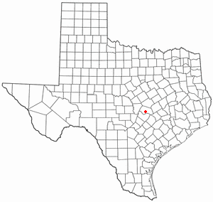
Kurten is a town located along U.S. Highway 190 in Brazos County, Texas, United States. As of the 2010 census, it had a population of 398. It was incorporated in 2000 and is part of the Bryan–College Station metropolitan area.

Bryan Independent School District is a public school district based in Bryan, Texas (USA). It also serves rural areas in northern Brazos County, and a small portion of Robertson County.

<span class="mw-page-title-main">Bryan–College Station</span> Metropolitan Statistical Area in Texas, United States

Bryan–College Station is a metropolitan area centering on the twin cities of Bryan and College Station in the Brazos Valley region of Texas. The 2010 census placed the population of the three county metropolitan area at 255,519. The 2019 population estimate was 273,101.

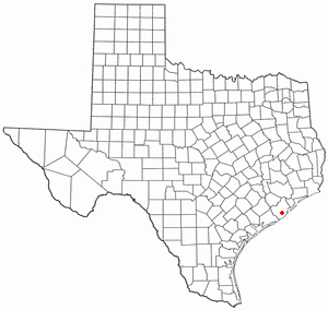
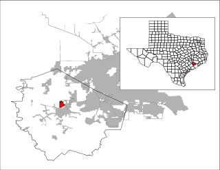
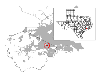
Lake Bryan is a census-designated place (CDP) in Brazos County, Texas, United States, situated around a reservoir of the same name managed by Bryan Texas Utilities. The population was 2,060 at the 2020 census. It is part of the Bryan–College Station metropolitan area.

James Earl Rudder High School is a public high school located in Bryan, Texas. It is part of the Bryan Independent School District. The school enrollment is more than 1,300 students. In 2015, the school was rated "Met Standard" by the Texas Education Agency.

References

  1. "2019 U.S. Gazetteer Files". United States Census Bureau. Retrieved August 7, 2020.
  2. 1 2 U.S. Geological Survey Geographic Names Information System: Wixon Valley, Texas
  3. 1 2 "Population and Housing Unit Estimates". United States Census Bureau. May 24, 2020. Retrieved May 27, 2020.
  4. 1 2 "U.S. Census website". United States Census Bureau . Retrieved 2008-01-31.
  5. 1 2 "Geographic Identifiers: 2010 Demographic Profile Data (G001): Wixon Valley city, Texas". U.S. Census Bureau, American Factfinder. Archived from the original on February 12, 2020. Retrieved April 22, 2014.
  6. "US Gazetteer files: 2010, 2000, and 1990". United States Census Bureau. 2011-02-12. Retrieved 2011-04-23.
  7. "Census of Population and Housing". Census.gov. Retrieved June 4, 2015.
  8. "2020 CENSUS - SCHOOL DISTRICT REFERENCE MAP: Brazos County, TX" (PDF). U.S. Census Bureau . Retrieved 2022-10-15. - Compare this map to the BISD boundary maps.
  9. "Elementary School Attendance Zones" (PDF). Bryan Independent School District . Retrieved 2022-10-15. - Linked from here - Compare to the US Census school district maps
  10. "Bilingual Attendance Zones" (PDF). Bryan Independent School District . Retrieved 2022-10-15. - Linked from here - Compare to the original zoned elementary school to determine the bilingual elementary school.
  11. "Intermediate School Attendance Zones" (PDF). Bryan Independent School District . Retrieved 2022-10-15. - Linked from here - Compare to the US Census school district maps
  12. "Middle School Attendance Zones" (PDF). Bryan Independent School District . Retrieved 2022-10-15. - Linked from here - Compare to the US Census school district maps
  13. "High School Attendance Zones" (PDF). Bryan Independent School District . Retrieved 2022-10-15. - Linked from here - Compare to the US Census school district maps