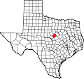
Indian Gap, Texas | |
---|---|
Coordinates: 31°39′47″N98°24′48″W / 31.66306°N 98.41333°W | |
Country | United States |
State | Texas |
County | Hamilton |
Elevation | 1,562 ft (476 m) |
Time zone | UTC-6 (Central (CST)) |
• Summer (DST) | UTC-5 (CDT) |
GNIS feature ID | 1338427 [1] |
Indian Gap is an unincorporated community located between two hills in western Hamilton County in Central Texas, United States.
Comanche Indians would use these hills to begin their raids, inspiring the name of the community. The community was settled in 1877. Hawley Gerrells was an early settler, who opened a post office in his home in 1879. At various times his home served as a store, a church, and a social center. H.A. Shipman bought the townsite and farmed it for several years. In 1889, he took over Gerrells' store and post office, and in 1892 he sold town lots. The population was 90 in the 1920s. At one point, Indian Gap had a bank, a hotel, three stores, a blacksmith shop, a gin, a barber shop, churches, and a weekly newspaper, The Arrow. The post office closed in 1972. By the 1970s, the population had declined to 36 and remained there through 2000. [2] The population was recorded as 27 in 2010 and rose to 35 as of 2019. [3]
Indian Gap is located at the intersection of Farm to Market Roads 218 and 1702, 17 mi (27 km) west of Hamilton, 35 mi (56 km) east of Brownwood, and 40 mi (64 km) south of Stephenville in the hills of far-western Hamilton County. [3]
Indian Gap had its own schools at its peak, which closed about 1959. [2] Today, the community is served by the Hamilton Independent School District.
Indian Gap is the hometown of Frank N. Mitchell, awarded a Medal of Honor for his actions in the Korean War. [4]
Burnet is a city in and the county seat of Burnet County, Texas, United States. Its population was 6,436 at the 2020 census.
Indian Creek is an unincorporated community in southern Brown County in west-central Texas, United States. According to the Handbook of Texas, there were no population estimates available for the community in 2000. It is located within the Brownwood, Texas micropolitan area.
Bend is an unincorporated community in Lampasas and San Saba counties in western Central Texas. Its population was 1,678 as of the 2010 census.
Rosston is a small farming and ranching community in southwestern Cooke County, Texas, United States. According to the Handbook of Texas, the community had a population of 75 in 2000. It is located within the Dallas-Fort Worth Metroplex.
Jonesboro is an unincorporated community in Coryell and Hamilton counties in Central Texas, United States. The Coryell County portion of the community is part of the Killeen–Temple–Fort Hood Metropolitan Statistical Area.
Minden is an unincorporated community in Rusk County, Texas, United States. According to the Handbook of Texas, the community had a population of 350 in 2000. It is located within the Longview, Texas metropolitan area.
Copeville is an unincorporated community in Collin County, Texas, United States. According to the Handbook of Texas, the community had a population of 106 in 2000. It is located in the Dallas-Fort Worth Metroplex.
Pottsville is an unincorporated community located in western Hamilton County in Central Texas, United States.
Prairie Dell is an unincorporated community in Bell County, Texas, United States. According to the Handbook of Texas, the community had an estimated population of 12 in 2000. The community is part of the Killeen-Temple-Fort Hood metropolitan area.
Fairy is an unincorporated community located in Hamilton County in Central Texas, United States.
Comyn is an unincorporated community located in Comanche County in Central Texas, United States. According to the Handbook of Texas, it had a population of 40 in 2000.
Austonio is an unincorporated community in Houston County, Texas, United States. According to the Handbook of Texas, the community had a population of 37 in 2000.
Mixon is a small unincorporated community in northern Cherokee County, Texas, United States. According to the Handbook of Texas, the community had a population of 50 in 2000. It is located within the Tyler-Jacksonville combined statistical area.
Dialville is a small unincorporated community in north-central Cherokee County, Texas, United States. According to the Handbook of Texas, the community had a population of 200 in 2000. It is located within the Tyler-Jacksonville combined statistical area.
Ponta is a small unincorporated community in eastern Cherokee County, Texas, United States. According to the Handbook of Texas, the community had a population of 50 in 2000. It is located within the Tyler-Jacksonville combined statistical area.
Holly is an unincorporated community in Houston County, Texas, United States. According to the Handbook of Texas, the community had a population of 112 in 2000.
Charlie is an unincorporated community in northern Clay County, Texas, United States. According to the Handbook of Texas, the community had a population of 65 in 2000. It is located within the Wichita Falls metropolitan area.
Nix is an unincorporated community in southwestern Lampasas County, Texas, United States. It was once a stop on a stagecoach route. According to the Handbook of Texas, it had a population of only six in 2000. It is located within the Killeen-Temple-Fort Hood metropolitan area.
Church Hill is an unincorporated community in Rusk County, located in the U.S. state of Texas. According to the Handbook of Texas, the community had a population of 20 in 2000. It is located within the Longview, Texas metropolitan area.
Prairieville is an unincorporated rural small village in Kaufman County, Texas, United States. There is a grocery store at Prairieville, a church, and several homes. According to the Handbook of Texas, the community had a population of 50 in 2000. It is located within the Dallas-Fort Worth metropolitan area.