Mills County is a county located in Central Texas, United States. It was created on March 15, 1887, from parts of four existing counties—Brown, Comanche, Hamilton, and Lampasas—and named after John T. Mills. The 2020 census reported a population of 4,456. The county seat is Goldthwaite. A long-time resident of the county quipped that residing here is the closest a person could get to living in Mayberry.

Lampasas County is a county located on the Edwards Plateau in the U.S. state of Texas. As of the 2020 census, its population was 21,627. Its county seat is Lampasas. The county is named for the Lampasas River.

Hamilton County is a county located on the Edwards Plateau in the U.S. state of Texas. As of the 2020 census, its population was 8,222. The county seat is Hamilton. The county was created in 1858. It is named for James Hamilton Jr., a former governor of South Carolina who gave financial aid to the Republic of Texas.

Lampasas is a city in Lampasas County, Texas, United States. Its population was 7,291 at the 2020 census. It is the seat of Lampasas County.

Brady is a city in McCulloch County, Texas, United States. Brady refers to itself as the "Heart of Texas", as it is the city closest to the geographical center of the state, which is about 15 miles northeast of Brady. Its population was 5,118 at the 2020 census. It is the county seat of McCulloch County.

Copperas Cove is a city located in central Texas at the southern corner of Coryell County with smaller portions in Lampasas and Bell counties. Founded in 1879 as a small ranching and farming community, today the city is the largest in Coryell County, with 36,670 at 2020. The city's economy is closely linked to nearby Fort Cavazos, making it part of the Killeen-Temple-Fort Hood Metropolitan Statistical Area.

U.S. Route 183 (US 183) is a north–south United States highway. The highway's northern terminus is in Presho, South Dakota, at an intersection with Interstate 90. Its southern terminus is in Refugio, Texas, at the southern intersection of U.S. Highway 77 and Alternate US 77.
McGirk is an unincorporated community in eastern Moniteau County, Missouri, United States. It is located approximately five miles east of California on old U.S. Route 50.
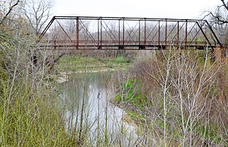
The Lampasas River is a river in the U.S. state of Texas. The river originates near the city of Hamilton and travels southeast for 75 miles through central Texas to a man-made reservoir called Stillhouse Hollow Lake. The river flows about 84 miles southeast through Lampasas, Burnet, and Bell Counties. It continues for nine miles after the lake to converge with the Leon River to form the Little River (Texas) near Belton.
The Little River is a river in Central Texas in the Brazos River watershed. It is formed by the confluence of the Leon River and the Lampasas River near Little River, Texas in Bell County. It flows generally southeast for 75 miles (121 km) until it empties into the Brazos River about 5 miles (8.0 km) southwest of Hearne, at a site called Port Sullivan in Milam County. The Little River has a third tributary, the San Gabriel River, which joins the Little about 8 miles (13 km) north of Rockdale and five miles southwest of Cameron. Cameron, the county seat of Milam County and the only city of any significant size on the Little River, was established in 1846.
Star Independent School District was a public school district based in the community of Star, Texas, USA.
Bend is an unincorporated community in Lampasas and San Saba counties in western Central Texas. Its population was 1,678 as of the 2010 census.

Ding Dong is an unincorporated community in Central Texas, United States. According to the Handbook of Texas, it had a population of 22 in 2000. It is located within the Killeen–Temple metropolitan area.
John Pinckney Calhoun Higgins, better known as "Pink" Higgins, was a gunman and cowboy of the Old West. He is known to have killed 14 men in his lifetime.
Noxville is a ghost town on the James River, 21 miles (34 km) east of Junction on Ranch to Market Road 479, in Kimble County, in the U.S. state of Texas.
Sage, Bethel, and Pleasant Hill were small closely linked unincorporated communities in Burnet County, Texas. They were close to the small town of Lake Victor and seven or eight miles away from Burnet, Texas.

Nix is an unincorporated community in southwestern Lampasas County, Texas, United States. It was once a stop on a stagecoach route. According to the Handbook of Texas, it had a population of only six in 2000. It is located within the Killeen-Temple-Fort Hood metropolitan area.

Cuthbert is a ghost town in Mitchell County, Texas, United States. Cuthbert was established in 1890 when the founder D. T. Bozeman built a wagon yard and store. The community and post office were named for Thomas Cuthbertson, a family friend of the Bozemans. By the early 1920s, Cuthbert had a church, two stores, a blacksmith shop, a cotton gin, telephone office, and a school. In 1920, the T. and P. Abrams No. 1 oil well, one of the first commercial oil ventures in the Permian Basin, was drilled just over a mile north of the town. A post office, two businesses, and a population of twenty-five were reported at the community in 1936, the year that its school was consolidated with that of Colorado City. After World War II, the improvement of rural roads in the area led to Cuthbert's decline as it lost its trade to Colorado City. The Cuthbert post office was discontinued circa 1960, when the town reported one business and a population of twenty-five. By 1974, only a cemetery and scattered farms remained in the area.
McDuff is a ghost town in Bastrop County, Texas, United States. The community was located eight miles southwest of Elgin, 12 miles northwest of Bastrop, and 25 miles east of Austin. It was on an old stage mail route from Bastrop to Austin. Today, the town site would correspond roughly with the intersection of Farm to Market Road 969 and Upper Elgin River Road.